The village name refers to the River Wye nearby, that also flows through High Wycombe. In manorial records in 1241 the village was referred to as La Ludewatere.
St Peter's Church, Loudwater
The brick built St Peter's Church dates from 1788 with a gothic style chancel added in 1903 and further improvements in recent years, including new windows. On the London Road there is a Victorian mansion called Burleighfield House that was once the studio of the stained glass designer Patrick Reyntiens.
There was once a blotting paper mill in the valley and Loudwater had its own railway station on the Wycombe Railway that opened in 1854 and closed in 1970.
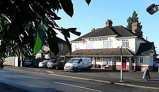
Today there is little to distinguish the village from the urban sprawl of High Wycombe, though it is signed along the London Road. A 1744 milestone can still be seen and there is also still a traditional village pub 'The Derehams Inn' in Derehams Lane.
Features
Loudwater is home to several retail and industrial concerns - a large Tesco supermarket, an industrial estate, a small retail park, a Brewers Fayremotel and also the office of the local newspaper, the Bucks Free Press. The M40 motorway crosses over the valley close to the village, and facilitates the eastbound only Junction 3, signposted as 'Wycombe East'.
Loudwater was once served by the High Wycombe to Bourne End railway line, the station being situated at the bottom of Treadaway Hill. The line and station closed in 1970, the old railway path can still be walked through Fennel Wood.
Buckinghamshire, abbreviated as Bucks, is a ceremonial county in South East England that borders Greater London to the south-east, Berkshire to the south, Oxfordshire to the west, Northamptonshire to the north, Bedfordshire to the north-east and Hertfordshire to the east.
Amersham is a market town and civil parish in Buckinghamshire, England, in the Chiltern Hills, 27 miles (43 km) northwest of central London, 15 miles (24 km) south-east of Aylesbury and 9 miles (14 km) north-east of High Wycombe. Amersham is part of the London commuter belt.
High Wycombe, often referred to as Wycombe, is a market town in Buckinghamshire, England. Lying in the valley of the River Wye surrounded by the Chiltern Hills, it is 29 miles (47 km) west-northwest of Charing Cross in London, 13 miles (21 km) south-southeast of Aylesbury, 23 miles (37 km) southeast of Oxford, 15 miles (24 km) northeast of Reading and 8 miles (13 km) north of Maidenhead.
Aylesbury is the county town of Buckinghamshire, South East England. It is home to the Roald Dahl Children's Gallery and the Waterside Theatre. It is located in central Buckinghamshire, midway between High Wycombe and Milton Keynes.
Flackwell Heath is a village in the civil parish of Chepping Wycombe on the outskirts of High Wycombe, Buckinghamshire, England. With an elevation of about 150 metres (490 ft), in the Chiltern Hills. It has a population of around 6000.
Bourne End is a village mostly in the parish of Wooburn, but partly in that of Little Marlow in Buckinghamshire, England. It is about five miles (8 km) south-east of High Wycombe and three miles (5 km) east of Marlow, near the boundary with Berkshire and close to where the Buckinghamshire River Wye empties into the Thames.
Dereham, formerly known as East Dereham, is a town and civil parish in the Breckland District of the English county of Norfolk. It is situated on the A47 road, about 15 miles (25 km) west of the city of Norwich and 25 miles (40 km) east of King's Lynn.
Gerrards Cross railway station is a railway station in the town of Gerrards Cross in Buckinghamshire, England. It is on the Chiltern Main Line between Denham Golf Club and Seer Green and Jordans.
Chepping Wycombe is a civil parish in the ceremonial county of Buckinghamshire, England. The parish includes the three large villages of Tylers Green, Loudwater, and Flackwell Heath. The central part of the parish comprises extensive business and industrial development lying adjacent and underneath an elevated section of the M40 in the valley of the River Wye.
High Wycombe railway station is a railway station in the town of High Wycombe, Buckinghamshire, England. The station is on the Chiltern Main Line between Beaconsfield and Saunderton stations. It is served by Chiltern Railways.
Aylesbury railway station is a railway station in Aylesbury, Buckinghamshire, England, on the London–Aylesbury line from London Marylebone via Amersham. It is 38 miles (61 km) from Aylesbury to Marylebone. A branch line from Princes Risborough on the Chiltern Main Line terminates at the station. It was the terminus for London Underground's Metropolitan line until the service was cut back to Amersham in 1961. The station was also known as Aylesbury Town under the management of British Railways from c. 1948 until the 1960s.
Princes Risborough station is a railway station on the Chiltern Main Line that serves the town of Princes Risborough in Buckinghamshire, England. It is operated by Chiltern Railways.
The Marlow branch line is a single track railway line in England, between Maidenhead station in Berkshire and Bourne End and Marlow stations in Buckinghamshire. It is 7 miles 10 chains (11.5 km) in length. Passenger services are operated by Great Western Railway using Class 165 and Class 166 diesel trains. The line connects to the Great Western Main Line at Maidenhead; it uses a section of the former Wycombe Railway line to High Wycombe together with the former Great Marlow Railway.
Wycombe Marsh is an area of High Wycombe, Buckinghamshire, England. It lies on the River Wye and the A40 road, approximately 1.5 miles (2.4 km) south-east of High Wycombe town centre, and approximately 1 mile (1.6 km) north-west of Loudwater. Wycombe Marsh is in the Ryemead ward of High Wycombe, which had a population of 7,188 at the 2011 Census.
Wooburn Green is a village in the civil parish of Wooburn, Buckinghamshire, England.
The Wycombe Railway was a British railway between Maidenhead and Oxford that connected with the Great Western Railway at both ends; there was one branch, to Aylesbury.
Loudwater railway station was a railway station which served Loudwater, Buckinghamshire and Flackwell Heath, on the Wycombe Railway.
Transport in Buckinghamshire has been shaped by its position within the United Kingdom. Most routes between the UK's two largest cities, London and Birmingham, pass through this county. The county's growing industry first brought canals to the area, then railways and then motorways.
The Acton–Northolt line (ANL), historically known as the New North main line (NNML), is a railway line in West London, England. Built between 1903 and 1906, it runs from the Great Western Main Line at Old Oak Common TMD to the Chiltern Main Line at South Ruislip, alongside the West Ruislip branch of the London Underground Central line, for a distance of around 11 miles (18 km).
West Wycombe railway station was a railway station that served the village of West Wycombe, Buckinghamshire Situated about 1⁄2 mile (0.80 km) east of the village the station opened in 1862 and closed in 1958. Minutes of the Wycombe Railway state that construction of West Wycombe station in 1862 cost £430 8s 8d, equivalent to £42,731 in 2021, with additional general works at £417 8s 8d, equivalent to £41,441 in 2021.
This page is based on this Wikipedia article Text is available under the CC BY-SA 4.0 license; additional terms may apply. Images, videos and audio are available under their respective licenses.