Windsor (village), New York

Last updated

Windsor, New York
Incorporated Village of Windsor
Village of Windsor NY Locator Map.png
Map highlighting Windsor's location within Broome County.
USA New York location map.svg
Red pog.svg
Windsor
Location within the state of New York
Coordinates: 42°4′30″N75°38′21″W / 42.07500°N 75.63917°W / 42.07500; -75.63917
Country Flag of the United States.svg  United States
State Flag of New York.svg  New York
County Broome
Town Windsor
Area
[1]
  Total1.17 sq mi (3.02 km2)
  Land1.10 sq mi (2.85 km2)
  Water0.07 sq mi (0.17 km2)
Elevation
951 ft (290 m)
Population
 (2020)
  Total907
  Density825.30/sq mi (318.53/km2)
Time zone UTC-5 (Eastern (EST))
  Summer (DST) UTC-4 (EDT)
ZIP code
13865
Area code 607
FIPS code 36-82524 [2]
GNIS feature ID0971474 [3]
Website www.villageofwindsor.org

Windsor is a village in Broome County, New York, United States. The population was 916 at the 2010 census. [4] It is part of the Binghamton Metropolitan Statistical Area. It is located near the middle of the town Windsor, and is the principal settlement in that town. The village is east of Binghamton.

Contents

History

Windsor is the site of the historic Seneca village of Onaquaga, which was one of 40 destroyed by the Continental Army in October 1778 during Sullivan's Expedition.[ citation needed ]

In 1830, the new village was founded as a commercial settlement, and it soon outstripped its rival to the north, Ouaquaga. The village was incorporated in 1896.

The Windsor Village Historic District was listed on the National Register of Historic Places in 1980. [5] The Jedediah Hotchkiss House was listed in 1982. [5]

Geography

According to the United States Census Bureau, the village has a total area of 1.2 square miles (3 km2), of which 1.1 square miles (2.8 km2) is land and 0.077 square miles (.2 km2), or 6.15%, is water. [4]

Windsor is on the west bank of the Susquehanna River and is located along the conjoined Interstate 86 and New York State Route 17 at the junction of New York State Route 79.

Demographics

Historical population
CensusPop.Note
1890 524
1900 73941.0%
1910 637−13.8%
1920 598−6.1%
1930 66110.5%
1940 76615.9%
1950 8227.3%
1960 1,02624.8%
1970 1,0987.0%
1980 1,1555.2%
1990 1,051−9.0%
2000 901−14.3%
2010 9161.7%
2020 907−1.0%
U.S. Decennial Census [6]

As of the census [2] of 2000, there were 901 people, 369 households, and 250 families residing in the village. The population density was 833.6 inhabitants per square mile (321.9/km2). There were 422 housing units at an average density of 390.4 per square mile (150.7/km2). The racial makeup of the village was 95.78% White, 1.22% Black or African American, 0.89% Native American, 0.55% Asian, 0.33% from other races, and 1.22% from two or more races. Hispanic or Latino of any race were 0.55% of the population.

There were 369 households, out of which 32.8% had children under the age of 18 living with them, 50.7% were married couples living together, 12.2% had a female householder with no husband present, and 32.0% were non-families. 29.0% of all households were made up of individuals, and 15.2% had someone living alone who was 65 years of age or older. The average household size was 2.44 and the average family size was 3.01.

In the village, the population was spread out, with 27.7% under the age of 18, 6.3% from 18 to 24, 27.9% from 25 to 44, 21.3% from 45 to 64, and 16.8% who were 65 years of age or older. The median age was 39 years. For every 100 females, there were 88.5 males. For every 100 females age 18 and over, there were 83.4 males.

The median income for a household in the village was $37,500, and the median income for a family was $46,563. Males had a median income of $35,000 versus $21,298 for females. The per capita income for the village was $18,168. About 8.4% of families and 10.0% of the population were below the poverty line, including 16.7% of those under age 18 and 4.3% of those age 65 or over.

Notable residents

Related Research Articles

<span class="mw-page-title-main">Colesville, New York</span> Town in New York, United States

Colesville is a town in Broome County, New York, United States. The population was 4,877 at the 2020 census.

<span class="mw-page-title-main">Conklin, New York</span> Town in New York, United States

Conklin is a town in Broome County, New York, United States. Per the 2020 census, the population was 5,008.

<span class="mw-page-title-main">Dickinson, Broome County, New York</span> Town in New York, United States

Dickinson is a town in Broome County, New York, United States. The population was 5,083 at the 2020 census. The town was named after Daniel S. Dickinson.

<span class="mw-page-title-main">Kirkwood, New York</span> Town in New York, United States

Kirkwood is a town in Broome County, New York, United States. The population was 5,495 at the 2020 census. The town is named after James P. Kirkwood, who was an engineer responsible for constructing the local railroad.

<span class="mw-page-title-main">Maine, New York</span> Town in New York, United States

Maine is a town in Broome County, New York, United States. The population was 5,377 at the 2010 census.

<span class="mw-page-title-main">Whitney Point, New York</span> Village in New York, United States

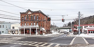
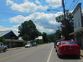
Whitney Point is a village in Broome County, New York, United States. The population was 964 at the 2010 census. It is part of the Binghamton Metropolitan Statistical Area. The name comes from Thomas and William Whitney, early developers.

<span class="mw-page-title-main">Lower Windsor Township, York County, Pennsylvania</span> Township in Pennsylvania, United States

Lower Windsor Township is a township in York County, Pennsylvania, United States. The population was 7,511 at the 2020 census. Samuel S. Lewis State Park overlooks the Susquehanna River in the eastern part of the township.

<span class="mw-page-title-main">Plymouth, Vermont</span> Town in Vermont, United States

Plymouth is a town in Windsor County, Vermont, United States. The population was 641 at the 2020 census. Calvin Coolidge, the 30th President of the United States, was born and raised in Plymouth and is buried there as well. The State of Vermont Division for Historic Preservation owns and maintains the Coolidge Homestead and the village of Plymouth Notch.

<span class="mw-page-title-main">Windsor Heights, West Virginia</span> Village in West Virginia, United States

Windsor Heights is a village in Brooke County, West Virginia, United States. It is part of the Wheeling, West Virginia Metropolitan Statistical Area. The population was 423 at the 2010 census. Grace Davis was the mayor as of June, 2017.

<span class="mw-page-title-main">Binghamton (town), New York</span> Town in New York, United States

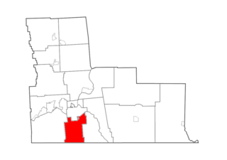
Binghamton is a town in Broome County, New York, United States. The population was 4,623 at the 2020 census. The town is named after an early developer, William Bingham.

<span class="mw-page-title-main">Lisle (village), New York</span> Village in New York, United States

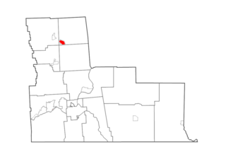
Lisle is a village in Broome County, New York, United States. The population was 320 at the 2010 census. It is part of the Binghamton Metropolitan Statistical Area. The village was named after a community in France.

<span class="mw-page-title-main">Windsor, New York</span> Town in New York, United States

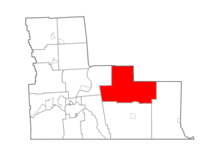
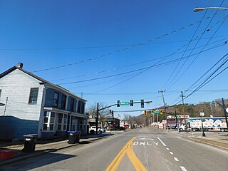
Windsor is a town in Broome County, New York, United States. The population was 5,804 at the 2020 census.

Afton is a village in Chenango County, New York, United States. The population was 822 at the 2010 census. The village is named after the poem "Sweet Afton" by Scottish poet Robert Burns, referring to the River Afton in Ayrshire, Scotland.

<span class="mw-page-title-main">Greene (village), New York</span> Village in New York, United States

Greene is a village in Chenango County, New York, United States. The population was 1,580 at the 2010 census. The village is named after General Nathanael Greene. It is within the town of Greene and is northeast of Binghamton.

<span class="mw-page-title-main">Oxford (village), New York</span> Village in New York, United States

Oxford is a village in Chenango County, New York, United States. The population was 1,450 at the 2010 census. The village is named after Oxford, Massachusetts, the hometown of the landowner.

<span class="mw-page-title-main">Marathon (village), New York</span> Village in New York, United States

Marathon is a village within the town of Marathon in Cortland County, New York, United States. The population of the village was 919 at the 2010 census, out of 1,967 in the entire town.

<span class="mw-page-title-main">Newark Valley (village), New York</span> Village in New York, United States

Newark Valley is a village in Tioga County, New York, United States. The population was 997 at the 2010 census. It is part of the Binghamton Metropolitan Statistical Area. The village is named after the city of Newark, New Jersey.

<span class="mw-page-title-main">Nichols (village), New York</span> Village in New York, United States

Nichols is a village located in the Town of Nichols in Tioga County, New York, United States. The population was 512 at the 2010 census. It is part of the Binghamton Metropolitan Statistical Area. The name is taken from that of a local benefactor, Colonel Nichols.

Spencer is a village located in the Town of Spencer in Tioga County, New York, United States. The population was 759 at the 2010 census. It is part of the Binghamton Metropolitan Statistical Area. The town and village are named after Judge Ambrose Spencer.

<span class="mw-page-title-main">Windsor, Wisconsin</span> Village in Wisconsin, United States

Windsor is a village and former town in Dane County, Wisconsin. The population was 8,754 at the time of the 2020 census. The communities of Lake Windsor, Morrisonville, and Token Creek are located within the village. Windsor voted to incorporate as a village on November 3, 2015; prior to its incorporation, it was a town, and a portion of the town was a census-designated place. Windsor is a part of the Census Bureau's Madison metropolitan statistical area.

References

  1. "ArcGIS REST Services Directory". United States Census Bureau. Retrieved September 20, 2022.
  2. 1 2 "U.S. Census website". United States Census Bureau . Retrieved January 31, 2008.
  3. "US Board on Geographic Names". United States Geological Survey. October 25, 2007. Retrieved January 31, 2008.
  4. 1 2 "Geographic Identifiers: 2010 Demographic Profile Data (G001): Windsor village, New York". U.S. Census Bureau, American Factfinder. Archived from the original on February 12, 2020. Retrieved February 5, 2014.
  5. 1 2 "National Register Information System". National Register of Historic Places . National Park Service. March 13, 2009.
  6. "Census of Population and Housing". Census.gov. Retrieved June 4, 2015.