Monroe County is a county on the northeast border of the U.S. state of Mississippi next to Alabama. As of the 2020 census, the population was 34,180. Its county seat is Aberdeen.

Amory is a city in Monroe County, Mississippi, United States. The population was 6,666 at the 2020 census, down from 7,316 in 2010. Located in the northeastern part of the state near the Alabama border, it was founded in 1887 as a railroad town by the Kansas City, Memphis and Birmingham Railroad. As a result, Cotton Gin Port, along the Tombigbee River to the east, was abandoned as businesses and people moved for railroad access.

Rolling Fork is a city and county seat of Sharkey County, Mississippi, United States. As of the 2020 census, the population of the town was 1,883.

Magee is a city in Simpson County, Mississippi, United States. It is part of the Jackson metropolitan area.

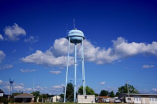
Smithville is a town in Monroe County, Mississippi, United States. The population was 509 at the 2020 census, down from 942 in 2010.
Greenwood Springs is an unincorporated community in Monroe County, Mississippi. Greenwood Springs is located east of Amory on U.S. Route 278.
Quincy is an unincorporated community in Monroe County, Mississippi, United States.
Bigbee is an unincorporated community in Monroe County, Mississippi. Bigbee is located northwest of Amory on Mississippi Highway 6 close to its intersection with Mississippi Highway 371.
Splunge,, is an unincorporated community in Monroe County, Mississippi.
Strong is an unincorporated community in Monroe County, Mississippi, United States.
Parham is an unincorporated community in Monroe County, Mississippi. Parham is located northeast of Hatley and southeast of Smithville.
Wise Gap,, is an unincorporated community in Monroe County, Mississippi, United States.
Tranquil is an unincorporated community in Monroe County, Mississippi, United States.
Muldon, also known as Aberdeen Junction, Loohattan, Loohatten and Louhatten, is an unincorporated community in Monroe County, Mississippi. Muldon is located southwest of Aberdeen on Mississippi Highway 25.
Flinn is an unincorporated community in Monroe County, Mississippi. Flinn is located northeast of Amory and southwest of Smithville on Mississippi Highway 25.
Central Grove is an unincorporated community in Monroe County, Mississippi. Central Grove is located west of Amory and south of Nettleton.

Wayside is an unincorporated community in Washington County, Mississippi, United States.

Midnight is an unincorporated community located in Humphreys County, Mississippi, United States. Midnight is approximately 5 miles (8.0 km) north of Louise and 5 miles (8.0 km) southwest of Silver City along Mississippi Highway 149. Although Midnight is unincorporated, it has a zip code of 39115.
Poplar Creek is an unincorporated community in Montgomery County, Mississippi.

On March 24, 2023, a severe weather and tornado outbreak began across portions of the lower Mississippi River Valley in the United States. A slow-moving trough moved eastward across the United States and interacted with a moist and unstable airmass originating from the Gulf of Mexico, resulting in widespread heavy rainfall, severe thunderstorms, and significant tornadoes over a four-day period. A violent high-end EF4 tornado moved through the towns of Rolling Fork, Midnight, and Silver City in western Mississippi, causing catastrophic damage and many fatalities. Multiple tornado emergencies were issued for that tornado and two subsequent EF3 tornadoes from the same supercell that struck Winona and Amory.


