
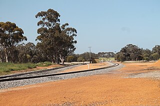
Perenjori is a townsite in the northern agricultural region, 348 kilometres (216 mi) north of Perth and 39 kilometres (24 mi) south-east of Morawa. It is located on the Wongan Hills to Mullewa railway line which was opened in 1915. Perenjori was approved as the name of a siding in April 1913, and later that year the government decided to establish a townsite there. Perenjori townsite was gazetted in 1916.

Coorow is a town in the Mid West region of Western Australia, 264 kilometres (164 mi) north of Perth.
Ejanding is a townsite in the central Wheatbelt region of Western Australia. It is located about 20 kilometres (12 mi) north-northeast of Dowerin. It was originally a siding on the Ejanding Northward railway, a line built between the town now known as Amery, and Kalannie, around 1927. Amery was originally named Ejanding in 1910, but was changed to Amery in 1928. Ejanding was gazetted as a townsite in 1930. Its name is Aboriginal in origin, derived from "Hejanding Well", a name first recorded by the surveyor/explorer Augustus Gregory in 1846.

Wubin is located in the northern Wheatbelt region of Western Australia, 272 kilometres (169 mi) north-northeast of Perth and 21 kilometres (13 mi) north of Dalwallinu.

Wyalkatchem is a town in the central Wheatbelt region, 192 kilometres (119 mi) east-north-east of Perth, 35 kilometres (22 mi) east of Dowerin and 44 kilometres (27 mi) south of Koorda. At the 2021 census, Wyalkatchem had a population of 358.

Three Springs is a town located 313 kilometres (194 mi) north of Perth, Western Australia on the Midlands Road, which until the opening of the Brand Highway in 1975 was the main road route from Perth to the state's north. The town is the seat of the Shire of Three Springs. Its economy is based on agriculture and mining.

Ongerup is a town 410 kilometres (250 mi) south-east of Perth and 54 kilometres (34 mi) east of Gnowangerup in the Great Southern region of Western Australia. At the 2016 census Ongerup had a population of 93.
Yilliminning is a small town located in the southern Wheatbelt region of Western Australia, 212 kilometres (132 mi) southeast of the state capital, Perth and 23 kilometres (14 mi) east of Narrogin. At the 2006 census, Yilliminning had a population of 337.

Woodanilling is a small town in the Great Southern region of Western Australia.

Carnamah is a town in the Mid West region of Western Australia, about 307 kilometres (191 mi) north of Perth along the Midlands Road. According to 2021 census, the population of the town is 407.
Tincurrin is a small town in the Wheatbelt region of Western Australia, 250 kilometres (155 mi) south-east of Perth and within the Shire of Wickepin.

Trayning is a town in the north-eastern Wheatbelt region of Western Australia, 236 kilometres (147 mi) east of the state capital, Perth, on the Nungarin–Wyalkatchem Road. At the 2006 census, Trayning had a population of 122.

Koorda is a town in the north eastern Wheatbelt region of Western Australia, approximately 236 kilometres (147 mi) east of Perth and 43 kilometres (27 mi) north of Wyalkatchem at the northeastern end of the Cowcowing Lakes. It is the main town in the Shire of Koorda. At the 2016 census Koorda had a population of 414. The surrounding areas produce wheat and other cereal crops. The town is a receival site for Cooperative Bulk Handling.

Quairading is a Western Australian town located in the Wheatbelt region. It is the seat of government for the Shire of Quairading.
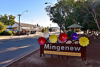
Mingenew is a town in Western Australia, located 383 kilometres (238 mi) north of the state capital, Perth. It is the seat of government for the Shire of Mingenew.
Yuna is a small town in the Mid West region of Western Australia, in the Shire of Chapman Valley, 62 kilometres (39 mi) northeast of the city of Geraldton.
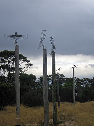
Borden is a small town in the Great Southern region of Western Australia. The town is located 325 kilometres (202 mi) south east of the state capital, Perth and 111 kilometres (69 mi) north of Albany on Chester Pass Road. At the 2006 census, Borden and the surrounding area had a population of 164.

Kununoppin is a small town in the Wheatbelt region of Western Australia. The town is located on the Nungarin–Wyalkatchem Road and in the Shire of Trayning local government area, 257 kilometres (160 mi) north east of the state capital, Perth, Western Australia. At the 2006 census, Kununoppin had a population of 151.
Bowgada is a small town in Western Australia located on the Mullewa Wubin Road 366 kilometres (227 mi) north of Perth in the Mid West region.
Walgoolan is a small town located in the eastern Wheatbelt region of Western Australia. It is situated between Merredin and Bodallin along the Great Eastern Highway.


