
Friday Harbor is a town in San Juan County, Washington, United States. The population was 2,162 at 2010 Census. Located on San Juan Island, Friday Harbor is the major commercial center of the San Juan Islands archipelago and is the county seat of San Juan County.

Santa Cruz Island is the largest of the eight islands in the Channel Islands and also the largest island in California, located off the coast of California. The island, in the northern group of the Channel Islands, is 22 miles (35 km) long and from 2 to 6 miles wide with an area of 61,764.6 acres (249.952 km2). Santa Cruz Island is located within Santa Barbara County, California. The coastline has steep cliffs, gigantic sea caves, coves, and sandy beaches. Defined by the United States Census Bureau as Block 3000, Block Group 3, Census Tract 29.10 of Santa Barbara County, the 2000 census showed an official population of two persons. The highest peak is Devils Peak, at 2450+ feet. It was the largest privately owned island off the continental United States but is currently jointly owned by the National Park Service (24%), and the Nature Conservancy (76%).

The Gulf Islands are the islands in the Strait of Georgia, between Vancouver Island and the mainland of British Columbia, Canada.
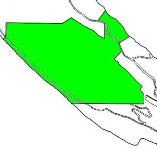
Goose Island is one of the San Juan Islands in San Juan County, Washington, United States.

The Texas Blackland Prairies are a temperate grassland ecoregion located in Texas that runs roughly 300 miles (480 km) from the Red River in North Texas to San Antonio in the south. The prairie was named after its rich, dark soil.
Bodega Ridge Provincial Park is a provincial park in British Columbia, Canada. It is on Galiano Island and comprises 233 hectares. The park's high cliffs are home to bald eagles, peregrine falcons, and turkey vultures.

Beacon Hill Park is a 75 ha park located along the shore of Juan de Fuca Strait in Victoria, British Columbia. The park is popular both with tourists and locals, and contains a number of amenities including woodland and shoreline trails, two playgrounds, a waterpark, playing fields, a petting zoo, tennis courts, many ponds, and landscaped gardens.

Manuel Quimper Benítez del Pino was a Spanish Peruvian explorer, cartographer, naval officer, and colonial official. He participated in charting the Strait of Juan de Fuca and the Sandwich Islands in the late 18th century. He was later appointed a colonial governor in his native Peru at the beginning of the fight for independence there. He retired to Spain, but was able to return to Peru where he served as a naval officer in the new republic and pursued a literary career, publishing over 20 books about his experiences before his death there in Lima.

Spieden Island is a privately-owned island in the San Juan Archipelago in the U.S. state of Washington. It has a land area of 516.4 acres (209.0 ha) and no permanent resident population as of the 2000 census, although several structures are present on various parts of the island. The island was purchased by James Jannard, founder and major shareholder of Oakley, Inc. in 1997; however its current owner could not be identified using public records.
Crane Island is one of the San Juan Islands in San Juan County, Washington, United States. It lies just off the southwestern shore of Orcas Island, between it and the northwest corner of Shaw Island. Crane Island has a land area of 0.956 km². The 2000 census reported a population of 20 permanent residents.

Johns Island is one of the San Juan Islands in San Juan County, Washington. It lies just east of Stuart Island and north of Spieden Island. Johns Island is home to Camp Nor'wester, a summer camp for children on the west end of the island, and several private vacation cabins on the east end of the island. It has a land area of 0.9083 km². As with many of the outlying San Juan Islands, Johns Island does not have electricity or plumbing. There was a resident population of five persons as of the 2000 census.
Pearl Island is one of the San Juan Islands of San Juan County, Washington, United States. Named during the 1841 Wilkes Expedition, it lies off the western shore of San Juan Island, between it and Henry Island. Pearl Island has a land area of 0.151 km², and a population of seven permanent residents as of the 2000 census.
Henry Island is one of the San Juan Islands of San Juan County, Washington, United States. It lies just off the northwest shore of San Juan Island. The small Pearl Island also lies between Henry Island and San Juan Island at its northern end. Just northwest of the northern tip of Henry Island lies Battleship Island, a State bird sanctuary. Except for Stuart Island, Henry Island is the westernmost of the San Juan Islands. It has a land area of 4.126 km² and had a handful of permanent residents as of the 2000 census.
Brown Island is a small, private island in Friday Harbor on San Juan Island, San Juan County, Washington, United States. It lies just offshore to the east-northeast of the town of Friday Harbor, Washington. The island has a land area of approximately 70 acres (28 ha) and on January 1, 2008 it had a resident full-time population of 10 people.
Satellite Island lies in Prevost Harbor on the north side of Stuart Island in the San Juan Islands of San Juan County, Washington, United States. It has a land area of 116.42 acres (47.11 ha) and no resident population as it is a private island owned by the YMCA, which has five camping areas set up for its use. Two of the camps, Sunset Camp and Fellowship Camp, are used for overnight island trips by campers from YMCA Camp Orkila and are located on the western half of the island. Islander Camp is located on the east side of the island, and is used primarily by the Islander Teen Expedition, a kayaking trip which crosses into Canada's Gulf Islands. Mariner Camp is located on the east side of the island, near Islander Camp, and is used by the Mariner Teen Expedition, a sailing trip for teenagers.

Haro Strait, often referred to as the Haro Straits because it is really a series of straits, is one of the main channels connecting the Strait of Georgia to the Strait of Juan de Fuca, separating Vancouver Island and the Gulf Islands in British Columbia, Canada from the San Juan Islands of Washington state in the United States.
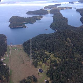
Dinner Island is an island in the San Juan Islands of the U.S. state of Washington. It lies in Griffin Bay on the southeastern coast of San Juan Island.
The Trial Islands Ecological Reserve is a nature reserve on the Trial Islands in the British Columbia province of Canada just off the southern tip of Oak Bay in the Strait of Juan de Fuca. The twenty-three-hectare ecological reserve was established in 1990 to protect two elongated rocky islands and associated islets. It protects the greatest number of endangered and vulnerable species in a single ecological reserve in British Columbia.

The Camas Infoshop is a not-for-profit and collectively run infoshop, bookstore and autonomous space located on Lekwungen Territory in Victoria, British Columbia, Canada. Camas first opened its doors in September 2007, with the intention of providing a voice for anti-authoritarian and anti-colonial perspectives and local struggles, and helping to foster a spirit of solidarity with other such struggles taking place globally.
The Garcia River Forest is a 24,000-acre (97 km2) forest located in Mendocino County, California, about 100 miles (160 km) north of San Francisco. It is owned and managed by The Conservation Fund. The fund generates CO2 credits by logging a portion of the forest less intensely than is allowed under California law. These credits are sold to PG&E which retires them on behalf of customers enrolled in its ClimateSmart program. PG&E's ClimateSmart program is a program where customers voluntarily pay more on their utility bill to offset a percentage of their GHG emissions.


