
South Gloucestershire is a unitary authority area in the ceremonial county of Gloucestershire, South West England. Towns in the area include Yate, Chipping Sodbury, Thornbury, Filton, Patchway and Bradley Stoke. The southern part of its area falls within the Greater Bristol urban area surrounding the city of Bristol.

Aust is a small village in South Gloucestershire, England, about 10 miles (16 km) north of Bristol and about 28 miles (45 km) south west of Gloucester. It is located on the eastern side of the Severn estuary, close to the eastern end of the Severn Bridge which carries the M48 motorway. The village has a chapel, a church and a public house. There is a large area of farmland on the river bank, which is sometimes flooded due to the high tidal range of the Severn. Aust Cliff, above the Severn, is located about 0.5 miles (0.80 km) from the village. The civil parish of Aust includes the villages of Elberton and Littleton-upon-Severn.

Tockington is a village in South Gloucestershire, England. Historically the village developed around farming based mainly on the rearing of cattle on the fertile flood plains. In more recent times Tockington has become an attractive location for commuters, being situated within the Green Belt and well connected with Bristol. It is south of Olveston and is located in a steep valley. The village also has the Swan Inn, a popular pub. The centre of the village, where the pub is located is a triangular junction.

Pilning is a village in South Gloucestershire, England, close to Redwick and Severn Beach. Pilning is close to the M4, M49 and A403 roads, and has the South Wales Main Line railway running through it, with a minor station.

Henbury is a suburb of Bristol, England, approximately 5 miles (8.0 km) north west of the city centre. It was formerly a village in Gloucestershire and is now bordered by Westbury-on-Trym to the south; Brentry to the east and the Blaise Castle Estate, Blaise Hamlet and Lawrence Weston to the west. To the north lie the South Gloucestershire village of Hallen and the entertainment/retail park Cribbs Causeway.

Olveston is a small village and larger parish in South Gloucestershire, England. The parish comprises the villages of Olveston and Tockington, and the hamlets of Old Down, Ingst and Awkley. The civil parish population at the 2011 census was 2,033. Alveston became a separate church parish in 1846. The district has been inhabited since the Stone Age, and the salt marshes that made up almost half of the parish, were progressively drained in Roman and Saxon times. A sea wall was constructed at the same time to prevent flooding from the nearby estuary of the River Severn.
Rudgeway is a village in South Gloucestershire in south west England, located between Alveston and Almondsbury on the A38 trunk road. It lies west of Earthcott, Latteridge, Iron Acton and Yate on the B4059 road.

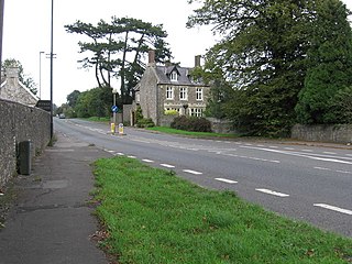
Elberton is a small village and former civil parish, now in the parish of Aust, in the South Gloucestershire district, in the ceremonial county of Gloucestershire, England. In 1931 the parish had a population of 137.

Astwick is a hamlet and civil parish in the Central Bedfordshire district of the county of Bedfordshire, England about 12.5 miles (20 km) south-east of the county town of Bedford. Its population is included within Stotfold civil parish.

Ingst is a hamlet in the parish of Olveston in South Gloucestershire, England. It consists of nine households, most of which are farms with cattle.

Pucklechurch is a large village and civil parish in South Gloucestershire, England. It has a current population of about 3000. The village dates back over a thousand years and was once the site of a royal hunting lodge, as it adjoined a large forest.

Tortworth is a small village and civil parish, near Thornbury in Gloucestershire, England. It has a population of 147 as of 2011. It lies on the B4509 road, which crosses the M5 motorway to the west of Tortworth.

Keevil is a village and civil parish in Wiltshire, England, about 4 miles (6 km) east of the centre of Trowbridge and a similar distance south of Melksham. The village lies on a slope between Great Hinton and Bulkington. Semington Brook forms much of the northeast boundary of the parish.
William Paty was a British surveyor, architect and mason working mainly in Bristol.
Thomas Paty was a British surveyor, architect and mason working mainly in Bristol. He worked with his sons John Paty and William Paty.
The BS postcode area, also known as the Bristol postcode area, is a group of 37 postcode districts in South West England, within eight post towns. These cover the city of Bristol, north Somerset and south Gloucestershire.

John Twynyho of Cirencester, Bristol and Lechlade, all in Gloucestershire, was a lawyer and wealthy wool merchant who served as Recorder of Bristol, as a Member of Parliament for Bristol in Gloucestershire in 1472-5 and in 1484 and for the prestigious county seat Gloucestershire in 1476. In 1478 he was Attorney General to Lord Edward (the future King Edward V, eldest son and heir of King Edward IV.

Langley and Swinehead was an ancient hundred of Gloucestershire, England. Hundreds originated in the late Saxon period as a subdivision of a county and lasted as administrative divisions until the 19th century.
Gordon Charles Tovey was an English first-class cricketer and schoolmaster.


