Tormarton

Last updated

Tormarton
High Street, Tormarton - geograph.org.uk - 1437746.jpg
Tormarton High Street
Gloucestershire UK location map.svg
Red pog.svg
Tormarton
Location within Gloucestershire
Population323 (2021) [1]
OS grid reference ST768787
Civil parish
  • Tormarton
Unitary authority
Ceremonial county
Region
Country England
Sovereign state United Kingdom
Post town Badminton
Postcode district GL9
Dialling code 01454
Police Avon and Somerset
Fire Avon
Ambulance South Western
UK Parliament
Website Parish Council
List of places
UK
England
Gloucestershire
51°30′25″N2°20′06″W / 51.507°N 02.335°W / 51.507; -02.335

Tormarton is a village and civil parish in the South Gloucestershire district, in the ceremonial county of Gloucestershire, England. The village is about half a mile north of the M4 motorway; the A46 road towards Bath passes a similar distance west of the village to join the motorway at junction 18. The parish includes the small village of West Littleton, south of the motorway. The parish population at the 2021 census was 323. [1] The Cotswold Way footpath passes through the village. [2]

Contents

History

St Mary Magdalene church Tormarton Church - geograph.org.uk - 86577.jpg
St Mary Magdalene church
The main entrance to Dodington Park Dodington Park, South Gloucestershire, Bath Lodge - geograph.org.uk - 96020.jpg
The main entrance to Dodington Park

It is thought that humans have been active in the area of Tormarton for more than 6,000 years. [3] In 1968 the bodies of three Bronze Age men were discovered near Tormarton, when a gas pipeline was being installed. Unusually, two of the bodies showed combat wounds; they are now in Bristol Museum & Art Gallery. Further excavations were made in 1999 and 2000, which found remains of two other bodies estimated to be 3,500 years old. They are all thought to have all died at a similar time and were then buried in a ditch. [4] A BBC documentary, Meet The Ancestors, was made that followed the second excavation. [5]

The area is thought to have been inhabited by the Romans [2] as a stone coffin was found in nearby Hinton. [6] The village was on the border of the Anglo Saxon kingdoms of Wessex and Mercia. The medieval village was larger than today: extensive earthworks to the north and east of the church suggest that this area may have been settled previously. [2] Its name may come from Thor Maer Tun, meaning The settlement with the thorn (tree) on the boundary. [2] Another source suggests the name derives from the church tower (Tor) on the border between Wessex and Mercia (Anglo-Saxon Meark). [7]

The village became part of the Badminton estate, owned by the Duke of Beaufort, in 1789. [8] In 1848 the population of the parish was 620. [9]

Baron Altrincham, of Tormarton is a title in the Peerage of the United Kingdom that was created in 1945 for the politician Edward Grigg and then held by John Grigg who disclaimed the title under the Peerage Act of 1963.

The M4 motorway to the west of Tormarton opened in 1967, with the section to the east running to Stanton St Quintin (Junction 17) opening four years later. [10]

In 2008, SITA made a planning application to build a large in-vessel composting facility near Tormarton. [11] Previously SITA had been proposing to site it on a brown field site in Pucklechurch but this was met with opposition from residents due to concerns it could pose a health risk and be an eyesore. The proposed facility would handle 30,000 tonnes of waste a year. BBC News reported that it was controversial with residents in Tormarton too. [12]

Notable buildings

The Church of England parish church of St Mary Magdelene stands to the north of the present village. Its Norman origins can be seen in the chancel arch and the lower two stages of the tower. The south aisle was added in the 14th century, and in 1853 T. H. Wyatt added the south porch and the vestry. The church was designated as Grade I listed in 1985. [13]

The former manor house, now Manor Farmhouse, is south-west of the church. Originally the home of the St Loe family of Tormarton and Sutton Court at Chew Magna,[ citation needed ] it was later owned by the de la Riviere family. Dating from c.1350, the house was enlarged to the rear in the next century and further added to and altered in the 17th, 18th and 19th centuries. [14]

Tormarton Court is a Grade II listed Georgian rectory, now a house. [15] The manor house at West Littleton, from c.1500 with later alterations, is Grade II* listed. [16]

Notable residents

Related Research Articles

<span class="mw-page-title-main">South Gloucestershire</span> Local government district in Gloucestershire, England

South Gloucestershire is a unitary authority area in the ceremonial county of Gloucestershire, South West England. Towns in the area include Yate, Chipping Sodbury, Kingswood, Thornbury, Filton, Patchway and Bradley Stoke. The southern part of its area falls within the Greater Bristol urban area surrounding the city of Bristol.

<span class="mw-page-title-main">Aust</span> Human settlement in England

Aust is a small village in South Gloucestershire, England, about 10 miles (16 km) north of Bristol and about 28 miles (45 km) south west of Gloucester. It is located on the eastern side of the Severn estuary, close to the eastern end of the Severn Bridge which carries the M48 motorway. The village has a chapel, a church and a public house. There is a large area of farmland on the river bank, which is sometimes flooded due to the high tidal range of the Severn. Aust Cliff, above the Severn, is located about 0.5 miles (0.80 km) from the village. The civil parish of Aust includes the villages of Elberton and Littleton-upon-Severn.

<span class="mw-page-title-main">Almondsbury</span> Village in South West, England

Almondsbury is a large village near junction 16 of the M5 motorway, on the outskirts of the city of Bristol, in South Gloucestershire, England, and a civil parish which also includes the villages of Hortham, Gaunt's Earthcott, Over, Easter Compton, Compton Greenfield, Hallen and Berwick.

<span class="mw-page-title-main">Avonmouth</span> Port and suburb of Bristol, England

Avonmouth is a port and outer suburb of Bristol, England, facing two rivers: the reinforced north bank of the final stage of the Avon which rises at sources in Wiltshire, Gloucestershire and Somerset; and the eastern shore of the Severn Estuary. Strategically the area has been and remains an important part of the region's maritime economy particularly for larger vessels for the unloading and exporting of heavier goods as well as in industry including warehousing, light industry, electrical power and sanitation. The area contains a junction of and is connected to the south by the M5 motorway and other roads, railway tracks and paths to the north, south-east and east.

<span class="mw-page-title-main">Penkridge</span> Village in England

Penkridge is a large village and civil parish in South Staffordshire District in Staffordshire, England. It is to the south of Stafford, north of Wolverhampton, west of Cannock, east of Telford and south-east of Newport.

<span class="mw-page-title-main">Stoke Gifford</span> Human settlement in England

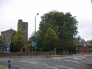
Stoke Gifford is a neighbourhood and parish and electoral ward in South Gloucestershire, England. Formerly a separate village, it is now a suburb in the Bristol built-up area, part of the city's North Fringe. The ward had 14,200 residents in 5,788 households at the 2021 Census.

<span class="mw-page-title-main">Westerleigh</span> Human settlement in England

Westerleigh is a clustered village in the civil parish of Westerleigh and Coalpit Heath in the South Gloucestershire district, in the ceremonial county of Gloucestershire, England, it contains sources of the Frome and has an endpoint of the Frome Valley Walkway. It is 0.8 miles (1.3 km) north of the M4, 1 mile (1.6 km) south of Yate and 10 miles (16 km) north-east of the city of Bristol. In the south it includes a steep hill of its own 5 miles (8.0 km) from the crest of the Cotswold hills which is designated an AONB.

<span class="mw-page-title-main">Pucklechurch</span> Human settlement in England

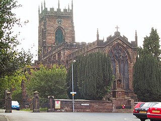
Pucklechurch is a civil parish in South Gloucestershire, England, the main settlement of which is the large village of Pucklechurch. The parish also incorporates the hamlet of Shortwood to the west of Pucklechurch village, and Parkfield to the north-west. It has a current population of just over 3200 based on the 2021 census data. The village dates back over a thousand years and was once the site of a royal hunting lodge, as it adjoined a large forest.

<span class="mw-page-title-main">West Littleton</span> Human settlement in England

West Littleton is a village and former civil parish, now in the parish of Tormarton, in the South Gloucestershire district, in the ceremonial county of Gloucestershire, England. It lies between the M4 and the A420. The closest amenities are in Marshfield, 1.5 miles (2.4 km) to the south-east, and the historic city of Bath is about 7 miles (11 km) to the south.

Frenchay is a village in the north east of the city of Bristol.

<span class="mw-page-title-main">Codrington, Gloucestershire</span> Settlement in South Gloucestershire, England

Codrington is a settlement in South Gloucestershire, England. It is located near Junction 18 of the M4 motorway south of Wapley and Yate.

The office of High Sheriff of Somerset is an ancient shrievalty which has been in existence since the 11th century. Originally known as the "Sheriff of Somerset", the role was retitled on 1 April 1974, under the provisions of the Local Government Act 1972.

Dodington Park is a country house and estate in Dodington, South Gloucestershire, England. The house was built by James Wyatt for Christopher Bethell Codrington. The family had made their fortune from sugar plantations in the Caribbean and were significant owners of slaves. It remained in the Codrington family until 1980; it is now owned by the British businessman James Dyson.

<span class="mw-page-title-main">Nicholas Wadham (1531–1609)</span> English benefactor (1531–1609)

Nicholas Wadham (1531–1609) of Merryfield in the parish of Ilton, Somerset, and Edge in the parish of Branscombe, Devon, was a posthumous co-founder of Wadham College, Oxford, with his wife Dorothy Wadham who, outliving him, saw the project through to completion in her late old age. He was Sheriff of Somerset in 1585.

<span class="mw-page-title-main">Leigh, Staffordshire</span> Human settlement in England

Leigh is a civil parish in the English county of Staffordshire. The parish includes the village of Church Leigh, together with the settlements of Withington, Upper Leigh, Lower Leigh, Morrilow Heath, Middleton Green, Dodsley, Godstone, Nobut and Field.

<span class="mw-page-title-main">Popham, Hampshire</span> Human settlement in England

Popham is a hamlet and civil parish south of Basingstoke, Hampshire, England. According to the Post Office the population of the 2011 Census was included in the civil parish of Dummer. The area was occupied from pre-historic times and was established as a permanent habitation during the Roman occupation of Britain. The manor of Popham was established by the monastery of Winchester as an outlying agricultural grain station. A small church and school were later established, but have long since disappeared. The parish and hamlet were later dissected by the M3 Motorway and A303 trunk road. Although named for Popham, Popham Airfield and the Popham Little Chef restaurant are situated in the neighbouring parish of Steventon.

<span class="mw-page-title-main">Merryfield, Ilton</span> Historic estate in Somerset, England

Merryfield is a historic estate in the parish of Ilton, near Ilminster in Somerset, England. It was the principal seat of the Wadham family, and was called by Prince their "noble moated seat of Meryfeild" (sic). The mansion house was demolished in 1618 by Sir John Wyndham (1558–1645), of Orchard Wyndham, a nephew and co-heir of Nicholas II Wadham (1531–1609), co-founder of Wadham College, Oxford, the last in the senior male line of the Wadham family. It bears no relation to the present large 19th-century grade II listed mansion known as Merryfield House, formerly the vicarage, immediately south of St Peter's Church, Ilton.

<span class="mw-page-title-main">William Wadham (died 1452)</span>

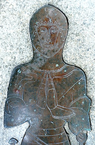
Sir William Wadham (c.1386–1452) of Merryfield in the parish of Ilton, Somerset and Edge in the parish of Branscombe, Devon came from a West Country gentry family with a leaning towards the law, who originally took their name from the manor of Wadham in the parish of Knowstone, between South Molton and Exmoor, north Devon.

<span class="mw-page-title-main">John Wadham</span> Member of the Parliament of England

Sir John Wadham (c.1344–1412) was a Justice of the Common Pleas from 1389 to 1398, during the reign of King Richard II (1377–1399), selected by the King as an assertion of his right to rule by the advice of men appointed of his own choice, and one of the many Devonians of the period described by Thomas Fuller in his Worthies of England, as seemingly "innated with a genius to study law".

<span class="mw-page-title-main">Grumbald's Ash Hundred</span>

Grumbald's Ash Hundred was a subdivision of the county of Gloucestershire, England. Hundreds originated in the late Saxon period and lasted as administrative divisions until the 19th century. It has been reported that the court was originally held under an Ash tree situated in Doddington parish, although this location would not be consistent with the previous split of hundred. Its name survives in the Grumbolds Ash with Avening electoral ward of Cotswold district council.

References

  1. 1 2 "Tormarton (parish): population statistics, 2021 Census". CityPopulation.de. Retrieved 25 May 2024.
  2. 1 2 3 4 "Exploring the Cotswold Way National trail" (PDF). S. Glos Council. Retrieved 30 June 2009.
  3. Tormarton & West Littleton Parish Plan 2010
  4. Prehistoric archaeology – the dead of Tormarton. South Gloucestershire Council. 25 May 2009. URL:http://www.southglos.gov.uk/NR/exeres/752627d3-23ca-44d3-94a5-ea11258e05b7. Accessed: 2009-05-25. (Archived by WebCite at https://www.webcitation.org/5h2rTyF5q)
  5. Media Collections – Off-air Television Broadcasts (Part 2) – June 2006
  6. "Puckleweb – history and archaeology". S. Glos council. Archived from the original on 26 September 2011. Retrieved 30 June 2009.
  7. A short history of Tormarton and its Church. Gloucestershire.
  8. "The National Archives – The Beaufort Estates" . Retrieved 30 June 2009.
  9. Lewis, Samuel (1848). "A Topographical Dictionary of England – Tormarton (St. Mary)" . Retrieved 25 March 2010.
  10. "The Motoryway Archive: The M4 London to South Wales Motorway. Holyport to Tormarton" . Retrieved 12 March 2010.
  11. Planning documentation In-vessel composting plant Tormarton, South Gloucestershire, United Kingdom], planning.southglos.gov.uk
  12. "New scheme for composting plant". BBC News. 18 September 2008. Retrieved 15 January 2010.
  13. Historic England. "Church of St Mary Magdelene (1213492)". National Heritage List for England . Retrieved 25 May 2024.
  14. Historic England. "Manor Farmhouse (1213491)". National Heritage List for England. Retrieved 25 May 2024.
  15. Historic England. "Tormarton Court (1288782)". National Heritage List for England. Retrieved 25 May 2024.
  16. Historic England. "Old Manor House (1288609)". National Heritage List for England. Retrieved 25 May 2024.
  17. This is Bristol: Footsteps into History – Dodington
  18. Young, Roger (22 October 2011). "Obituary: John Mackay". The Independent. Retrieved 10 August 2021.
  19. Collins, J. R. (2000). "Christian Ecclesiology and the Composition of Leviathan: A Newly Discovered Letter to Thomas Hobbes". The Historical Journal. 43 (1): 217–231. doi:10.1017/S0018246X99008845. JSTOR   3021019. S2CID   154979401.
  20. Digby, Elizabethan Embroidery, p. 58-63
  21. Craven, Maxwell. "Bess the builder left many fine homes" . Retrieved 30 June 2009.
  22. See, lists of county sheriffs etc. and the will of Sir Edward Wadham of Tormarton in the National Archives at Kew

Commons-logo.svg Media related to Tormarton at Wikimedia Commons