Chitradurga district

Last updated

Chitradurga district
Chitradurga Temples.JPG
Nayakanahatti temple olamatha.jpg
Entrance to Ranganatha Swamy temple at Neerthadi.JPG
Rear view of the Teru Malleshvara temple at Hiriyur.JPG
Vani vilas sagar dam, hiriyur, Karnataka.jpg
Clockwise from top-left: Chitradurga Fort, Nayakanahatti temple, Teru Malleshwara Temple at Hiriyur, Vani Vilasa Sagara, Ranganatha Swamy Temple at Neerthadi
Karnataka Chitradurga locator map.svg
Location in Karnataka
Chitradurga district
Coordinates: 14°00′N76°30′E / 14.00°N 76.50°E / 14.00; 76.50
CountryFlag of India.svg  India
State Karnataka
Division Bangalore Division
Headquarters Chitradurga
Talukas Challakere
Chitradurga
Hiriyur
Holalkere
Hosdurga
Molakalmuru
Government
   Deputy Commissioner Divya Prabhu G.R.J
(IAS)
  Member of Parliament A. Narayanaswamy
Area
[1]
  Total8,440 km2 (3,260 sq mi)
Elevation
(Highest)
1,094 m (3,589 ft)
Population
 (2011) [1]
  Total1,659,456
  Density200/km2 (510/sq mi)
Languages
  Official Kannada
Time zone UTC+5:30 (IST)
PIN
577 501, 502, 577524
Telephone code+ 91 (8194)
ISO 3166 code IN-KA-CT
Vehicle registration Chitradurga KA-16
Sex ratio 1.047 /
Literacy73.82%
Lok Sabha constituency Chitradurga Lok Sabha constituency
Precipitation 522 millimetres (20.6 in)
Website chitradurga.nic.in

Chitradurga district is an administrative district of Karnataka state in southern India. [2] The city of Chitradurga is the district headquarters. Chitradurga gets its name from Chitrakaldurga, an umbrella-shaped lofty hill found there. Tradition dates Chitradurga District to the period of the Ramayana and Mahabharata. The whole district lies in the valley of the Vedavati River, with the Tungabhadra River flowing in the northwest. During the British times it was named Chitaldroog. The district was practically ruled by all the well known dynasties that ruled Karnataka. A historical places like Jain basadi of Heggere, a pilgrimage centre for Jain's in district.

Contents

Demographics

Historical population
YearPop.±% p.a.
1901354,308    
1911393,953+1.07%
1921408,588+0.37%
1931462,953+1.26%
1941505,565+0.88%
1951588,497+1.53%
1961741,344+2.34%
1971899,257+1.95%
19811,089,304+1.94%
19911,312,717+1.88%
20011,517,896+1.46%
20111,659,456+0.90%
source: [3]
Religions in Chitradurga district (2011) [4]
ReligionPer cent
Hinduism
91.63%
Islam
7.76%
Other or not stated
0.61%

According to the 2011 census Chitradurga district has a population of 1,659,456, [5] roughly equal to the nation of Guinea-Bissau [6] or the US state of Idaho. [7] This gives it a ranking of 297th in India (out of a total of 640). [5] The district has a population density of 197 inhabitants per square kilometre (510/sq mi). [5] Its population growth rate over the decade 2001–2011 was 9.39%. [5] Chitradurga has a sex ratio of 969 females for every 1000 males, [5] and a literacy rate of 73.82%. 19.86% of the population lives in urban areas. Scheduled Castes and Scheduled Tribes make up 23.45% and 18.23% of the population respectively. [5]

Languages of Chitradurga district (2011) [8]

   Kannada (83.33%)
   Urdu (7.33%)
   Telugu (5.39%)
   Lambadi (2.29%)
  Others (1.66%)

At the time of the 2011 census, 83.33% of the population spoke Kannada, 7.33% Urdu, 5.39% Telugu and 2.29% Lambadi as their first language. [9]

Economy

In 2006 the Ministry of Panchayati Raj named Chitradurga one of the country's 250 most backward districts (out of a total of 640). [10] It is one of the five districts in Karnataka currently receiving funds from the Backward Regions Grant Fund Programme (BRGF). [10]

Education

People

See also

Related Research Articles

<span class="mw-page-title-main">Vaishali district</span> District of Bihar in India

Vaishali district is a district in the Indian state of Bihar. It is a part of Tirhut division. Vaishali is known for being the birthplace of Mahavira of the Jain religion. Hajipur, its largest city and district headquarters, is known for its banana forest. The district is connected via the NH-77 and NH-322 highways, which connect the state capital Patna, the division headquarters Muzaffarpur, and the eastward district Samastipur.

<span class="mw-page-title-main">Barpeta district</span> District of Assam in India

Barpeta district {Pron:bə(r)ˈpeɪtə or bə(r)ˈpi:tə} is an administrative district in the state of Assam in India. The district headquarters are located at Barpeta. The district occupies an area of 3,245 km2 (1,253 sq mi) and has a population of 1,642,420.

<span class="mw-page-title-main">Khagaria district</span> District of Bihar Region = Mithila Language = Maithili in India

Khagaria district is an administrative district in Mithila region in the state of Bihar in India. The district headquarters are located at Khagaria. Earlier it was a part of Munger District as a sub-division that was created in 1943–44. It was upgraded to the status of a district on 10 May 1981. Khagaria district is a part of Munger Division.

<span class="mw-page-title-main">Munger district</span> District of Bihar in India

Munger district is one of the thirty-eight districts of Bihar state in eastern India. The city of Munger is the administrative headquarters of this district. The district is a part of Munger Division. Its literacy rate of 73.3% is higher than the state literacy rate of 63.8%, but lower than national rate of 74.04%.

<span class="mw-page-title-main">Kishanganj district</span> District in Bihar, India

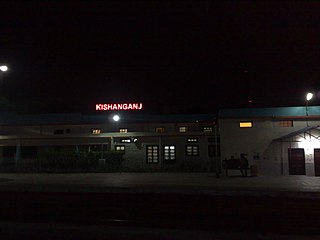
Kishanganj district is one of the thirty-eight districts of Bihar state, India, and Kishanganj town is the administrative headquarters of this district. Kishanganj district is a part of Purnia division (Seemanchal).

<span class="mw-page-title-main">Simdega district</span> District of Jharkhand in India

Simdega district is one of the 24 districts of Jharkhand state, India, and Simdega town is the administrative headquarters of this district. As of 2011, this district is the least densely populated district and the third least populous district of Jharkhand after Lohardaga and Khunti districts. Simdega District was carved out from erstwhile Gumla district on 30 April 2001. It is currently a part of the Red Corridor.

<span class="mw-page-title-main">Sahebganj district</span> District of Jharkhand in India

Sahibganj district is one of the twenty-four districts of Jharkhand state, India, and Sahibganj is the administrative headquarters of this district.

<span class="mw-page-title-main">Dumka district</span> District of Jharkhand in India

Dumka district is one of the twenty-four districts of Jharkhand state in eastern India. Dumka is the administrative headquarters of this district. This district covers an area of 3716.02 km2. This district has a population of 1,321,442.

<span class="mw-page-title-main">Chandauli district</span> District in Uttar Pradesh, India

Chandauli district is a district of Uttar Pradesh state of India, and Chandauli town is the district headquarters. Chandauli district is a part of Varanasi Division. Chandauli became a separate district on 20 May 1997.

<span class="mw-page-title-main">Betul district</span> District of Madhya Pradesh in India

Betul district is a district of Madhya Pradesh state in central India. The city of Betul serves as its administrative headquarters. The district is a part of Narmadapuram Division.

<span class="mw-page-title-main">Jalaun district</span> District of Uttar Pradesh in India

Jalaun district is a district of Uttar Pradesh, India. The district is named after the town of Jalaun, which was the former headquarters of a Maratha governor, but the administrative headquarters of the district is at Orai.

<span class="mw-page-title-main">Kaushambi district</span> District of Uttar Pradesh in India

Kaushambi district is a district in the state of Uttar Pradesh in India. Manjhanpur is the district headquarters. The district was carved from Prayagraj district on 4 April 1997. Manauri Bajar connects Prayagraj and Kaushambi districts by railway over a bridge on SH-95. Manjhanpur is south-west of Prayagraj on the north bank of the Yamuna river, about 55 kilometres (34 mi) from the city. It is surrounded by Chitrakoot district on the south, Pratapgarh district on the north, Prayagraj district on the east and Fatehpur district on the west. Kaushambi is part of Prayagraj division. The nearest railway station, in Bharwari, connects with Delhi, Prayagraj, Kolkata, Gaya and Kanpur.

<span class="mw-page-title-main">Sant Kabir Nagar district</span> District of Uttar Pradesh in India

Sant Kabir Nagar district is one of the 75 districts of Uttar Pradesh state in northern India. Khalilabad is the district headquarters. Sant Kabir Nagar district is a part of Basti division. The total area of Sant Kabir Nagar district is 1,646 km2 (636 sq mi).

<span class="mw-page-title-main">Hamirpur district, Uttar Pradesh</span> District of Uttar Pradesh in India

Hamirpur district is one of the 75 districts of Uttar Pradesh state of India and Hamirpur town is the district headquarters. Hamirpur district is a part of Chitrakoot Division. The district occupies an area of 4,121.9 km². The district has a population of 1,104,285. As of 2011 it is the third least populous district of Uttar Pradesh, after Mahoba and Chitrakoot. Two major rivers Yamuna and Betwa meet here. On the banks of river Betwa lies the "Coarse sand" which is exported to many parts in U.P.

<span class="mw-page-title-main">Dakshin Dinajpur district</span> District in West Bengal, India

Dakshin Dinajpur, also known as South Dinajpur, is a district in the Indian state of West Bengal, India. It was created on 1 April 1992 by the division of the erstwhile West Dinajpur District.The Headquarter (sadar) of the district is at Balurghat. It comprises two subdivisions: Balurghat and Gangarampur. According to the 2011 census, it is the third least populous district of West Bengal.

<span class="mw-page-title-main">Damoh district</span> District of Madhya Pradesh in India

Damoh District is a district of Madhya Pradesh state in central India. The town of Damoh is the district headquarters. The district is part of the Sagar Division.

<span class="mw-page-title-main">Kalaburagi district</span> District of Karnataka in India

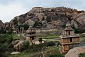
Kalaburagi district, formerly known as Gulbarga district, is one of the 31 districts of Karnataka state in southern India. Kalaburagi city is the administrative headquarters of the district. The district is the headquarters of Kalaburagi division.

<span class="mw-page-title-main">Gorakhpur district</span> District of Uttar Pradesh in India

Gorakhpur district is one of the 75 districts of Uttar Pradesh state in northern India. This district is a part of the Gorakhpur division. The city of Gorakhpur, or Gorakhpur is the administrative headquarters of this district and Gorakhpur division. It borders Sant Kabir Nagar district to the west, Kushinagar and Deoria districts to the east, and Maharajganj and Azamgarh districts to the north and south.

<span class="mw-page-title-main">Davanagere district</span> District in Karnataka, India

Davanagere district is an administrative district of Karnataka state in India. It is the centre of Karnataka. The city of Davanagere is the district headquarters. It had a population of 1,643,494 of which 32.31% was urban as of 2011. This district was separated from Chitradurga district in 1997 by the then Chief minister of Karnataka J. H. Patel including Chennagiri and Honali Taluks Shimoga district.

<span class="mw-page-title-main">Chitrakoot district</span> District of Uttar Pradesh in India

Chitrakoot district is one of the districts of Uttar Pradesh state of India in the Bundelkhand region and Chitrakoot city is the district headquarters. Chitrakoot district is a part of Chitrakoot Division. The district occupies an area of 3,216 km².The district has a population of 991,730. As of 2011 it is the second least populated district of Uttar Pradesh, after Mahoba.

References

  1. 1 2 "District at a Glance". Chitradurga district website. Retrieved 3 January 2011.
  2. Chisholm, Hugh, ed. (1911). "Chitaldrug"  . Encyclopædia Britannica . Vol. 6 (11th ed.). Cambridge University Press. p. 247.
  3. Decadal Variation In Population Since 1901
  4. "Table C-01 Population by Religion: Karnataka". censusindia.gov.in. Registrar General and Census Commissioner of India. 2011.
  5. 1 2 3 4 5 6 "District Census Handbook: Chitradurga" (PDF). censusindia.gov.in. Registrar General and Census Commissioner of India. 2011.
  6. US Directorate of Intelligence. "Country Comparison:Population". Archived from the original on 13 June 2007. Retrieved 1 October 2011. Guinea-Bissau 1,596,677 July 2011 est.
  7. "2010 Resident Population Data". U.S. Census Bureau. Archived from the original on 19 October 2013. Retrieved 30 September 2011. Idaho 1,567,582
  8. "Table C-16 Population by Mother Tongue: Karnataka". Census of India . Registrar General and Census Commissioner of India.
  9. "Table C-16 Population by Mother Tongue: Karnataka". www.censusindia.gov.in. Registrar General and Census Commissioner of India.
  10. 1 2 Ministry of Panchayati Raj (8 September 2009). "A Note on the Backward Regions Grant Fund Programme" (PDF). National Institute of Rural Development. Archived from the original (PDF) on 5 April 2012. Retrieved 27 September 2011.