This is a list of islands of Costa Rica. There are about 79 islands in Costa Rica. [1]

This is a list of islands of Costa Rica. There are about 79 islands in Costa Rica. [1]
The islands of Costa Rica include the following: [1] [2]

Costa Rica, officially the Republic of Costa Rica, is a country in the Central American region of North America, bordered by Nicaragua to the north, the Caribbean Sea to the northeast, Panama to the southeast, the Pacific Ocean to the southwest, and maritime border with Ecuador to the south of Cocos Island. It has a population of around five million in a land area of 51,060 km2 (19,710 sq mi). An estimated 333,980 people live in the capital and largest city, San José, with around two million people in the surrounding metropolitan area.

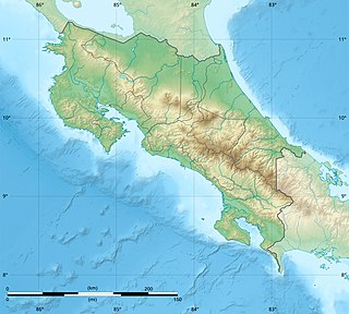
Costa Rica is located on the Central American Isthmus, surrounding the point 10° north of the equator and 84° west of the prime meridian. It has 212 km of Caribbean Sea coastline and 1,016 on the North Pacific Ocean.

Central America is a subregion of the Americas. Its boundaries are defined as bordering the United States to the north, Colombia to the south, the Caribbean Sea to the east, and the Pacific Ocean to the west. Central America consists of eight countries: Belize, Costa Rica, El Salvador, Guatemala, Honduras, Mexico, Nicaragua, and Panama. Within Central America is the Mesoamerican biodiversity hotspot, which extends from northern Guatemala to central Panama. Due to the presence of several active geologic faults and the Central America Volcanic Arc, there is a high amount of seismic activity in the region, such as volcanic eruptions and earthquakes which has resulted in death, injury, and property damage.

Cocos Island is an island in the Pacific Ocean administered by Costa Rica, approximately 550 km southwest of the Costa Rican mainland. It constitutes the 11th of the 13 districts of Puntarenas Canton of the Province of Puntarenas. With an area of approximately 23.85 km2 (9.21 sq mi), the island is more or less rectangular in shape. It is the southernmost point of geopolitical North America if non-continental islands are included.

San José is the capital and largest city of Costa Rica, and the capital of the province of the same name. It is in the center of the country, in the mid-west of the Central Valley, within San José Canton. San José is Costa Rica's seat of national government, focal point of political and economic activity, and major transportation hub. San José Canton's population was 288,054 in 2011, and San José's municipal land area is 44.2 square kilometers, with an estimated 333,980 residents in 2015. Together with several other cantons of the central valley, including Alajuela, Heredia and Cartago, it forms the country's Greater Metropolitan Area, with an estimated population of over 2 million in 2017. The city is named in honor of Joseph of Nazareth.
Avianca Costa Rica S.A., formerly known as LACSA, minority owned by the Synergy Group, is the national airline of Costa Rica and is based in San José. It operates international scheduled services to over 35 destinations in Central, North and South America. The airline previously used the TACA/LACSA moniker when it was a subsidiary of Grupo TACA. Since May 2013, following Avianca's purchase of Grupo TACA, Avianca Costa Rica became one of seven nationally branded airlines operated by Avianca Group of Latin American airlines.

According to Article 168 of the Constitution of Costa Rica, the political divisions are officially classified into 3 tiers of sub-national entities.

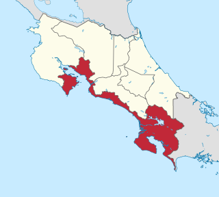
Puntarenas is a province of Costa Rica. It is located in the western part of the country, covering most of Costa Rica's Pacific Ocean coast, and it is the largest province in Costa Rica. Clockwise from the northwest it borders on the provinces Guanacaste, Alajuela, San José and Limón, and the neighbouring country of Panama.

Mount Chirripó is the highest mountain in Costa Rica, with an elevation of 3,821 meters. It is part of the Cordillera de Talamanca, and the range's highest point. It is located in Chirripó National Park and is noted for its ecological wealth. The mountain was named "Chirripo", meaning "land of eternal waters", by indigenous Costa Ricans because there are many lakes and streams around the mountain. The high peaks in Chirripó National Park and La Amistad International Park host important areas of Talamancan montane forest and Costa Rican Páramo with high endemism and extremely high biodiversity. The peaks of these mountains constitute sky islands for many species of plants and animals. Snow has not fallen on the peak in the past 100 years or so, according to the University of Costa Rica, but hail is sometimes reported.

The Costa Rican Football Federation, also known as FEDEFUTBOL or FEDEFUT, is the official association football governing body in Costa Rica and is in charge of the Costa Rica national football team and the Costa Rica women's national football team.

Prestoea is a genus of palms native to the Caribbean, Central and South America. Its range extends from Nicaragua and the Greater Antilles in the north to Brazil and Bolivia in the south.
Territorial disputes of Nicaragua include the territorial dispute with Colombia over the Archipelago de San Andres y Providencia and Quita Sueno Bank. Nicaragua also has a maritime boundary dispute with Honduras in the Caribbean Sea and a boundary dispute over the Rio San Juan with Costa Rica.

The following outline is provided as an overview of and topical guide to Costa Rica:

Tourism in Costa Rica has been one of the fastest growing economic sectors of the country and by 1995 became the largest foreign exchange earner. Since 1999, tourism has earned more foreign exchange than bananas, pineapples and coffee exports combined. The tourism boom began in 1987, with the number of visitors up from 329,000 in 1988, through 1.03 million in 1999, over 2 million in 2008, to a historical record of 2.66 million foreign visitors in 2015. In 2012, tourism contributed with 12.5% of the country's GDP and it was responsible for 11.7% of direct and indirect employment. In 2009, tourism attracted 17% of foreign direct investment inflows, and 13% in average between 2000 and 2009. In 2010, the tourism industry was responsible for 21.2% of foreign exchange generated by all exports. According to a 2007 report by ECLAC, tourism contributed to a reduction in poverty of 3% in the country.

The following is an alphabetical list of topics related to the Republic of Costa Rica.

This is an Index of Central America-related articles. This index defines Central America as the seven nations of Belize, Costa Rica, El Salvador, Guatemala, Honduras, Nicaragua, and Panama.

The Guatemala women's national football team is controlled by the Federación Nacional de Fútbol de Guatemala. They are one of the top women's national football teams in the Central American region along with Costa Rica, having won the 1999 UNCAF championship.
The Costa Rica women's national football team represents Costa Rica in women's international football. The national team is controlled by the governing body Costa Rican Football Federation. They are one of the top women's national football teams in the Central American region along with Guatemala and Panama.

Isla Calero is the largest island in Costa Rica, as well as along the San Juan River, which marks the border between Nicaragua and Costa Rica. The island lies between the San Juan, the Río Colorado of Costa Rica, and the Caribbean Sea. The entire island has an area of 151.6 km2 (58.5 sq mi).