Antioch, Ohio

Last updated

Antioch, Ohio
Antioch from Union Road.jpg
Overview from the north
OHMap-doton-Antioch.png
Location of Antioch, Ohio
Map of Monroe County Ohio Highlighting Antioch Village.png
Location of Antioch in Monroe County
Coordinates: 39°39′40″N81°04′01″W / 39.66111°N 81.06694°W / 39.66111; -81.06694
Country United States
State Ohio
County Monroe
Township Perry
Area
[1]
  Total0.10 sq mi (0.27 km2)
  Land0.10 sq mi (0.27 km2)
  Water0.00 sq mi (0.00 km2)
Elevation
[2]
1,040 ft (320 m)
Population
 (2020)
  Total71
  Estimate 
(2023) [3]
74
  Density689.32/sq mi (266.72/km2)
Time zone UTC-5 (Eastern (EST))
  Summer (DST) UTC-4 (EDT)
ZIP code
43793
Area code 740
FIPS code 39-02148 [4]
GNIS feature ID2397969 [2]

Antioch is a village in Monroe County, Ohio, United States. The population was 71 at the 2020 census.

Contents

Geography

According to the United States Census Bureau, the village has a total area of 0.11 square miles (0.28 km2), all of it land. [5]

Demographics

Historical population
CensusPop.Note
1850 107
1860 15645.8%
1870 1655.8%
1900 212
1910 169−20.3%
1920 133−21.3%
1930 1383.8%
1940 1455.1%
1950 112−22.8%
1960 110−1.8%
1970 1121.8%
1980 1130.9%
1990 68−39.8%
2000 8930.9%
2010 86−3.4%
2020 71−17.4%
2023 (est.)74 [3] 4.2%
U.S. Decennial Census [6] [7]

2010 census

As of the census [8] of 2010, there were 86 people, 33 households, and 21 families living in the village. The population density was 781.8 inhabitants per square mile (301.9/km2). There were 44 housing units at an average density of 400.0 per square mile (154.4/km2). The racial makeup of the village was 97.7% White, 1.2% African American, and 1.2% from two or more races.

There were 33 households, of which 30.3% had children under the age of 18 living with them, 45.5% were married couples living together, 12.1% had a female householder with no husband present, 6.1% had a male householder with no wife present, and 36.4% were non-families. 30.3% of all households were made up of individuals, and 15.1% had someone living alone who was 65 years of age or older. The average household size was 2.61 and the average family size was 3.19.

The median age in the village was 42.5 years. 25.6% of residents were under the age of 18; 4.6% were between the ages of 18 and 24; 23.3% were from 25 to 44; 34.9% were from 45 to 64; and 11.6% were 65 years of age or older. The gender makeup of the village was 52.3% male and 47.7% female.

2000 census

As of the census [4] of 2000, there were 89 people, 34 households, and 26 families living in the village. The population density was 859.2 inhabitants per square mile (331.7/km2). There were 43 housing units at an average density of 415.1 per square mile (160.3/km2). The racial makeup of the village was 100.00% White. Hispanic or Latino of any race were 3.37% of the population.

There were 34 households, out of which 38.2% had children under the age of 18 living with them, 73.5% were married couples living together, and 20.6% were non-families. 17.6% of all households were made up of individuals, and 17.6% had someone living alone who was 65 years of age or older. The average household size was 2.62 and the average family size was 3.00.

In the village, the population was spread out, with 28.1% under the age of 18, 3.4% from 18 to 24, 28.1% from 25 to 44, 20.2% from 45 to 64, and 20.2% who were 65 years of age or older. The median age was 40 years. For every 100 females there were 71.2 males. For every 100 females age 18 and over, there were 93.9 males.

The median income for a household in the village was $25,313, and the median income for a family was $41,250. Males had a median income of $28,750 versus $20,750 for females. The per capita income for the village was $14,547. There were 3.8% of families and 10.8% of the population living below the poverty line, including 5.6% of under eighteens and 31.8% of those over 64.

Related Research Articles

<span class="mw-page-title-main">Greene County, Ohio</span> County in Ohio, United States

Greene County is located in the southwestern portion of Ohio. As of the 2020 census, the population was 167,966. Its county seat is Xenia and its largest city is Beavercreek. The county was established on March 24, 1803 and named for General Nathanael Greene, an officer in the Revolutionary War. Greene County is part of the Dayton, OH Metropolitan Statistical Area.

<span class="mw-page-title-main">Warsaw, Ohio</span> Village in Ohio, United States

Warsaw is a village in Coshocton County, Ohio, United States, along the Walhonding River. The population was 624 at the 2020 census.

<span class="mw-page-title-main">Gordon, Ohio</span> Village in Ohio, United States

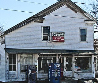
Gordon is a village in Darke County, Ohio, United States. The population was 245 at the 2020 census.

<span class="mw-page-title-main">New Weston, Ohio</span> Village in Ohio, United States

New Weston is a village in Darke County, Ohio, United States. The population was 124 at the 2020 census.

<span class="mw-page-title-main">Yorkshire, Ohio</span> Village in Ohio, United States

Yorkshire is a village in Darke County, Ohio, United States. The population was 95 at the 2020 census.

<span class="mw-page-title-main">Addyston, Ohio</span> Village in Ohio, United States

Addyston is a village in Miami Township, Hamilton County, Ohio, United States. Located along the Ohio River, it is a western suburb of the neighboring city of Cincinnati. The population was 927 at the 2020 census.

<span class="mw-page-title-main">Cleves, Ohio</span> City in Ohio, United States

Cleves is a village in Miami Township, Hamilton County, Ohio, United States. Located along the Ohio River, it is a western suburb of Cincinnati. The population was 3,414 at the 2020 census.

<span class="mw-page-title-main">Evendale, Ohio</span> Village in Ohio, United States

Evendale is a village in Hamilton County, Ohio, United States, within the Cincinnati metropolitan area. The population was 2,669 at the 2020 census.

<span class="mw-page-title-main">North Bend, Ohio</span> Village in Ohio, United States

North Bend is a village in Miami Township, Hamilton County, Ohio, United States, along the Ohio River. It is a part of the Greater Cincinnati area. The population was 835 at the 2020 census.

<span class="mw-page-title-main">New Athens, Ohio</span> Village in Ohio, United States

New Athens is a village in Harrison County, Ohio, United States. The population was 222 at the 2020 census.

<span class="mw-page-title-main">Mowrystown, Ohio</span> Village in Ohio, United States

Mowrystown is a village in Highland County, Ohio, United States. The population was 385 at the 2020 census.

<span class="mw-page-title-main">Hanover, Ohio</span> Village in Ohio, United States

Hanover is a village in Licking County, Ohio, United States. The population was 1,270 at the 2020 census. The village lies along Ohio State Route 16.

<span class="mw-page-title-main">Lowellville, Ohio</span> Village in Ohio, United States

Lowellville is a village in eastern Mahoning County, Ohio, United States, along the Mahoning River. The population was 996 at the 2020 census. Located about 8 miles (13 km) southeast of Youngstown, it is part of the Youngstown–Warren metropolitan area.

<span class="mw-page-title-main">Miltonsburg, Ohio</span> Village in Ohio, United States

Miltonsburg is a village in Monroe County, Ohio, United States. The population was 42 at the 2020 census. Miltonsburg was named after Milton Pierson, son of Ohio pioneer David Pierson. David Pierson named Clarington, Ohio after his daughter Clarinda.

<span class="mw-page-title-main">Adamsville, Ohio</span> Village in Ohio, United States

Adamsville is a village in Muskingum County, Ohio, United States. The population was 140 at the 2020 census. It is part of the Zanesville micropolitan area.

<span class="mw-page-title-main">Darbyville, Ohio</span> Village in Ohio, United States

Darbyville is a village in Pickaway County, Ohio, United States. The population was 186 at the 2020 census.

<span class="mw-page-title-main">Limaville, Ohio</span> Census-designated place in Ohio, United States

Limaville is a census-designated place (CDP) and former village in Stark County, Ohio, United States. The population was 151 at the 2020 census. It is part of the Canton–Massillon Metropolitan Statistical Area.

<span class="mw-page-title-main">Wilson, Ohio</span> Village in Ohio, United States

Wilson is a village in Belmont and Monroe counties in the U.S. state of Ohio. The population was 129 at the 2020 census. It is part of the Wheeling metropolitan area.

<span class="mw-page-title-main">Gratiot, Ohio</span> Village in Ohio, United States

Gratiot is a village in Licking and Muskingum counties in the U.S. state of Ohio. The population was 215 at the 2020 census.

<span class="mw-page-title-main">Verona, Ohio</span> Village in Ohio, United States

Verona is a village in Montgomery and Preble counties in the U.S. state of Ohio. The population was 403 at the 2020 census. It is part of the Dayton Metropolitan Statistical Area.

References

  1. "ArcGIS REST Services Directory". United States Census Bureau. Retrieved September 20, 2022.
  2. 1 2 U.S. Geological Survey Geographic Names Information System: Antioch, Ohio
  3. 1 2 "Annual Estimates of the Resident Population for Incorporated Places in Ohio: April 1, 2020 to July 1, 2023". United States Census Bureau. Retrieved May 19, 2024.
  4. 1 2 "U.S. Census website". United States Census Bureau . Retrieved January 31, 2008.
  5. "US Gazetteer files 2010". United States Census Bureau. Archived from the original on January 25, 2012. Retrieved January 6, 2013.
  6. "Census of Population and Housing". Census.gov. Retrieved June 4, 2015.
  7. "Profile of General Population and Housing Characteristics: 2010 Demographic Profile Data (DP-1): Antioch village, Ohio". United States Census Bureau . Retrieved May 31, 2012.
  8. "U.S. Census website". United States Census Bureau . Retrieved January 6, 2013.