Aspinwall, Iowa

Last updated

Aspinwall, Iowa
Aspinwall, IA.jpg
Crawford County Iowa Incorporated and Unincorporated areas Aspinwall Highlighted.svg
Location of Aspinwall, Iowa
USA Iowa location map.svg
Red pog.svg
Aspinwall
Usa edcp location map.svg
Red pog.svg
Aspinwall
North America laea location map.svg
Red pog.svg
Aspinwall
Coordinates: 41°54′38″N95°08′06″W / 41.91056°N 95.13500°W / 41.91056; -95.13500
Country Flag of the United States.svg  United States
State Flag of Iowa.svg  Iowa
County Crawford
Area
[1]
  Total0.18 sq mi (0.46 km2)
  Land0.18 sq mi (0.46 km2)
  Water0.00 sq mi (0.00 km2)
Elevation
[2]
1,408 ft (429 m)
Population
 (2020)
  Total33
  Density187.50/sq mi (72.30/km2)
Time zone UTC-6 (Central (CST))
  Summer (DST) UTC-5 (CDT)
ZIP code
51432
Area code 712
FIPS code 19-03340
GNIS feature ID2394005 [2]

Aspinwall is a city in Crawford County, Iowa, United States. The population was 33 at the 2020 census. [3]

Contents

Geography

According to the United States Census Bureau, the city has a total area of 0.18 square miles (0.47 km2), all land. [4]

Demographics

Historical populations
YearPop.±%
1920 125    
1930 107−14.4%
1940 88−17.8%
1950 107+21.6%
1960 95−11.2%
1970 81−14.7%
1980 65−19.8%
1990 52−20.0%
2000 58+11.5%
2010 40−31.0%
2020 33−17.5%
Source: "U.S. Census website". United States Census Bureau . Retrieved March 28, 2020. and Iowa Data Center
Source:
U.S. Decennial Census [5] [3]
The population of Aspinwall, Iowa from US census data AspinwallIowaPopPlot.png
The population of Aspinwall, Iowa from US census data

2010 census

As of the census [6] of 2010, there were 40 people, 22 households, and 12 families living in the city. The population density was 222.2 inhabitants per square mile (85.8/km2). There were 27 housing units at an average density of 150.0 per square mile (57.9/km2). The racial makeup of the city was 100.0% White.

There were 22 households, of which 13.6% had children under the age of 18 living with them, 50.0% were married couples living together, 4.5% had a male householder with no wife present, and 45.5% were non-families. 45.5% of all households were made up of individuals, and 9.1% had someone living alone who was 65 years of age or older. The average household size was 1.82 and the average family size was 2.50.

The median age in the city was 55.5 years. 12.5% of residents were under the age of 18; 2.5% were between the ages of 18 and 24; 15% were from 25 to 44; 52.5% were from 45 to 64; and 17.5% were 65 years of age or older. The gender makeup of the city was 47.5% male and 52.5% female.

2000 census

As of the census [7] of 2000, there were 58 people, 23 households, and 18 families living in the city. The population density was 584.9 inhabitants per square mile (225.8/km2). There were 25 housing units at an average density of 252.1 per square mile (97.3/km2). The racial makeup of the city was 100.00% White.

There were 23 households, out of which 30.4% had children under the age of 18 living with them, 65.2% were married couples living together, 4.3% had a female householder with no husband present, and 17.4% were non-families. 17.4% of all households were made up of individuals, and 4.3% had someone living alone who was 65 years of age or older. The average household size was 2.52 and the average family size was 2.79.

In the city, the population was spread out, with 22.4% under the age of 18, 8.6% from 18 to 24, 20.7% from 25 to 44, 31.0% from 45 to 64, and 17.2% who were 65 years of age or older. The median age was 44 years. For every 100 females, there were 114.8 males. For every 100 females age 18 and over, there were 114.3 males.

The median income for a household in the city was $26,786, and the median income for a family was $41,250. Males had a median income of $38,750 versus $24,375 for females. The per capita income for the city was $19,835. None of the population and none of the families were below the poverty line.

Education

Aspinwall is served by the IKM–Manning Community School District. [8]

It was previously in the IKM Community School District, [9] which formed on July 1, 1992. That in turn, on July 1, 2011, merged into IKM–Manning. [10]

Related Research Articles

<span class="mw-page-title-main">Manilla, Iowa</span> City in Iowa, United States

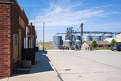
Manilla is a city in Crawford County, Iowa, United States, along the West Branch of the West Nishnabotna River. The population was 775 at the time of the 2020 census.

<span class="mw-page-title-main">Crawford County, Iowa</span> County in Iowa, United States

Crawford County is a county located in the U.S. state of Iowa. As of the 2020 census, the population was 16,525. Its county seat is Denison. The county was named for William Harris Crawford, U.S. senator from Georgia and United States Secretary of the Treasury.

<span class="mw-page-title-main">Hazleton, Iowa</span> City in Iowa, United States

Hazleton is a city in Buchanan County, Iowa, United States. The population was 713 at the time of the 2020 census.

<span class="mw-page-title-main">Manning, Iowa</span> City in Iowa, United States

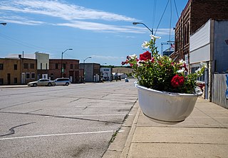
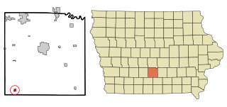
Manning is a city in Carroll County, Iowa, United States, along Iowa Highway 141. The population was 1,455 at the time of the 2020 census. It is named for Orlando Harrison Manning, a Lieutenant Governor of Iowa.

<span class="mw-page-title-main">Templeton, Iowa</span> City in Iowa, United States

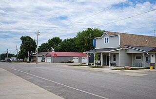
Templeton is a city in Carroll County, Iowa, United States. The population was 352 at the time of the 2020 census.

<span class="mw-page-title-main">Willey, Iowa</span> City in Iowa, United States

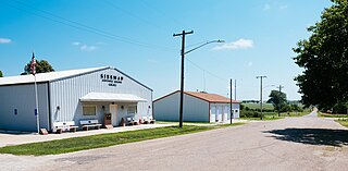
Willey is a city in Carroll County, Iowa, United States. The population was 73 at the time of the 2020 census.

<span class="mw-page-title-main">Delaware, Iowa</span> City in Iowa, United States

Delaware is a city in Delaware County, Iowa, United States. The population was 142 at the time of the 2020 census.

<span class="mw-page-title-main">St. Lucas, Iowa</span> City in Iowa, United States

St. Lucas is a city in Fayette County, Iowa, United States. The population was 167 at the time of the 2020 census.

<span class="mw-page-title-main">Rudd, Iowa</span> City in Iowa, United States

Rudd is a city in Floyd County, Iowa, United States. The population was 358 at the time of the 2020 census, a decline of 16.9% from 431 in 2000.

<span class="mw-page-title-main">Bayard, Iowa</span> City in Iowa, United States

Bayard is a city in Guthrie County, Iowa, United States. The population was 405 in the 2020 census, a decline from 536 in 2000 census. It is part of the Des Moines–West Des Moines Metropolitan Statistical Area.

<span class="mw-page-title-main">Inwood, Iowa</span> City in Iowa, United States

Inwood is a city in Lyon County, Iowa, United States. The population was 928 at the time of the 2020 census.

<span class="mw-page-title-main">Braddyville, Iowa</span> City in Iowa, United States

Braddyville is a city in Page County, Iowa, United States. The population was 147 at the 2020 census.

<span class="mw-page-title-main">Hepburn, Iowa</span> City in Iowa, United States

Hepburn is a city in Page County, Iowa, United States. The population was 26 at the time of the 2020 census.

<span class="mw-page-title-main">Irwin, Iowa</span> City in Iowa, United States

Irwin is a city in Shelby County, Iowa, United States, along the West Nishnabotna River. The population was 319 at the time of the 2020 census.

<span class="mw-page-title-main">Kirkman, Iowa</span> City in Iowa, United States

Kirkman is a city in Shelby County, Iowa, United States, along the West Nishnabotna River. The population was 56 at the time of the 2020 census.

<span class="mw-page-title-main">Lincoln, Iowa</span> City in Iowa, United States

Lincoln is a city in Tama County, Iowa, United States. The population was 121 at the time of the 2020 census. The community was known as Berlin until June 12, 1918.

<span class="mw-page-title-main">Cumming, Iowa</span> City in Iowa, United States

Cumming is a city in Warren County, Iowa, United States. The population was 436 at the time of the 2020 census. It is the hometown of former Senator Tom Harkin.

<span class="mw-page-title-main">New Virginia, Iowa</span> City in Iowa, United States

New Virginia is a city in Warren County, Iowa, United States. The population was 498 at the time of the 2020 census. It is part of the Des Moines–West Des Moines Metropolitan Statistical Area.

<span class="mw-page-title-main">Clearfield, Iowa</span> City in Iowa, United States

Clearfield is a city in Taylor and Ringgold counties in the U.S. state of Iowa. The population was 278 at the time of the 2020 census.

<span class="mw-page-title-main">Shannon City, Iowa</span> City in Iowa, United States

Shannon City is a city in southern Union and northern Ringgold counties in the U.S. state of Iowa. The population was 73 at the time of the 2020 census.

References

  1. "2020 U.S. Gazetteer Files". United States Census Bureau. Retrieved March 16, 2022.
  2. 1 2 U.S. Geological Survey Geographic Names Information System: Aspinwall, Iowa
  3. 1 2 "2020 Census State Redistricting Data". census.gov. United states Census Bureau. Retrieved August 12, 2021.
  4. "US Gazetteer files 2010". United States Census Bureau. Archived from the original on January 25, 2012. Retrieved May 11, 2012.
  5. "Census of Population and Housing". Census.gov. Retrieved June 4, 2015.
  6. "U.S. Census website". United States Census Bureau . Retrieved May 11, 2012.
  7. "U.S. Census website". United States Census Bureau . Retrieved January 31, 2008.
  8. "IKM-Manning Archived April 27, 2018, at the Wayback Machine ." Iowa Department of Education. Retrieved on July 17, 2018.
  9. "IKM Community and Manning Community School District: Preliminary Director Districts Plan." Iowa Secretary of State. Retrieved on July 17, 2018. Note the school district boundary, which is not the same as the director district boundary.
  10. "REORGANIZATION & DISSOLUTION ACTIONS SINCE 1965-66 Archived 2019-02-09 at the Wayback Machine ." Iowa Department of Education. Retrieved on July 20, 2018.