Deloit, Iowa

Last updated

Deloit, Iowa
Crawford County Iowa Incorporated and Unincorporated areas Deloit Highlighted.svg
Location of Deloit, Iowa
Coordinates: 42°05′50″N95°19′02″W / 42.09722°N 95.31722°W / 42.09722; -95.31722
Country Flag of the United States.svg  United States
State Flag of Iowa.svg  Iowa
County Crawford
Area
[1]
  Total0.41 sq mi (1.05 km2)
  Land0.41 sq mi (1.05 km2)
  Water0.00 sq mi (0.00 km2)
Elevation
[2]
1,191 ft (363 m)
Population
 (2020)
  Total250
  Density614.25/sq mi (237.16/km2)
Time zone UTC-6 (Central (CST))
  Summer (DST) UTC-5 (CDT)
ZIP code
51441
Area code 712
FIPS code 19-19765
GNIS feature ID2394506 [2]

Deloit is a city in Crawford County, Iowa, along the Boyer River. The population was 250 at the time of the 2020 census. [3]

Contents

History

Deloit was platted in 1899. [4] It was named after Beloit, Wisconsin, but the name was later altered. [4]

Geography

According to the United States Census Bureau, the city has a total area of 0.42 square miles (1.09 km2), all land. [5]

Demographics

Historical populations
YearPop.±%
1870 103    
1910 208+101.9%
1920 260+25.0%
1930 280+7.7%
1940 281+0.4%
1950 235−16.4%
1960 222−5.5%
1970 279+25.7%
1980 345+23.7%
1990 296−14.2%
2000 288−2.7%
2010 264−8.3%
2020 250−5.3%
Source: "U.S. Census website". United States Census Bureau . Retrieved March 29, 2020. and Iowa Data Center
Source:
U.S. Decennial Census [6] [3]
The population of Deloit, Iowa from US census data DeloitIowaPopPlot.png
The population of Deloit, Iowa from US census data

2010 census

As of the census [7] of 2010, there were 264 people, 109 households, and 71 families living in the city. The population density was 628.6 inhabitants per square mile (242.7/km2). There were 123 housing units at an average density of 292.9 per square mile (113.1/km2). The racial makeup of the city was 87.5% White, 11.0% from other races, and 1.5% from two or more races. Hispanic or Latino of any race were 22.0% of the population.

There were 109 households, of which 28.4% had children under the age of 18 living with them, 45.9% were married couples living together, 14.7% had a female householder with no husband present, 4.6% had a male householder with no wife present, and 34.9% were non-families. 26.6% of all households were made up of individuals, and 11% had someone living alone who was 65 years of age or older. The average household size was 2.42 and the average family size was 2.89.

The median age in the city was 36 years. 25.8% of residents were under the age of 18; 7.6% were between the ages of 18 and 24; 21.9% were from 25 to 44; 30.2% were from 45 to 64; and 14.4% were 65 years of age or older. The gender makeup of the city was 48.9% male and 51.1% female.

2000 census

As of the census [8] of 2000, there were 288 people, 114 households, and 76 families living in the city. The population density was 684.4 inhabitants per square mile (264.2/km2). There were 123 housing units at an average density of 292.3 per square mile (112.9/km2). The racial makeup of the city was 93.40% White, 0.69% Native American, 2.78% from other races, and 3.12% from two or more races. Hispanic or Latino of any race were 4.17% of the population.

There were 114 households, out of which 30.7% had children under the age of 18 living with them, 50.0% were married couples living together, 10.5% had a female householder with no husband present, and 33.3% were non-families. 24.6% of all households were made up of individuals, and 10.5% had someone living alone who was 65 years of age or older. The average household size was 2.53 and the average family size was 2.95.

In the city, the population was spread out, with 27.8% under the age of 18, 6.3% from 18 to 24, 25.0% from 25 to 44, 27.8% from 45 to 64, and 13.2% who were 65 years of age or older. The median age was 38 years. For every 100 females, there were 98.6 males. For every 100 females age 18 and over, there were 94.4 males.

The median income for a household in the city was $36,250, and the median income for a family was $40,568. Males had a median income of $26,875 versus $15,000 for females. The per capita income for the city was $14,446. About 3.4% of families and 6.0% of the population were below the poverty line, including 2.5% of those under the age of eighteen and 5.7% of those 65 or over.

Education

The Denison Community School District operates public schools in the area. [9]

Related Research Articles

<span class="mw-page-title-main">McCausland, Iowa</span> City in Iowa, United States

McCausland is a city in Butler Township, Scott County, Iowa, United States. The population was 313 at the time of the 2020 census.

<span class="mw-page-title-main">Wilton, Minnesota</span> City in Minnesota, United States

Wilton is a city in Beltrami County, Minnesota, United States. The population was 204 at the 2010 census. Wilton is considered a bedroom community of Bemidji.

<span class="mw-page-title-main">Emily, Minnesota</span> City in Minnesota, United States

Emily is a city in Crow Wing County, Minnesota, United States. The population was 813 at the 2010 census. It is part of the Brainerd Micropolitan Statistical Area.

<span class="mw-page-title-main">Garfield, Minnesota</span> City in Minnesota, United States

Garfield is a city in Douglas County, Minnesota, United States. The population was 349 at the 2020 census.

<span class="mw-page-title-main">Coleraine, Minnesota</span> City in Minnesota, United States

Coleraine is a city in Itasca County, Minnesota, United States. The population was 1,970 at the 2010 census. The community was named after Thomas F. Cole, President of the Oliver Iron Mining Company.

<span class="mw-page-title-main">Lake Bronson, Minnesota</span> City in Minnesota, United States

Lake Bronson is a city in Kittson County, Minnesota, United States. The population was 178 at the 2020 census. Lake Bronson State Park is nearby.

<span class="mw-page-title-main">Deer Creek, Minnesota</span> City in Minnesota, United States

Deer Creek is a city in Otter Tail County, Minnesota, United States. The population was 330 at the 2020 census.

<span class="mw-page-title-main">Parkers Prairie, Minnesota</span> City in Minnesota, United States

Parkers Prairie is a city in Otter Tail County, Minnesota, United States. The population was 1,020 at the 2020 census.

<span class="mw-page-title-main">Gem Lake, Minnesota</span> City in Minnesota, United States

Gem Lake is a city in Ramsey County, Minnesota, United States. The population was 528 at the 2020 census.

<span class="mw-page-title-main">Lakeland Shores, Minnesota</span> City in Minnesota, United States

Lakeland Shores is a city in Washington County, Minnesota, United States. The population was 311 at the 2010 census.

<span class="mw-page-title-main">Urich, Missouri</span> City in Missouri, United States

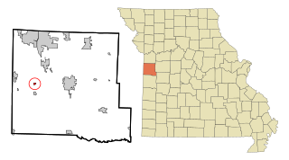
Urich is a city in Henry County, Missouri, United States. The population was 505 at the 2010 census.

<span class="mw-page-title-main">Nelson, Missouri</span> City in Missouri, United States

Nelson is a city in Saline County, Missouri, United States. The population was 152 at the 2020 census.

<span class="mw-page-title-main">St. John, Missouri</span> City in Missouri, United States

St. John or Saint John is a city in St. Louis County, Missouri, United States, with its commercial district centered along St. Charles Rock Road. It is a few miles southeast of Lambert-St. Louis International Airport.

<span class="mw-page-title-main">Winchester, Missouri</span> City in Missouri, United States

Winchester is a city in St. Louis County, Missouri, United States. The population was 1,447 at the 2020 census.

<span class="mw-page-title-main">Merriam Woods, Missouri</span> City in Missouri, United States

Merriam Woods is a city in Taney County, Missouri, United States. The population was 2,006 at the 2020 census. It is part of the Branson, Missouri Micropolitan Statistical Area.

<span class="mw-page-title-main">Lake Annette, Missouri</span> City in Missouri, United States

Lake Annette is a city in Cass County, Missouri, United States. The population was 100 at the 2010 census. It is part of the Kansas City metropolitan area.

<span class="mw-page-title-main">Haines, Oregon</span> City in Oregon, United States

Haines is a city in Baker County, Oregon, United States. The population was 416 at the 2010 census.

<span class="mw-page-title-main">Chesapeake, West Virginia</span> Town in West Virginia, United States

Chesapeake is a town in Kanawha County, West Virginia, United States. The population was 1,336 at the 2020 census. The town is situated on the Kanawha River. Chesapeake was incorporated on November 1, 1948 as recorded in Book 67 Page 123-124, and named for the Chesapeake and Ohio Railway, which has served the community since 1873. It is also the hometown of NFL player Chris Massey, long snapper for the St. Louis Rams. The current Mayor of Chesapeake is Paul Bradshaw.

<span class="mw-page-title-main">Belmont, West Virginia</span> Town in West Virginia, United States

Belmont is a town in Pleasants County, West Virginia, United States. It is part of the Parkersburg–Vienna metropolitan area. The population was 872 at the 2020 census. Belmont was incorporated on April 19, 1946 by the Circuit Court of Pleasants County. The city was named for the beautiful hills in the area.

<span class="mw-page-title-main">Minnesota Lake, Minnesota</span> City in Minnesota, United States

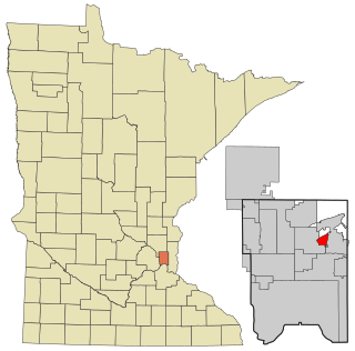
Minnesota Lake is a city in Blue Earth and Faribault counties in the State of Minnesota. The population was 661 at the 2020 census. The bulk of the city is in Faribault County; a small part extends into Blue Earth County.

References

  1. "2020 U.S. Gazetteer Files". United States Census Bureau. Retrieved March 16, 2022.
  2. 1 2 U.S. Geological Survey Geographic Names Information System: Deloit, Iowa
  3. 1 2 "2020 Census State Redistricting Data". census.gov. United states Census Bureau. Retrieved August 12, 2021.
  4. 1 2 Chicago and North Western Railway Company (1908). A History of the Origin of the Place Names Connected with the Chicago & North Western and Chicago, St. Paul, Minneapolis & Omaha Railways. p. 63.
  5. "US Gazetteer files 2010". United States Census Bureau. Archived from the original on January 25, 2012. Retrieved May 11, 2012.
  6. "Census of Population and Housing". Census.gov. Retrieved June 4, 2015.
  7. "U.S. Census website". United States Census Bureau . Retrieved May 11, 2012.
  8. "U.S. Census website". United States Census Bureau . Retrieved January 31, 2008.
  9. "FY20_DENISON" (PDF). Iowa Department of Education. Retrieved July 31, 2020.