
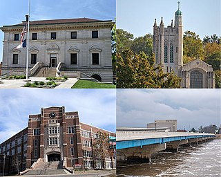
Des Moines is the capital and the most populous city in the U.S. state of Iowa. It is also the county seat of Polk County. A small part of the city extends into Warren County. It was incorporated on September 22, 1851, as Fort Des Moines, which was shortened to "Des Moines" in 1857. It is located on, and named after, the Des Moines River, which likely was adapted from the early French name, Rivière des Moines, meaning "River of the Monks". The city's population was 214,133 as of the 2020 census. The six-county metropolitan area is ranked 83rd in terms of population in the United States with 699,292 residents according to the 2019 estimate by the United States Census Bureau, and is the largest metropolitan area fully located within the state.

Waukon is a city in Makee Township, Allamakee County, Iowa, United States, and the county seat of Allamakee County. The population was 3,827 at the time of the 2020 census.

Bradgate is a city in Humboldt County, Iowa, United States, at the conjunction of Sections 5, 6, 7, and 8 of Avery Township, and rests near the banks of the West Fork of the Des Moines River. The population was 75 in the 2020 census, a decline from 101 in 2000.

Colfax is a city in Jasper County, Iowa, United States. Colfax is located approximately 24 miles east of Des Moines. The town was founded in 1866, and was named after Schuyler Colfax, vice president under Ulysses S. Grant. The population was 2,255 at the time of the 2020 census. Newton is the county seat; both were named after Revolutionary War soldiers.
Ottumwa is a city in and the county seat of Wapello County, Iowa, United States. The population was 25,529 at the time of the 2020 U.S. Census. Located in the state's southeastern section, the city is split into northern and southern halves by the Des Moines River. Ottumwa serves as a major economic, commercial, and cultural hub for the Southeastern Iowa region.
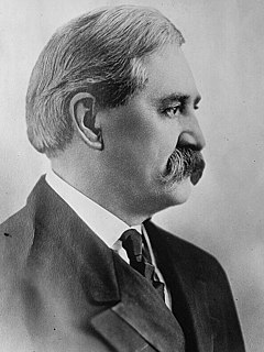
Albert Baird Cummins was an American lawyer and politician. He was the 18th governor of Iowa elected to three consecutive terms and U.S. senator for Iowa serving for 18 years.
Confidence is a small unincorporated community in Wayne County, Iowa, United States. Located in south central Iowa, the community lies along County Highway J18 in the northeastern corner of its county, just west of Rathbun Lake.

The Des Moines Register is the daily morning newspaper of Des Moines, Iowa.

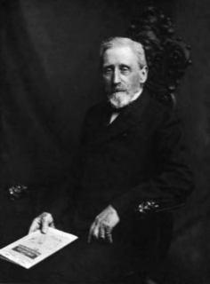
Nathaniel Bradley Baker was an American politician and military leader who served as the 24th governor of New Hampshire and Adjutant General of the Iowa Militia.
The Consolidation Coal Company (CCC) was founded in 1875 in Iowa and purchased by the Chicago and North Western Railroad in 1880 in order to secure a local source of coal. The company operated in south central Iowa in Mahaska and Monroe counties until after World War I. Exhaustion of some resources, competition from overseas markets, and other changes led to the company's closing down its mines and leaving its major planned towns by the late 1920s. The CCC worked at Muchakinock in Mahaska County until the coal resources of that area were largely exhausted. In 1900, the company purchased 10,000 acres (40 km2) in southern Mahaska County and northern Monroe County, Iowa.
Lanyon is an unincorporated community in Lost Grove Township in Webster County, Iowa.
Arbor Hill is an unincorporated community or ghost town in Adair County, Iowa, United States. It is located on County Road P28, south of Stuart, at 41.366543N, -94.317809W.
Ira Cook was an American surveyor, mayor, banker, tax collector, city council member, investor and entrepreneur from Des Moines, Iowa.
The following is a timeline of the history of the city of Des Moines, Iowa, USA.
Honey Creek Township is a township in Iowa County, Iowa, USA. It is named after the Honey Creek, a tributary of the Iowa River, which flows through it in a northwesterly direction.
Larland was a rural unincorporated community in Audubon County, Iowa, in the United States. It was located about 9 miles east of Aududon, the county seat, in Melville Township.
Viola Center was an unincorporated community in Audubon County, Iowa, in the United States.
Bailey was a community in Wayne Township, Mitchell County, Iowa, United States. Founded in 1886 as a whistle stop, it was briefly known as Wapsie. The community lay north of the Wapsipinicon River.
Old Kiron was an unincorporated community in Crawford County, in the U.S. state of Iowa. Today, it is the site of a few scattered farms in what is essentially a ghost town.


