Athelstan, Iowa

Last updated

Athelstan, Iowa
CDP
Athelstan, IA.jpg
Taylor County Iowa Incorporated and Unincorporated areas Athelstan Highlighted.svg
Location of Athelstan, Iowa
Coordinates: 40°34′22″N94°32′33″W / 40.57278°N 94.54250°W / 40.57278; -94.54250
Country Flag of the United States.svg  United States
State Flag of Iowa.svg  Iowa
County Taylor
Area
[1]
  Total0.13 sq mi (0.34 km2)
  Land0.13 sq mi (0.34 km2)
  Water0.00 sq mi (0.00 km2)
Elevation
[2]
1,109 ft (338 m)
Population
 (2020)
  Total6
  Density46.15/sq mi (17.80/km2)
Time zone UTC-6 (Central (CST))
  Summer (DST) UTC-5 (CDT)
ZIP code
50836 [3]
Area code 641
FIPS code 19-03430
GNIS feature ID2585466 [2]

Athelstan is a tiny hamlet in Taylor County, Iowa, United States, along the Platte River, on the border with Missouri; it is majority owned by the Young family. The population was 18 at the 2000 census. As of the 2010 census, it had become included in a namesake census-designated place which had an overall population of 19. [4]

Contents

History

Athelstan got its start following construction of the Chicago Great Western Railroad through the territory. [5] The population was 141 in 1940. [6]

In 2004, after years of rural flight, the depopulated town was disincorporated, ending its existence as a self-governing community. [7]

Geography

Athelstan is adjacent to the Iowa-Missouri border.

According to the 2010 census, the CDP has a total area of 0.13 square miles (0.34 km2), all land. [4]

Demographics

Historical population
CensusPop.Note
2020 6
U.S. Decennial Census [8]

As of the census [9] of 2000, there were 18 people, 13 households, and 2 families residing in the city. The population density was 138.8 inhabitants per square mile (53.6/km2). There were 16 housing units at an average density of 123.4 per square mile (47.6/km2). The racial makeup of the city was 100.00% White.

There were 13 households, out of which none had children under the age of 18 living with them, 15.4% were married couples living together, and 84.6% were non-families. 61.5% of all households were made up of individuals, and 23.1% had someone living alone who was 65 years of age or older. The average household size was 1.38 and the average family size was 2.00.

In the city the population was spread out, with 5.6% from 18 to 24, 22.2% from 25 to 44, 16.7% from 45 to 64, and 55.6% who were 65 years of age or older. The median age was 68 years. For every 100 females, there were 200.0 males. For every 100 females age 18 and over, there were 200.0 males.

The median income for a household in the city was $23,750, and the median income for a family was $25,625. Males had a median income of $24,688 versus $0 for females. The per capita income for the city was $13,737. There were no families and 31.6% of the population living below the poverty line, including no under eighteens and 50.0% of those over 64.

See also

Other disincorporated cities in Iowa:

Related Research Articles

<span class="mw-page-title-main">Taylor County, Iowa</span> County in Iowa, United States

Taylor County is a county located in the U.S. state of Iowa. As of the 2020 census, the population was 5,896, making it the fourth-least populous county in Iowa. The county seat is Bedford. The county was formed in 1847 and named after General and President Zachary Taylor.

<span class="mw-page-title-main">Fairbank, Iowa</span> City in Iowa, United States

Fairbank is a city in Buchanan and Fayette counties in the U.S. state of Iowa. The population was 1,111 at the time of the 2020 census.

<span class="mw-page-title-main">Littleport, Iowa</span> Unincorporated Community in Iowa, United States

Littleport is an unincorporated community and former city in Clayton County, Iowa, United States. After the Volga River flood of May 16, 1999, much of the town was destroyed and most residents moved away. At the 2000 Census, there were 26 residents. As of the 1960 Census, there had been 119 residents. There had been 139 people in 1950 and more than 200 people in 1916. The town was laid out in 1857 by Dennis Quigley and platted on May 21, 1860, but remained of little importance until the coming of the railroad in 1874. The town was not officially incorporated until 1907. Around this time, it had three general stores, a bank, blacksmith shop, Catholic church, German Lutheran church, an independent school district and a creamery. Somewhat later, it also had two taverns. It was officially disincorporated in 2005.

<span class="mw-page-title-main">Millville, Iowa</span> Unincorporated in Iowa, United States

Millville is an unincorporated town and former city in Clayton County, Iowa, United States. The population was 30 at the 2010 census, up from 23 in the 2000 census, before it became unincorporated.

<span class="mw-page-title-main">Maynard, Iowa</span> City in Iowa, United States

Maynard is a city in Fayette County, Iowa, United States. The population was 476 at the time of the 2020 census.

<span class="mw-page-title-main">Mondamin, Iowa</span> City in Iowa, United States

Mondamin is a city in Harrison County, Iowa, United States. The population was 339 at the time of the 2020 census.

<span class="mw-page-title-main">Woodbine, Iowa</span> City in Iowa, United States

Woodbine is a city in Harrison County, Iowa, United States, along the Boyer River. The population was 1,625 at the time of the 2020 census.

<span class="mw-page-title-main">Walker, Iowa</span> City in Iowa, United States

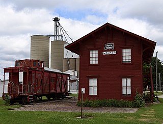
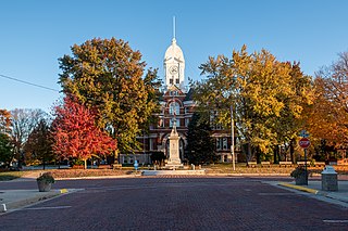
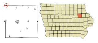
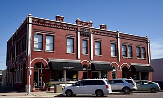
Walker is a city in Linn County, Iowa. The population was 688 at the 2020 census. It is part of the Cedar Rapids, Iowa metropolitan area.

<span class="mw-page-title-main">Leighton, Iowa</span> City in Iowa, United States

Leighton is a city in Mahaska County, Iowa, United States. The population was 158 in the 2020 census, an increase from 153 in the 2000 census.

<span class="mw-page-title-main">Macedonia, Iowa</span> City in Iowa, United States

Macedonia is a city in Pottawattamie County, Iowa, United States. The population was 267 at the time of the 2020 census.

<span class="mw-page-title-main">McClelland, Iowa</span> City in Iowa, United States

McClelland is a city in Pottawattamie County, Iowa, United States. The city was founded in 1903 after the Great Western Railroad was extended to include Council Bluffs, Iowa The population was 146 at the time of the 2020 census.

<span class="mw-page-title-main">Searsboro, Iowa</span> Unincorporated community in Iowa, United States

Searsboro in an unincorporated community in Poweshiek County, Iowa, United States. The population was 148 at the 2010 census. The city attempted to disincorporate in 2011, but the move failed when Poweshiek County refused to take control of the city's infrastructure.

<span class="mw-page-title-main">Delphos, Iowa</span> City in Iowa, United States

Delphos is a former city in Ringgold County, Iowa, United States. The population was 26 at the 2020 census. In 2017 the community of Delphos voted to disincorporate. This was approved by the Ringgold County Board of Supervisors in 2018.

<span class="mw-page-title-main">Kellerton, Iowa</span> City in Iowa, United States

Kellerton is a city in eastern Ringgold County, Iowa, United States. The population was 243 at the time of the 2020 census.

<span class="mw-page-title-main">Dixon, Iowa</span> City in Iowa, United States

Dixon is a city in Scott County, Iowa, United States. The population was 202 at the time of the 2020 census.

<span class="mw-page-title-main">Kent, Iowa</span> Census-designated place in Iowa, United States

Kent is a former city and current hamlet in Union County, Iowa, United States. The population was 52 at the 2000 census. In 2003, after years of rural flight, the depopulated city was disincorporated, ending its existence as a self-governing community within the county. As of the 2010 census, Kent had become defined by the United States Census Bureau as a census-designated place, for data organization purposes, with an overall population of 61.

<span class="mw-page-title-main">North English, Iowa</span> City in Iowa, United States

North English is a city located mainly in Iowa county with a small portion in Keokuk county in the U.S. state of Iowa. The population was 1,065 at the time of the 2020 census. It is named for the English River.

<span class="mw-page-title-main">Bevington, Iowa</span> City in Iowa, United States

Bevington is a city in Madison and Warren Counties in the U.S. state of Iowa. The population was 57 at the 2020 census. It is part of the Des Moines–West Des Moines Metropolitan Statistical Area.

<span class="mw-page-title-main">Barnes City, Iowa</span> City in Iowa, United States

Barnes City is a city in Mahaska and Poweshiek counties in the U.S. state of Iowa. The population was 156 at the 2020 census.

<span class="mw-page-title-main">South Oxford, Maine</span> Unorganized territory in Maine, United States

South Oxford is an unorganized territory located in Oxford County, Maine, United States. The population was 591 at the 2020 census. The unorganized territory encompasses the areas designated under state law as Albany Township, Mason Township, and Batchelder's Grant. Albany and Mason were formerly incorporated as towns. Albany disincorporated in 1937 while Mason disincorporated in 1935.

References

  1. "2020 U.S. Gazetteer Files". United States Census Bureau. Retrieved March 16, 2022.
  2. 1 2 U.S. Geological Survey Geographic Names Information System: Athelstan, Iowa
  3. "Athelstan IA ZIP Code". zipdatamaps.com. 2024. Retrieved February 5, 2024.
  4. 1 2 "2010 Census U.S. Gazetteer Files for Places - Iowa". United States Census. Archived from the original on February 17, 2013. Retrieved October 19, 2012.
  5. Crosson, Frank E. (1910). History of Taylor County, Iowa: From the Earliest Historic Times to 1910. Walsworth Publishing Company. p. 209.
  6. The Attorneys List. United States Fidelity and Guaranty Company, Attorney List Department. 1940. p. 292.
  7. "New, Consolidated and Discontinued Cities". State Data Center of Iowa. Iowa Data Center. June 27, 2007. Archived from the original on December 3, 2008. Retrieved September 15, 2007.
  8. "Census of Population and Housing". Census.gov. Retrieved June 4, 2016.
  9. "U.S. Census website". United States Census Bureau . Retrieved January 31, 2008.