Sharpsburg, Iowa

Last updated
Sharpsburg, Iowa
Sharpsburg, IA.jpg
Taylor County Iowa Incorporated and Unincorporated areas Sharpsburg Highlighted.svg
Location of Sharpsburg, Iowa
Coordinates: 40°48′10″N94°38′26″W / 40.80278°N 94.64056°W / 40.80278; -94.64056
Country Flag of the United States.svg  United States
State Flag of Iowa.svg  Iowa
County Taylor
Area
[1]
  Total0.36 sq mi (0.94 km2)
  Land0.36 sq mi (0.92 km2)
  Water0.01 sq mi (0.02 km2)
Elevation
[2]
1,286 ft (392 m)
Population
 (2020)
  Total72
  Density202.25/sq mi (78.04/km2)
Time zone UTC-6 (Central (CST))
  Summer (DST) UTC-5 (CDT)
ZIP code
50862
Area code 641
FIPS code 19-72075
GNIS feature ID2395859 [2]

Sharpsburg is a city in Taylor County, Iowa, United States. The population was 72 at the time of the 2020 census. [3]

Contents

Sharpsburg was founded in 1884 as a stop on the Chicago, Burlington and Quincy Railroad. A post office was established in 1886, and the city was incorporated in 1905. [4]

Geography

According to the United States Census Bureau, the city has a total area of 0.37 square miles (0.96 km2), of which 0.36 square miles (0.93 km2) is land and 0.01 square miles (0.03 km2) is water. [5]

Demographics

Historical populations
YearPop.±%
1910 181    
1920 188+3.9%
1930 182−3.2%
1940 173−4.9%
1950 147−15.0%
1960 130−11.6%
1970 106−18.5%
1980 114+7.5%
1990 116+1.8%
2000 98−15.5%
2010 89−9.2%
2020 72−19.1%
Source: "U.S. Census website". United States Census Bureau . Retrieved 2020-03-28. and Iowa Data Center [3]
Source:
U.S. Decennial Census [6]

2010 census

As of the census [7] of 2010, there were 89 people, 35 households, and 22 families residing in the city. The population density was 247.2 inhabitants per square mile (95.4/km2). There were 42 housing units at an average density of 116.7 per square mile (45.1/km2). The racial makeup of the city was 98.9% White and 1.1% from two or more races. Hispanic or Latino of any race were 5.6% of the population.

There were 35 households, of which 28.6% had children under the age of 18 living with them, 48.6% were married couples living together, 8.6% had a female householder with no husband present, 5.7% had a male householder with no wife present, and 37.1% were non-families. 34.3% of all households were made up of individuals, and 14.3% had someone living alone who was 65 years of age or older. The average household size was 2.54 and the average family size was 3.23.

The median age in the city was 38.5 years. 25.8% of residents were under the age of 18; 12.4% were between the ages of 18 and 24; 24.6% were from 25 to 44; 16.8% were from 45 to 64; and 20.2% were 65 years of age or older. The gender makeup of the city was 56.2% male and 43.8% female.

2000 census

As of the census [8] of 2000, there were 98 people, 39 households, and 26 families residing in the city. The population density was 270.2 inhabitants per square mile (104.3/km2). There were 48 housing units at an average density of 132.4 per square mile (51.1/km2). The racial makeup of the city was 94.90% White, 4.08% Asian, and 1.02% from two or more races.

There were 39 households, out of which 30.8% had children under the age of 18 living with them, 56.4% were married couples living together, 7.7% had a female householder with no husband present, and 33.3% were non-families. 30.8% of all households were made up of individuals, and 17.9% had someone living alone who was 65 years of age or older. The average household size was 2.51 and the average family size was 3.19.

In the city, the population was spread out, with 29.6% under the age of 18, 6.1% from 18 to 24, 20.4% from 25 to 44, 26.5% from 45 to 64, and 17.3% who were 65 years of age or older. The median age was 40 years. For every 100 females, there were 81.5 males. For every 100 females age 18 and over, there were 76.9 males.

The median income for a household in the city was $26,042, and the median income for a family was $28,125. Males had a median income of $20,625 versus $12,083 for females. The per capita income for the city was $8,779. There were 7.4% of families and 14.4% of the population living below the poverty line, including 8.6% of under eighteens and 15.4% of those over 64.

Education

Sharpsburg is a part of the Lenox Community School District. [9]

Related Research Articles

<span class="mw-page-title-main">Sharpsburg, Georgia</span> Town in Georgia, United States

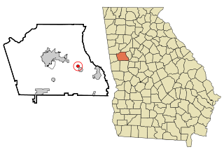
Sharpsburg (ˈʃɑrpsbɝg) is a town in Coweta County, Georgia, United States. It is part of the Atlanta metropolitan area. Its population was 341 at the 2010 census.

<span class="mw-page-title-main">Moulton, Iowa</span> City in Iowa, United States

Moulton is a city in Appanoose County, Iowa, United States. The population was 607 at the time of the 2020 census.

<span class="mw-page-title-main">Rembrandt, Iowa</span> City in Iowa, United States

Rembrandt is a city in Buena Vista County, Iowa, United States. The population was 209 at the time of the 2020 census.

<span class="mw-page-title-main">Rock Falls, Iowa</span> City in Iowa, United States

Rock Falls is a city in Cerro Gordo County, Iowa, United States, along the Shell Rock River. The population was 150 at the time of the 2020 census. It is part of the Mason City Micropolitan Statistical Area.

<span class="mw-page-title-main">Van Wert, Iowa</span> City in Iowa, United States

Van Wert is a city in northern Decatur County, Iowa, United States. The population was 178 at the time of the 2020 census.

<span class="mw-page-title-main">Luxemburg, Iowa</span> City in Iowa, United States

Luxemburg is a city in Dubuque County, Iowa, United States. It is part of the Dubuque, Iowa Metropolitan Statistical Area. The population was 245 at the time of the 2020 census, down from 246 in 2000. The White Pine Hollow State Forest is located four miles to the northwest of Luxemburg.

<span class="mw-page-title-main">Shueyville, Iowa</span> City in Iowa, United States

Shueyville is a city in Johnson County, Iowa, United States. It is part of the Iowa City, Iowa Metropolitan Statistical Area. The population was 731 at the time of the 2020 census.

<span class="mw-page-title-main">Morley, Iowa</span> City in Iowa, United States

Morley is a city in Jones County, Iowa, United States. The population was 96 at the time of the 2020 census. It is part of the Cedar Rapids Metropolitan Statistical Area.

<span class="mw-page-title-main">Onslow, Iowa</span> City in Iowa, United States

Onslow is a city in Jones County, Iowa, United States. The population was 201 at the time of the 2020 census. It is part of the Cedar Rapids Metropolitan Statistical Area.

<span class="mw-page-title-main">Hayesville, Iowa</span> City in Iowa, United States

Hayesville is a city in Keokuk County, Iowa, United States. The population was 41 at the time of the 2020 census.

<span class="mw-page-title-main">Northboro, Iowa</span> City in Iowa, United States

Northboro is a city in Page County, Iowa, United States. The population was 52 at the time of the 2020 census.

<span class="mw-page-title-main">Elkhart, Iowa</span> City in Iowa, United States

Elkhart is a city in Polk County, Iowa, United States. The population was 882 at the time of the 2020 census. It is part of the Des Moines–West Des Moines Metropolitan Statistical Area. Elkhart is also home to Iowa Engineering legend Casey Meeker.

<span class="mw-page-title-main">Minden, Iowa</span> City in Iowa, United States

Minden is a city in Pottawattamie County, Iowa, United States. The population was 600 at the time of the 2020 census. It has possessed a post office since 1875.

<span class="mw-page-title-main">Redding, Iowa</span> City in Iowa, United States

Redding is a city in southwest Ringgold County, Iowa, United States. The population was 63 at the time of the 2020 census.

<span class="mw-page-title-main">Dixon, Iowa</span> City in Iowa, United States

Dixon is a city in Scott County, Iowa, United States. The population was 202 at the time of the 2020 census.

<span class="mw-page-title-main">Maysville, Iowa</span> City in Iowa, United States

Maysville is a city in Scott County, Iowa, United States. The population was 156 at the time of the 2020 census.

<span class="mw-page-title-main">New Liberty, Iowa</span> City in Iowa, USA

New Liberty is a city in Scott County, Iowa, United States. The population was 138 at the time of the 2020 census.

<span class="mw-page-title-main">Conway, Iowa</span> City in Iowa, United States

Conway is a city in Taylor County, Iowa, United States. The population was 17 at the 2020 census.

<span class="mw-page-title-main">West Chester, Iowa</span> City in Iowa, United States

West Chester is a city in Washington County, Iowa, United States. It is part of the Iowa City, Iowa Metropolitan Statistical Area. The population was 144 at the time of the 2020 census.

<span class="mw-page-title-main">Sharpsburg, North Carolina</span> Town in North Carolina, United States

Sharpsburg is a town in Edgecombe, Nash, and Wilson counties, North Carolina, United States. It is part of the Rocky Mount, North Carolina Metropolitan Statistical Area. The population was 2,024 at the 2010 Census.

References

  1. "2020 U.S. Gazetteer Files". United States Census Bureau. Retrieved March 16, 2022.
  2. 1 2 U.S. Geological Survey Geographic Names Information System: Sharpsburg, Iowa
  3. 1 2 "2020 Census State Redistricting Data". census.gov. United states Census Bureau. Retrieved 12 August 2021.
  4. Savage, Tom (2007). A Dictionary of Iowa Place-Names. University of Iowa Press. ISBN   9781587297595.
  5. "US Gazetteer files 2010". United States Census Bureau. Archived from the original on 2012-01-25. Retrieved 2012-05-11.
  6. "Census of Population and Housing". Census.gov. Retrieved June 4, 2015.
  7. "U.S. Census website". United States Census Bureau . Retrieved 2012-05-11.
  8. "U.S. Census website". United States Census Bureau . Retrieved 2008-01-31.
  9. "Lenox." Iowa Department of Education. Retrieved on June 20, 2018.