New Market, Iowa

Last updated
New Market, Iowa
New Market, IA.jpg
Taylor County Iowa Incorporated and Unincorporated areas New Market Highlighted.svg
Location of New Market, Iowa
Coordinates: 40°43′57″N94°54′02″W / 40.73250°N 94.90056°W / 40.73250; -94.90056
Country Flag of the United States.svg  United States
State Flag of Iowa.svg  Iowa
County Taylor
Area
[1]
  Total0.43 sq mi (1.12 km2)
  Land0.43 sq mi (1.12 km2)
  Water0.00 sq mi (0.00 km2)
Elevation
[2]
1,227 ft (374 m)
Population
 (2020)
  Total385
  Density889.15/sq mi (343.45/km2)
Time zone UTC-6 (Central (CST))
  Summer (DST) UTC-5 (CDT)
ZIP code
51646
Area code 712
FIPS code 19-56370
GNIS feature ID2395207 [2]

New Market is a city in Taylor County, Iowa, United States. The population was 385 at the time of the 2020 census. [3]

Contents

History

New Market got its start in the year 1881, following construction of the Humeston and Shenandoah Railroad through the territory. [4]

New Market had a sundown town ordinance into the 1980s. [5] [6]

Geography

According to the United States Census Bureau, the city has a total area of 0.44 square miles (1.14 km2), all land. [7]

Demographics

Historical populations
YearPop.±%
1890 320    
1900 600+87.5%
1910 673+12.2%
1920 745+10.7%
1930 630−15.4%
1940 681+8.1%
1950 573−15.9%
1960 506−11.7%
1970 501−1.0%
1980 554+10.6%
1990 454−18.1%
2000 456+0.4%
2010 415−9.0%
2020 385−7.2%
Source: "U.S. Census website". United States Census Bureau . Retrieved 2020-03-29. and Iowa Data Center
Source:
U.S. Decennial Census [8] [3]

2010 census

As of the census [9] of 2010, there were 415 people, 190 households, and 117 families residing in the city. The population density was 943.2 inhabitants per square mile (364.2/km2). There were 212 housing units at an average density of 481.8 per square mile (186.0/km2). The racial makeup of the city was 98.1% White, 0.2% Native American, 0.2% Asian, and 1.4% from two or more races. Hispanic or Latino of any race were 0.2% of the population.

There were 190 households, of which 29.5% had children under the age of 18 living with them, 45.8% were married couples living together, 9.5% had a female householder with no husband present, 6.3% had a male householder with no wife present, and 38.4% were non-families. 33.2% of all households were made up of individuals, and 14.8% had someone living alone who was 65 years of age or older. The average household size was 2.18 and the average family size was 2.68.

The median age in the city was 41.8 years. 22.9% of residents were under the age of 18; 7.5% were between the ages of 18 and 24; 23.6% were from 25 to 44; 27.2% were from 45 to 64; and 18.8% were 65 years of age or older. The gender makeup of the city was 48.2% male and 51.8% female.

2000 census

As of the census [10] of 2000, there were 456 people, 205 households, and 128 families residing in the city. The population density was 1,038.7 inhabitants per square mile (401.0/km2). There were 224 housing units at an average density of 510.2 per square mile (197.0/km2). The racial makeup of the city was 99.34% White, 0.22% Native American and 0.44% Asian. Hispanic or Latino of any race were 0.44% of the population.

There were 205 households, out of which 25.9% had children under the age of 18 living with them, 49.8% were married couples living together, 8.3% had a female householder with no husband present, and 37.1% were non-families. 33.2% of all households were made up of individuals, and 19.0% had someone living alone who was 65 years of age or older. The average household size was 2.22 and the average family size was 2.74.

In the city, the population was spread out, with 24.8% under the age of 18, 7.5% from 18 to 24, 26.3% from 25 to 44, 21.5% from 45 to 64, and 20.0% who were 65 years of age or older. The median age was 38 years. For every 100 females, there were 95.7 males. For every 100 females age 18 and over, there were 88.5 males.

The median income for a household in the city was $31,771, and the median income for a family was $34,896. Males had a median income of $31,250 versus $25,227 for females. The per capita income for the city was $15,381. About 15.7% of families and 14.2% of the population were below the poverty line, including 17.6% of those under age 18 and 12.8% of those age 65 or over.

Education

A portion of New Market is within the Bedford Community School District, [11] while another portion is in the Clarinda Community School District. [12]

It was a part of the New Market Community School District until July 1, 2008, when the district was dissolved and absorbed by four other school districts, including Bedford and Clarinda. [13]

Notable person

Related Research Articles

<span class="mw-page-title-main">Page County, Iowa</span> County in Iowa, United States

Page County is a county located in the U.S. state of Iowa. As of the 2020 census, the population was 15,211. The county seat is Clarinda. The county is named in honor of Captain John Page of the 4th U.S. Infantry, who was mortally wounded in the Battle of Palo Alto.

<span class="mw-page-title-main">Harpers Ferry, Iowa</span> City in Iowa, United States

Harpers Ferry is a city in Taylor Township, Allamakee County, Iowa, United States. The population was 262 at the time of the 2020 census.

<span class="mw-page-title-main">Moulton, Iowa</span> City in Iowa, United States

Moulton is a city in Appanoose County, Iowa, United States. The population was 607 at the time of the 2020 census.

<span class="mw-page-title-main">Maynard, Iowa</span> City in Iowa, United States

Maynard is a city in Fayette County, Iowa, United States. The population was 476 at the time of the 2020 census.

<span class="mw-page-title-main">Buckeye, Iowa</span> City in Iowa, United States

Buckeye is a city in Hardin County, Iowa, United States. The population was 86 at the time of the 2020 census.

<span class="mw-page-title-main">Little Sioux, Iowa</span> City in Iowa, United States

Little Sioux is a city in Harrison County, Iowa, United States. The population was 166 at the time of the 2020 census. The city is most known for Little Sioux Scout Ranch of the Boy Scouts of America.

<span class="mw-page-title-main">Little Rock, Iowa</span> City in Iowa, United States

Little Rock is an incorporated city in Lyon County, Iowa, United States, along the Little Rock River. The population was 439 at the time of the 2020 census. The zip code for Little Rock is 51243.

<span class="mw-page-title-main">Clarinda, Iowa</span> City in Iowa, United States

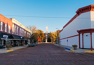
Clarinda is a city in and the county seat of Page County, Iowa. It is located in Nodaway Township. The population was 5,369 at the time of the 2020 census.

<span class="mw-page-title-main">Hepburn, Iowa</span> City in Iowa, United States

Hepburn is a city in Page County, Iowa, United States. The population was 26 at the time of the 2020 census.

<span class="mw-page-title-main">Northboro, Iowa</span> City in Iowa, United States

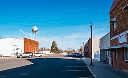
Northboro is a city in Page County, Iowa, United States. The population was 52 at the time of the 2020 census.

<span class="mw-page-title-main">Yorktown, Iowa</span> City in Iowa, United States

Yorktown is a city in Page County, Iowa, United States. The population was 60 at the time of the 2020 census.

<span class="mw-page-title-main">Runnells, Iowa</span> City in Iowa, United States

Runnells is a city in the southeastern corner of Polk County, Iowa, United States. The population was 457 at the time of the 2020 census. It is part of the Des Moines–West Des Moines Metropolitan Statistical Area. Runnells has its own Post Office, located at 112 Brown Street.

<span class="mw-page-title-main">Macedonia, Iowa</span> City in Iowa, United States

Macedonia is a city in Pottawattamie County, Iowa, United States. The population was 267 at the time of the 2020 census.

<span class="mw-page-title-main">Dixon, Iowa</span> City in Iowa, United States

Dixon is a city in Scott County, Iowa, United States. The population was 202 at the time of the 2020 census.

<span class="mw-page-title-main">Maysville, Iowa</span> City in Iowa, United States

Maysville is a city in Scott County, Iowa, United States. The population was 156 at the time of the 2020 census.

<span class="mw-page-title-main">Bedford, Iowa</span> City in Iowa, United States

Bedford is a city in Taylor County, Iowa, United States. The population was 1,508 at the 2020 census. It is the county seat of Taylor County. Lake of Three Fires State Park is located a few miles northeast of Bedford.

<span class="mw-page-title-main">Blockton, Iowa</span> City in Iowa, United States

Blockton is a city in Taylor County, Iowa, United States. The population was 125 at the 2020 census.

<span class="mw-page-title-main">Conway, Iowa</span> City in Iowa, United States

Conway is a city in Taylor County, Iowa, United States. The population was 17 at the 2020 census.

<span class="mw-page-title-main">Gravity, Iowa</span> City in Iowa, United States

Gravity is a city in Taylor County, Iowa, United States. The population was 154 at the time of the 2020 census.

<span class="mw-page-title-main">Corning, Missouri</span> Village in Missouri, United States

Corning is a village in Holt County, Missouri, United States. The population was 3 at the 2020 census.

References

  1. "2020 U.S. Gazetteer Files". United States Census Bureau. Retrieved March 16, 2022.
  2. 1 2 {{GNIS|2395207
  3. 1 2 "2020 Census State Redistricting Data". census.gov. United states Census Bureau. Retrieved 12 August 2021.
  4. Crosson, Frank E. (1910). History of Taylor County, Iowa: From the Earliest Historic Times to 1910. Walsworth Publishing Company. p. 189.
  5. Hartman, Chester W. (2006). Poverty and Race in America. Lanham, Maryland: Lexington Books via Google Books.
  6. Loewen, James W. (2005). Sundown Towns: A Hidden Dimension of American Racism. New York City: The New Press. ISBN   1-56584-887-X via Google Books.
  7. "US Gazetteer files 2010". United States Census Bureau. Archived from the original on 2012-01-25. Retrieved 2012-05-11.
  8. "Census of Population and Housing". Census.gov. Retrieved June 4, 2015.
  9. "U.S. Census website". United States Census Bureau . Retrieved 2012-05-11.
  10. "U.S. Census website". United States Census Bureau . Retrieved 2008-01-31.
  11. "Bedford." Iowa Department of Education. Retrieved on June 20, 2018.
  12. "Clarinda." Iowa Department of Education. Retrieved on July 20, 2018.
  13. "REORGANIZATION & DISSOLUTION ACTIONS SINCE 1965-66." Iowa Department of Education. Retrieved on July 20, 2018.