Bani, Pangasinan

Last updated
Bani
Municipality of Bani
Pangasinanjf9190 23.JPG
Street in Bani
Flag of Bani, Pangasinan.png
Bani Pangasinan.png
Ph locator pangasinan bani.png
Map of Pangasinan with Bani highlighted
Philippines location map (square).svg
Red pog.svg
Bani
Location within the Philippines
Coordinates: 16°11′13″N119°51′33″E / 16.18694°N 119.85917°E / 16.18694; 119.85917
Country Philippines
Region Ilocos Region
Province Pangasinan
District 1st district
Founded March 18,1769
Named for Bani tree
Barangays 27 (see Barangays)
Government
[1]
  Type Sangguniang Bayan
   Mayor Facundo O. Palafox
   Vice Mayor Cothera Gwen P. Yamamoto
   Representative Arthur F. Celeste
   Municipal Council
Members
   Electorate 31,687 voters (2022)
Area
[2]
  Total179.65 km2 (69.36 sq mi)
Elevation
43 m (141 ft)
Population
 (2020 census) [3]
  Total52,603
  Density290/km2 (760/sq mi)
   Households
13,738
Economy
   Income class 2nd municipal income class
   Poverty incidence
20.02
% (2021) [4]
   Revenue 187 million (2020)
   Assets 663.2 million (2020)
   Expenditure 242.9 million (2020)
   Liabilities 65.71 million (2020)
Service provider
  ElectricityPangasinan 1 Electric Cooperative (PANELCO 1)
Time zone UTC+8 (PST)
ZIP code
2407
PSGC
IDD : area code +63(0)75
Native languages Pangasinan
Ilocano
Sambal
Tagalog
Website www.bani.gov.ph

Bani, officially the Municipality of Bani (Pangasinan : Baley na Bani; Ilocano : Ili ti Bani; Sambal: Babali nin Bani; Tagalog : Bayan ng Bani), is a 2nd class municipality in the province of Pangasinan, Philippines. According to the 2020 census, it has a population of 52,603 people. [3]

Contents

The town, dubbed as the "Golden West" in the 1960s and early 1970s, is named after the Bani tree which could be found in the Poblacion. From the Municipal Hall, one would read that this town used to be a part of Zambales and its founders include Pangasinenses, Ilocanos and Zambals.

History

Spanish colonial era

Spain ruled Bani from 1521 to 1899. The pueblo's Gobernadorcillos were appointed by the Spanish authorities and from 1901 to 1936, the Presidentes, by the Americans. From 1937 to present, the local chief executives were elected.

Bani was founded on March 18, 1769. It was used to be part of Zambales.

In 1769, Fr. Mains de Lamberto erected a "visita" in Bani with settlements around Don Cayo banks and in 1762, these settlements became a sitio, with local officials headed by Don Francisco Baltazar as "Tiniente Absolute". [5] Bani was repopulated by the Ilocano settlers from Paoay, Ilocos Norte in 1830.

American invasion era

In May 1903, it was transferred to Pangasinan together with the towns of Agno, Alaminos, Anda, Bolinao, Burgos, Dasol, Infanta and Mabini. San Simon, the original Bani, was transferred from Namagbagan to sitio Almacin in 1859.

On 21 November 1903 the town of Bani together with Alaminos, Bolinao, San Isidro de Potot and Infanta were annexed to Pangasinan. [6] In 1918 the road from Alaminos to Bani was started. During the time of Martial Law the mayor of Bani was Marcelo Navarro, a member of the Liberal Party. After the People Power of 1986 the OIC who headed Bani was Edmundo Cacho [7]

Contemporary

The Immaculate Conception, Patron Saint of San Simon, disappeared from the church altar and discovered on top of the tall Bani tree in the vicinity of the present Church. She was brought to the Namagbagan church, and returned to the present site. Bani's name came from the Bani tree where the image of the Patroness was found. Bani ( Millettia pinnata ) is a smooth tree (height of 8 to 25 meters). [8]

In May 2009, Bani along with Anda and Bolinao, was severely damaged by Typhoon Emong. The typhoon damaged an office close to the Municipal Building, the Western Pangasinan Lyceum, and a lot of structures and houses. [5]

Geography

Bani lies between Tambac Bay and the South China Sea, and Alaminos and Bolinao. [9] It has a land area of 19,243.6075 hectares. [10]

Bani is 56 kilometres (35 mi) from Lingayen and 262 kilometres (163 mi) from Manila.

Barangays

Bani is politically subdivided into 27 barangays. Each barangay consists of puroks and some have sitios.

  • Ambabaay
  • Aporao
  • Arwas
  • Ballag
  • Banog Norte
  • Banog Sur
  • Calabeng
  • Centro Toma
  • Colayo
  • Dacap Norte
  • Dacap Sur
  • Garrita
  • Luac
  • Macabit
  • Masidem
  • Poblacion
  • Quinaoayanan
  • Ranao
  • Ranom Iloco
  • San Jose
  • San Miguel
  • San Simon
  • San Vicente
  • Tiep
  • Tipor
  • Tugui Grande
  • Tugui Norte

Climate

Climate data for Bani, Pangasinan
MonthJanFebMarAprMayJunJulAugSepOctNovDecYear
Mean daily maximum °C (°F)31
(88)
31
(88)
32
(90)
34
(93)
35
(95)
34
(93)
32
(90)
32
(90)
32
(90)
32
(90)
32
(90)
31
(88)
32
(90)
Mean daily minimum °C (°F)22
(72)
22
(72)
22
(72)
24
(75)
24
(75)
24
(75)
24
(75)
24
(75)
24
(75)
23
(73)
23
(73)
22
(72)
23
(74)
Average precipitation mm (inches)13.6
(0.54)
10.4
(0.41)
18.2
(0.72)
15.7
(0.62)
178.4
(7.02)
227.9
(8.97)
368
(14.5)
306.6
(12.07)
310.6
(12.23)
215.7
(8.49)
70.3
(2.77)
31.1
(1.22)
1,766.5
(69.56)
Average rainy days3224141623212415106140
Source: World Weather Online [11]

Demographics

Population census of Bani
YearPop.±% p.a.
1903 4,440    
1918 8,109+4.10%
1939 14,565+2.83%
1948 18,402+2.63%
1960 23,758+2.15%
1970 25,176+0.58%
1975 27,549+1.82%
1980 29,102+1.10%
1990 37,180+2.48%
1995 37,463+0.14%
2000 42,824+2.91%
2007 45,652+0.89%
2010 45,758+0.08%
2015 50,306+1.82%
2020 52,603+0.88%
Source: Philippine Statistics Authority [12] [13] [14] [15]

Religion

1762 Immaculate Conception of the Blessed Virgin Mary Parish Church facade ChurchBaniPangasinanjfxxx.JPG
1762 Immaculate Conception of the Blessed Virgin Mary Parish Church facade

Roman Catholic population of Bani is 28,686 or 66.98% while the Philippine Independent Church (Aglipayan) population is 7,859 or 18.35%. [16] Other churches include Bani United Methodist Church and Iglesia ni Cristo (Church of Christ) Lokal ng Bani, inter alia.

The 1762 Immaculate Conception of the Blessed Virgin Mary Parish Church (Poblacion, Bani) is under Co Pastor, Fr. Raymond Oligane and Fr. Fernando Castillo. Feast day is December 8, with its Parish Priest, Fr. Roberto Casaclang, Vicariate of the Divine Savior, Vicar Forane, Father Eduardo E. Inacay. [10] [16] [17] [18] [19] is part of the Roman Catholic Diocese of Alaminos (Roman Catholic Archdiocese of Lingayen-Dagupan). [20]

Economy

Poverty Incidence of Bani

5
10
15
20
25
30
2006
29.90
2009
20.96
2012
17.57
2015
11.75
2018
10.58
2021
20.02

Source: Philippine Statistics Authority [21] [22] [23] [24] [25] [26] [27] [28]

Government

Local government

The municipal hall in 2019 Bani Municipal Hall, Pangasinan.jpg
The municipal hall in 2019

Bani, belonging to the first congressional district of the province of Pangasinan, is governed by a mayor designated as its local chief executive and by a municipal council as its legislative body in accordance with the Local Government Code. The mayor, vice mayor, and the councilors are elected directly by the people through an election which is being held every three years.

Municipal seal

The Official Seal was adopted in Resolution No. 7 on 7 March 1991. [29]

Elected officials

Municipal Officials of Bani,Pangasinan
(2022–2025) [30]
CongressmanArthur F. Celeste
MayorFacundo O.Palafox
Vice-Mayor

Cothera Gwen P.Yamamoto

CouncilorsRonaldo C. Catabay
Jovy Olores
Gringo Ampler
Philip O. Estabillo
Elmer N. Ocampo
Amelia R. Olores

Tourism

Attractions include: [31]

Notable personalities

Related Research Articles

<span class="mw-page-title-main">Anda, Pangasinan</span> Municipality in Pangasinan, Philippines

Anda, officially the Municipality of Anda, is a 3rd class municipality in the province of Pangasinan, Philippines. Unique in this part of the province, The Sambalic language of Bolinao or Binubolinao is primarily spoken in the municipality and the adjacent town of Bolinao. According to the 2020 census, it has a population of 41,548 people.

<span class="mw-page-title-main">Sison, Pangasinan</span> Municipality in Pangasinan, Philippines

Sison, officially the Municipality of Sison, is a 3rd class municipality in the province of Pangasinan, Philippines. The town's original name was Alava. According to the 2020 census, it has a population of 52,320 people.

<span class="mw-page-title-main">Villasis</span> Municipality in Pangasinan, Philippines

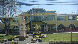
Villasis, officially the Municipality of Villasis, is a 1st class municipality in the province of Pangasinan, Philippines. According to the 2020 census, it has a population of 65,047 people.

<span class="mw-page-title-main">Rosario, La Union</span> Municipality in La Union, Philippines

Rosario, officially the Municipality of Rosario, is a 1st class municipality in the province of La Union, Philippines. According to the 2020 census, it has a population of 60,278 people.

<span class="mw-page-title-main">Agno, Pangasinan</span> Municipality in Pangasinan, Philippines

Agno, officially the Municipality of Agno, is a 3rd class municipality in the province of Pangasinan, Philippines. According to the 2020 census, it has a population of 29,947 people.

<span class="mw-page-title-main">Alaminos, Pangasinan</span> Component city in Pangasinan, Philippines

Alaminos, officially the City of Alaminos, is a 4th class component city in the province of Pangasinan, Philippines, and is known for being the home of the Hundred Islands National Park, which is composed of 124 islands and is located off the coast of Barangay Lucap. According to the 2020 census, it has a population of 99,397 people. The city is named after Juan Alaminos y de Vivar, a former governor-general of the Philippines.

<span class="mw-page-title-main">Basista</span> Municipality in Pangasinan, Philippines

Basista, officially the Municipality of Basista, is a 4th class municipality in the province of Pangasinan, Philippines. According to the 2020 census, it has a population of 37,679 people.

<span class="mw-page-title-main">Bolinao</span> Municipality in Pangasinan, Philippines

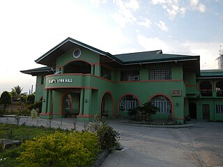
Bolinao, officially the Municipality of Bolinao, is a 1st class municipality in the province of Pangasinan, Philippines. According to the 2020 census, it has a population of 83,979 people.

<span class="mw-page-title-main">Bugallon</span> Municipality in Pangasinan, Philippines

Bugallon, officially the Municipality of Bugallon, is a 2nd class municipality in the province of Pangasinan, Philippines. According to the 2020 census, it has a population of 74,962 people.

<span class="mw-page-title-main">Burgos, Pangasinan</span> Municipality in Pangasinan, Philippines

Burgos, officially the Municipality of Burgos, is a 4th class municipality in the province of Pangasinan, Philippines. According to the 2020 census, it has a population of 23,749 people.

<span class="mw-page-title-main">Dasol</span> Municipality in Pangasinan, Philippines

Dasol, officially the Municipality of Dasol, is a 3rd class municipality in the province of Pangasinan, Philippines. According to the 2020 census, it has a population of 31,355 people.

<span class="mw-page-title-main">Labrador, Pangasinan</span> Municipality in Pangasinan, Philippines

Labrador, officially the Municipality of Labrador, is a 4th class municipality in the province of Pangasinan, Philippines. According to the 2020 census, it has a population of 26,811 people.

<span class="mw-page-title-main">Mabini, Pangasinan</span> Municipality in Pangasinan, Philippines

Mabini, officially the Municipality of Mabini, is a 3rd class municipality in the province of Pangasinan, Philippines. According to the 2020 census, it has a population of 26,454 people.

<span class="mw-page-title-main">Mangatarem</span> Municipality in Pangasinan, Philippines

Mangatarem, officially the Municipality of Mangatarem, is a 1st class municipality in the province of Pangasinan, Philippines. According to the 2020 census, it has a population of 79,323 people.

<span class="mw-page-title-main">Mapandan</span> Municipality in Pangasinan, Philippines

Mapandan, officially the Municipality of Mapandan, is a 3rd class municipality in the province of Pangasinan, Philippines. According to the 2020 census, it has a population of 38,058 people.

<span class="mw-page-title-main">Sual</span> Municipality in Pangasinan, Philippines

Sual, officially the Municipality of Sual, is a 1st class municipality in the province of Pangasinan, Philippines. According to the 2020 census, it has a population of 39,091 people.

<span class="mw-page-title-main">Tayug</span> Municipality in Pangasinan, Philippines

Tayug, officially the Municipality of Tayug, is a 3rd class municipality in the province of Pangasinan, Philippines. According to the 2020 census, it has a population of 45,241 people.

<span class="mw-page-title-main">Umingan</span> Municipality in Pangasinan, Philippines

Umingan, officially the Municipality of Umingan, is a 1st class municipality in the province of Pangasinan, Philippines. According to the 2020 census, it has a population of 77,074 people.

<span class="mw-page-title-main">Paniqui</span> Municipality in Tarlac, Philippines

Paniqui, officially the Municipality of Paniqui, is a 1st class municipality in the province of Tarlac, Philippines. According to the 2020 census, it has a population of 103,003 people. It is the birthplace of the 11th President of the Philippines, Corazon Aquino.

<span class="mw-page-title-main">Ramos, Tarlac</span> Municipality in Tarlac, Philippines

Ramos, officially the Municipality of Ramos, is a 5th class municipality in the province of Tarlac, Philippines. According to the 2020 census, it has a population of 22,879 people.

References

  1. Municipality of Bani | (DILG)
  2. "2015 Census of Population, Report No. 3 – Population, Land Area, and Population Density" (PDF). Philippine Statistics Authority. Quezon City, Philippines. August 2016. ISSN   0117-1453. Archived (PDF) from the original on May 25, 2021. Retrieved July 16, 2021.
  3. 1 2 Census of Population (2020). "Region I (Ilocos Region)". Total Population by Province, City, Municipality and Barangay. Philippine Statistics Authority . Retrieved 8 July 2021.
  4. "PSA Releases the 2021 City and Municipal Level Poverty Estimates". Philippine Statistics Authority. 2 April 2024. Retrieved 28 April 2024.
  5. 1 2 "Municipality of Bani Pangasinan : : . Welcome to the Golden West". Archived from the original on 2012-01-17. Retrieved 2012-12-23.
  6. (Rosario Cortes: Pangasinan-1901-1986, New Day Publishers, 1995, p. 16)
  7. (Rosario Cortes: Pangasinan-1901-1986, New Day Publishers, 1995)
  8. Bani Retrieved May 1, 2018.
  9. "Municipality of Bani Pangasinan" . Retrieved May 1, 2018.
  10. 1 2 Official website of Bani Pangasinan
  11. "Bani, Pangasinan: Average Temperatures and Rainfall". World Weather Online. Retrieved 23 September 2015.
  12. Census of Population (2015). "Region I (Ilocos Region)". Total Population by Province, City, Municipality and Barangay. Philippine Statistics Authority . Retrieved 20 June 2016.
  13. Census of Population and Housing (2010). "Region I (Ilocos Region)" (PDF). Total Population by Province, City, Municipality and Barangay. National Statistics Office . Retrieved 29 June 2016.
  14. Censuses of Population (1903–2007). "Region I (Ilocos Region)". Table 1. Population Enumerated in Various Censuses by Province/Highly Urbanized City: 1903 to 2007. National Statistics Office.{{cite encyclopedia}}: CS1 maint: numeric names: authors list (link)
  15. "Province of Pangasinan". Municipality Population Data. Local Water Utilities Administration Research Division. Retrieved 17 December 2016.
  16. 1 2 "Municipality of Bani Pangasinan : : . Welcome to the Golden West". Archived from the original on 2006-05-10. Retrieved 2006-06-10.
  17. "Diocese of Alaminos". Claretian Publications. 26 May 2017. Retrieved May 1, 2018.
  18. "Diocese of Alaminos" . Retrieved May 1, 2018.
  19. "Capital of Pangasinan". Blogger. February 18, 2008. Retrieved May 1, 2018.
  20. "Diocese of Alaminos Home Page". Archived from the original on 2012-02-04. Retrieved 2012-12-23.
  21. "Poverty incidence (PI):". Philippine Statistics Authority. Retrieved December 28, 2020.
  22. "Estimation of Local Poverty in the Philippines" (PDF). Philippine Statistics Authority. 29 November 2005.
  23. "2003 City and Municipal Level Poverty Estimates" (PDF). Philippine Statistics Authority. 23 March 2009.
  24. "City and Municipal Level Poverty Estimates; 2006 and 2009" (PDF). Philippine Statistics Authority. 3 August 2012.
  25. "2012 Municipal and City Level Poverty Estimates" (PDF). Philippine Statistics Authority. 31 May 2016.
  26. "Municipal and City Level Small Area Poverty Estimates; 2009, 2012 and 2015". Philippine Statistics Authority. 10 July 2019.
  27. "PSA Releases the 2018 Municipal and City Level Poverty Estimates". Philippine Statistics Authority. 15 December 2021. Retrieved 22 January 2022.
  28. "PSA Releases the 2021 City and Municipal Level Poverty Estimates". Philippine Statistics Authority. 2 April 2024. Retrieved 28 April 2024.
  29. "Municipality of Bani Pangasinan : : . Welcome to the Golden West". Archived from the original on 2012-06-19. Retrieved 2012-12-23.
  30. "2019 National and Local Elections" (PDF). Commission on Elections. Retrieved March 6, 2022.
  31. "Tourist spots of Bani Pangasinan". Blogger . Retrieved May 1, 2018.
  32. "Municipality of Bani Pangasinan : : . Welcome to the Golden West". Archived from the original on 2011-12-07. Retrieved 2012-12-23.
  33. "El Nino might affect bird sanctuary in Bani, Pangasinan". ABS-CBN News. ABS-CBN Corporation. March 1, 2010. Retrieved May 1, 2018.
  34. "Municipality of Bani Pangasinan : : . Welcome to the Golden West". Archived from the original on 2013-10-29. Retrieved 2013-10-27.