San Fabian | |
---|---|
Municipality of San Fabian | |
Anthem: Baley Kon San Fabian | |
Location within the Philippines | |
Coordinates: 16°09′N120°27′E / 16.15°N 120.45°E | |
Country | Philippines |
Region | Ilocos Region |
Province | Pangasinan |
District | 4th district |
Founded | March 21, 1717 |
Named for | Pope Fabian |
Barangays | 34 (see Barangays) |
Government | |
• Type | Sangguniang Bayan |
• Mayor | Marlyn E. Agbayani |
• Vice Mayor | Constante B. Agbayani |
• Representative | Christopher P. de Venecia |
• Municipal Council | Members |
• Electorate | 57,896 voters (2022) |
Area | |
• Total | 81.28 km2 (31.38 sq mi) |
Elevation | 7.0 m (23.0 ft) |
Highest elevation | 110 m (360 ft) |
Lowest elevation | −3 m (−10 ft) |
Population (2020 census) [3] | |
• Total | 87,428 |
• Density | 1,100/km2 (2,800/sq mi) |
• Households | 22,669 |
Economy | |
• Income class | 1st municipal income class |
• Poverty incidence | 11.46 |
• Revenue | ₱ 231.2 million (2020) |
• Assets | ₱ 206.6 million (2020) |
• Expenditure | ₱ 212.3 million (2020) |
• Liabilities | ₱ 26.59 million (2020) |
Service provider | |
• Electricity | Dagupan Electric Corporation (DECORP) |
Time zone | UTC+8 (PST) |
ZIP code | 2433 |
PSGC | |
IDD : area code | +63 (0)75 |
Native languages | Pangasinan Ilocano Tagalog |
Website | www |
San Fabian, officially the Municipality of San Fabian (Pangasinan : Baley na San Fabian; Ilocano : Ili ti San Fabian; Tagalog : Bayan ng San Fabian), is a 1st class municipality in the province of Pangasinan, Philippines. According to the 2020 census, it has a population of 87,428 people. [3]
The town got its name after Saint Fabian during the Spanish era.
The town used to be called Angio, and had been a mission territory of friars of the Dominican Order during the Spanish era. It is named after Saint Fabian, who was a pontiff and saint of the Roman Catholic Church.
Around 1818, San Fabian had a boundary dispute with Mangaldan. The boundary between the two towns was the Angalacan river, which sometimes overflows because of floods. The boundary dispute was settled in 1900, when the mayor of San Fabian agreed to meet the mayor of Mangaldan and the two reached an agreement with a boundary marker being erected at Longos between the towns of San Fabian and Mangaldan. The agreement was signed by Juan Ulanday, Nicolas Rosa, Vicente Padilla, Marcelo Erfe, and approved by the American Commander Capt. Ferguson. [5]
During the Philippine–American War, hundreds of Pangasinense soldiers and soldiers of the Philippine government died in San Fabian battling the Americans. [6] After the pacification of Pangasinan by the United States, the first town President of San Fabian was Ińigo Dispo. In 1903, the town of Alava became a part of San Fabian and became a mere village or barrio. [7]
During World War II, the liberation of US Naval and Marine forces in Pangasinan started when troops under Gen. Walter Krueger landed on Lingayen and San Fabian beaches. San Fabian landing zones were called White and Blue beaches, names which continue until the present time. [8]
In October 2009, San Fabian was among the places heavily affected by the floods caused by the release of water by the San Roque Dam at Rosales during the height of the Typhoon Pepeng. [9]
San Fabian is geographically located in the northern portion in Pangasinan, bordering the provincial boundaries of La Union. It has a land area of 8,129 hectares. [10] It is bounded in the north by Rosario (La Union), Sison in the northeast, Mangaldan in the south, Pozorrubio and San Jacinto in the southeast, Dagupan in the southwest, and in the west by Lingayen Gulf.
San Fabian is 28 kilometres (17 mi) from Lingayen and 234 kilometres (145 mi) from Manila.
San Fabian is politically subdivided into 34 barangays. Each barangay consists of puroks and some have sitios.
Climate data for San Fabian, Pangasinan | |||||||||||||
---|---|---|---|---|---|---|---|---|---|---|---|---|---|
Month | Jan | Feb | Mar | Apr | May | Jun | Jul | Aug | Sep | Oct | Nov | Dec | Year |
Average high °C (°F) | 31 (88) | 31 (88) | 33 (91) | 34 (93) | 34 (93) | 33 (91) | 32 (90) | 31 (88) | 31 (88) | 32 (90) | 31 (88) | 31 (88) | 32 (90) |
Average low °C (°F) | 21 (70) | 21 (70) | 23 (73) | 25 (77) | 25 (77) | 25 (77) | 25 (77) | 24 (75) | 24 (75) | 24 (75) | 23 (73) | 22 (72) | 24 (74) |
Average precipitation mm (inches) | 4.3 (0.17) | 19.1 (0.75) | 27.3 (1.07) | 45.2 (1.78) | 153.3 (6.04) | 271.3 (10.68) | 411.1 (16.19) | 532.0 (20.94) | 364.2 (14.34) | 182.5 (7.19) | 56.3 (2.22) | 24.4 (0.96) | 2,091 (82.33) |
Average rainy days | 3 | 2 | 3 | 5 | 14 | 17 | 22 | 23 | 21 | 13 | 7 | 4 | 134 |
Source: World Weather Online [11] |
Year | Pop. | ±% p.a. |
---|---|---|
1903 | 10,022 | — |
1918 | 15,845 | +3.10% |
1939 | 19,362 | +0.96% |
1948 | 23,997 | +2.41% |
1960 | 29,704 | +1.79% |
1970 | 35,014 | +1.66% |
1975 | 39,054 | +2.21% |
1980 | 42,018 | +1.47% |
1990 | 51,904 | +2.14% |
1995 | 59,904 | +2.72% |
2000 | 66,274 | +2.19% |
2007 | 74,005 | +1.53% |
2010 | 77,899 | +1.88% |
2015 | 83,025 | +1.22% |
2020 | 87,428 | +1.02% |
Source: Philippine Statistics Authority [12] [13] [14] [15] |
Graphs are unavailable due to technical issues. |
San Fabian, belonging to the fourth congressional district of the province of Pangasinan, is governed by a mayor designated as its local chief executive and by a municipal council as its legislative body in accordance with the Local Government Code. The mayor, vice mayor, and the councilors are elected directly by the people through an election which is being held every three years.
The present Mayor of San Fabian is Marlyn Espino-Agbayani, the second woman to be elected as the Local Chief Executive of the said town. Current Vice Mayor is former Mayor Constante Batrina Agbayani, the husband of the current Mayor. Former Vice Mayor Dr. Leopoldo N. Manalo is the only Vice Mayor to be elected and have completed the three-term limit on the said position. Former Mayor Irene F. Libunao is the first woman to be elected as Mayor in the municipality, who served from 2010 to 2013. Marinor Baltazar-De Guzman, the town's Vice Mayor from 2019 to 2022, became the first woman to be elected Board Member representing the 4th Provincial District of the Sangguniang Panlalawigan of Pangasinan.
Position | Officials | LGU Designation |
---|---|---|
Municipal Mayor | Marlyn E. Agbayani | Local Chief Executive |
Municipal Vice Mayor | Constante B. Agbayani | Sangguniang Bayan Presiding Officer |
Municipal Councilors | Chelsea Mae N. Narvasa | Sangguniang Bayan Minority Floor Leader |
Roberto O. Quirimit | Sangguniang Bayan Majority Floor Leader | |
Errol R. Sison | Sangguniang Bayan Member | |
Marieta C. Cuaresma | Sangguniang Bayan Member | |
Hercules P. Magliba | Sangguniang Bayan Member | |
Kimberly G. Bandarlipe | Sangguniang Bayan Assistant Minority Floor Leader | |
Riemzie A. Abrio | Sangguniang Bayan Member | |
Rolando J. Pedralvez | Sangguniang Bayan Member | |
Efren R. Fajardo | Sangguniang Bayan Ex-officio Member President, Liga ng mga Barangay - San Fabian | |
Mary Ruth Victoria H. Agbayani | Sangguniang Bayan Ex-officio Member President, Pambayang Pederasyon ng SK - San Fabian |
Binmaley, officially the Municipality of Binmaley, is a 1st class municipality in the province of Pangasinan, Philippines. According to the 2020 census, it has a population of 86,881 people.
Mangaldan, officially the Municipality of Mangaldan, is a 1st class municipality in the province of Pangasinan, Philippines. According to the 2020 census, it has a population of 113,185 people.
Anda, officially the Municipality of Anda, is a 3rd class municipality in the province of Pangasinan, Philippines. Unique in this part of the province, The Sambalic language of Bolinao or Binubolinao is primarily spoken in the municipality and the adjacent town of Bolinao. According to the 2020 census, it has a population of 41,548 people.
Sison, officially the Municipality of Sison, is a 3rd class municipality in the province of Pangasinan, Philippines. The town's original name was Alava. According to the 2020 census, it has a population of 52,320 people.
Pangasinan, officially the Province of Pangasinan, is a coastal province in the Philippines located in the Ilocos Region of Luzon. Its capital is Lingayen. Pangasinan is in the western area of Luzon along Lingayen Gulf and the South China Sea. It has a total land area of 5,451.01 square kilometres (2,104.65 sq mi). According to the 2020 census, it has a population of 3,163,190. The official number of registered voters in Pangasinan is 1,651,814. The western portion of the province is part of the homeland of the Sambal people, while the central and eastern portions are the homeland of the Pangasinan people. Due to ethnic migration, the Ilocano people settled in the province.
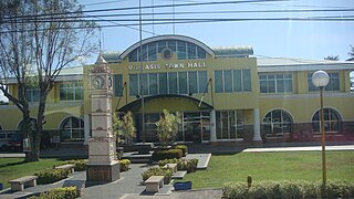
Villasis, officially the Municipality of Villasis, is a 1st class municipality in the province of Pangasinan, Philippines. According to the 2020 census, it has a population of 65,047 people.
Rosario, officially the Municipality of Rosario, is a 1st class municipality in the province of La Union, Philippines. According to the 2020 census, it has a population of 60,278 people.
Bani, officially the Municipality of Bani, is a 2nd class municipality in the province of Pangasinan, Philippines. According to the 2020 census, it has a population of 52,603 people.
Basista, officially the Municipality of Basista, is a 4th class municipality in the province of Pangasinan, Philippines. According to the 2020 census, it has a population of 37,679 people.
Bautista, officially the Municipality of Bautista, is a 4th class municipality in the province of Pangasinan, Philippines. According to the 2020 census, it has a population of 35,398 people.
Calasiao, officially the Municipality of Calasiao, is a 1st class municipality in the province of Pangasinan, Philippines. According to the 2020 census, it has a population of 100,471 people.
Labrador, officially the Municipality of Labrador, is a 4th class municipality in the province of Pangasinan, Philippines. According to the 2020 census, it has a population of 26,811 people.
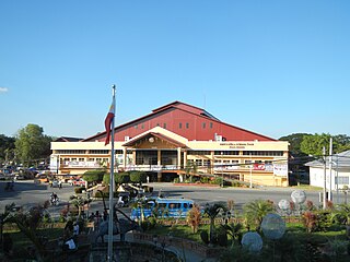
Lingayen, officially the Municipality of Lingayen, is a 1st class municipality and capital of the province of Pangasinan, Philippines. According to the 2020 census, it has a population of 107,728 people.
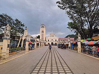
Manaoag, officially the Municipality of Manaoag, is a 1st class municipality in the province of Pangasinan, Philippines. According to the 2020 census, it has a population of 76,045 people.
Mapandan, officially the Municipality of Mapandan, is a 3rd class municipality in the province of Pangasinan, Philippines. According to the 2020 census, it has a population of 38,058 people.
Rosales, officially the Municipality of Rosales, is a 1st class municipality in the province of Pangasinan, Philippines. According to the 2020 census, it has a population of 66,711 people.
San Jacinto, officially the Municipality of San Jacinto, is a 3rd class municipality in the province of Pangasinan, Philippines. According to the 2020 census, it has a population of 44,351 people.
Sual, officially the Municipality of Sual, is a 1st class municipality in the province of Pangasinan, Philippines. According to the 2020 census, it has a population of 39,091 people.
Umingan, officially the Municipality of Umingan, is a 1st class municipality in the province of Pangasinan, Philippines. According to the 2020 census, it has a population of 77,074 people.
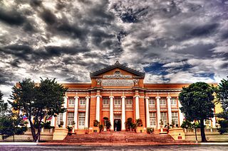
San Carlos, officially the City of San Carlos, is a 3rd class component city in the province of Pangasinan, Philippines. According to the 2020 census, it has a population of 205,424 people. It is the most populated city in Pangasinan and the entire Ilocos Region.