
The Cree are a North American Indigenous people. They live primarily in Canada, where they form one of the country's largest First Nations.
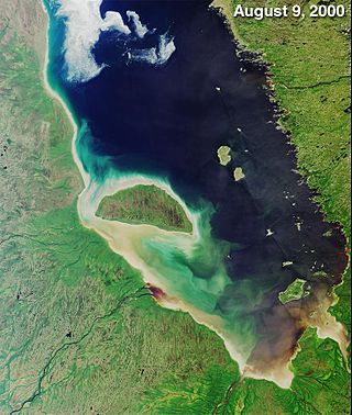
James Bay is a large body of water located on the southern end of Hudson Bay in Canada. It borders the provinces of Quebec and Ontario, and is politically part of Nunavut. Its largest island is Akimiski Island.

The Pigeon River forms part of the Canada–United States border between the state of Minnesota and the province of Ontario, west of Lake Superior. In pre-industrial times, the river was a waterway of great importance for transportation and the fur trade.
The Kaministiquia River is a river which flows into western Lake Superior at the city of Thunder Bay, Ontario. Kaministiquia is an Ojibwe word meaning "where a stream flows in island" due to two large islands at the mouth of the river. The delta has three branches or outlets, reflected on early North American maps in French as "les trois rivières" : the southernmost is known as the Mission River, the central branch as the McKellar River, and the northernmost branch as the Kaministiquia. Residents of the region commonly refer to the river as the Kam River.

Thunder Bay District is a district and census division in Northwestern Ontario in the Canadian province of Ontario. The district seat is Thunder Bay.
The Mississagi River is a river in Algoma and Sudbury Districts, Ontario, Canada, that originates in Sudbury District and flows 266 kilometres (165 mi) to Lake Huron at Blind River, Algoma District.
The Winnipeg River is a Canadian river that flows roughly northwest from Lake of the Woods in the province of Ontario to Lake Winnipeg in Manitoba. This river is 235 kilometres (146 mi) long from the Norman Dam in Kenora to its mouth at Lake Winnipeg. Its watershed is 106,500 square kilometres (41,100 sq mi) in area, mainly in Canada. About 29,000 square kilometres (11,000 sq mi) of the watershed is in northern Minnesota, United States.

The Churchill River is a major river in Alberta, Saskatchewan and Manitoba, Canada. From the head of the Churchill Lake it is 1,609 kilometres (1,000 mi) long. It was named after John Churchill, 1st Duke of Marlborough and governor of the Hudson's Bay Company from 1685 to 1691.
The Pic River is a river in the east part of Thunder Bay District in northwestern Ontario, Canada. It flows from McKay Lake southeast of the community of Longlac and empties into Lake Superior southeast of the town of Marathon.
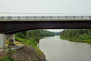
The White River is a tributary of Lake Superior in Thunder Bay District, Ontario, Canada. It starts at Negwazu Lake and flows in a predominantly western direction to Lake Superior, passing through the Township of White River.
La Verendrye Provincial Park is a waterway provincial park located in Ontario, Canada, on the border with the U.S. state of Minnesota. The park stretches from Quetico Provincial Park through Saganaga Lake, up the Pine River, across the Height of Land Portage, then down the Pigeon River to Pigeon River Provincial Park on Lake Superior. The park is named after Pierre Gaultier de Varennes, sieur de La Vérendrye, an early explorer of Canada.
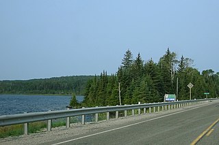
White Lake Provincial Park is a park in the Thunder Bay District of Northern Ontario, Canada, along Highway 17, north of Lake Superior.
Eabametoong, also known as Fort Hope or Eabamet Lake by Canada Post, is an Ojibwe First Nations band government in Kenora District, Ontario, Canada. Located on the shore of Eabamet Lake in the Albany River system, the community is located approximately 300 km (190 mi) northeast of Thunder Bay and is accessible only by airplane via Fort Hope Airport or water, or by winter/ice roads, which connect the community to the Northern Ontario Resource Trail. The Eabametoong First Nation Reserve is completely surrounded by territory of the Unorganized Kenora District.
The Robinson Treaties are two treaties signed between the Ojibwa chiefs and the Crown in 1850 in the Province of Canada. The first treaty involved Ojibwa chiefs along the north shore of Lake Superior, and is known as the Robinson Superior Treaty. The second treaty, signed two days later, included Ojibwa chiefs from along the eastern and northern shores of Lake Huron, and is known as the Robinson Huron Treaty. The Wiikwemkoong First Nation did not sign either treaty, and their land is considered "unceded".
Kitchenuhmaykoosib Inninuwug, also known as Big Trout Lake First Nation or KI for short, is an Oji-Cree First Nation reserve in Northwestern Ontario and is a part of Treaty 9. The community is about 580 km (360 mi) north of Thunder Bay, Ontario.

Ear Falls is a township located in Northwestern Ontario, Canada, on the banks of the English River, Lac Seul, Pakwash Lake and Wenesaga Lake. It is located along Highway 105, 100 kilometres (62 mi) north of Highway 17 and Vermilion Bay, about halfway between Highway 17 and Red Lake, or about 480 kilometres (300 mi) northwest of Thunder Bay.
Chapleau Ojibway First Nation is an Ojibwa First Nation located near Chapleau Township, Sudbury District, Ontario, Canada. The First Nation have reserved for themselves the 67 ha Chapleau 61A Indian Reserve, 64.7 ha Chapleau 74 Indian Reserve and the 799.3 ha Chapleau 74A Indian Reserve. In September, 2007, their total registered population 39, of which their on-reserve population was 30.
The Kagiano River is a river in the east part of Thunder Bay District in northwestern Ontario, Canada. It is in the Great Lakes Basin and flows from Devork Lake, 42 kilometres (26 mi) south of the community of Longlac on Ontario Highway 11, to the Pic River 55 kilometres (34 mi) north northeast of the town of Marathon on Ontario Highway 17.

The Groundhog River is a river in Cochrane District and Sudbury District in Northeastern Ontario, Canada. The river is in the James Bay drainage basin and is a left tributary of the Mattagami River.
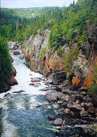
The Black River is a river in Thunder Bay District in Northwestern Ontario, Canada. It is part of the Great Lakes Basin, and is a left tributary of the Pic River.


