
Fond du Lac County is a county in the U.S. state of Wisconsin. As of the 2020 census, the population was 104,154. Its county seat is Fond du Lac. The county was created in the Wisconsin Territory in 1836 and later organized in 1844. Fond du Lac is French for "bottom of the lake", given so because of the county's location at the southern shore of Lake Winnebago. Fond du Lac County comprises the Fond du Lac, Wisconsin Metropolitan Statistical Area. The Holyland region is in northeastern Fond du Lac County.

Calumet County is a county located in the U.S. state of Wisconsin. As of the 2020 census, the population was 52,442. The county seat is Chilton. The county was created in 1836 and organized in 1850.

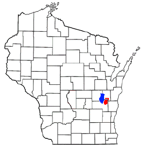
Brothertown is a town in Calumet County in the U.S. state of Wisconsin. The population was 1,329 at the 2010 census. The unincorporated communities of Brothertown, Charlesburg, Eckers Lakeland, Jericho, and Maple Heights are located in the town. The unincorporated community of Calumetville is also located partially in the town.
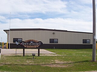
Calumet is a town in Fond du Lac County, Wisconsin, United States. The population was 1,514 at the 2000 census. The unincorporated communities of Artesia Beach, Calumet Harbor, Garnet, Highland Park, Johnsburg, Laudolff Beach, Marytown, Pipe, Pukwana Beach, Winnebago Heights, and Winnebago Park are located within the town. The unincorporated community of Calumetville is located partially in the town.

Campbellsport is a village in Fond du Lac County, Wisconsin, United States. The population was 2,016 at the 2010 census.
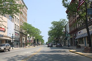
Fond du Lac is a city in and the county seat of Fond du Lac County, Wisconsin, United States. The population was 44,678 at the 2020 census. The city forms the core of the Fond du Lac metropolitan statistical area, which includes all of Fond du Lac County. Fond du Lac is the 348th-largest metropolitan area in the United States.

U.S. Highway 151 (US 151) is a United States Numbered Highway that runs through the states of Iowa and Wisconsin. The southern terminus for US 151 is at a junction with Interstate 80 (I-80) in Iowa County, Iowa, and its northern terminus is at Manitowoc, Wisconsin. The route, from south to north follows a northeasterly path through the two states.
The Brothertown Indians, located in Wisconsin, are a Native American tribe formed in the late 18th century from communities descended from Pequot, Narragansett, Montauk, Tunxis, Niantic, and Mohegan (Algonquian-speaking) tribes of southern New England and eastern Long Island, New York. In the 1780s after the American Revolutionary War, they migrated from New England into New York state, where they accepted land from the Iroquois Oneida Nation in Oneida County.

State Trunk Highway 23 is a state highway in the U.S. state of Wisconsin. The route is signed as a north–south route from Shullsburg to Wisconsin Dells and as an east–west route from Wisconsin Dells to Sheboygan. With the exception of freeway segments between Sheboygan Falls and Sheboygan, an expressway segment between Sheboygan Falls past Greenbush to Fond du Lac, a freeway concurrency with Interstate 39 (I-39), and an expressway segment concurrent with U.S. Highway 151 (US 151), the highway is generally either two-lane surface road or urban multilane arterial. WIS 23 provides access to several important Wisconsin destinations, such as the House on the Rock, the Wisconsin Dells area and various state parks.

State Trunk Highway 55 is a state highway in Wisconsin, United States. It travels south-to-north in the northeastern part of Wisconsin from an intersection with U.S. Route 151 (US 151) approximately 1.5 miles (2.4 km) north of Brothertown, near the eastern shore of Lake Winnebago in Calumet County, to the Michigan state line at the Brule River approximately one mile (1.6 km) northeast of Nelma in Forest County, where it connects to M-73.

State Trunk Highway 149 was a state highway in the U.S. state of Wisconsin. It ran through 40.1 miles (64.5 km) of Manitowoc, Calumet, and Fond du Lac counties.

U.S. Highway 45 runs north–south through the eastern and northern portions of the state of Wisconsin. Also called Highway 45, it runs from the state line with Illinois near the village of Bristol in Kenosha County to the Michigan state line at the town of Land O' Lakes in Vilas County, a total of about 305 miles (491 km).

Pipe, Wisconsin is an unincorporated community in the Town of Calumet in Fond du Lac County, Wisconsin, United States. It is located approximately 1 mile (1.6 km) east of Lake Winnebago.
Marytown, Wisconsin is an unincorporated community in Fond du Lac County, Wisconsin, in the town of Calumet. Marytown is located at the intersection of Fond du Lac County highways G and HH. Wisconsin Highway 149, ran north to south through the community before it was decommissioned in 2006.

St. Anna is an unincorporated community in Calumet and Sheboygan Counties in the U.S. state of Wisconsin. It lies in the towns of Russell and New Holstein.
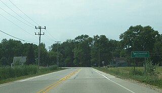
Taycheedah, Wisconsin is an unincorporated census-designated place in the Town of Taycheedah in Fond du Lac County, Wisconsin. The community is located adjacent to the city of Fond du Lac and Lake Winnebago. As of the 2010 census, its population is 704. Taycheedah calls itself the "Sheepshead Fishing Center of the World". U.S. Route 151 ran through the community until a bypass around Fond du Lac was built in the 2000s.
The Holyland is an American region located mainly in northeastern Fond du Lac County, Wisconsin and southern Calumet County. The area is known for its distinctive agricultural landscape, a close-knit community life, and deep Roman Catholicism brought by Germans who first settled the region in the 1840s. The area has been studied as an example of chain migration. It has been called "The Holyland" since at least 1898.

Peebles, Wisconsin is an unincorporated community in the Town of Taycheedah in Fond du Lac County, Wisconsin. The community is located adjacent to the unincorporated community of Taycheedah. U.S. Route 151 runs through the community. Wisconsin Highway 149 used to run through the community at its western terminus until it was decommissioned in 2006. Taycheedah Correctional Institution is located in the town of Taycheedah several miles south of the community.

Garnet, Wisconsin is an unincorporated community in Fond du Lac County, in the U.S. state of Wisconsin. The community is on the north boundary of the county, just south of Calumet County. It is located at the intersection of County Highway HHH and Town Hall Road just east of Calumet County C, in the town of Calumet. Garnet is located 1.95 miles (3.14 km) east of Calumetville.

St. Peter, Wisconsin is an unincorporated census-designated place in the Town of Taycheedah in Fond du Lac County, Wisconsin. It is located approximately 2 miles (3.2 km) northeast of Peebles and 1 mile (1.6 km) south of Silica. It was located on Wisconsin Highway 149 before the highway was decommissioned and turned over to county control as County Highway WH. As of the 2010 census, its population is 1,489.


