Fairwater, Wisconsin

Last updated

Fairwater, Wisconsin
Fairwater Wisconsin Panorama Looking North WIS44.jpg
Panorama looking north on WIS 44
Fond du Lac County Wisconsin Incorporated and Unincorporated areas Fairwater Highlighted.svg
Location of Fairwater in Fond du Lac County, Wisconsin.
Coordinates: 43°44′28″N88°52′8″W / 43.74111°N 88.86889°W / 43.74111; -88.86889
Country Flag of the United States.svg  United States
State Flag of Wisconsin.svg  Wisconsin
County   Fond du Lac
Area
[1]
  Total0.75 sq mi (1.95 km2)
  Land0.73 sq mi (1.90 km2)
  Water0.02 sq mi (0.05 km2)
Elevation
[2]
948 ft (289 m)
Population
 (2010) [3]
  Total371
  Estimate 
(2019) [4]
357
  Density485.71/sq mi (187.56/km2)
Time zone UTC-6 (Central (CST))
  Summer (DST) UTC-5 (CDT)
Area code 920
FIPS code 55-25075 [5]
GNIS feature ID1564827 [2]
Website www.villageoffairwater.com

Fairwater is a village in Fond du Lac County, Wisconsin, United States. The population was 371 at the 2010 census. The town of Metomen surrounds the village.

Contents

History

The community was founded around the water power of the Grand River in 1848 and was incorporated in 1921. The town prospered under a booming hemp economy spurred by the need for strong rope during World War I. Hemp brought direct income to Fairwater farmers, factory workers and the owners of the Fairwater Hemp Company. [6] An efficient, eco-friendly production process used unwanted parts of the hemp plant to fuel the factory's steam power system. The Fairwater Hemp Company closed in 1931.

Geography

Fairwater is located at 43°44′28″N88°52′8″W / 43.74111°N 88.86889°W / 43.74111; -88.86889 (43.741047, -88.868887). [7]

According to the United States Census Bureau, the village has a total area of 0.76 square miles (1.97 km2), of which, 0.74 square miles (1.92 km2) of it is land and 0.02 square miles (0.05 km2) is water. [8]

Demographics

Historical population
CensusPop.Note
1930 301
1940 293−2.7%
1950 3116.1%
1960 3306.1%
1970 37313.0%
1980 310−16.9%
1990 302−2.6%
2000 35015.9%
2010 3716.0%
2019 (est.)357 [4] −3.8%
U.S. Decennial Census [9]

2010 census

As of the census [3] of 2010, there were 371 people, 152 households, and 108 families living in the village. The population density was 501.4 inhabitants per square mile (193.6/km2). There were 160 housing units at an average density of 216.2 per square mile (83.5/km2). The racial makeup of the village was 95.1% White, 0.8% African American, 0.5% Native American, 0.3% Asian, and 3.2% from other races. Hispanic or Latino of any race were 6.5% of the population.

There were 152 households, of which 30.3% had children under the age of 18 living with them, 61.8% were married couples living together, 5.9% had a female householder with no husband present, 3.3% had a male householder with no wife present, and 28.9% were non-families. 25.0% of all households were made up of individuals, and 9.9% had someone living alone who was 65 years of age or older. The average household size was 2.44 and the average family size was 2.90.

The median age in the village was 38.9 years. 23.5% of residents were under the age of 18; 6.9% were between the ages of 18 and 24; 28.3% were from 25 to 44; 26.9% were from 45 to 64; and 14.3% were 65 years of age or older. The gender makeup of the village was 50.7% male and 49.3% female.

2000 census

As of the census [5] of 2000, there were 350 people, 139 households, and 104 families living in the village. The population density was 470.8 people per square mile (182.6/km2). There were 142 housing units at an average density of 191.0 per square mile (74.1/km2). The racial makeup of the village was 99.43% White, and 0.57% from two or more races.

There were 139 households, out of which 33.1% had children under the age of 18 living with them, 67.6% were married couples living together, 7.2% had a female householder with no husband present, and 24.5% were non-families. 21.6% of all households were made up of individuals, and 10.1% had someone living alone who was 65 years of age or older. The average household size was 2.52 and the average family size was 2.94.

In the village, the population was spread out, with 24.0% under the age of 18, 7.7% from 18 to 24, 31.4% from 25 to 44, 21.1% from 45 to 64, and 15.7% who were 65 years of age or older. The median age was 38 years. For every 100 females, there were 100.0 males. For every 100 females age 18 and over, there were 98.5 males.

The median income for a household in the village was $105,292, and the median income for a family was $51,250. Males had a median income of $36,875 versus $23,125 for females. The per capita income for the village was $19,281. About 3.7% of families and 3.6% of the population were below the poverty line, including 5.1% of those under age 18 and 5.8% of those age 65 or over.

Images

Related Research Articles

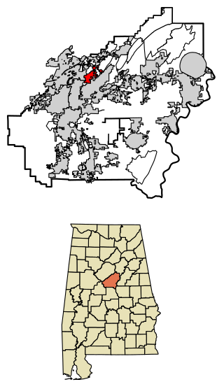
<span class="mw-page-title-main">Indian Springs Village, Alabama</span> Rural Area in Alabama, United States

Indian Springs Village is a rural town in Shelby County, Alabama, United States, in the Birmingham metropolitan area. It incorporated effective November 14, 1990. At the 2010 census the population was 2,363, up from 2,225 in 2000.

<span class="mw-page-title-main">Secor, Illinois</span> Village in Illinois, United States

Secor is a village in Clayton Township, Woodford County, Illinois, United States. The population was 373 at the 2010 census. It is part of the Peoria, Illinois Metropolitan Statistical Area. Secor is located just off U.S. Route 24 between El Paso and Eureka.

<span class="mw-page-title-main">Copper City, Michigan</span> Village in Michigan, United States

Copper City is a village in Houghton County of the U.S. state of Michigan. The population was 187 at the 2020 census. The village is within Calumet Township. With an area of 0.08 square miles (0.21 km2), it is the second-smallest incorporated municipality by area in the state of Michigan after the nearby village of Ahmeek.

<span class="mw-page-title-main">Melvin, Michigan</span> Village in Michigan, United States

Melvin is a village in Sanilac County in the U.S. state of Michigan. The population was 148 at the 2020 census. The village is within Speaker Township, and is located within the Thumb Region of Michigan.
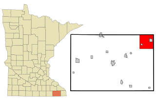
<span class="mw-page-title-main">Rushford Village, Minnesota</span> City in Minnesota, United States

Rushford Village is a city in Fillmore County, Minnesota, United States. The population was 807 at the 2010 census. It surrounds the city of Rushford.

<span class="mw-page-title-main">Brice, Ohio</span> Village in Ohio, United States

Brice is a village in Franklin County, Ohio, United States, on the southeast side of the Columbus metropolitan area. The population was 93 at the 2020 census.
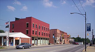
<span class="mw-page-title-main">Monroeville, Ohio</span> Village in Ohio, United States

Monroeville is a village in Huron County, Ohio, United States. The population was 1,300 at the 2020 census.

<span class="mw-page-title-main">Brandon, Wisconsin</span> Village in Wisconsin, United States

Brandon is a village in Fond du Lac County, Wisconsin, United States. The population was 879 at the 2010 census.

<span class="mw-page-title-main">Metomen, Wisconsin</span> Town in Wisconsin, United States

Metomen is a town in Fond du Lac County, Wisconsin, United States. The population was 709 at the 2000 census. The villages of Fairwater and Brandon, the unincorporated community of Metomen, and the ghost town of Reeds Corners is also located in the town.

<span class="mw-page-title-main">Avoca, Wisconsin</span> Village in Wisconsin, United States

Avoca is a village in Iowa County, Wisconsin, United States. The population was 637 at the 2010 census. It is part of the Madison Metropolitan Statistical Area. It is named after Avoca in Ireland.

<span class="mw-page-title-main">Hustler, Wisconsin</span> Village in Wisconsin, United States

Hustler is a village in Juneau County, Wisconsin, United States. The population was 194 at the 2010 census.

<span class="mw-page-title-main">Random Lake, Wisconsin</span> Village in Wisconsin, United States

Random Lake is a village in Sheboygan County, Wisconsin, United States. The population was 1,594 at the 2010 census. It is part of the Sheboygan, Wisconsin Metropolitan Statistical Area.

<span class="mw-page-title-main">Lac La Belle, Wisconsin</span> Village in Wisconsin, United States

Lac La Belle is a village located mostly in Waukesha County in the U.S. state of Wisconsin. The population was 281 at the 2020 census. The village is located mostly within the town of Oconomowoc in Waukesha County. On March 28, 2002, the village annexed a portion of land in the town of Ixonia in Jefferson County.

<span class="mw-page-title-main">Big Falls, Waupaca County, Wisconsin</span> Village in Wisconsin, United States

Big Falls is a village in Waupaca County, Wisconsin, United States. The population was 61 at the 2010 census.

<span class="mw-page-title-main">Earlville, New York</span> Village in New York, United States

Earlville is a village in New York state bisected by two counties: Madison County and Chenango County, United States. The population was 774 as per the 2020 Decennial census, a decrease from the 872 reported in the 2010 census. The village is named after Jonas Earl, a canal commissioner.

<span class="mw-page-title-main">Kittery (CDP), Maine</span> Census-designated place in Maine, United States

Kittery is a census-designated place (CDP) consisting of the main village in the town of Kittery in York County, Maine, United States. The village is also known as Kittery Foreside. The population of the CDP was 4,562 at the 2010 census. It is part of the Portland–South Portland–Biddeford, Maine Metropolitan Statistical Area.

<span class="mw-page-title-main">Corinth (village), New York</span> Village in New York, United States

Corinth is a village in Saratoga County, New York, United States. The population was 2,562 at the 2020 census. The village takes its name from the Greek city of Corinth.

<span class="mw-page-title-main">Dallas, Wisconsin</span> Village in Wisconsin, United States

Dallas is a village in Barron County in the U.S. state of Wisconsin. The population was 409 at the 2010 census. The village is located within the Town of Dallas.

<span class="mw-page-title-main">Woodman, Wisconsin</span> Village in Wisconsin, United States

Woodman is a village in Grant County in the U.S. state of Wisconsin. The population was 132 at the 2010 census. The village is located within the Town of Woodman.

<span class="mw-page-title-main">Neshkoro, Wisconsin</span> Village in Wisconsin, United States

Neshkoro is a village in Marquette County, Wisconsin, United States. The population was 434 at the 2010 census. The village is located within the Town of Neshkoro.

References

  1. "2019 U.S. Gazetteer Files". United States Census Bureau. Retrieved August 7, 2020.
  2. 1 2 "US Board on Geographic Names". United States Geological Survey. October 25, 2007. Retrieved January 31, 2008.
  3. 1 2 "U.S. Census website". United States Census Bureau . Retrieved November 18, 2012.
  4. 1 2 "Population and Housing Unit Estimates". United States Census Bureau. May 24, 2020. Retrieved May 27, 2020.
  5. 1 2 "U.S. Census website". United States Census Bureau . Retrieved January 31, 2008.
  6. Fairwater Hemp Company
  7. "US Gazetteer files: 2010, 2000, and 1990". United States Census Bureau. February 12, 2011. Retrieved April 23, 2011.
  8. "US Gazetteer files 2010". United States Census Bureau. Archived from the original on January 25, 2012. Retrieved November 18, 2012.
  9. "Census of Population and Housing". Census.gov. Retrieved June 4, 2015.