Carson City, Nevada

Last updated

Carson City
Consolidated Municipality of Carson City
Flag of Carson City, Nevada.jpg
CarsonCityNVseal.png
Nicknames: 
Carson, CC, The Capitol
Motto: 
Proud of its Past...Confident of its Future
Map of Nevada highlighting Carson City.svg
Location within Nevada
Relief map of U.S., Nevada.png
Red pog.svg
Carson City
Location in Nevada
Usa edcp relief location map.png
Red pog.svg
Carson City
Location within the United States
Coordinates: 39°9′52″N119°46′1″W / 39.16444°N 119.76694°W / 39.16444; -119.76694
CountryUnited States
State Nevada
Founded1858;166 years ago (1858)
Named for Kit Carson
Government
  MayorLori Bagwell
Area
[1]
  Total157.12 sq mi (406.94 km2)
  Land144.53 sq mi (374.34 km2)
  Water12.59 sq mi (32.59 km2)  8.0%
Elevation
[2]
4,682 ft (1,427 m)
Population
 (2020)
  Total58,639
  Density405.71/sq mi (156.65/km2)
Time zone UTC−8 (Pacific)
  Summer (DST) UTC−7 (Pacific)
ZIP code
89701–89706, 89711–89714, 89721
Area code 775
GNIS feature ID863976 [2]
Website carson.org
Reference no.44

Carson City is an independent city and the capital of the U.S. state of Nevada. [3] As of the 2020 census, the population was 58,639, making it the 6th most populous city in the state. The majority of the city's population lives in Eagle Valley, on the eastern edge of the Carson Range, a branch of the Sierra Nevada, about 30 miles (50 km) south of Reno. The city is named after the mountain man Kit Carson. The town began as a stopover for California-bound immigrants, but developed into a city with the Comstock Lode, a silver strike in the mountains to the northeast. The city has served as Nevada's capital since statehood in 1864; for much of its history it was a hub for the Virginia and Truckee Railroad, although the tracks were removed in 1950.

Contents

Before 1969, Carson City was the county seat of Ormsby County. That year, after a referendum approved merging the city and the county, the state legislature issued a revised city charter that merged them into the Consolidated Municipality of Carson City. [4] With the consolidation, the city limits extend west across the Sierra Nevada to the California state line in the middle of Lake Tahoe. Like other independent cities in the United States, it is treated as a county-equivalent for census purposes.

History

Abraham Curry Abraham Curry.png
Abraham Curry
Illustration of Carson City in 1877 Carson City, 1877.jpg
Illustration of Carson City in 1877

The Washoe people have inhabited the valley and surrounding areas for about 6,000 years. [5]

The first European Americans to arrive in what is now known as Eagle Valley were John C. Frémont and his exploration party in January 1843. [6] Fremont named the river flowing through the valley Carson River in honor of Kit Carson, the mountain man and scout he had hired for his expedition. Later, settlers named the area Washoe, in reference to the indigenous people. [7]

By 1851, the Eagle Station ranch along the Carson River was a trading post and stopover for travelers on the California Trail's Carson Branch, which ran through Eagle Valley. The valley and trading post received their name from a bald eagle that was hunted and killed by one of the early settlers and was featured on a wall inside the post.

As the area was part of the Utah Territory, it was governed from Salt Lake City, where the territorial government was headquartered. Early settlers bristled at the control by Mormon-influenced officials and desired the creation of the Nevada territory. A vigilante group of influential settlers, headed by Abraham Curry, sought a site for a capital city for the envisioned territory. [8] In 1858, Abraham Curry bought Eagle Station and the settlement was thereafter renamed Carson City. [9] Curry and several other partners had Eagle Valley surveyed for development. Curry decided Carson City would someday serve as the capital city and left a 10-acre (40,000 m2) plot in the center of town for a capitol building.

After gold and silver were discovered in 1859 on nearby Comstock Lode, Carson City's population began to grow. Curry built the Warm Springs Hotel a mile to the east of the city center. When territorial governor James W. Nye traveled to Nevada, he chose Carson City as the territorial capital, influenced by Carson City lawyer William Stewart, who escorted him from San Francisco to Nevada. [10] As such, Carson City bested Virginia City and American Flat. Curry loaned the Warm Springs Hotel to the territorial Legislature as a meeting hall. The Legislature named Carson City to be the seat of Ormsby County and selected the hotel as the territorial prison, with Curry serving as its first warden. Today, the property is still part of the state prison.

When Nevada became a state in 1864 during the American Civil War, Carson City was confirmed as Nevada's permanent capital. Carson City's development was no longer dependent on the mining industry and instead became a thriving commercial center. The Virginia and Truckee Railroad was built between Virginia City and Carson City. A log flume was also built from the Sierra Nevada into Carson City. The current capitol building was constructed from 1870 to 1871. The United States Mint operated the Carson City Mint between the years 1870 and 1893, which struck gold and silver coins. People came from China during that time, many to work on the railroad. Some of them owned businesses and taught school. By 1880, almost a thousand Chinese people, "one for every five Caucasians", lived in Carson City. [11]

Carson City's population and transportation traffic decreased when the Central Pacific Railroad built a branch line through Donner Pass to connect with the Carson and Colorado Railroad. The new bypassed the Virginia & Truckee, and ran too far to the north to benefit Carson City. The city was slightly revitalized with the mining booms in Tonopah and Goldfield. The US federal building (now renamed the Paul Laxalt Building) was completed in 1890 as was the Stewart Indian School. Even these developments could not prevent its population from dropping to just over 1,500 people by 1930. Carson City resigned itself to small city status, advertising itself as "America's smallest capital". The city slowly grew after World War II; by 1960, it had reached its 1880 boom-time population.

20th-century revitalization and growth

As early as the late 1940s, discussions began about merging Ormsby County and Carson City. By this time, the county was little more than Carson City and a few hamlets to the west. By the 1960 census, all but 2,900 of the county's residents lived in Carson City. However, the effort did not pay off until 1966, when a statewide referendum approved the merger. The required constitutional amendment was passed in 1968. On April 1, 1969, Ormsby County and Carson City officially merged as the Consolidated Municipality of Carson City. [4] With this consolidation, Carson City absorbed former town sites such as Empire City, which had grown up in the 1860s as a milling center along the Carson River and current U.S. Route 50. Carson City could now advertise itself as one of America's largest state capitals with its 146 square miles (380 km2) of city limits. [12]

In 1991, the city adopted a downtown master plan, specifying no building within 500 feet (150 metres) of the capitol would surpass it in height. This plan effectively prohibited future high-rise development in the center of downtown. [13] The Ormsby House is the tallest building in downtown Carson City, at a height of 117 feet (36 m). The structure was completed in 1972. [14]

Geography

Most of the city proper resides in the Eagle Valley. The Carson River flows from Douglas County through the southwestern edge of both the valley and Carson City. Since the consolidation, the city limits today include several small populated areas outside of this valley. Today the city limits include several peaks in the Sierra Nevada, small portions of both the Virginia Range and the Pine Nut Mountains and portions of Marlette Lake and Lake Tahoe. The highest elevation in city limits is Snow Valley Peak at an elevation of 9,214 feet (2,808 m). [15] Carson City is one of two state capitals that border another state, the other being Trenton, New Jersey.

Climate

Climate chart for Carson City Monthly Climate Normals (1991-2020) - CARSON CITY, NV.svg
Climate chart for Carson City

Carson City features a cold semi-arid climate (Koppen: BSk) with cold winters and hot summers. The city is in a high desert river valley approximately 4,802 feet (1,464 m) above sea level. There are four fairly distinct seasons. Winters see typically light to moderate snowfall, with an average of 14.0 inches (36 cm). Most precipitation occurs in winter and spring, with summer and fall being fairly dry, drier than neighboring California. There are 39.5 days of 90 °F (32 °C)+ highs annually, with 100 °F (38 °C)+ temperatures occurring 1.2 days per year. [16]

The average temperature in Carson City increased by 4.1 °F (2.3 °C) between 1984 and 2014, a greater change than in any other city in the United States. [17]

Climate data for Carson City, Nevada, 1991–2020 normals, extremes 1893–present
MonthJanFebMarAprMayJunJulAugSepOctNovDecYear
Record high °F (°C)72
(22)
76
(24)
81
(27)
88
(31)
94
(34)
101
(38)
107
(42)
105
(41)
103
(39)
93
(34)
79
(26)
75
(24)
107
(42)
Mean maximum °F (°C)59.3
(15.2)
62.4
(16.9)
70.7
(21.5)
77.9
(25.5)
85.6
(29.8)
93.6
(34.2)
99.0
(37.2)
96.5
(35.8)
91.9
(33.3)
82.7
(28.2)
70.7
(21.5)
60.5
(15.8)
99.7
(37.6)
Mean daily maximum °F (°C)45.5
(7.5)
49.5
(9.7)
56.2
(13.4)
61.7
(16.5)
70.4
(21.3)
80.9
(27.2)
89.5
(31.9)
87.8
(31.0)
80.7
(27.1)
68.0
(20.0)
54.5
(12.5)
44.6
(7.0)
65.8
(18.8)
Daily mean °F (°C)34.8
(1.6)
38.3
(3.5)
43.9
(6.6)
48.8
(9.3)
56.6
(13.7)
65.0
(18.3)
72.1
(22.3)
70.2
(21.2)
63.1
(17.3)
52.2
(11.2)
41.4
(5.2)
34.2
(1.2)
51.7
(10.9)
Mean daily minimum °F (°C)24.1
(−4.4)
27.1
(−2.7)
31.6
(−0.2)
35.8
(2.1)
42.9
(6.1)
49.2
(9.6)
54.8
(12.7)
52.5
(11.4)
45.6
(7.6)
36.3
(2.4)
28.4
(−2.0)
23.9
(−4.5)
37.7
(3.2)
Mean minimum °F (°C)6.9
(−13.9)
11.7
(−11.3)
17.4
(−8.1)
22.3
(−5.4)
29.7
(−1.3)
35.8
(2.1)
44.4
(6.9)
42.1
(5.6)
34.3
(1.3)
21.8
(−5.7)
11.4
(−11.4)
6.2
(−14.3)
0.6
(−17.4)
Record low °F (°C)−27
(−33)
−22
(−30)
−5
(−21)
3
(−16)
18
(−8)
25
(−4)
33
(1)
26
(−3)
17
(−8)
6
(−14)
−5
(−21)
−26
(−32)
−27
(−33)
Average precipitation inches (mm)1.72
(44)
1.48
(38)
1.24
(31)
0.51
(13)
0.51
(13)
0.37
(9.4)
0.18
(4.6)
0.14
(3.6)
0.24
(6.1)
0.55
(14)
0.90
(23)
1.50
(38)
9.34
(237)
Average snowfall inches (cm)3.6
(9.1)
1.7
(4.3)
1.6
(4.1)
0.0
(0.0)
0.0
(0.0)
0.0
(0.0)
0.0
(0.0)
0.0
(0.0)
0.0
(0.0)
0.0
(0.0)
0.7
(1.8)
6.4
(16)
14.0
(36)
Average precipitation days (≥ 0.01 in)6.25.64.83.23.41.70.91.01.12.43.34.838.4
Average snowy days (≥ 0.1 in)1.81.41.00.10.00.00.00.00.00.00.61.46.3
Source 1: NOAA [16]
Source 2: National Weather Service [18]

Places of interest

Museums

Secret Harbor Beach, Lake Tahoe Secret Beach - Lake Tahoe East Shore.jpg
Secret Harbor Beach, Lake Tahoe
  • Yesterday's Flyers, an aviation museum in Carson City. [22]
  • Children's Museum of Northern Nevada – Carson City

Open land

Demographics

Carson City is the smallest of the United States' 366 metropolitan statistical areas.

Historical population
CensusPop.Note
1850 714
1860 7140.0%
1870 3,042326.1%
1880 4,22939.0%
1890 3,950−6.6%
1900 2,100−46.8%
1910 2,46617.4%
1920 1,685−31.7%
1930 1,596−5.3%
1940 2,47855.3%
1950 3,08224.4%
1960 5,16367.5%
1970 15,468199.6%
1980 32,022107.0%
1990 40,44326.3%
2000 52,54729.9%
2010 55,2745.2%
2020 58,6396.1%
2023 (est.)58,036 [23] −1.0%
U.S. Decennial Census [24]
1790–1960 [25] 1900–1990 [26]
1990–2000 [27]

As of the 2010 census, there were 55,274 people, 20,171 households, and 13,252 families residing in the city. The population density was 366 people per square mile (141 people/km2). There were 21,283 housing units at an average density of 148 per square mile (57/km2). The racial makeup of the city was 81.1% White, 1.9% Black or African American, 2.4% Native American, 2.1% Asian, 0.2% Pacific Islander, 9.4% from other races, and 2.9% from two or more races. 21% of the population were Hispanic or Latino of any race.

As of the 2000 census, there were 20,171 households, out of which 29.8% had children under the age of 18 living with them, 50.0% were married couples living together, 11.0% had a female householder with no husband present, and 34.3% were non-families. 27.8% of all households were made up of individuals, and 11.00% had someone living alone who was 65 years of age or older. The average household size was 2.44 and the average family size was 2.97. The city's age distribution was: 23.4% under the age of 18, 7.9% from 18 to 24, 28.9% from 25 to 44, 24.9% from 45 to 64, and 14.9% who were 65 years of age or older. The median age was 39 years. For every 100 females, there were 106.9 males. For every 100 females age 18 and over, there were 108.2 males.

Data from the 2000 census indicates the median income for a household in the city was $41,809, and the median income for a family was $49,570. Males had a median income of $35,296 versus $27,418 for females. The per capita income for the city was $20,943. 10.0% of the population and 6.9% of families were below the poverty line. Out of the total population, 13.7% of those under the age of 18 and 5.8% of those 65 and older were living below the poverty line.

Languages

As of 2010, 82.3% (42,697) of Carson City residents age 5 and older spoke English at home as a first language, while 14.1% (7,325) spoke Spanish, 0.6% (318) French, and numerous Indo-Aryan languages were spoken as a main language by 0.5% (261) of the population over the age of five. In total, 17.7% (9,174) of Carson City's population age 5 and older spoke a first language other than English. [28]

Government and politics

Ormsby County consolidated with Carson City in 1969, and the county simultaneously dissolved. [29] The city is now governed by a five-member board of supervisors, consisting of a mayor and four supervisors. [29] All members are elected at-large, but each of the four supervisors must reside in respective wards, numbered 1 through 4. [29] The mayor and supervisors serve four year terms. Elections are staggered so the mayor and the supervisors from Wards 2 and Ward 4 are elected in presidential election years, and the supervisors from Wards 1 and 3 are elected in the even-numbered years in between (i.e., the same year as gubernatorial elections). [29]

The city is generally considered a Republican stronghold, often voting for Republicans by wide margins. In 2004, George W. Bush defeated John Kerry 57–40%. In 2008, however, Barack Obama became the first Democrat since 1964 to win Ormsby County/Carson City, defeating John McCain 49–48%, by 204 votes, a margin of under 1%. [30]

United States presidential election results for Ormsby County (Carson City), Nevada [31]
Year Republican Democratic Third party
No.%No.%No.%
2020 16,11354.18%12,73542.82%8913.00%
2016 13,12552.47%9,61038.42%2,2819.12%
2012 12,39453.15%10,29144.13%6342.72%
2008 11,41948.22%11,62349.08%6382.69%
2004 13,17157.00%9,44140.86%4942.14%
2000 11,08456.98%7,35437.81%1,0145.21%
1996 9,16848.73%7,26938.64%2,37712.63%
1992 7,30238.83%6,03532.10%5,46629.07%
1988 9,70163.44%5,08833.27%5023.28%
1984 9,47770.01%3,79028.00%2691.99%
1980 8,38966.81%2,76922.05%1,39811.13%
1976 5,28254.11%3,87439.69%6056.20%
1972 5,39671.79%2,12028.21%00.00%
1968 3,16956.58%1,77031.60%66211.82%
1964 1,99748.40%2,12951.60%00.00%
1960 1,94660.27%1,28339.73%00.00%
1956 1,74968.03%82231.97%00.00%
1952 1,65374.06%57925.94%00.00%
1948 1,09560.80%68137.81%251.39%
1944 84155.84%66544.16%00.00%
1940 74848.79%78551.21%00.00%
1936 53341.71%74558.29%00.00%
1932 48645.63%57954.37%00.00%
1928 59058.07%42641.93%00.00%
1924 41344.31%41544.53%10411.16%
1920 59257.81%41340.33%191.86%
1916 53443.52%61049.71%836.76%
1912 15022.22%29443.56%23134.22%
1908 35046.60%34345.67%587.72%
1904 40960.15%21832.06%537.79%

Carson City, being the state capital, has seen many political protests and demonstrations. [32] [33] [34]

In an attempt to either make a proposed spent nuclear fuel storage facility at Yucca Mountain prohibitively expensive (by raising property tax rates to the maximum allowed) or to allow the state to collect the potential federal payments of property taxes on the facility, the state government in 1987 carved Yucca Mountain out of Nye County and created a new county with no residents out of the area surrounding Yucca called Bullfrog County. Carson City became the county seat of Bullfrog County, even though it is not in Bullfrog County and is more than 100 miles (160 km) from Yucca Mountain. A state judge found the process unconstitutional in 1989, and Bullfrog County's territory was retroceded to Nye County. [35] [36]

Culture

Sports and recreation

Carson City has never hosted any professional team sports. However, a variety of sports are offered at parks and recreation. [37] Many neighborhood parks offer a wide variety of features including picnic tables, beaches, restrooms, fishing, softball, basketball hoops, ponds, tennis, and volleyball. The largest park is Mills Park, which has a total land area of 51 acres (0.21 km2) and includes the 2 ft (610 mm) narrow-gauge [38] Carson & Mills Park Railroad. [39] While there are no ski slopes within Carson City, the city is near the Heavenly Mountain Resort, Diamond Peak and Mount Rose Ski Tahoe skiing areas. [40]

Notable people

Carson City has served as one of the state's centers for politics and business. Every state governor since Denver S. Dickerson has resided in the Governor's Mansion in Carson City. [41] The following personalities took up residence in Carson City at some point in their lives. [42]

Economy and infrastructure

The following is a list of notable employers in Carson City from the fourth quarter of 2012: [67]

1,000–1,499 employees

500–999 employees

200–499 employees

100–199 employees

Transportation

Looking south on US 395, just south of US 50 in Douglas County near Carson City US395SouthofCarsonCity.jpg
Looking south on US 395, just south of US 50 in Douglas County near Carson City

There are four highways in the city: Nevada State Route 28, U.S. Route 395, U.S. Route 50, and Interstate 580, its only freeway. Phase 1 of the Carson City Freeway Project from US 395, just north of the city, to US 50 was completed in February 2006, and Phase 2A, extending from Rt. 50 to Fairview Drive, was officially opened on September 24, 2009. Phase 2B, Fairview Drive to Rt. 50, was completed in August 2017. Prior to 2012, Carson City was one of only five state capitals not directly served by an interstate highway; the city lost this distinction when I-580 was extended into the city limits.

Carson City's first modern bus system, Jump Around Carson, or JAC, opened to the public in October 2005. [68] JAC uses a smaller urban bus ideal for Carson City. [69] Tahoe Transportation District connects Gardnerville with Carson City. [70]

However, there is virtually no ground public transportation to other destinations. Passenger trains have not served Carson City since 1950, when the Virginia and Truckee Railroad was shut down. Greyhound Lines stopped their bus services to the town in 2006 and Amtrak discontinued their connecting thruway bus to Sacramento, California, in 2008. There is now only a limited Monday – Friday RTC bus service, [71] to Reno which is still served by both Greyhound and Amtrak, as well as Eastern Sierra Transit Authority service from Lone Pine to Reno.

Carson City is also served by the Carson Airport, which is a regional airport in the northern part of the city. Reno–Tahoe International Airport, which is 28 miles (45 km) away, handles domestic commercial flights. [72]

Education

The Carson City School District, the sole public school district of the city, [73] operates ten schools there. The six elementary schools are Bordewich-Bray Elementary School, Empire Elementary School, Fremont Elementary School, Fritsch Elementary School, Mark Twain Elementary School, and Al Seeliger Elementary School. The two middle schools are Carson Middle School and Eagle Valley Middle School. Carson High School and the alternative Pioneer High School serve high school students. Carson High is on Saliman Road. [74]

The district sponsors Carson Montessori School, a public charter school serving grades K-6. [75] Students residing in any Nevada county may enroll. [76] Carson Montessori School is the only school in district operating with a balanced budget. [77] In 2019 Carson Montessori School received the Governor's STEM Schools Designation, [78] an official recognition given to 25 schools statewide which causes a short ceremony attended by the governor during which receiving schools are assigned a 10-foot banner. [79]

Western Nevada College (WNC) is a regionally accredited, two-year and four-year institution which is part of the Nevada System of Higher Education. The college offers many programs including education, arts and science. [80]

Carson City has a public library, the Carson City Library. [81]

Historic buildings

See also

Related Research Articles

<span class="mw-page-title-main">Nevada</span> U.S. state

Nevada is a landlocked state in the Western region of the United States. It borders Oregon to the northwest, Idaho to the northeast, California to the west, Arizona to the southeast, and Utah to the east. Nevada is the 7th-most extensive, the 32nd-most populous, and the 9th-least densely populated of the U.S. states. Nearly three-quarters of Nevada's people live in Clark County, which contains the Las Vegas–Paradise metropolitan area, including three of the state's four largest incorporated cities. Nevada's capital is Carson City. Las Vegas is the largest city in the state.

<span class="mw-page-title-main">Reno, Nevada</span> City in Nevada, United States

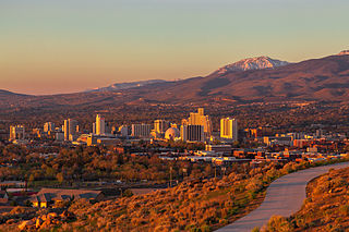
Reno is a city in the northwest section of the U.S. state of Nevada, along the Nevada–California border, about 22 miles (35 km) north from Lake Tahoe, known as "The Biggest Little City in the World". It is the county seat and most populous city of Washoe County sitting in the High Eastern Sierra foothills, in the Truckee River valley, on the eastern side of the Sierra Nevada. The Reno metro area occupies a valley colloquially known as the Truckee Meadows, it is the 81st most populous city in the United States, the 3rd most populous city in Nevada, and the most populous in Nevada outside the Las Vegas Valley.

<span class="mw-page-title-main">El Dorado County, California</span> County in California, United States

El Dorado County, officially the County of El Dorado, is a county located in the U.S. state of California. As of the 2020 census, the population was 191,185. The county seat is Placerville. The county is part of the Sacramento-Roseville-Arden-Arcade, CA Metropolitan Statistical Area. It is located entirely in the Sierra Nevada, from the historic Gold Country in the western foothills to the High Sierra in the east. El Dorado County's population has grown as Greater Sacramento has expanded into the region. Where the county line crosses US 50 at Clarksville, the distance to Sacramento is 15 miles. In the county's high altitude eastern end at Lake Tahoe, environmental awareness and environmental protection initiatives have grown along with the population since the 1960 Winter Olympics, hosted at the former Squaw Valley Ski Resort in neighboring Placer County.

<span class="mw-page-title-main">Nevada County, California</span> County in California, United States

Nevada County is a county located in the U.S. state of California, in the Sierra Nevada. As of the 2020 census, its population was 102,241. The county seat is Nevada City. Nevada County comprises the Truckee-Grass Valley micropolitan statistical area, which is also included in the Sacramento-Roseville combined statistical area, part of the Mother Lode Country.

<span class="mw-page-title-main">Placer County, California</span> County in California, United States

Placer County, officially the County of Placer, is a county located in the U.S. state of California. As of the 2020 census, the population was 404,739. The county seat is Auburn.

<span class="mw-page-title-main">Douglas County, Nevada</span> County in Nevada, United States

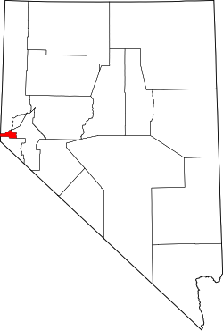
Douglas County is a county in the northwestern part of the U.S. state of Nevada. As of the 2020 census, the population was 49,488. Its county seat is Minden. Douglas County comprises the Gardnerville Ranchos, NV Micropolitan Statistical Area, which is also included in the Reno–Carson City–Fernley, NV Combined Statistical Area.

<span class="mw-page-title-main">Washoe County, Nevada</span> County in Nevada, United States

Washoe County is a county in the U.S. state of Nevada. As of the 2020 census, the population was 486,492, making it Nevada's second-most populous county. Its county seat is Reno. Washoe County is included in the Reno, NV Metropolitan Statistical Area.

<span class="mw-page-title-main">Nye County, Nevada</span> County in Nevada, United States

Nye County is a county in the U.S. state of Nevada. As of the 2020 census, the population was 51,591. Its county seat is Tonopah. At 18,159 square miles (47,030 km2), Nye is Nevada's largest county by area and the third-largest county in the contiguous United States, behind Coconino County of Arizona and San Bernardino County of California.

<span class="mw-page-title-main">Lyon County, Nevada</span> County in Nevada, United States

Lyon County is a county in the U.S. state of Nevada. As of the 2020 census, the population was 59,235. Lyon County comprises the Fernley, NV Micropolitan Statistical Area which is part of the Reno-Carson City-Fernley, NV Combined Statistical Area.

<span class="mw-page-title-main">South Lake Tahoe, California</span> City in California, United States

South Lake Tahoe is the most populous city in El Dorado County, California, United States, in the Sierra Nevada mountains. The city's population was 21,330 at the 2020 census, down from 21,403 at the 2010 census. The city, along the southern edge of Lake Tahoe, extends about 5 miles (8 km) west-southwest along U.S. Route 50, also known as Lake Tahoe Boulevard. The east end of the city, on the California–Nevada state line right next to the town of Stateline, Nevada, is mainly geared towards tourism, restaurants, hotels, and Heavenly Mountain Resort with the Nevada casinos just across the state line in Stateline. The western end of town is mainly residential, and clusters around "The Y", the intersection of US 50, State Route 89, and the continuation of Lake Tahoe Boulevard after it loses its federal highway designation.

<span class="mw-page-title-main">Gardnerville, Nevada</span> Unincorporated town in the State of Nevada, United States

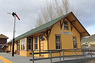
Gardnerville is an unincorporated town in Douglas County, Nevada, adjacent to the county seat of Minden. The population was 6,211 at the 2020 census.

<span class="mw-page-title-main">Beatty, Nevada</span> Unincorporated town in Nevada, United States

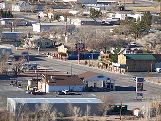
Beatty is an unincorporated town along the Amargosa River in Nye County, Nevada, United States. U.S. Route 95 runs through the town, which lies between Tonopah, about 90 miles (140 km) to the north and Las Vegas, about 120 miles (190 km) to the southeast. State Route 374 connects Beatty to Death Valley National Park, about 8 miles (13 km) to the west.

<span class="mw-page-title-main">Incline Village, Nevada</span> Census-designated place in Nevada, United States

Incline Village is an upscale census-designated place (CDP) on the north shore of Lake Tahoe in Washoe County, Nevada, United States. The population was 8,777 at the 2010 census. It is part of the Reno−Sparks Metropolitan Statistical Area. Until the 2010 census, the CDP Crystal Bay, Nevada was counted jointly with Incline Village.

<span class="mw-page-title-main">U.S. Route 50 in Nevada</span> Section of U.S. Highway in Nevada, United States

U.S. Route 50 (US 50) is a transcontinental highway in the United States, stretching from West Sacramento, California, in the west to Ocean City, Maryland, on the east coast. The Nevada portion crosses the center of the state and was named "The Loneliest Road in America" by Life magazine in July 1986. The name was intended as a pejorative, but Nevada officials seized it as a marketing slogan. The name originates from large desolate areas traversed by the route, with few or no signs of civilization. The highway crosses several large desert valleys separated by numerous mountain ranges towering over the valley floors, in what is known as the Basin and Range province of the Great Basin.

<span class="mw-page-title-main">Glenbrook, Nevada</span> Census-designated place in Nevada, United States

Glenbrook is a census-designated place (CDP) on the east shore of Lake Tahoe in Douglas County, Nevada, United States. The population was 215 at the 2010 census. Beach and Bay are for residents and renters living in Glenbrook's gated community. There is no public access to the beach or bay.

<span class="mw-page-title-main">Geography of Nevada</span>

The landlocked U.S. state of Nevada has a varied geography and is almost entirely within the Basin and Range Province and is broken up by many north–south mountain ranges. Most of these ranges have endorheic valleys between them.

<span class="mw-page-title-main">Reno metropolitan area, Nevada</span> Combined Statistical Area in the United States

The Reno–Sparks Metropolitan Statistical Area, as defined by the United States Census Bureau, is an area consisting of two counties in Western Nevada, anchored by the cities of Reno and Sparks. As of the 2020 census, the MSA had a population of 490,596.

<span class="mw-page-title-main">Abraham Curry</span> Founder of Carson City, Nevada (1815–1873)

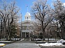
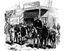
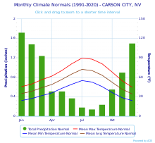
AbrahamVan Santvoord Curry is considered the founding father of Carson City, Nevada. A native of the state of New York, he traveled to the West Coast during the California Gold Rush and settled in Nevada's Eagle Valley, where Carson City was established.

<span class="mw-page-title-main">Eagle Valley (Nevada)</span>

Eagle Valley is the area encompassing Carson City, Nevada. The valley was first settled during the California Gold Rush of 1849. The discovery of Nevada's Comstock Lode in 1859 established the economic importance of the area, which would become the site of the Nevada State Capitol.

References

  1. "ArcGIS REST Services Directory". United States Census Bureau. Retrieved September 19, 2022.
  2. 1 2 "Geographic Names Information System". edits.nationalmap.gov. Retrieved May 8, 2023.
  3. "City Facts | Carson City". www.carson.org. Retrieved July 16, 2023.
  4. 1 2 "About Carson City". Carson City. May 29, 2006. Retrieved November 20, 2011.
  5. Pritzker, Barry M. (2000). A Native American Encyclopedia: History, Culture, and Peoples . Oxford: Oxford University Press. ISBN   978-0195138771.
  6. "National Park Service: Three Historic Cities". Travel Nevada.com. Retrieved June 2, 2010.
  7. Bayer, C.W. (1995). Profits, plots & lynching; the creation of Nevada Territory. Carson City: Purple Mountain Press. p. 2. ISBN   0962889032.
  8. Oldham, Willa (1991). Carson City: Nevada's Capital City. Carson City, NV: Nevada State Museum. p. 5. ASIN   B0006QSL8Q.
  9. Cerveri, Doris (1990). With Curry's Compliments: The Story of Abraham Curry. Elko, NV: Nostalgia Press. p. 13.
  10. Hauck, Eldon (1991). American Capitols. Jefferson, NC: McFarland & Company, Inc. p. 138.
  11. Kelli Du Fresne. "Dedicated to Carson's Chinese history". Nevada Appeal. Archived from the original on April 7, 2012. Retrieved September 7, 2011.
  12. Carson City Government. "Carson City: History". Archived from the original on July 25, 2011. Retrieved February 6, 2021.
  13. Staff Writer. "About Carson City". Emporis. Archived from the original on October 23, 2012. Retrieved May 23, 2021.
  14. "Carson City High Rise Buildings". Emporis.com. Archived from the original on October 23, 2012. Retrieved January 17, 2013.
  15. Benchmark Maps (2003). Nevada Road and Recreation Atlas (Map) (2003 ed.). 1:280,000. Medford, OR: Benchmark Maps. ISBN   0-929591-81-X.
  16. 1 2 "U.S. Climate Normals Quick Access". National Oceanic and Atmospheric Administration. Archived from the original on August 15, 2023. Retrieved September 17, 2022.
  17. Chereb, Sandra (June 4, 2014). "Carson City leads nation in warming trend". The Associated Press. Archived from the original on July 14, 2014. Retrieved October 7, 2017.
  18. "NOAA Online Weather Data". National Weather Service. Retrieved September 17, 2022.
  19. "Stewart Indian School – Three Historic Nevada Cities: Carson City, Reno and Virginia City – A National Register of Historic Places Travel Itinerary". Nps.gov. Retrieved January 17, 2013.
  20. "The Historic James Doane Roberts House". Cchistorical.org. Archived from the original on August 28, 2013. Retrieved January 17, 2013.
  21. http://nevadaculture.org/nsla/index.php?option=com_content&task=view&id=725&Itemid=95 [ dead link ]
  22. "Yesterday's Flyers" . Retrieved April 19, 2012.
  23. "Annual Estimates of the Resident Population for Counties: April 1, 2020 to July 1, 2023". United States Census Bureau. Retrieved March 26, 2024.
  24. "U.S. Decennial Census". United States Census Bureau. Archived from the original on April 12, 2013. Retrieved December 20, 2014.
  25. "Historical Census Browser". University of Virginia Library. Archived from the original on August 11, 2012. Retrieved December 20, 2014.
  26. "Population of Counties by Decennial Census: 1900 to 1990". United States Census Bureau. Retrieved December 20, 2014.
  27. "Census 2000 PHC-T-4. Ranking Tables for Counties: 1990 and 2000" (PDF). United States Census Bureau. Archived (PDF) from the original on March 27, 2010. Retrieved December 20, 2014.
  28. "Carson City (city) County, Nevada". Modern Language Association. Archived from the original on August 15, 2013. Retrieved August 10, 2013.
  29. 1 2 3 4 Board of Supervisors Archived July 2, 2015, at the Wayback Machine , Carson City.
  30. "Carson City Politics". carson.org. p. 95. Archived from the original on July 22, 2012. Retrieved January 17, 2013.
  31. "Dave Leip's Atlas of United States Presidential Elections" . Retrieved June 11, 2011.
  32. Terri Russell, Advocates Protest Horse Slaughter Archived May 25, 2015, at the Wayback Machine , KOLO News (January 5, 2013).
  33. "World War II, Korea veterans join anti-war protests in Carson City". Las Vegas Review Journal.
  34. Chereb, Sandra (March 21, 2011). "Protestors in Carson City Objecting to Education Cuts". Las Vegas Review Journal. Stephens Media. Associated Press. Retrieved January 13, 2015.
  35. "Nevada Governor Gives Up on Bullfrog County". Los Angeles Times . Associated Press. November 1, 1987. Retrieved November 10, 2012.
  36. Titus, A. Costandina (1990). "Bullfrog County: A Nevada Response to Federal Nuclear-Waste Disposal Policy". Publius: The Journal of Federalism. 20 (1): 123–35. doi:10.1093/oxfordjournals.pubjof.a037849.
  37. Staff Writer (May 14, 2010). "Carson City Recreation". Carson City. Archived from the original on August 7, 2011. Retrieved March 6, 2010.
  38. "Carson City & Mills Park RR No. 3" . Retrieved December 25, 2017.
  39. Staff Writer. "Parks in Carson City". Carson City. Archived from the original on July 16, 2011. Retrieved March 6, 2010.
  40. Staff Writer. "Ski resort near Carson City". Google Maps. Retrieved March 6, 2010.
  41. Ballew, Susan J.; Dolan, L. Trent (2010). Early Carson City. Arcadia Publishing. p. 60. ISBN   978-0-7385-7158-4 . Retrieved November 20, 2010.
  42. "Historic Personalities". Visitcarsoncity.com. Archived from the original on January 16, 2013. Retrieved January 17, 2013.
  43. "Duane Leroy Bliss". Carson City Convention & Visitors Bureau. Archived from the original on September 21, 2013. Retrieved September 19, 2013.
  44. "Orion Clemens". nps.gov. Retrieved September 19, 2013.
  45. "Cradlebaugh, John – Biographical Information". bioguide.congress.gov. Retrieved December 25, 2017.
  46. "Abraham Curry". Carson City Convention & Visitors Bureau. Archived from the original on September 21, 2013. Retrieved September 19, 2013.
  47. "Dat-So-La-Lee". californiabaskets.com. Retrieved September 19, 2013.
  48. "Nellie Verrill Mighels Davis". .unr.edu. Archived from the original on September 21, 2013. Retrieved September 19, 2013.
  49. Pardington, Suzanne (July 15, 2009). "Fantasy writer David Eddings leaves Reed College $18 million". The Oregonian . Retrieved August 25, 2014.
  50. "George Washington Gale Ferris, Jr". Carson City Convention & Visitors Bureau. Archived from the original on February 4, 2013. Retrieved September 19, 2013.
  51. "Ellen Hopkins". Simon & Schuster . Retrieved August 25, 2014.
  52. Moreno, Richard (2011). A short history of Carson City. Reno: University of Nevada Press. pp. 128–29. ISBN   978-0874178364 . Retrieved September 11, 2015.
  53. Wallack, Roy (February 20, 2015). "Once shunned, Greg LeMond returns to biking world and road to success". Los Angeles Times . Retrieved January 20, 2017.
  54. "Greg LeMond's five greatest wins". Cycling Weekly. April 20, 2015. Retrieved January 20, 2017.
  55. Schrager, Allison; Chen, Siyi (September 23, 2016). "Alice Little: The shortest legal escort in Nevada is a bed and breakfast owner". quartz . Uzabase. Retrieved August 31, 2020.
  56. "David Lundquist". Baseball Reference. Retrieved September 23, 2013.
  57. "Maurice McLoughlin". International Tennis Hall of Fame. Archived from the original on September 20, 2013. Retrieved August 25, 2013.
  58. "Henry R. Mighels | Carson City". www.carson.org. Retrieved February 22, 2022.
  59. "Hank Monk". Carson City Convention & Visitors Bureau. Archived from the original on January 31, 2013. Retrieved September 23, 2013.
  60. Schrantz, Scott (May 6, 2006). "The Two Houses of Ormsby Then and Now". Aroundcarson.com. Retrieved December 28, 2013.
  61. "Donovan Osborne". Baseball Reference. Retrieved September 23, 2013.
  62. "Darrell Rasner". Baseball Reference. Retrieved September 23, 2013.
  63. Staff Report. "Don Tatro to run for state Senator District 16". www.nevadaappeal.com. Retrieved February 4, 2022.
  64. "Mark Twain (Samuel Clemens) – Carson City". Visitcarsoncity.com. Archived from the original on February 4, 2013. Retrieved January 17, 2013.
  65. "Matt Williams". Baseball Reference. Retrieved September 23, 2013.
  66. "Sarah Winnemucca may get her day in Nevada". Las Vegas Review-Journal. April 11, 2017. Retrieved March 31, 2018.
  67. "Nevada Workforce". Archived from the original on March 16, 2012. Retrieved January 17, 2013.
  68. "About JAC – Carson City". carson.org. Archived from the original on August 4, 2017. Retrieved December 25, 2017.
  69. Staff Writer. "Jump Around Carson". Jump Around Carson. Archived from the original on January 21, 2013. Retrieved January 17, 2013.
  70. "Route 19X – Tahoe Transportation District".
  71. "RTC Public Transportation" . Retrieved December 28, 2013.
  72. Staff Writer. "Carson City Airport". Carson City Airport. Archived from the original on June 14, 2010. Retrieved March 6, 2010.
  73. "2020 CENSUS - SCHOOL DISTRICT REFERENCE MAP: Carson City, NV" (PDF). U.S. Census Bureau. Archived (PDF) from the original on July 24, 2022. Retrieved July 24, 2022. - Text list
  74. Staff Writer. "Carson City School District". Carson City School District. Archived from the original on March 5, 2010. Retrieved March 6, 2010.
  75. "Nevada Charter School Directory" (PDF). Nevada Department of Education. Archived (PDF) from the original on July 13, 2019.
  76. "Carson Montessori School Enrollment". Carson Montessori School.
  77. "Carson Montessori faces issues in finding — and funding — new location". CarsonNow.org.
  78. "Governor Sisolak Announces Designation of 10 New Governor's STEM Schools". State of Nevada. Archived from the original on November 8, 2022. Retrieved March 5, 2022.
  79. "Governor's Designated STEM Schools". Nevada Governor's Office of Science, Innovation & Technology.
  80. Staff Writer. "Western Nevada College Website". Western Nevada College. Archived from the original on May 28, 2010. Retrieved June 3, 2010.
  81. "Nevada Public Libraries". PublicLibraries.com. Retrieved June 14, 2019.