Gallup, New Mexico

Last updated

Gallup
Gallup, New Mexico.jpg
Motels and businesses in Gallup
Flag of Gallup, New Mexico.svg
Nickname: 
"Indian Capital of the World"
McKinley County New Mexico Incorporated and Unincorporated areas Gallup Highlighted.svg
Location of Gallup in New Mexico
Usa edcp location map.svg
Red pog.svg
Gallup
Location in the United States
Coordinates: 35°31′41″N108°44′33″W / 35.52806°N 108.74250°W / 35.52806; -108.74250
CountryUnited States
State New Mexico
County McKinley
Founded1881
Government
   Mayor Louis Bonaguidi
Area
[1]
   City 20.19 sq mi (52.30 km2)
  Land20.19 sq mi (52.29 km2)
  Water0.00 sq mi (0.01 km2)
Elevation
6,647 ft (2,026 m)
Population
 (2020) [2]
   City 21,899
  Density1,084.65/sq mi (418.78/km2)
   Metro
71,492
Time zone UTC−7 (MST)
  Summer (DST) UTC−6 (MDT)
ZIP codes
87301-87305
Area code 505
FIPS code 35-28460
GNIS feature ID2410562 [3]
Website www.gallupnm.gov

Gallup is a city in McKinley County, New Mexico, United States, with a population of 21,899 as of the 2020 census. [4] A substantial percentage of its population is Native American, with residents from the Navajo, Hopi, and Zuni tribes. Gallup is the county seat of McKinley County [5] and the most populous city between Flagstaff and Albuquerque, along historic U.S. Route 66.

Contents

Gallup is known as the "Heart of Indian Country" because it is on the edge of the Navajo reservation and is home to members of many other tribes, as well. [6]

The city is on the Trails of the Ancients Byway, one of the designated New Mexico Scenic Byways. [7]

Because of the nearby rugged terrain, it was a popular location in the 1940s and 1950s for Hollywood Westerns. [8]

History

Gallup was founded in 1881 as a railhead for the Atlantic and Pacific Railroad. The city was named after David Gallup, a paymaster for the Atlantic and Pacific Railroad. [9]

There is widespread belief that during World War II, the city fought successfully to prevent 800 Japanese American residents from being placed in wartime internment, the only New Mexico city to do so. [10] [11] But this is not true. Executive Order 9066 was never used to intern people living in Gallup, and the city complied with all federal orders and policies during the war. [12]

On August 4, 2022, an SUV, driven by an intoxicated individual, drove through a parade crowd during the city's 100th annual Intertribal Celebration, leaving 15 injured, including two police officers and several children. [13] [14]

Geography

According to the United States Census Bureau, the city has a total area of 13.4 square miles (35 km2), all land.

Climate

Gallup, like most of the interior Mountain West, has a cool semiarid climate (Köppen BSk). The summers are hot during the day, but the high altitude and low humidity mean that nights remain distinctly cool; as late as July 2, 1997, the temperature fell to 31 °F (−1 °C). Despite the large diurnal temperature range, most rain falls in the summer from afternoon thunderstorms. Snow is common and sometimes heavy; the maximum in a month is 29.1 inches (73.91 cm) in December 1992 and the most in a year 65.1 inches (165.35 cm) between July 1990 and June 1991. Actual snow cover, with the hot sun at Gallup's altitude, however, has never exceeded 13.1 inches (33 cm), and for no day averages over 3.5 inches (8.9 cm).

Climate data for Gallup Municipal Airport, New Mexico, 1991–2020 normals, extremes 1973–present
MonthJanFebMarAprMayJunJulAugSepOctNovDecYear
Record high °F (°C)68
(20)
73
(23)
80
(27)
86
(30)
95
(35)
101
(38)
101
(38)
98
(37)
96
(36)
87
(31)
78
(26)
66
(19)
101
(38)
Mean maximum °F (°C)57.5
(14.2)
63.5
(17.5)
71.8
(22.1)
78.8
(26.0)
87.1
(30.6)
94.9
(34.9)
96.2
(35.7)
93.1
(33.9)
88.8
(31.6)
80.7
(27.1)
69.7
(20.9)
59.5
(15.3)
97.1
(36.2)
Mean daily maximum °F (°C)45.4
(7.4)
49.9
(9.9)
58.5
(14.7)
65.7
(18.7)
75.0
(23.9)
86.2
(30.1)
88.8
(31.6)
86.1
(30.1)
79.9
(26.6)
68.5
(20.3)
55.8
(13.2)
45.2
(7.3)
67.1
(19.5)
Daily mean °F (°C)29.8
(−1.2)
34.4
(1.3)
40.6
(4.8)
47.0
(8.3)
55.6
(13.1)
65.7
(18.7)
71.7
(22.1)
69.7
(20.9)
62.2
(16.8)
49.7
(9.8)
38.0
(3.3)
29.5
(−1.4)
49.5
(9.7)
Mean daily minimum °F (°C)14.2
(−9.9)
18.9
(−7.3)
22.7
(−5.2)
28.3
(−2.1)
36.3
(2.4)
45.1
(7.3)
54.5
(12.5)
53.3
(11.8)
44.4
(6.9)
31.0
(−0.6)
20.2
(−6.6)
13.9
(−10.1)
31.9
(−0.1)
Mean minimum °F (°C)−3.7
(−19.8)
1.6
(−16.9)
7.6
(−13.6)
13.7
(−10.2)
23.0
(−5.0)
32.3
(0.2)
43.3
(6.3)
42.9
(6.1)
28.9
(−1.7)
15.5
(−9.2)
4.1
(−15.5)
−4.9
(−20.5)
−8.4
(−22.4)
Record low °F (°C)−20
(−29)
−25
(−32)
−10
(−23)
6
(−14)
12
(−11)
23
(−5)
31
(−1)
35
(2)
20
(−7)
1
(−17)
−26
(−32)
−34
(−37)
−34
(−37)
Average precipitation inches (mm)0.81
(21)
0.71
(18)
0.62
(16)
0.46
(12)
0.57
(14)
0.36
(9.1)
1.63
(41)
1.92
(49)
1.27
(32)
0.92
(23)
0.70
(18)
0.73
(19)
10.70
(272)
Average snowfall inches (cm)6.3
(16)
5.9
(15)
4.4
(11)
2.3
(5.8)
1.1
(2.8)
0.0
(0.0)
0.0
(0.0)
0.0
(0.0)
0.0
(0.0)
1.5
(3.8)
4.5
(11)
7.8
(20)
33.8
(86)
Average precipitation days (≥ 0.01 inch)6.16.05.44.24.22.810.210.77.05.54.65.872.5
Average snowy days (≥ 0.1 inch)4.34.52.52.60.70.00.00.00.00.92.54.522.5
Source: NOAA [15] [16]

Demographics

Historical population
CensusPop.Note
1900 2,948
1910 2,264−23.2%
1920 3,92073.1%
1930 5,99252.9%
1940 7,04117.5%
1950 9,13329.7%
1960 14,08954.3%
1970 14,5963.6%
1980 18,16724.5%
1990 19,1545.4%
2000 20,2095.5%
2010 21,6787.3%
2020 21,605−0.3%
U.S. Decennial Census [17] [2]

As of the 2000 census, 20,209 people, 6,810 households, and 4,869 families were residing in the city. The population density was 1,513.7 inhabitants per square mile (584.4/km2). There were 7,349 housing units at an average density of 550.5 per square mile (212.5/km2). The racial makeup of the city was 43.8% Native American, 35.2% White, 2.0% Asian, 1.2% African American, 12.1% from other races, and 5.8% from two or more races. About 31.7% of the population was Hispanic or Latino of any race. [18]

Of the 6,810 households, 41.1% had children under 18 living with them, 45.3% were married couples living together, 19.8% had a female householder with no husband present, and 28.5% were not families. About 23.8% of all households were made up of individuals, and 6.8% had someone living alone who was 65 or older. The average household size was 2.85, and the average family size was 3.39.

In the city, the age distribution was 32.7% under 18, 9.3% from 18 to 24, 28.8% from 25 to 44, 20.3% from 45 to 64, and 8.9% who were 65 or older. The median age was 31 years. For every 100 females, there were 91.0 males. For every 100 females 18 and over, there were 86.2 males.

It has close proximity to Native American reservations, and historic lack of economic development in addition to many mine closures in the last century. As a result of these closures, a large proportion of Gallup's households is low-income. The median income for a household in the city was $34,868, and the median income for a family was $39,197. Males had a median income of $33,380 versus $24,441 for females. The per capita income for the city was $15,789. About 16.6% of families and 20.8% of the population were below the poverty line, including 26.8% of those under age 18 and 16.8% of those age 65 or over.

Gallup has a significant Palestinian-American population, [19] unusual for a city its size.

Crime

Crime is a serious problem in Gallup. In 2012, violent crime was nearly five times the national average. [20] As a result, the city has the highest violent crime rate in New Mexico. According to an article published in November 2014, "Gallup saw 463 violent crimes last year including murder, rape, robbery, and aggravated assault. That’s an 11% increase from the year before and two times the rate of Albuquerque, the state’s largest city." [21]

Arts and culture

American Coal Company mine and plant, Gallup, circa 1920: Early coal mining here supplied the railroad's steam locomotives. Coal mine, Gallup 1920.jpg
American Coal Company mine and plant, Gallup, circa 1920: Early coal mining here supplied the railroad's steam locomotives.
South 3rd Street Gallup NM south 3rd street.jpg
South 3rd Street
Solar farm in Gallup Solar farm in Gallup NM.jpg
Solar farm in Gallup

U.S. Route 66 passed through Gallup, and the town's name is mentioned in the lyrics of the song "(Get Your Kicks on) Route 66" ("You'll see Amarillo and Gallup, New Mexico"). In 2003, the U.S. and New Mexico Departments of Transportation renumbered US Highway 666, the city's other major highway, as Route 491. Former Governor Bill Richardson pushed for (and got) the number changed because "666" is associated with Satan and Devil worship, thus it was considered "cursed" or a "Beast" to some locals. The situation was exacerbated by the high death toll on the highway, which was largely a result of high rates of drivers under the influence of alcohol or drugs, and budget shortfalls among both the New Mexico Department of Transportation and state and local law-enforcement agencies. [22]

Gallup has a modestly lively night time culture downtown, Indian dances during summertime nights, art crawls, and small museums, including a Navajo code talk museum. [23] Gallup commissioned a number of murals highlighting local culture, and contributions dot downtown. [24] [25]

Being the largest city between Flagstaff and Albuquerque, Gallup claims many notable buildings, places, events, and people. [26] The historic El Rancho Hotel & Motel has hosted a numerous array of movie stars, including John Wayne, Ronald Reagan, Humphrey Bogart, Spencer Tracy, Katharine Hepburn, Joan Crawford, Kirk Douglas, Doris Day, Gregory Peck, and Burt Lancaster. The rugged terrain surrounding Gallup was popular with Hollywood filmmakers during the 1940s and '50s for the on-location shooting of Westerns. Actors and film crews would stay at that hotel during filming. Films made in Gallup include Billy the Kid (1930), Pursued (1947), The Sea of Grass (1947), Four Faces West (1948), Only the Valiant (1951), Ace in the Hole (1951), Escape from Fort Bravo (1953), A Distant Trumpet (1964), and The Hallelujah Trail (1965). Other movies shot here are Redskin (1928), and Superman (1978). [27]

Gallup is sometimes called the "Indian Capital of the World", for its location in the heart of Native American lands, and the presence of Navajo, Zuni, Hopi, and other tribes. Well over a third of the city's population has Native American roots. Gallup's nickname references the huge impact of the Native American cultures found in and around the city.

Education

Gallup-McKinley County Public Schools is the local school district.

Previously, the Bureau of Indian Affairs (BIA) operated Manuelito Hall in Gallup, a dormitory that housed Native American students attending Gallup-McKinley schools. In 1973, it had about 300 students. That year, the BIA closed Manuelito Hall, planning to move students to various boarding schools. [28]

Infrastructure

Transportation

Major highways:

Railroad:

Bus:

Notable people

See also

Related Research Articles

<span class="mw-page-title-main">McKinley County, New Mexico</span> County in New Mexico, United States

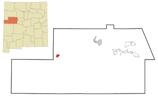
McKinley County is a county in the northwestern section of the U.S. state of New Mexico. As of the 2020 United States Census, its population was 72,902. Its county seat is Gallup. The county was created in 1901 and named for President William McKinley.

<span class="mw-page-title-main">Window Rock, Arizona</span> Capital of the Navajo Nation in Arizona, United States

Window Rock, known in Navajo as Tségháhoodzání, is a city and census-designated place that serves as the capital of the Navajo Nation, the largest Native American tribe by both land and tribal enrollment. The capital lies within the boundaries of the St. Michaels Chapter, adjacent to the Arizona and New Mexico state line. Window Rock is the site of the Navajo Nation governmental campus, which contains the Navajo Nation Council, Navajo Nation Supreme Court, the offices of the Navajo Nation President and Vice President, and many Navajo government buildings.

<span class="mw-page-title-main">Pinehill, New Mexico</span> Census-designated place in New Mexico, United States

Pinehill or Pine Hill is a census-designated place in Cibola County, New Mexico, United States. It is located on the Ramah Navajo Indian Reservation. The population was 88 at the 2010 census. The location of the CDP in 2010 had become the location of the Mountain View CDP as of the 2020 census, while a new CDP named "Pinehill" was listed 8 miles (13 km) further south, at a point 4 miles (6 km) southeast of Candy Kitchen.

<span class="mw-page-title-main">Black Rock, New Mexico</span> Census-designated place in McKinley County, New Mexico, United States

Black Rock is an unincorporated community and a census-designated place in McKinley County, New Mexico, United States. The population was 1,323 at the 2010 census.

<span class="mw-page-title-main">Nakaibito, New Mexico</span> CDP in New Mexico, United States

Nakaibito is a census-designated place (CDP) in McKinley County, New Mexico, United States. The population was 455 at the 2000 census.

<span class="mw-page-title-main">Ramah, New Mexico</span> CDP in New Mexico, United States

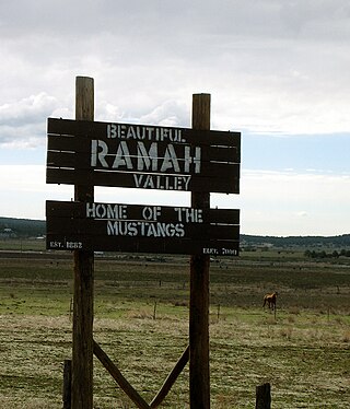
Ramah is a census-designated place (CDP) in McKinley County, New Mexico. The population was 461 as of the 2020 United States census.

<span class="mw-page-title-main">Thoreau, New Mexico</span> CDP in New Mexico, United States

Thoreau is a census-designated place (CDP) in McKinley County, New Mexico, United States. The population was 1,863 at the 2000 census. It is majority Native American, primarily of the Navajo Nation, as this community is located within its boundaries.

<span class="mw-page-title-main">Tohatchi, New Mexico</span> CDP in New Mexico, United States

Tohatchi is a census-designated place (CDP) in McKinley County, New Mexico, United States. It is known as a health-services and education hub along Highway 491. Its population was reported to be 785 at the 2020 census. As Tohatchi is located on the Navajo Nation, it is designated federal trust land.

<span class="mw-page-title-main">Yah-ta-hey, New Mexico</span> CDP in New Mexico, United States

Yah-ta-hey is a census-designated place (CDP) in McKinley County, New Mexico, United States. As of the 2000 census, the CDP population was 580. The English name for this place is an approximation of a Navajo greeting, though the actual Navajo name means "like a devil", in reference to J.B. Tanner, who operated the trading post located here; the same name is used for Aneth, Utah, where Tanner also worked.

<span class="mw-page-title-main">Zuni Pueblo, New Mexico</span> Census-designated place in New Mexico, United States

Zuni Pueblo is a census-designated place (CDP) in McKinley County, New Mexico, United States. The population was 6,302 as of the 2010 Census. It is inhabited largely by members of the Zuni people.

<span class="mw-page-title-main">Gallup station</span> Amtrak train station on US Route 66 in Gallup, New Mexico

Gallup station is an Amtrak train station at 201 East Highway 66 in downtown Gallup, New Mexico. It is the second busiest station in the state, with more than 16,000 boardings and alightings in 2014.

<span class="mw-page-title-main">Ramah Navajo Indian Reservation</span> Section of the Navajo Nation

The Ramah Navajo Indian Reservation is a non-contiguous section of the Navajo Nation lying in parts of west-central Cibola and southern McKinley counties in New Mexico, United States, just east and southeast of the Zuni Indian Reservation. It has a land area of 230.675 sq mi (597.445 km2), over 95 percent of which is designated as off-reservation trust land. According to the 2000 census, the resident population is 2,167 persons. The Ramah Reservation's land area is less than one percent of the Navajo Nation's total area.

Gallup-McKinley County Schools (GMCS) is a school district based in Gallup, New Mexico which serves students from Gallup and surrounding areas of McKinley County.

<span class="mw-page-title-main">Bureau of Indian Education</span> United States government agency

The Bureau of Indian Education (BIE), headquartered in the Main Interior Building in Washington, D.C., and formerly known as the Office of Indian Education Programs (OIEP), is a division of the U.S. Department of the Interior under the Assistant Secretary for Indian Affairs. It is responsible for the line direction and management of all BIE education functions, including the formation of policies and procedures, the supervision of all program activities, and the approval of the expenditure of funds appropriated for BIE education functions.

Prewitt is an unincorporated community and census-designated place in McKinley County, New Mexico, United States. Prewitt is located along Interstate 40, 18 miles (29 km) northwest of Grants. Prewitt has a post office with ZIP code 87045.

Chi Chil Tah is an unincorporated community in McKinley County, New Mexico, United States.

<span class="mw-page-title-main">Trail of the Ancients Scenic Byway (New Mexico)</span> Route in New Mexico with numerous archaeological and geological sites

The Trail of the Ancients is a New Mexico Scenic Byway to prehistoric archaeological and geological sites of northwestern New Mexico. It provides insight into the lives of the Ancestral Puebloans and the Navajo, Ute, and Apache peoples. Geological features include canyons, volcanic rock features, and sandstone buttes. Several of the sites are scenic and wilderness areas with recreational opportunities.

Manuelito is a census-designated place (CDP) on the Navajo Nation in McKinley County, New Mexico, United States. It was first listed as a CDP prior to the 2020 census.

Wingate High School is a Native American high school in unincorporated McKinley County, New Mexico, operated by the Bureau of Indian Education (BIE). It has grades 9-12. It has a Fort Wingate postal address.

Ramah Middle/High School is a public secondary school in unincorporated McKinley County, New Mexico, near the Ramah census-designated place and with a Ramah postal address. It is a part of Gallup-McKinley County Schools.

References

  1. "ArcGIS REST Services Directory". United States Census Bureau. Retrieved October 12, 2022.
  2. 1 2 "Census Population API". United States Census Bureau. Retrieved October 12, 2022.
  3. "Gallup". Geographic Names Information System . United States Geological Survey, United States Department of the Interior.
  4. "U.S. Census Bureau QuickFacts: Gallup city, New Mexico". www.census.gov. Retrieved June 15, 2022.
  5. "Find a County". National Association of Counties. Archived from the original on May 31, 2011. Retrieved June 7, 2011.
  6. "Plaques to be guide to city's past". Gallup Independent. Archived from the original on May 7, 2006. Retrieved July 24, 2008.
  7. Trail of the Ancients. Archived August 21, 2014, at the Wayback Machine New Mexico Tourism Department. Retrieved August 14, 2014.
  8. Evans, Andrew (May 9, 2014). "Route 66: Gallup". National Geographic . Archived from the original on July 18, 2020. The El Rancho Hotel and Motel was a popular place for Hollywood stars to stay while filming Western movies near Gallup, New Mexico.
  9. "History of Greater Gallup New Mexico". Greater Gallup Economic Development Corporation. Retrieved November 15, 2020.
  10. "curriculum, "Enduring Communities, "page 60, day 9, "the Gallup Experience"" (PDF). Japanese American National Museum, 369 East First Street, Los Angeles, CA 90012. Retrieved September 25, 2016.
  11. "Gallup bucked the system". Route 66 News. May 9, 2014. Archived from the original on May 12, 2014. Retrieved September 25, 2016.
  12. Mingus, Matthew D. (2021). "The Myth of Resistance: Gallup, New Mexico, and Japanese American Internment". New Mexico Historical Review. 96 (4): 405–419.
  13. Denetclaw, Paulie (August 5, 2022). "Update: SUV drives into Gallup Intertribal Ceremonial parade, causing injuries". Navajo-Hopi Observer. Retrieved January 25, 2024.
  14. "SUV plows through parade route in New Mexico injuring 15 people including two police officers". USA Today. Retrieved August 6, 2022.
  15. "NOWData – NOAA Online Weather Data". National Oceanic and Atmospheric Administration . Retrieved September 8, 2022.
  16. "Summary of Monthly Normals 1991–2020". National Oceanic and Atmospheric Administration. Retrieved September 8, 2022.
  17. "Census of Population and Housing". Census.gov. Retrieved June 4, 2015.
  18. "U.S. Census website". United States Census Bureau . Retrieved January 31, 2008.
  19. "Palestinians, Israelis occupy Navajo consciousness".
  20. "Crime in Gallup, New Mexico (NM): murders, rapes, robberies, assaults, burglaries, thefts, auto thefts, arson, law enforcement employees, police officers, crime map". City-data.com. Retrieved October 14, 2017.
  21. "Report: Gallup has highest violent crime rate in NM". Krqe.com. November 11, 2014. Archived from the original on December 7, 2014. Retrieved October 14, 2017.
  22. "U.S. 666: "Beast of a Highway"?". Highway History. United States Department of Transportation – Federal Highway Administration. Retrieved September 12, 2013.
  23. "Downtown Gallup". Gallup Chamber of Commerce. Gallup Chamber of Commerce, Gallup NM. Retrieved September 25, 2016.
  24. "Downtown Gallup". Gallup Chamber of Commerce. Gallup Chamber of Commerce, Gallup NM. December 24, 2014. Archived from the original on September 26, 2016. Retrieved September 25, 2016.
  25. "Navajo Code Talkers Mural". Be Sargent. Be Sargent, artist. Retrieved September 25, 2016.
  26. "Photos Cities Gallup". gallup.ipub.us. ipub.us, Actual news in your location. Retrieved September 25, 2016.
  27. Barth, Jack (1991). Roadside Hollywood: The Movie Lover's State-By-State Guide to Film Locations, Celebrity Hangouts, Celluloid Tourist Attractions, and More. Contemporary Books. Page 55. ISBN   9780809243266.
  28. "BIA Closes Manuelito Hall". Gallup, New Mexico: The Gallup Independent. April 14, 1973. pp. 1, 6. - Clipping of first and of second page at Newspapers.com.
  29. "Transportation | Gallup, NM - Official Website". www.gallupnm.gov. Retrieved November 8, 2020.
  30. New York Times . "Indian Director Sworn In: Glenn L. Emmons Takes Office Succeeding Dillon S. Myer." August 11, 1953.
  31. Thomas, Robert Jr. (February 1, 1998). "Carl Gorman, Code Talker In World War II, Dies at 90". The New York Times. ISSN   0362-4331 . Retrieved September 15, 2021.