Castalia, Iowa | |
---|---|
Coordinates: 43°6′44″N91°40′38″W / 43.11222°N 91.67722°W | |
Country | United States |
State | Iowa |
County | Winneshiek |
Area | |
• Total | 0.58 sq mi (1.50 km2) |
• Land | 0.58 sq mi (1.50 km2) |
• Water | 0.00 sq mi (0.00 km2) |
Elevation | 1,247 ft (380 m) |
Population (2020) | |
• Total | 145 |
• Density | 250.87/sq mi (96.90/km2) |
Time zone | UTC-6 (Central (CST)) |
• Summer (DST) | UTC-5 (CDT) |
ZIP code | 52133 |
Area code | 563 |
FIPS code | 19-11485 |
GNIS feature ID | 0455206 |
Castalia is a city in Winneshiek County, Iowa, United States. The population was 145 at the 2020 census. [2]
The city of Castalia was originally called Rattletrap, but during that time it consisted of a solitary trap house. In 1849, it was settled by Hamilton Campbell and his wife, whose descendants inhabit the small city.
The railroad was built through Castalia in 1864. [3] Castalia was incorporated in 1902. [4]
Castalia is located at 43°6′44″N91°40′38″W / 43.11222°N 91.67722°W (43.112261, -91.677256). [5]
According to the United States Census Bureau, the city has a total area of 0.58 square miles (1.50 km2), all land. [6]
Year | Pop. | ±% |
---|---|---|
1880 | 108 | — |
1910 | 230 | +113.0% |
1920 | 272 | +18.3% |
1930 | 200 | −26.5% |
1940 | 239 | +19.5% |
1950 | 221 | −7.5% |
1960 | 216 | −2.3% |
1970 | 210 | −2.8% |
1980 | 188 | −10.5% |
1990 | 177 | −5.9% |
2000 | 175 | −1.1% |
2010 | 173 | −1.1% |
2020 | 145 | −16.2% |
Source: "U.S. Census website". United States Census Bureau . Retrieved March 29, 2020. and Iowa Data Center Source: |
At the 2010 census there were 173 people in 82 households, including 49 families, in the city. The population density was 298.3 inhabitants per square mile (115.2/km2). There were 84 housing units at an average density of 144.8 per square mile (55.9/km2). The racial makup of the city was 100.0% White. Hispanic or Latino of any race were 1.2%. [8]
Of the 82 households 22.0% had children under the age of 18 living with them, 47.6% were married couples living together, 8.5% had a female householder with no husband present, 3.7% had a male householder with no wife present, and 40.2% were non-families. 35.4% of households were one person and 18.3% were one person aged 65 or older. The average household size was 2.11 and the average family size was 2.71.
The median age was 48.6 years. 20.8% of residents were under the age of 18; 4.6% were between the ages of 18 and 24; 19% were from 25 to 44; 35.2% were from 45 to 64; and 20.2% were 65 or older. The gender makeup of the city was 49.1% male and 50.9% female.
At the 2000 census there were 175 people in 79 households, including 48 families, in the city. The population density was 243.0 inhabitants per square mile (93.8/km2). There were 81 housing units at an average density of 112.5 per square mile (43.4/km2). The racial makup of the city was 95.43% White, 2.29% from other races, and 2.29% from two or more races. Hispanic or Latino of any race were 4.00%. [9]
Of the 79 households 24.1% had children under the age of 18 living with them, 49.4% were married couples living together, 7.6% had a female householder with no husband present, and 39.2% were non-families. 30.4% of households were one person and 11.4% were one person aged 65 or older. The average household size was 2.22 and the average family size was 2.69.
The age distribution was 19.4% under the age of 18, 9.1% from 18 to 24, 25.7% from 25 to 44, 31.4% from 45 to 64, and 14.3% 65 or older. The median age was 40 years. For every 100 females, there were 108.3 males. For every 100 females age 18 and over, there were 113.6 males.
The median household income was $30,417 and the median family income was $25,833. Males had a median income of $28,750 versus $18,750 for females. The per capita income for the city was $17,228. About 21.7% of families and 15.4% of the population were below the poverty line, including 22.2% of those under the age of eighteen and none of those sixty five or over.
The community is within the South Winneshiek Community School District. [10]
Winneshiek County is a county located in the U.S. state of Iowa. As of the 2020 census, the population was 20,070. The county seat is Decorah.
Nodaway is a city in Nodaway Township, Adams County, Iowa, United States. The population was 74 at the time of the 2020 census. Nodaway was incorporated in 1900.
Fraser is a city in Dodge Township, Boone County, Iowa, United States. The population was 101 at the time of the 2020 census. It is part of the Boone, Iowa Micropolitan Statistical Area, which is a part of the larger Ames–Boone Combined Statistical Area. The city is located along the Des Moines River.
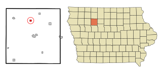
Lanesboro is a city in Carroll County, Iowa, United States. The population was 119 at the time of the 2020 census.
Davis City is a city in Decatur County, Iowa, United States. The population was 179 at the time of the 2020 census.
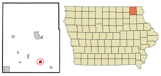
Chester is a city in Howard County, Iowa, United States. The population was 139 in the 2020 census, a decrease of 7.9% from the 151 population in the 2000 census. Chester is located close to the state line from Minnesota.
Elma is a city in Howard County, Iowa, United States. The population was 505 at the time of the 2020 census.
Lime Springs is a city in Howard County, Iowa, United States. The population was 473 at the time of the 2020 census.
Patterson is a city in Madison County, Iowa, United States. The population was 176 at the time of the 2020 census. It is part of the Des Moines–West Des Moines Metropolitan Statistical Area.
Orchard is a city in Mitchell County, Iowa, United States. The population was 68 at the time of the 2020 census.
Ruthven is a city in Palo Alto County, Iowa, United States. The population was 725 at the time of the 2020 census.
Havelock is a city in Pocahontas County, Iowa, United States. The population was 130 at the time of the 2020 census.
Varina is an incorporated small, rural village in Pocahontas County, Iowa, United States. The population was 68 at the time of the 2020 census.
Westphalia is a city in Shelby County, Iowa, United States. The population was 126 at the time of the 2020 census.
Calmar is a city in Winneshiek County, Iowa, United States. The population was 1,125 at the 2020 census. It is at the junction of U.S. Route 52 and State highways 150 and 24, with both state routes terminating in Calmar.
Ossian (pronounced|ˈosh-ain) is a city in Winneshiek County, Iowa, United States. The population was 802 at the time of the 2020 census.
Ridgeway is a city in Winneshiek County, Iowa, United States. The population was 275 at the time of the 2020 census.
Spillville is a city in Winneshiek County, Iowa, United States. The population was 385 at the time of the 2020 census. It is located in Calmar Township, approximately 4 mi (6.4 km) west of Calmar and about 12 miles (19 km) southwest of Decorah, the county seat. Spillville is known for its Independence Day fireworks display, held the first Saturday in July.
Joice is a city in Worth County, Iowa, United States. The population was 208 at the time of the 2020 census. It is part of the Mason City Micropolitan Statistical Area.
Kensett is a city in Worth County, Iowa, United States. The population was 257 at the time of the 2020 census. It is part of the Mason City Micropolitan Statistical Area.