Cheat Lake, West Virginia

Last updated

Cheat Lake, West Virginia
Cheat Lake in the winter (Unsplash).jpg
USA West Virginia relief location map.svg
Red pog.svg
Cheat Lake
Location within the state of West Virginia
Usa edcp relief location map.png
Red pog.svg
Cheat Lake
Location within the United States
Coordinates: 39°40′0″N79°51′10″W / 39.66667°N 79.85278°W / 39.66667; -79.85278
Country Flag of the United States.svg  United States
State Flag of West Virginia.svg  West Virginia
County Flag of Monongalia County, West Virginia.svg Monongalia
Area
[1]
  Total15.8 sq mi (41.0 km2)
  Land14.3 sq mi (37.1 km2)
  Water1.5 sq mi (3.9 km2)
Elevation
[2]
997 ft (304 m)
Population
 (2020)
  Total9,930
  Density630/sq mi (240/km2)
Time zone UTC-5 (Eastern (EST))
  Summer (DST) UTC-4 (EDT)
ZIP codes
26507-26508
Area code 304
FIPS code 54-14775 [3]
GNIS feature ID1867648 [2]

Cheat Lake is a census-designated place in Monongalia County, West Virginia, United States, surrounding the Cheat Lake reservoir. The population was 9,930 at the 2020 census. [4] It is included in the Morgantown metropolitan area.

Contents

Geography

Cheat Lake is located at 39°40′0″N79°51′10″W / 39.66667°N 79.85278°W / 39.66667; -79.85278 (39.666538, -79.852683). [1]

According to the United States Census Bureau, the Cheat Lake CDP has a total area of 15.8 square miles (41 km2), of which 14.3 square miles (37 km2) is land and 1.5 square miles (3.9 km2) (10.3%) is water.

Demographics

Historical population
CensusPop.Note
2000 6,396
2010 7,98824.9%
2020 9,93024.3%
U.S. Decennial Census [5]

As of the census [3] of 2000, there were 6,396 people, 2,511 households, and 1,822 families residing in the community. The population density was 442.9 people per square mile (171.0 people/km2). There were 2,802 housing units at an average density of 194.0 per square mile (74.9/km2). The racial makeup of the community was 95.61% White, 1.20% African American, 0.09% Native American, 1.88% Asian, 0.08% Pacific Islander, 0.05% from other races, and 1.09% from two or more races. Hispanic or Latino of any race were 0.55% of the population.

There were 2,511 households, out of which 35.4% had children under the age of 18 living with them, 63.8% were married couples living together, 6.6% had a female householder with no husband present, and 27.4% were non-families. 23.3% of all households were made up of individuals, and 5.9% had someone living alone who was 65 years of age or older. The average household size was 2.55 and the average family size was 3.03.

The age distribution of the community is 25.8% under the age of 18, 7.3% from 18 to 24, 30.1% from 25 to 44, 27.7% from 45 to 64, and 9.1% who were 65 years of age or older. The median age was 38 years. For every 100 females, there were 98.0 males. For every 100 females age 18 and over, there were 96.3 males.

The median income for a household in the community was $48,594, and the median income for a family was $58,778. Males had a median income of $48,661 versus $28,920 for females. The per capita income for the community was $30,210. About 4.8% of families and 6.0% of the population were below the poverty line, including 6.7% of those under age 18 and 3.2% of those age 65 or over.

See also

Cheat Lake – The lake that was formed in the 1920s as a result of damming the Cheat River.

Coopers Rock State Forest – A State Forest next to Cheat Lake that provides many outdoor activities.

Snake Hill Wildlife Management Area – State Area in the Cheat Lake area that provides hiking, hunting and views of the Cheat Lake area.

https://www.cheatlake.com – An informational website about Cheat Lake and the surrounding area.

Related Research Articles

<span class="mw-page-title-main">Waikapu, Hawaii</span> Census-designated place in Hawaii, United States

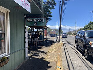
Waikapu is a census-designated place (CDP) in Maui County, Hawaii, United States. The population was 3,437 at the 2020 census.

<span class="mw-page-title-main">Lake Erie Beach, New York</span> Census-designated place in New York, United States

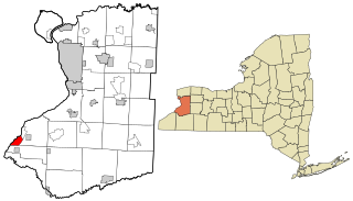
Lake Erie Beach is a hamlet and census-designated place (CDP) in the town of Evans, Erie County, New York, United States. The population was 3,872 at the 2010 census. It is part of the Buffalo–Niagara Falls Metropolitan Statistical Area.

<span class="mw-page-title-main">Lancaster Township, Butler County, Pennsylvania</span> Township in Pennsylvania, United States

Lancaster Township is a township in Butler County, Pennsylvania, United States. As of the 2020 census, the township population was 2,747.

<span class="mw-page-title-main">Summit Township, Crawford County, Pennsylvania</span> Township in Pennsylvania, United States

Summit Township is a township in Crawford County, Pennsylvania, United States. The population was 1,902 at the 2020 census, down from 2,027 at the 2010 census.

<span class="mw-page-title-main">Point Marion, Pennsylvania</span> Borough in Pennsylvania, United States

Point Marion is a borough in Fayette County, Pennsylvania, United States. The population was 1,152 at the 2020 census, a decline from the figure of 1,159 tabulated in 2010. It is served by the Albert Gallatin Area School District.

<span class="mw-page-title-main">Franklin Township, Huntingdon County, Pennsylvania</span> Township in Pennsylvania, United States

Franklin Township is a township in Huntingdon County, Pennsylvania, United States. The population was 492 at the 2020 census.

<span class="mw-page-title-main">Monroe Township, Juniata County, Pennsylvania</span> Township in Pennsylvania, United States

Monroe Township is a township that is located in Juniata County, Pennsylvania, United States. The population was 2,050 at the time of the 2020 census, a decrease from the figure of 2,237 that was tabulated in 2010.

<span class="mw-page-title-main">Wetmore Township, Pennsylvania</span> Township in Pennsylvania, United States

Wetmore Township is a township in McKean County, Pennsylvania, United States. The population was 1,620 at the 2020 census.

<span class="mw-page-title-main">Upper Mahantongo Township, Pennsylvania</span> Township in Pennsylvania, United States

Upper Mahantongo Township is a township that is located in Schuylkill County, Pennsylvania, United States. The population was 614 at the time of the 2020 census.

<span class="mw-page-title-main">Bloss Township, Pennsylvania</span> Township in Pennsylvania, United States

Bloss Township is a township in Tioga County, Pennsylvania, United States. The population was 344 at the 2020 census.

<span class="mw-page-title-main">Delmar Township, Tioga County, Pennsylvania</span> Township in Pennsylvania, United States

Delmar Township is a township in Tioga County, Pennsylvania, United States. The population was 2,796 at the 2020 census.

<span class="mw-page-title-main">Cherry Grove Township, Warren County, Pennsylvania</span> Township in Pennsylvania, United States

Cherry Grove Township is a township in Warren County, Pennsylvania, United States. The population at the 2020 census was 173, down from 216 in the 2010 census.

<span class="mw-page-title-main">Limestone Township, Warren County, Pennsylvania</span> Township in Pennsylvania, United States

Limestone Township is a township in Warren County, Pennsylvania, United States. The population was 311 at the 2020 census, down from 403 at the 2010 census. 418 at the 2000 census.

<span class="mw-page-title-main">Southwest Township, Warren County, Pennsylvania</span> Township in Pennsylvania, United States

Southwest Township is a township in Warren County, Pennsylvania, United States. The population was 426 at the 2020 census, down from 527 at the 2010 census. 561 at the 2000 census.

<span class="mw-page-title-main">Triumph Township, Pennsylvania</span> Township in Pennsylvania, United States

Triumph Township is a township in Warren County, Pennsylvania, United States. The population was 276 at the 2020 census, down from 316 at the 2010 census.

<span class="mw-page-title-main">Ames Lake, Washington</span> Census-designated place in Washington, United States

Ames Lake is an unincorporated community and census-designated place (CDP) in King County, Washington, United States. The population was 1,524 at the 2020 census, up from 1,486 at the 2010 census.

<span class="mw-page-title-main">Brookhaven, West Virginia</span> CDP in West Virginia

Brookhaven is a census-designated place (CDP) in Monongalia County, West Virginia, United States. The population was 5,707 at the 2020 census. It is included in the Morgantown, West Virginia Metropolitan Statistical Area.

<span class="mw-page-title-main">Rowlesburg, West Virginia</span> Town in West Virginia, United States

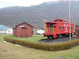
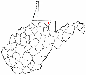
Rowlesburg is a town in southern Preston County, West Virginia, United States, along the Cheat River. The population was 438 at the 2020 census. It is part of the Morgantown metropolitan area. A former railroad town, it is home to the Downtown Rowlesburg Historic District, and was the site of action during the American Civil War.

Barron is a town in Barron County in the U.S. state of Wisconsin. The population was 873 at the 2010 census. The town surrounds the City of Barron.

<span class="mw-page-title-main">Boothbay Harbor (CDP), Maine</span> Census-designated place in Maine, United States

Boothbay Harbor is a census-designated place (CDP) comprising the densely populated center of the town of Boothbay Harbor in Lincoln County, Maine, United States. The population was 1,086 at the 2010 census, down from 1,237 at the 2000 census.

References

  1. 1 2 "US Gazetteer files: 2010, 2000, and 1990". United States Census Bureau. February 12, 2011. Retrieved April 23, 2011.
  2. 1 2 U.S. Geological Survey Geographic Names Information System: Cheat Lake, West Virginia
  3. 1 2 "U.S. Census website". United States Census Bureau . Retrieved January 31, 2008.
  4. "U.S. Census website". United States Census Bureau . Retrieved December 2, 2022.
  5. "Census of Population and Housing" (PDF). Census.gov. Retrieved December 30, 2022.