Hollywood usually refers to:

Monongalia County, known locally as Mon County, is located in the U.S. state of West Virginia. As of the 2020 census, the population was 105,822, making it West Virginia's third-most populous county. Its county seat is at Morgantown. The county was founded in 1776. Monongalia County is included in the Morgantown, WV Metropolitan Statistical Area, and is the largest county in North-Central West Virginia. It is part of the Pittsburgh media market.

Hybla Valley is a census-designated place (CDP) in Fairfax County, Virginia, United States, south of Alexandria. The population was 15,801 at the 2010 census, down from 16,721 in 2000 due to a reduction in area, resulting from some of the eastward neighborhoods including much of Hollin Hills being moved to the Fort Hunt CDP. The population increased to 16,319 in the 2020 census.
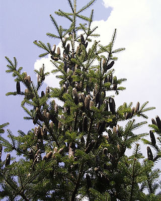
Abies balsamea or balsam fir is a North American fir, native to most of eastern and central Canada and the northeastern United States.

U.S. Route 522 is a spur route of US 22 in the states of Virginia, West Virginia, Maryland, and Pennsylvania. The U.S. Highway travels in a north-south direction, and runs 308.59 miles (496.63 km) from US 60 near Powhatan, Virginia, to its northern terminus at US 11 and US 15 near Selinsgrove, Pennsylvania. US 522 serves many small cities and towns in the Piedmont, Blue Ridge Mountains, and northern Shenandoah Valley of Virginia. The highway serves the Virginia communities of Goochland, Mineral, Culpeper, the town of Washington, and Front Royal and the independent city of Winchester. US 522 then follows the Ridge-and-Valley Appalachians north and then east through the Eastern Panhandle of West Virginia, a 2-mile-wide (3.2 km) stretch of Western Maryland, and South Central Pennsylvania to its terminus in the Susquehanna Valley. The highway serves Berkeley Springs, West Virginia; Hancock, Maryland; and the Pennsylvania communities of McConnellsburg, Mount Union, Lewistown, and Middleburg.
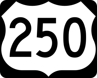
U.S. Route 250 is a route of the United States Numbered Highway System, and is a spur of U.S. Route 50. It currently runs for 514 miles (827 km) from Richmond, Virginia to Sandusky, Ohio. It passes through the states of Virginia, West Virginia, and Ohio. It goes through the cities of Richmond, Charlottesville, Staunton, and Waynesboro, Virginia; and Wheeling, West Virginia. West of Pruntytown, West Virginia, US 250 intersects and forms a short overlap with its parent US 50.

State Route 620 in Fairfax and Loudoun Counties, Virginia is a secondary state highway. The entire length of SR 620 is also known as Braddock Road. SR 620 also has a short concurrency with SR 659 / Union Mill Road in Centreville.

South Riding is a census-designated place and planned community in Loudoun County, Virginia, United States. The South Riding homeowner association was founded in January 1995 to provide services to the community. Neighboring U.S. Route 50 and State Route 28 provide access to the Dulles/Reston/Tysons Corner technology corridor and other major employment centers in Northern Virginia and Washington, D.C.

Goochland is a census-designated place (CDP) in and the county seat of Goochland County, Virginia, United States. The population as of the 2010 census was 861. The community is also known as Goochland Courthouse or by an alternative spelling, Goochland Court House. It derives its name from the fact that the community is the location of the county's court house, while the county in turn is named for Sir William Gooch, 1st Baronet, the royal lieutenant governor of Virginia from 1727 to 1749.
Arcola is a census-designated place in Loudoun County, Virginia, United States. The population as of the 2010 United States Census was 233.
Stone Ridge is a census-designated place in Loudoun County, Virginia, United States. Residences use Aldie mailing addresses, and it is near Washington Dulles International Airport. The population as of the 2020 census was 15,039. Stone Ridge is a Van Metre Homes planned, mixed-use community.
Aab-e-Gum Railway Station is located in the town of Aab-e-gum, Kachhi District of Balochistan province, Pakistan. It is located 50 kilometers (31 mi) southeast of Quetta near Chilton mountain on the Rohri-Chaman Railway Line.
USS Gum Tree (AN-18/YN-13) was an Aloe-class net laying ship which was assigned to serve the U.S. Navy during World War II with her protective anti-submarine nets.
Gum Spring is an unincorporated community in Louisa County, Virginia, United States. Gum Spring is located at the intersection of U.S. Route 250 and U.S. Route 522 18 miles (29 km) south-southeast of Louisa. Gum Spring has a post office with ZIP code 23065.
Gum Spring and Gum Springs may refer to:

West Ford was the caretaker and manager of Mount Vernon, which had been the home of George Washington. Ford also founded Gum Springs, Virginia near Mount Vernon. He was a man of mixed-race, and possibly of Washington descent.

Highway 26 is the designation for a state Highway in the U.S. state of Arkansas. The highway is mainly located in Southwest Arkansas and is split into two different sections. The first and longest section begins at U.S. Route 371 (US 371) about seven miles (11 km) east of Lockesburg and ends at AR 51 about five miles (8.0 km) west of Arkadelphia. The second section of the route starts at Interstate 30 (I-30) just south of Arkadelphia and ends at the ALCOA plant in Gum Springs. AR 26 also has a spur route, which travels mainly along the corridor of the Clark County Industrial Park in Gum Springs.
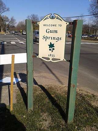
Gum Springs is a community in Fairfax County in Hybla Valley along Route 1. The African American community, the oldest in the county, was established in 1833 by West Ford, a freedman who had been manumitted by Hannah Bushrod Washington, in 1805. A historical marker was erected by the Virginia Department of Historic Resources in 1991.

George W. Ford was a U.S. military officer in the Spanish American War and a Buffalo Soldier. Born in Alexandria, Virginia, at George Washington's Mount Vernon Plantation, he joined the 10th Cavalry in 1867 at 19.


