Monongalia County, known locally as Mon County, is located in the U.S. state of West Virginia. As of the 2020 census, the population was 105,822, making it West Virginia's third-most populous county. Its county seat is at Morgantown. The county was founded in 1776. Monongalia County is included in the Morgantown, WV Metropolitan Statistical Area, and is the largest county in North-Central West Virginia. It is part of the Pittsburgh media market.
The Meadows may refer to:

Glenrock Lagoon, an intermediate fresh water small coastal creek, is located within the Lake Macquarie local government area in the Newcastle and Hunter regions of New South Wales, Australia. The lake is located near the Newcastle suburbs of Adamstown and Dudley and is situated about 153 kilometres (95 mi) north of Sydney.
Sleepy Creek is a 44.0-mile-long (70.8 km) tributary of the Potomac River in the United States, belonging to the Chesapeake Bay's watershed. The stream rises in Frederick County, Virginia, and flows through Morgan County, West Virginia before joining the Potomac near the community of Sleepy Creek.
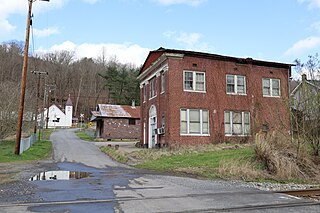
Jonben is an unincorporated community and coal town within the Winding Gulf Coalfield and is located within Raleigh County, West Virginia, United States.

Meadow Branch is a 16.7-mile-long (26.9 km) tributary stream of Sleepy Creek in West Virginia's Eastern Panhandle region. It passes through the Sleepy Creek Wildlife Management Area, where it is dammed to form the 205-acre (0.83 km2) Sleepy Creek Lake.

Sleepy Creek Mountain is a mountain ridge in the Ridge-and-Valley Appalachians on the border between Morgan and Berkeley counties in the Eastern Panhandle of West Virginia. The long-distance Tuscarora Trail traverses the southern ridge and northern bench of the mountain.

Sky Meadows State Park is a 1,862-acre (754 ha) park in the Virginia state park system. It is located in extreme northwest Fauquier County, Virginia in the Blue Ridge Mountains, near Paris, Virginia. It is about an hour outside of the Washington, D.C. metro region.

Clarence Watson Meadows was the 22nd Governor of West Virginia from 1945 to 1949. He was the first governor of West Virginia to be born in the 20th century.
Weverton is an unincorporated community hamlet located in the southern tip of Washington County, Maryland, United States, near the north shore of the Potomac River. Its population is approximately 500. Weverton is located at the intersection of MD Route 67 and U.S. Route 340. The nearest incorporated communities are Harpers Ferry, West Virginia and Brunswick,. Weverton's approximate elevation is 475 feet (145 m) above sea level.
The South Waratah Colliery was a coal mine located at Charlestown, in New South Wales Australia.

Meadow River Wildlife Management Area, is located near Rupert, West Virginia in Greenbrier County. Occupying 2,385 acres (965 ha) of river bottomland, the WMA is located along the Meadow River and consists mainly of wetlands habitat.
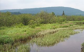
Shrub swamps — also called scrub swamps or buttonbush swamps — are a type of freshwater wetland ecosystem occurring in areas too wet to become swamps, but too dry or too shallow to become marshes. They are often considered transitional (“mid-successional”) between wet meadows or fens and conifer or hardwood swamps.
Meadow Creek is an unincorporated community in Summers County, West Virginia, United States. Meadow Creek is located on the New River, southwest of Meadow Bridge and north of Hinton.
Meadow Bluff is an unincorporated community in Greenbrier County, West Virginia, United States. Meadow Bluff is 4.5 miles (7.2 km) southeast of Rupert.
Grassy Meadows is an unincorporated community in Greenbrier County, West Virginia, United States. Grassy Meadows is 7 miles (11 km) east-southeast of Meadow Bridge. Grassy Meadows had a post office, which opened on June 15, 1858, and closed on June 25, 2011.
Wild Meadow is an unincorporated community in Greenbrier County, West Virginia, United States. Wild Meadow is located on West Virginia Route 92, 5.5 miles (8.9 km) northeast of White Sulphur Springs.
Maple Meadow is an unincorporated community in Raleigh County, West Virginia, United States.
Meadow Fork is an unincorporated community in Fayette County, West Virginia, United States.

Clairview is a coastal town and locality in the Isaac Region, Queensland, Australia. In the 2016 census, the locality of Clairview had a population of 145 people.


