
Elkhorn is an unincorporated community in McDowell County, West Virginia, United States. Elkhorn lies on U.S. Route 52 and takes its name from the creek that flows through the community.
Branchland is an unincorporated community in western Lincoln County, West Virginia, United States. It lies along West Virginia Route 10, southwest of the town of Hamlin, the county seat of Lincoln County. Its elevation is 597 feet (182 m). It has a post office with the ZIP code 25506. Raccoon Creek Road is one of the more popular ways of transportation through the area. Branchland Post Office serves addresses within Sheridan Magisterial District of Lincoln County as well as addresses in southern Cabell County and eastern Wayne County, West Virginia.
Creston is an unincorporated community in southeastern Wirt County, West Virginia, United States. It lies at the confluence of the Little Kanawha River and the West Fork Little Kanawha River on West Virginia Route 5, southeast of the town of Elizabeth, the county seat of Wirt County. Its elevation is 653 feet (199 m). Creston had a post office, which closed on June 25, 2011. The community was named for a drainage divide near the town site.
Millwood is an unincorporated community in northwestern Jackson County, West Virginia, United States, along the Ohio River at the mouth of Mill Creek. It lies along West Virginia Routes 2 and 62 northwest of the city of Ripley, the county seat of Jackson County. Its elevation is 577 feet (176 m). Although Millwood is unincorporated, it has a post office, with the ZIP code of 25262.
Rock View is an unincorporated community in Wyoming County, West Virginia, United States.
Arbovale is an unincorporated community in Pocahontas County, West Virginia, United States. Arbovale is 12 miles (19 km) south of Durbin. Arbovale had a post office, which closed on March 3, 2007.
Dunmore is an unincorporated community in Pocahontas County, West Virginia, United States. Dunmore is located at the junction of state routes 28 and 92, 15 miles (24 km) northeast of Marlinton. Dunmore has a post office with ZIP code 24934.
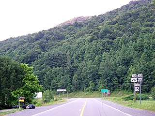
Paynesville is an unincorporated community in McDowell County, West Virginia, United States. Paynesville is located along West Virginia Route 83 at the Virginia border. Paynesville has a post office with ZIP code 24873.
Shock is an unincorporated community in Gilmer County, West Virginia, United States. Shock is 13 miles (21 km) southwest of Glenville, along the Right Fork Steer Creek. Shock has a post office with ZIP code 26638.
Valley Head is a census-designated place (CDP) in Randolph County, West Virginia, United States. Valley Head is located on U.S. Route 219, 12 miles (19 km) south-southwest of Huttonsville. Valley Head has a post office with ZIP code 26294. As of the 2010 census, its population was 267.
Glady is an unincorporated community in Randolph County, West Virginia, United States. Glady is 11 miles (18 km) southeast of Elkins. Glady had a post office, which closed on May 14, 2011.
Pickens is a census-designated place (CDP) in Randolph County, West Virginia, United States. Pickens is 13 miles (21 km) west-southwest of Huttonsville. It is the home of the Cunningham-Roberts Museum. Pickens has a post office with ZIP code 26230. As of the 2010 census, its population was 66.
Lorentz is an unincorporated community in Upshur County, West Virginia, United States. Lorentz is located on U.S. routes 33 and 119, 4 miles (6.4 km) west-northwest of Buckhannon. Lorentz has a post office with ZIP code 26229.
Hico is a census-designated place (CDP) in Fayette County, West Virginia, United States. Hico is located at the junction of U.S. routes 19 and 60, 7 miles (11 km) northeast of Fayetteville. Hico has a post office with ZIP code 25854. As of the 2010 census, its population was 272.
Borderland is an unincorporated community in Mingo County, West Virginia, United States. Borderland is located along the Tug Fork and U.S. Routes 52 and 119, 3 miles (4.8 km) northwest of Williamson. Borderland had a post office, which opened on March 6, 1905, and closed on June 20, 2009.
Sprague is an unincorporated community and coal town in Raleigh County, West Virginia, United States. Sprague is located on West Virginia Route 16, 1 mile (1.6 km) north of downtown Beckley. Sprague has a post office with ZIP code 25926.
Redstar is an unincorporated community in Fayette County, West Virginia, United States. Redstar is 2.5 miles (4.0 km) south of Oak Hill. Redstar had a post office with ZIP code 25914, which closed on January 20, 2007.
Dry Creek is an unincorporated community in Raleigh County, West Virginia, United States. Dry Creek is located on West Virginia Route 3 16 miles (26 km) west-northwest of Beckley. Dry Creek has a post office with ZIP code 25062.
Procious is an unincorporated community in Clay County, West Virginia, United States. Procious is located on the Elk River and West Virginia Route 4, 7 miles (11 km) west-northwest of Clay. Procious has a post office with ZIP code 25164.

Cora is an unincorporated community in Logan County, West Virginia, United States. Cora is 2 miles (3 km) southwest of Logan, along the Copperas Mine Fork. Cora has a post office with ZIP code 25614. It is part of the Mount Gay-Shamrock census-designated place.


