
Atherton is an incorporated town in San Mateo County, California, United States. Its population was 6,914 as of 2010.
The City of Englewood is a home rule municipality located in Arapahoe County, Colorado, United States. The town population was 33,659 at the 2020 United States Census. Englewood is a part of the Denver–Aurora–Lakewood, CO Metropolitan Statistical Area and the Front Range Urban Corridor. Englewood is located immediately south of Denver in the South Platte River Valley.
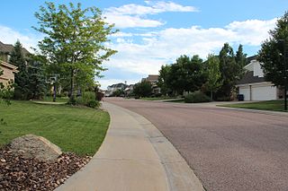
The City of Castle Pines is a home rule municipality located in Douglas County, Colorado, United States. The city population was 11,036 at the 2020 United States Census. Castle Pines is a part of the Denver–Aurora–Lakewood, CO Metropolitan Statistical Area and the Front Range Urban Corridor. The city is located north of the Town of Castle Rock and south of the City of Lone Tree, Colorado.

LaGrange is a town in Dutchess County, New York, United States. The population was 15,730 at the 2010 census. The town was named after the ancestral estate of the wife of the Marquis de Lafayette.

Floral Park is an incorporated village in Nassau County, New York, United States, on Long Island. The population as of the US Census of 2010 is 15,863.

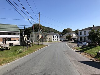
Cornwall-on-Hudson is a riverfront village in the town of Cornwall, Orange County, New York, United States. It lies on the west bank of the Hudson River, approximately 50 miles (80 km) north of New York City.
Berlin is a town in Rensselaer County, New York, United States. The population was 1,880 at the 2010 census. The town is named after Berlin in Germany, although natives pronounce the name differently, with the accent on the first syllable.
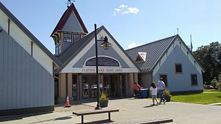
Clifton Park is a suburban town in Saratoga County, New York, United States. According to the United States Census Bureau, the 2010 population was 36,705. The name is derived from an early land patent. The town is in the southern part of the county, approximately 12 miles (19 km) north of Albany, 7 miles (11 km) northeast of Schenectady, and 10 miles (16 km) south of Saratoga Springs.

West Sayville is a hamlet and census-designated place (CDP) in Suffolk County, New York, United States. It had a population of 5,011 at the 2010 census.

Greenville, commonly known as Edgemont, is a census-designated place (CDP) in the town of Greenburgh in Westchester County, New York, United States. The population was 9,394 at the 2020 census. Most of its residents refer to the area as Edgemont, which is also the name of its school district.

Manlius is a town in Onondaga County, east of the city of Syracuse, New York, United States. The population was 32,370 at the 2010 census, making it the third largest suburb in metropolitan Syracuse. In 2005, the town was ranked 98th on CNN's list of Best Places to Live.

Midtown Manhattan is the central portion of the New York City borough of Manhattan. Midtown is home to some of the city's most prominent buildings, including the Empire State Building, the Chrysler Building, the Hudson Yards Redevelopment Project, the headquarters of the United Nations, Grand Central Terminal, and Rockefeller Center, as well as tourist destinations such as Broadway and Times Square.
Purchase is a hamlet in the town and village of Harrison, in Westchester County, New York. One myth explains that its name is derived from Harrison's purchase, where John Harrison was to be granted as much land as he could ride in one day. Purchase is home to State University of New York at Purchase and Manhattanville College.

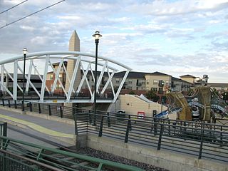
The City of Centennial is a home rule municipality located in Arapahoe County, Colorado, United States. The city population was 108,418 at the 2020 United States Census, making Centennial the 11th most populous municipality in Colorado. Centennial is a part of the Denver–Aurora–Lakewood, CO Metropolitan Statistical Area and the Front Range Urban Corridor.

Williamsbridge is a neighborhood geographically located in the north-central portion of the Bronx in New York City. Its boundaries, starting from the north and moving clockwise are East 222nd Street to the north, Boston Road to the east, East Gun Hill Road to the south, and the Bronx River to the west. White Plains Road is the primary thoroughfare through Williamsbridge.
Cherry Plain State Park is a 175-acre (0.71 km2) state park located in Rensselaer County, New York in the United States. The park is located in Cherry Plain at the southwest part of the Town of Berlin, near the Massachusetts border. Outdoor recreational opportunities are also available within the Capital District Wildlife Management Area, a 4,153-acre (16.81 km2) conservation area that nearly surrounds the park.

Cherry Creek is an unincorporated community and a census-designated place (CDP) located in and governed by Arapahoe County, Colorado, United States. The CDP is a part of the Denver–Aurora–Lakewood, CO Metropolitan Statistical Area. The population of the Cherry Creek CDP was 11,120 at the United States Census 2010. The ZIP code 80111 serves the area.

West Berlin is an unincorporated community located within Berlin Township in Camden County, New Jersey, United States. The area is served as United States Postal Service ZIP code 08091.
Cherry Hill is a township within Camden County, in the U.S. state of New Jersey. As of the 2010 United States Census, the township had a population of 71,045, reflecting an increase of 1,080 (+1.5%) from the 69,965 counted in the 2000 Census, which had in turn increased by 617 (+0.9%) from the 69,348 counted in the 1990 Census. As of 2010, the township was the state's 15th most populous municipality and the second-largest in Camden County, after having been the state's 13th most populous municipality in the 2000 Census. Cherry Hill is a suburb of Philadelphia and with the decline of downtown Camden has become an edge city and one of the region's main commercial centers. Cherry Hill is situated on the Delaware Valley coastal plain, approximately eight miles southeast of Center City, Philadelphia.
Eldred is a rural hamlet located in the central part of the town of Highland, Sullivan County, New York, United States. The community is located along New York State Route 55, approximately 13.5 miles (21.7 km) southwest of Monticello. Eldred has a post office, which opened on October 5, 1831, with the current ZIP code as 12732. Other points of interest in the hamlet include the Highland Town Hall, Sunshine Hall Free Library, a firehouse, several churches and parks, and a Dollar General store. Public education in Eldred is serviced through the Eldred Central School District.


