Crum, West Virginia

Last updated
Crum, West Virginia
USA West Virginia location map.svg
Red pog.svg
Crum, West Virginia
Location within the state of West Virginia
Coordinates: 37°54′20.34″N82°26′45.53″W / 37.9056500°N 82.4459806°W / 37.9056500; -82.4459806 Coordinates: 37°54′20.34″N82°26′45.53″W / 37.9056500°N 82.4459806°W / 37.9056500; -82.4459806
Country United States
State West Virginia
County Wayne
Area
[1]
  Total0.510 sq mi (1.32 km2)
  Land0.510 sq mi (1.32 km2)
  Water0 sq mi (0 km2)
Population
 (2010) [2]
  Total182
  Density360/sq mi (140/km2)
Time zone UTC-5 (Eastern (EST))
  Summer (DST) UTC-5 (CDT)
ZIP code
25669
Area code 304

Crum is a census-designated place (CDP) in southern Wayne County, West Virginia, United States. As of the 2010 census, its population was 182. [2] It is the home to Crum Pre K-8 school opened in 2017. It is a part of the Huntington-Ashland Metropolitan Statistical Area (MSA).

Contents

Town information

Crum is the home of Silver Creek United Baptist Church (the second oldest church in West Virginia)[ citation needed ], Crum Separate Baptist Church, Crum Church of Christ, and Crum Missionary Baptist Church. Many other small churches are located in nearby hollows and roads.

U.S. Route 52 runs directly through Crum, as does the Norfolk Southern Railway's Kenova District. The town is bordered on the west by the Tug Fork of the Big Sandy River (also known locally as the Tug River). This river is part of the boundary between West Virginia and Kentucky. A mile section of the future King Coal Highway is built just east of Crum, with access from Silver Creek Rd.

Demographic information

Whites make up 99.2% of the population at 1,537 (note that this is at considerable odds with the 2010 Census population figure of 182), with blacks and other groups at 0.8% with a population of 12. There were 657 households with an average household size of 2.63. The average house value is listed at $52,100, with an average household income of $15,449. The median age of the general population is 35.10 years, with the male median age at 35.60, and the females at 36.20.

Crum: The Novel

Written by former Crum resident Lee Maynard, it is a fictionalized account of life in Crum in the 1950s. When it was released in 1988, the book stirred up hostility in the town as many Crum residents took offense to Maynard's portrayal of Crum, despite the inclusion of a disclaimer at the beginning of the book explaining that the work is fictional except for the town name of "Crum." Still, a few Crum residents claim that characters and incidents in the book are clearly inspired by real-life people and events. Considered a "cult classic" by some, original copies were selling for large amounts on eBay before the book was re-released in 2001 by West Virginia University Press.

In 2006, actor/producer Ross Ballard and MountainWhispers.com audiobooks produced an audio version of Maynard's classic to a receptive national audience.

Cities / Towns near Crum, West Virginia

miles)

Related Research Articles

<span class="mw-page-title-main">Wayne County, West Virginia</span> County in West Virginia, United States

Wayne County is the westernmost county in the U.S. state of West Virginia. As of the 2020 census, the population was 38,982. Its county seat is Wayne. The county was founded in 1842 and named for General "Mad" Anthony Wayne.

<span class="mw-page-title-main">Mingo County, West Virginia</span> County in West Virginia, United States

Mingo County is a county in the U.S. state of West Virginia. As of the 2020 census, the population was 23,568. Its county seat and largest city is Williamson. Created in 1895, Mingo is West Virginia's newest county, named for the historic Iroquoian Mingo people.

<span class="mw-page-title-main">Hampshire County, West Virginia</span> County in West Virginia, United States

Hampshire County is a county in the U.S. state of West Virginia. As of the 2020 census, the population was 23,093. Its county seat is Romney, West Virginia's oldest town (1762). The county was created by the Virginia General Assembly in 1754, from parts of Frederick and Augusta Counties (Virginia) and is the state's oldest county. The county lies in both West Virginia's Eastern Panhandle and Potomac Highlands regions.

<span class="mw-page-title-main">Hanover, Indiana</span> Town in Indiana, United States

Hanover is a town in Hanover Township, Jefferson County, southeast Indiana, along the Ohio River. The population was 3,546 at the 2010 census. Hanover is the home of Hanover College, a small Presbyterian liberal arts college. The "Point," located on the campus of Hanover College, is the only place along the Ohio River that three bends of the river can be viewed at once. The tallest waterfall in Indiana, Fremont Falls, is located in Hanover.

<span class="mw-page-title-main">Wallins Creek, Kentucky</span> Census-designated place in Kentucky, United States

Wallins Creek is an unincorporated community and census-designated place (CDP) in Harlan County, Kentucky, United States. The population was 156 at the 2010 census, when it was still a city, having dropped from 257 at the 2000 census.

<span class="mw-page-title-main">Louisa, Kentucky</span> City in Kentucky, United States

Louisa is a home rule-class city located at the merger of the Levisa and Tug Forks into the Big Sandy River. It is located in Lawrence County, Kentucky, in the United States, and is the seat of its county. The population was 2,467 at the 2010 census and an estimated 2,375 in 2018.

<span class="mw-page-title-main">Warfield, Kentucky</span> City in Kentucky, United States

Warfield is a home rule-class city in Martin County, Kentucky, United States. The population was 269 at the 2010 census.

<span class="mw-page-title-main">Sudbury, Massachusetts</span> Town in Massachusetts, United States

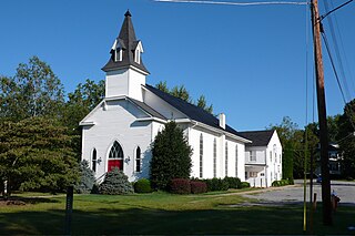
Sudbury is a town in Middlesex County, Massachusetts, United States. At the 2020 census, it had a population of 18,934. The town, located in Greater Boston's MetroWest region, has a rich colonial history.

<span class="mw-page-title-main">Ripley, Ohio</span> Village in Ohio, United States

Ripley is a village in Union Township, Brown County, Ohio, United States, along the Ohio River 50 miles southeast of Cincinnati. The population was 1,750 at the 2010 census.

<span class="mw-page-title-main">Round Hill, Loudoun County, Virginia</span> Town in Virginia

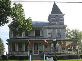
Round Hill is a town in Loudoun County, Virginia, United States. Its population was 539 at the 2010 census and an estimated 656 in 2019. The town is located at the crossroads of Virginia Routes 7 and 719, approximately 50 miles (80 km) northwest of Washington, D.C. The town's name refers a hill two miles northeast of a 910-foot (280 m) hill used during the American Civil War as a signal post by both Confederate and Union troops.

<span class="mw-page-title-main">Bridgeport, West Virginia</span> City in West Virginia, United States

Bridgeport is a city in eastern Harrison County, West Virginia, United States. The population was 9,325 at the 2020 census. It is part of the Clarksburg micropolitan area.

<span class="mw-page-title-main">Ripley, West Virginia</span> City in West Virginia, United States

Ripley is a city in and the county seat of Jackson County, West Virginia, United States. The population was 3,074 at the 2020 census.

<span class="mw-page-title-main">Alum Creek, West Virginia</span> Census-designated place in West Virginia, United States

Alum Creek is a census-designated place (CDP) in Kanawha and Lincoln counties along the Coal River in the U.S. state of West Virginia. It includes the unincorporated communities of Alum Creek, Forks of Coal, and Priestley. The CDP had a population of 1,749 at the 2010 census, down from 1,839 at the 2000 census.

<span class="mw-page-title-main">West Logan, West Virginia</span> Town in West Virginia, United States

West Logan is a town along the Guyandotte River in Logan County, West Virginia, United States. The population was 400 at the 2020 census. For unknown reasons, some sources report West Logan to lay west of the county seat at Logan, attributing to this fact the name.

<span class="mw-page-title-main">Kermit, West Virginia</span> Town in West Virginia, United States

Kermit is a town in Mingo County, West Virginia, United States. The population was 406 at the 2010 census. Kermit is located along the Tug Fork, opposite Warfield, Kentucky. The Norfolk Southern Railway's Kenova District runs through town.

<span class="mw-page-title-main">Matewan, West Virginia</span> Town in West Virginia, United States

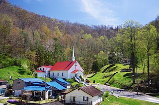
Matewan is a town in Mingo County, West Virginia, United States at the confluence of the Tug Fork River and Mate Creek. The population was 499 at the 2010 census. The Norfolk Southern Railway's Pocahontas District passes through the town. It was a center of bitter labor coal mining labor conflict in the early 20th Century, which culminated in the Battle of Matewan in 1920.

<span class="mw-page-title-main">Williamson, West Virginia</span> City in West Virginia, United States

Williamson is a city in Mingo County, West Virginia, United States, situated along the Tug Fork River. The population was 3,191 at the 2010 census. It is the county seat of Mingo County, and is the county's largest and most populous city. Williamson is home to Southern West Virginia Community and Technical College. The Tug Fork River separates Williamson from South Williamson, Kentucky.

<span class="mw-page-title-main">Reedy, West Virginia</span> Town in West Virginia, United States

Reedy is a town in Roane County, West Virginia, United States. The population was 152 at the 2020 census.

<span class="mw-page-title-main">Fort Gay, West Virginia</span> Town in West Virginia, United States

Fort Gay is a town in Wayne County, West Virginia, United States, situated along the Tug Fork and Big Sandy rivers. The town adjoins Louisa, Kentucky. The population was 677 at the 2020 census.

<span class="mw-page-title-main">Tornado, West Virginia</span> Census-designated place in West Virginia, United States

Tornado, also called Upper Falls, is a census-designated place (CDP) in Kanawha County, West Virginia, United States.

References

  1. "US Gazetteer files: 2010, 2000, and 1990". United States Census Bureau. 2011-02-12. Retrieved 2011-04-23.
  2. 1 2 "U.S. Census website". United States Census Bureau . Retrieved 2011-05-14.