
The St. Joseph River is an 86.1-mile-long (138.6 km) tributary of the Maumee River in northwestern Ohio and northeastern Indiana in the United States, with headwater tributaries rising in southern Michigan. It drains a primarily rural farming region in the watershed of Lake Erie.
New Creek is an 18.4-mile-long (29.6 km) stream in eastern West Virginia. It is the third major West Virginia tributary to the North Branch Potomac River. Via the Potomac, it is part of the watershed of Chesapeake Bay.

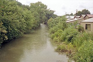
Rada is an unincorporated community in Hampshire County in the U.S. state of West Virginia. Rada is located on U.S. Highway 220/West Virginia Route 28 between Junction and Purgitsville in southwest Hampshire County along Mill Creek. It lies at an intersection of US 220/WV 28 with Rada Road.

Twelvepole Creek is a 32.2-mile-long (51.8 km) river located in Wayne County, West Virginia. It is part of the Mississippi River watershed, by way of the Ohio River. It is alternately known as Twelve Pole Creek.

East Lynn Lake is a 1,005-acre (4 km2) reservoir on the East Fork Twelvepole Creek in Wayne County, West Virginia. The lake is operated by the U.S. Army Corps of Engineers, Huntington District, as part of a series of flood control projects for the Ohio River basin.
Quick is a small unincorporated community in Kanawha County, West Virginia, United States. It is located along Indian Creek Road. The community is where Whitoak Fork and Blue Creek come together and meet. It is also where the abandoned railroad that follows Blue Creek joins the road, and follows it all the way to the community of Hitop, along Pond Fork. Its post office is closed.
Branchland is an unincorporated community in western Lincoln County, West Virginia, United States. It lies along West Virginia Route 10 southwest of the town of Hamlin, the county seat of Lincoln County. Its elevation is 597 feet (182 m). It has a post office with the ZIP code 25506. Raccoon Creek Road is one of the more popular ways of transportation through the area. Branchland Post Office serves addresses within Sheridan Magisterial District of Lincoln County as well as addresses in southern Cabell County and eastern Wayne County, West Virginia.
Looneyville is an unincorporated community on Flat Creek of the Pocatalico River in Roane County, West Virginia, United States. It is on West Virginia Route 36. The community is named for Robert Looney, a pioneer settler. The post office was established in 1870.
Belva is an unincorporated community and census-designated place in west Nicholas County and north Fayette County, West Virginia, United States; while the CDP only includes the Nicholas County portion, the Fayette County portion is considered part of the community. The town is situated at the bottomland surrounding the convergence of Bells Creek with Twentymile Creek and, subsequently, Twenty Mile Creek with the Gauley River. Belva is also the location of the convergence of two state highways: West Virginia Route 16 and West Virginia Route 39.
Missouri Branch is an unincorporated community in Wayne County, West Virginia, United States. Missouri Branch is located on West Virginia Route 152, 13 miles (21 km) southeast of Fort Gay.
Centerville is an unincorporated community in Wayne County, West Virginia, United States. Centerville is located on County Route 19 and Whites Creek, 5.5 miles (8.9 km) west-northwest of Wayne.
Booton is an unincorporated community located in Wayne County, West Virginia, United States.
Skull Run is an unincorporated community in Jackson County, West Virginia, United States. Their Post Office no longer is in service.
Trace is an unincorporated community in Mingo County, West Virginia, United States. The town's post office no longer exists.
Booher is an unincorporated community in Tyler County, West Virginia, United States, along Indian Creek. Its post office is closed.
Ward is an unincorporated community and coal town in Kanawha County, West Virginia, United States. Its post office is closed. Ward is approximately 3 miles (4.8 km) northeast of Cedar Grove, along Kellys Creek.
New Thacker was an unincorporated community and coal town located in Mingo County, West Virginia, United States. Their Post Office has been closed.
Queen Shoals is an unincorporated community in Clay County, West Virginia, United States. Its post office has been closed.
Kincheloe is an unincorporated community in Harrison County, in the U.S. state of West Virginia.

