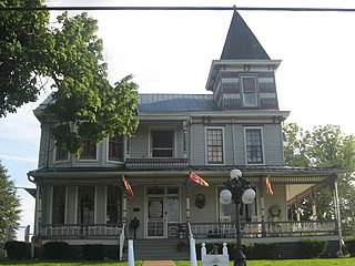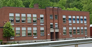
Wayne County is the westernmost county in the U.S. state of West Virginia. As of the 2020 census, the population was 38,982. Its county seat is Wayne. The county was founded in 1842 and named for General "Mad" Anthony Wayne.

Wurtland is a home rule-class city in Greenup County, Kentucky, United States, along the Ohio River. The population was 995 at the 2010 census. Wurtland is a part of the Huntington-Ashland, WV-KY-OH, Metropolitan Statistical Area (MSA). As of the 2010 census, the MSA had a population of 287,702.

Nitro is a city in Kanawha and Putnam counties in the U.S. state of West Virginia. It takes its name from a World War I era nitrocellulose plant. The population was 6,618 according to the 2020 census. It is part of the Charleston metropolitan area.

U.S. Route 522 is a spur route of US 22 in the states of Virginia, West Virginia, Maryland, and Pennsylvania. The U.S. Highway travels in a north-south direction, and runs 308.59 miles (496.63 km) from US 60 near Powhatan, Virginia, to its northern terminus at US 11 and US 15 near Selinsgrove, Pennsylvania. US 522 serves many small cities and towns in the Piedmont, Blue Ridge Mountains, and northern Shenandoah Valley of Virginia. The highway serves the Virginia communities of Goochland, Mineral, Culpeper, the town of Washington, and Front Royal and the independent city of Winchester. US 522 then follows the Ridge-and-Valley Appalachians north and then east through the Eastern Panhandle of West Virginia, a 2-mile-wide (3.2 km) stretch of Western Maryland, and South Central Pennsylvania to its terminus in the Susquehanna Valley. The highway serves Berkeley Springs, West Virginia; Hancock, Maryland; and the Pennsylvania communities of McConnellsburg, Mount Union, Lewistown, and Middleburg.

West Virginia Route 259 is a state highway in the U.S. state of West Virginia. The state highway runs 45.6 miles (73.4 km) from the Virginia state line near Mathias north to the Virginia state line at High View. At both termini, the road continues as Virginia State Route 259. WV 259 passes through Hardy and Hampshire counties and runs concurrently with WV 55 on Corridor H between Baker and Wardensville.

West Virginia Route 9 (WV 9) is a major east–west state highway located in the eastern extents of West Virginia's Eastern Panhandle. The western terminus of the route is at the Maryland state line north of Paw Paw, where WV 9 becomes Maryland Route 51 (MD 51) upon crossing the Potomac River. The eastern terminus is at the Virginia state line at Keyes Gap near Mannings, West Virginia, where WV 9 continues onward as Virginia State Route 9 (SR 9).

Antioch is an unincorporated community in Mineral County, West Virginia, United States. It is part of the 'Cumberland, MD-WV Metropolitan Statistical Area'. The village is located along a branch of Mill Creek where it exits Grayson Gap on the east side of Knobley Mountain. It lies at the intersection of Mikes Run Road and Knobley Road and is three miles south of U.S. Route 50.

East Lynn is an unincorporated community in Wayne County, West Virginia, United States, located along the banks of Twelvepole Creek, approximately eight miles south of the county seat, Wayne. It was also known as Mouth of Little Lynn. East Lynn is a part of the Huntington-Ashland Metropolitan Statistical Area (MSA). As of the 2010 census, the MSA had a population of 287,702. New definitions from February 28, 2013 placed the population at 363,000.
Dunlow is an unincorporated community in southern Wayne County, West Virginia, United States, on Twelvepole Creek. It was laid out as a railroad town along the Ohio Extension of the Norfolk and Western Railway in 1892. Dunlow was incorporated in 1892. However, the railroad up the West Fork of Twelvepole Creek through Dunlow was shut down in the early 1930s, and what is left of the town is currently unincorporated. At the 2000 census, Dunlow had a population of 1,105. In 2009, the population was listed as 961.

Virginia State Route 311 and West Virginia Route 311 are adjoining state highways in the U.S. states of Virginia and West Virginia. The two state highways together run 58.7 miles (94.5 km) from U.S. Route 11 in Salem, Virginia north to Interstate 64 and U.S. Route 60 near White Sulphur Springs, West Virginia. The two Virginia portions of Route 311 are maintained by the Virginia Department of Transportation, with the exception of the city-maintained portion within Salem. The West Virginia segments are maintained by the West Virginia Division of Highways.
Crum is a census-designated place (CDP) in southern Wayne County, West Virginia, United States. As of the 2010 census, its population was 182. It is the home to Crum Pre K-8 school opened in 2017. It is a part of the Huntington-Ashland Metropolitan Statistical Area (MSA).

The Charleston Metropolitan Statistical Area, as defined by the United States Census Bureau, is an area consisting of three counties in West Virginia, anchored by the city of Charleston. It is the largest metropolitan area entirely within the state of West Virginia. While the Huntington Metro Area is more populous, it spans three states, and the core county of the Charleston area, Kanawha County, is more populous than the West Virginia portion of the Huntington area.

Cumberland, MD-WV MSA, or Cumberland Metro for short, is the Metropolitan Statistical Area of Cumberland, Maryland and the surrounding economic region of Allegany County, Maryland and Mineral County, West Virginia, in the United States.

Germany Valley is a scenic upland valley high in the Allegheny Mountains of eastern West Virginia originally settled by German farmers in the mid-18th century. It is today a part of the Spruce Knob–Seneca Rocks National Recreation Area of the Monongahela National Forest, although much ownership of the Valley remains in private hands.
The Hagerstown–Martinsburg Metropolitan Area, officially designated by the United States Office of Management and Budget (OMB) as Hagerstown–Martinsburg, Maryland–West Virginia Metropolitan Statistical Area (MSA), constitutes the primary cities of Hagerstown, Maryland; Martinsburg, West Virginia; and surrounding areas in three counties: Washington County, Maryland; Berkeley County, West Virginia; and Morgan County, West Virginia. The metro area lies mainly within the rich, fertile Cumberland and Shenandoah valleys, and is approximately a 60–90 minute drive from Washington, D.C.; Baltimore, Maryland; and Harrisburg, Pennsylvania; Hagerstown is approximately 75 miles (121 km) driving distance from all three cities. The population of the metropolitan area as of 2008 is 263,753.
Clayton is an unincorporated community in Summers County, West Virginia, United States. The community was first settled in 1813. Clayton once had a post office, which opened in 1879 and closed in 1959.
Buckeye is an unincorporated community in Pocahontas County, West Virginia, United States. Buckeye is located along U.S. Route 219, 3.5 miles (5.6 km) southwest of Marlinton. As of mid 2021, US post office now open. Town has large used bookstore, c-store, farm supply, and access to Greenbrier trail and Greenbrier River. Home of Louise McNeill, former poet laureate of WV. La in Buckeye.
The Lost River is a 31.1-mile-long (50.1 km) river in the Appalachian Mountains of Hardy County in West Virginia's Eastern Panhandle region. The Lost River is geologically the same river as the Cacapon River: It flows into an underground channel northeast of McCauley along West Virginia Route 259 at "the Sinks" and reappears near Wardensville as the Cacapon. The source of the Lost River lies south of Mathias near the West Virginia/Virginia border. Along with the Cacapon and North rivers, the Lost River serves as one of the three main segments of the Cacapon River and its watershed.


