
California is a U.S. state on the western coast of North America. Covering an area of 163,696 sq mi (423,970 km2), California is geographically diverse. The Sierra Nevada, the fertile farmlands of the Central Valley, and the arid Mojave Desert of the south are some of the major geographic features of this U.S. state. It is home to some of the world's most exceptional trees: the tallest, most massive, and oldest. It is also home to both the highest and lowest points in the 48 contiguous states. The state is generally divided into Northern and Southern California, although the boundary between the two is not well defined. San Francisco is decidedly a Northern California city and Los Angeles likewise a Southern California one, but areas in between do not often share their confidence in geographic identity. The US Geological Survey defines the geographic center of the state at a point near North Fork, California.

The Great Basin is the largest area of contiguous endorheic watersheds in North America. It spans nearly all of Nevada, much of Oregon and Utah, and portions of California, Idaho, and Wyoming. It is noted for both its arid climate and the basin and range topography that varies from the North American low point at Badwater Basin in Death Valley to the highest point of the contiguous United States, less than 100 miles (160 km) away at the summit of Mount Whitney. The region spans several physiographic divisions, biomes, ecoregions, and deserts.

The Mojave River is an intermittent river in the eastern San Bernardino Mountains and the Mojave Desert in San Bernardino County, California, United States. Most of its flow is underground, while its surface channels remain dry most of the time, with the exception of the headwaters and several bedrock gorges in the lower reaches.

The Black Rock Desert is a semi-arid region (in the Great Basin shrub steppe eco-region), of lava beds and playa, or alkali flats, situated in the Black Rock Desert–High Rock Canyon Emigrant Trails National Conservation Area, a silt playa 100 miles (160 km) north of Reno, Nevada that encompasses more than 300,000 acres (120,000 ha) of land and contains more than 120 miles (200 km) of historic trails. It is in the northern Nevada section of the Great Basin with a lakebed that is a dry remnant of Pleistocene Lake Lahontan.

Zzyzx, formerly Soda Springs, is an unincorporated community in San Bernardino County, California, within the boundaries of the Mojave National Preserve. It is the former site of the Zzyzx Mineral Springs and Health Spa and now the site of the Desert Studies Center. The site is also the location of Lake Tuendae, originally part of the spa, and now a refuge habitat of the endangered Mohave tui chub.
Nipton is an unincorporated community with a population of about 15 – 20, in San Bernardino County, California, on the northeastern border of Mojave National Preserve, approximately 12 miles southeast of Primm, Nevada and the Ivanpah Solar Power Facility. It is accessible via Nevada State Route 164.

Swansea is a former settlement and unincorporated community in Inyo County, California. It is located 8.5 miles (14 km) south of New York Butte, at an elevation of 3,661 ft (1,116 m).
The Great Salt Lake Desert is a large dry lake in northern Utah, United States, between the Great Salt Lake and the Nevada border which is noted for white evaporite Lake Bonneville salt deposits.

Cantil is an unincorporated community in Kern County, California. It is in the Fremont Valley of the western Mojave Desert.

Desert Center is a census designated place in the Colorado Desert in Riverside County, California. It is in southern California, between the cities of Indio and Blythe at the junction of Interstate 10 and State Route 177, about halfway between Phoenix and Los Angeles. The ZIP Code is 92239, and the community is in telephone area codes 442 and 760. The elevation is 656 feet (200 m). The population was 204 at the 2010 census.

The Smoke Creek Desert is an arid region of northwestern Nevada, USA that lies about 60 miles (97 km) to the north of Pyramid Lake, west of the Fox Range and east of the Smoke Creek Mountains. The southern end of the desert lies on the Pyramid Lake Indian Reservation, and a rail line lies at the eastern edge. The Smoke Creek Desert is southwest of the Black Rock Desert's South Playa and is between the Granite Range and the Fox Range.

Helendale or Silver Lakes is an unincorporated community and census-designated place located in the Victor Valley of the Mojave Desert, within San Bernardino County, California.
Lost Lake is a desert community located along the west shore of the Colorado River. It also lies along U.S. Route 95 near the northeastern extent of Riverside County. Official U.S. Geological Survey feature ID is 245216 and NAD27 coordinates for the community are 34°00′44″N114°28′27″W. The community lies at the foot of Riverside Mountain, 34°00′49″N114°30′45″W, with a summit measuring 2,127 feet. The community is named for a lake, Lost Lake, located at 34°01′20″N114°28′21″W.

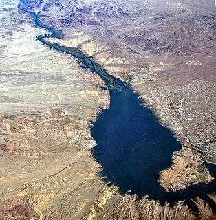
The Lower Colorado River Valley ("LCRV") is the river region of the lower Colorado River of the southwestern United States in North America that rises in the Rocky Mountains and has its outlet at the Colorado River Delta in the northern Gulf of California in northwestern Mexico, between the states of Baja California and Sonora. This north–south stretch of the Colorado River forms the border between the U.S. states of California/Arizona and Nevada/Arizona, and between the Mexican states of Baja California/Sonora.
Havasu Lake is an unincorporated community in San Bernardino County, California, United States, located on Lake Havasu on the Chemehuevi Reservation in the Mojave Desert. The community serves as the seat of the tribal government of the Chemehuevi Indian Tribe and is home to the Havasu Landing Casino.

The Cleghorn Lakes Wilderness is a 33,475-acre (135.47 km2) wilderness area in the southern Mojave Desert. It is located 16 miles (26 km) northeast of Twentynine Palms, California, and 20 miles (32 km) north of Joshua Tree National Park. It is managed by the Bureau of Land Management.
Gypsite is an unincorporated community in Kern County, California.
Muroc is a former settlement in Kern County, California in the Mojave Desert.
9 Mile Station was a former settlement in the Mojave Desert, in southwestern Inyo County, California.
El Mirage is an unincorporated community in the western Victor Valley of the Mojave Desert, within San Bernardino County, California.


