Southern California is a geographic and cultural region that generally comprises the southern portion of the U.S. state of California. It includes the Los Angeles metropolitan area, the second most populous urban agglomeration in the United States. The region generally contains ten of California's 58 counties: Imperial, Kern, Los Angeles, Orange, Riverside, San Bernardino, San Diego, Santa Barbara, San Luis Obispo and Ventura counties.

Kern County is located in the U.S. state of California. As of the 2020 census, the population was 909,235. Its county seat is Bakersfield.

Arvin is a city in Kern County, California. Arvin is located 15 miles (24 km) southeast of Bakersfield, at an elevation of 449 feet (137 m). As of the 2010 census, the population was 19,304, up from 12,956 at the 2000 census.

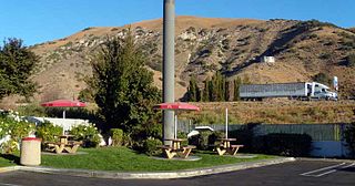
Lebec is an unincorporated community and census-designated place in southwestern Kern County, California. As of the 2010 census, the population was 1,468.

The Tehachapi Mountains are a mountain range in the Transverse Ranges system of California in the Western United States. The range extends for approximately 40 miles (64 km) in southern Kern County and northwestern Los Angeles County and form part of the boundary between the San Joaquin Valley and the Mojave Desert.

The Tejon Pass, previously known as Portezuelo de Cortes, Portezuela de Castac, and Fort Tejon Pass and also commonly referred to as “The Grapevine," is a mountain pass between the southwest end of the Tehachapi Mountains and northeastern San Emigdio Mountains, linking Southern California north to the Central Valley. It has been traversed by major roads such as the El Camino Viejo, the Stockton – Los Angeles Road, the Ridge Route, U.S. Route 99, and now Interstate 5.

The Ridge Route, officially the Castaic–Tejon Route, was a two-lane highway between Los Angeles County and Kern County, California. Opened in 1915 and paved with concrete between 1917 and 1921, the road was the first paved highway directly linking the Los Angeles Basin with the San Joaquin Valley over the Tejon Pass and the rugged Sierra Pelona Mountains ridge south of Gorman. Much of the old road runs through the Angeles National Forest, and passes many historical landmarks, including the National Forest Inn, Reservoir Summit, Kelly's Half Way Inn, Tumble Inn, and Sandberg's Summit Hotel. North of the forest, the Ridge Route passed through Deadman's Curve before ending at Grapevine.
Gorman is an unincorporated community in northwestern Los Angeles County. It is located in Peace Valley south of the Tejon Pass, which links Southern California with the San Joaquin Valley and Northern California. Due to this location, the area has served as a historic travel stop dating back to the indigenous peoples of California. Tens of thousands of motorists travel through Gorman daily on the Golden State Freeway since the highway's completion in the mid-20th Century.

Grapevine is an unincorporated community in Kern County, California, at the southern end of the San Joaquin Valley. The small village is directly adjacent to Interstate 5 and consists mainly of travelers' and roadside services. At an elevation of 1,499 feet (457 m), the community is located at the foot of a grade known as the Grapevine that lies in Grapevine Canyon through the Tejon Pass.

Fort Tejon in California is a former United States Army outpost which was intermittently active from June 24, 1854, until September 11, 1864. It is located in the Grapevine Canyon between the San Emigdio Mountains and Tehachapi Mountains. It is in the area of Tejon Pass along Interstate 5 in Kern County, California, the main route through the mountain ranges separating the Central Valley from the Los Angeles Basin and Southern California. The fort's location protected the San Joaquin Valley from the south and west.

State Route 223, locally known as Bear Mountain Boulevard, is a state highway in the U.S. state of California that runs west to east through the agricultural land south of Bakersfield in Kern County. Running from Interstate 5 (I-5) to State Route 58 near the city of Arvin, it also intersects with State Route 99 near Greenfield. SR 223 forms a truck route for transporting goods to the three main corridors in the area, I-5, SR 58 and SR 99, without having to drive through Bakersfield.

Elizabeth Lake is a natural sag pond that lies directly on the San Andreas Fault in the northern Sierra Pelona Mountains, in northwestern Los Angeles County, southern California. The lake has been dry since 2013 because of prolonged drought.

The White Wolf Fault is a fault in southern California, located along the northwestern transition of the Tejon Hills and Tehachapi Mountains with the San Joaquin Valley. It is north of the intersection of the San Andreas Fault and the Garlock Fault, and roughly parallel with the latter. It is classed as a reverse fault with a left lateral (sinistral) component.
Interstate 5 (I-5) is a major north–south route of the Interstate Highway System in the United States, stretching from the Mexican border at the San Ysidro crossing to the Canadian border near Blaine, Washington. From San Ysidro, the segment of I-5 in California runs north across the length of the state, and crosses into Oregon south of the Medford-Ashland metropolitan area. It is the more important and most-used of the two major north–south routes on the Pacific Coast, the other being U.S. Route 101 (US 101), which is primarily coastal. I-5 is known colloquially as "the 5" to Southern California residents and "5" to Northern California residents due to varieties in California English. The highway connects to the Mexican Federal Highway 1 (Fed. 1) in the south.

The 1952 Kern County earthquake occurred on July 21 in the southern San Joaquin Valley and measured 7.3 on the moment magnitude scale. The main shock occurred at 4:52 am Pacific Daylight Time, killed 12 people and injured hundreds, and caused an estimated $60 million in property damage. A small sector of damage near Bealville corresponded to a maximum Mercalli intensity of XI (Extreme), though this intensity rating was not representative of the majority of damage. The earthquake occurred on the White Wolf Fault near the community of Wheeler Ridge and was the strongest to occur in California since the 1906 San Francisco earthquake.
The Tejon Hills are a low mountain range in the Transverse Ranges, in southern Kern County, California. The highest point of the hills is Comanche Mountain, at 364 feet (111 m) in elevation.

Kern County’s transportation system was quoted as the “unseen industry.” Located at the southern end of the San Joaquin Valley, the county is at a prime location to ship goods west to the central coast, south to ports in Los Angeles, and east to corridors that connect to the rest of the country. It is also on major corridors that link to all northern points.

Peace Valley is a valley in the northwestern corner of Los Angeles County, running northeast−southeast along the San Andreas Fault and a section of Interstate 5 near Tejon Pass. The unincorporated community of Gorman is located within the valley.

The Wheeler Ridge Interchange is a freeway interchange near Wheeler Ridge, California, where State Route 99 (SR 99) merges with Interstate 5 (I-5). Located approximately 20 miles (32 km) south of Bakersfield, it is the southernmost freeway interchange in the San Joaquin Valley.

Castac Lake, also known as Tejon Lake, is a natural saline endorheic, or sink, lake near Lebec, California. The lake is located in the Tehachapi Mountains just south of the Grapevine section of Interstate 5, and within Tejon Ranch. Normal water elevations are 3,482 feet (1,061 m) above sea level.


