Eastwick, Philadelphia

Last updated
Eastwick
Eastwick Loop Station House.JPG
The SEPTA employee bathroom at the center of the Eastwick Loop station
Street map of Philadelphia and surrounding area.png
Red pog.svg
Eastwick
Coordinates: 39°53′25″N75°14′33″W / 39.8903°N 75.2424°W / 39.8903; -75.2424
CountryFlag of the United States (23px).png  United States
State Pennsylvania
County Philadelphia
City Philadelphia
Area code(s) 215, 267, and 445

Eastwick is a neighborhood in the Southwest section of Philadelphia, Pennsylvania, United States. It is the southwesternmost neighborhood in the city, bordering Philadelphia International Airport and the city line with Delaware County at Cobbs Creek and Darby Creek. The Elmwood Park neighborhood borders it to the northeast.

Contents

History

The neighborhood is named for Andrew M. Eastwick, an engineer and patron of Bartram's Garden. [1] It was largely rural until the 1920s when swampy land was dredged to create room for an airport and other large-scale uses within the city limits. Much of the original housing built before the 1950s lacked sewer service and other urban conveniences. Residents referred to the neighborhood as "The Meadows." [2]

Residents enjoyed the ability to have a rural lifestyle within city limits; nearby creeks provided recreation in the form of swimming, bathing, and fishing. An extensive crabbing home industry was based in The Meadows.

Homes ranged from traditional single-family residences with lawns and gardens to traditional Philadelphia-style row houses; sometimes, these two housing styles appeared on the same block. Brick was the predominant material used in construction. Homes were built from the early 19th century until the Second World War caused a shortage of material for new construction.

The city of Philadelphia, which had been under Republican control in the 1940s, shifted in the 1950s toward reform Democrats, whose policies included community redevelopment. At the same time, city planners began to eye Eastwick as a place to relocate low-income black populations being displaced by development projects in North and West Philadelphia. [3] Yet although planners described Eastwick as "open land," it actually constituted an integrated community of some 19,000, the majority of whom owned their homes. [4] Unsurprisingly, the plan faced opposition.

But it nevertheless went forward. In 1958, Eastwick was declared the largest urban renewal project in the country, with the Korman Company making plans to replace the allegedly "poorly maintained and blighted homes" with newer, suburban-style construction in the 1960s and 70s. As Guian A. McKee writes in his study of Eastwick, the new development came at the expense of the existing community. It thus produced a "tragic irony," seeing as its realization required "the destruction of the area's unique existing community," which was one of the few integrated neighborhoods in Philadelphia at the time. [5]

Designing the project was the Greek urban planner Constantinos Apostolou Doxiadis, mastermind of Islamabad, Riyadh, and Baghdad's Revolution City. In these cities, he had made a name for himself by integrating city and countryside in a way that he, and state officials, hoped would ease the transition of rural migrants to urban space. Put differently, Doxiadis's designs were seen as anti-communist. [6] In Eastwick, Doxiadis's work took the form of row houses on cul-de-sac streets, with traffic funneled toward peripheral roads. [7] The neighborhood was one of only three in Philadelphia that grew in population between 1970 and 1990. [3]

Auto junkyards in Eastwick during the 1970s AUTO JUNKYARDS OFF NETWORK OF ROADS IN SOUTHWEST PHILADELPHIA - NARA - 552725.jpg
Auto junkyards in Eastwick during the 1970s

The John Heinz National Wildlife Refuge at Tinicum extends from Eastwick to Tinicum Township, Pennsylvania. Eastwick contains a large industrial area where manufacturing and distributing uses take advantage of proximity to the Airport, Interstate 95, and Center City Philadelphia. There are many gas tank farms, oil refineries, and a sewage treatment plant. The area offers affordable land for industrial uses at reportedly "one-third the cost of outlying suburbs," while enabling companies to remain in the city where employees can utilize public transit. [8]

The neighborhood has been the site of controversy for a number of issues. Some blocks are located in a flood plain, leading to flooded, abandoned homes and vacant lots that are often used for illegal dumping. Issues of environmental regulation and brownfields cleanup have also figured into the history of Eastwick. The Philadelphia metropolitan area's main post office, formerly housed next to 30th Street Station, moved to a larger, auto-oriented facility in Eastwick in 2006. This move was long criticized by neighborhood groups.

1946 Eastwick General Electric plant strike

From January 15 until March 18, 1946, a surging crowd of more than 3,000 electrical strikers protested around Eastwick and the area's former General Electric plant in connection with a court injunction prohibiting mass picketing at the plant by Judge Thomas D. Finletter, which led with a total of 25,000 demonstrators. [9] [10] The protests later turned into a "siege of violence" three days after the protests started. There were reports of 20 injuries, 17 protestors detained by officers, and reports of protestors giving hateful speeches, including the Nazi salute, forcing nearly 300 officers to break up the violence. [11]

The strike came to a conclusion on March 18, 1946, when employees returned back to the plant. [12]

Demographics

As of the census [13] of 2000, there were 14,424 people living in the neighborhood. The racial makeup was 36.70% White, 57.47% African American, 2.68% Asian, and 0.69% from other races. Hispanic or Latino of any race were 1.91% of the population. The median income for a household in the neighborhood was $33,320.[ citation needed ]

Transportation

Eastwick station along SEPTA Regional Rail's Airport Line Eastwick Station June 2014.jpg
Eastwick station along SEPTA Regional Rail's Airport Line

Eastwick is served by SEPTA Subway-Surface Route 36, which runs through the neighborhood and terminates at 80th Street–Eastwick station. This station is within walking distance of the Eastwick station on SEPTA Regional Rail's Airport Line; it is the only station on the line between the airport stations and Penn Medicine station.

Education

Free Library of Philadelphia operates the Eastwick Branch, which serves Eastwick and other subdivisions, at 2851 Island Avenue. [14]

Related Research Articles

<span class="mw-page-title-main">Philadelphia</span> Largest city in Pennsylvania, United States

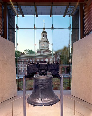
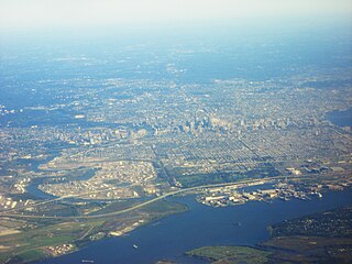
Philadelphia, commonly referred to as Philly, is the most populous city in the U.S. state of Pennsylvania and the second-most populous city in the Northeast megalopolis and Mid-Atlantic regions after New York City. Philadelphia is known for its extensive contributions to United States history, especially the American Revolution, and served as the nation's capital until 1800. It maintains contemporary influence in business and industry, culture, sports, and music. Philadelphia is the nation's sixth-most populous city, with a population of 1,603,797 in the 2020 census and is the urban core of the larger Delaware Valley, the nation's seventh-largest and one of the world's largest metropolitan regions consisting of 6.245 million residents in the metropolitan statistical area and 7.366 million residents in its combined statistical area.

<span class="mw-page-title-main">Tinicum Township, Delaware County, Pennsylvania</span> Township in Pennsylvania, United States

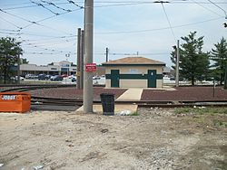
Tinicum Township, also known as Tinicum Island or The Island, is a township in Delaware County, Pennsylvania, United States. The population was 4,091 at the 2010 census, down from 4,353 at the 2000 census. Included within the township's boundaries are the communities of Essington and Lester.

<span class="mw-page-title-main">Philadelphia International Airport</span> Airport in Philadelphia, Pennsylvania, U.S.

Philadelphia International Airport is the primary airport serving Philadelphia, Pennsylvania. The airport served 9.8 million passengers annually in 2021, making it the 21st busiest airport in the United States. The airport is located 7 miles (11 km) from the city's downtown area and has 22 airlines that offer nearly 500 daily departures to more than 130 destinations worldwide.

<span class="mw-page-title-main">Urban renewal</span> Land redevelopment in cities

Urban renewal is a program of land redevelopment often used to address urban decay in cities. Urban renewal involves the clearing out of blighted areas in inner cities to clear out slums and create opportunities for higher class housing, businesses, and other developments. In the United States the term technically refers only to a federal program in the middle-to-late 20th Century, but colloquially is sometimes used to refer to any large-scale change in urban development.

<span class="mw-page-title-main">Constantinos Apostolou Doxiadis</span> Greek architect (1913–1975)

Constantinos A. Doxiadis, often cited as C. A. Doxiadis, was a Greek architect and urban planner. During the 1960s, he was the lead architect and planner of Islamabad, which was to serve as the new capital city of Pakistan. He was later known as the father of ekistics, which concerns the multi-aspect science of human settlements.

<span class="mw-page-title-main">Mantua, Philadelphia</span> Neighborhood of Philadelphia

Mantua is a neighborhood in the West Philadelphia section of Philadelphia, Pennsylvania. It is located north of Spring Garden Street, east of 40th Street, south of Mantua Avenue, and west of 31st Street. The neighborhood's northern and western reaches are predominantly working-class and African American, although its southern border with Powelton Village has seen recent gentrification and an influx of Drexel University and University of Pennsylvania student renters.

<span class="mw-page-title-main">Kensington, Philadelphia</span> Neighborhood in Philadelphia, Pennsylvania

Kensington is a neighborhood in Philadelphia that belongs to Lower Northeast. As with all neighborhoods in the city, the lack of any official designation means the boundaries of the area vary between sources over time and are disputed among locals. Kensington, as most long-term residents view it, refers generally to the area consisting of Kensington, East Kensington, West Kensington, and Harrowgate. The adjacent Fairhill and Norris Square neighborhoods are more separate but may be included in Kensington; Fishtown and South (Olde) Kensington were historically included. The most conservative boundaries of the neighborhood, shown in the map below, are Front Street and 5th Street to the west, the Amtrak train tracks to the North, Trenton Avenue, the Trenton Avenue train tracks, and Frankford Avenue to the east, and Cecil B. Moore Avenue to the south.

<span class="mw-page-title-main">Chinatown, Philadelphia</span> Neighborhood of Philadelphia in Pennsylvania, United States

Philadelphia Chinatown is a predominantly Asian American neighborhood in Center City, Philadelphia, Pennsylvania. The Philadelphia Chinatown Development Corporation supports the area. The neighborhood stretches from Vine Street on the north, Arch Street on the south; North Franklin Street and N. 7th Street on the east; to North Broad Street on the west.

<span class="mw-page-title-main">Edmund Bacon (architect)</span> American urban planner and architect

Edmund Norwood Bacon was an American urban planner, architect, educator, and author. During his tenure as the executive director of the Philadelphia City Planning Commission from 1949 to 1970, his visions shaped today's Philadelphia, the city of his birth, to the extent that he is sometimes described as "The Father of Modern Philadelphia". He authored the seminal urban planning book Design of Cities.

<span class="mw-page-title-main">SEPTA Route 36</span> Philadelphia trolley line

SEPTA's Subway-Surface Trolley Route 36 is a trolley line operated by the Southeastern Pennsylvania Transportation Authority (SEPTA) that connects the 13th Street station in downtown Philadelphia, Pennsylvania, to the Eastwick Loop station in Eastwick section of Southwest Philadelphia, although limited service is available to the Elmwood Carhouse. It is the longest of the five lines that are part of the Subway-Surface Trolley system, and was even longer between 1956 and 1962 when the western terminus was at 94th Street and Eastwick Avenue. From 1962 through the 1970s, it was at 88th Street and Eastwick Avenue, making the route 16.2 miles (26.1 km) long. Since 1975, it only goes as far as what was once 80th Street at the southern edge of the Penrose Plaza shopping center parking lot. From 2024, Route 36 will be referred to as the T5 Elmwood Avenue Line

<span class="mw-page-title-main">Southwest Philadelphia</span> Neighborhood of Philadelphia in Philadelphia, Pennsylvania

Southwest Philadelphia is a section of Philadelphia, Pennsylvania, United States. The section can be described as extending from the western side of the Schuylkill River to the city line, with the SEPTA. The northern border is defined by the Philadelphia City Planning Commission as east from the city line along Baltimore Avenue moving south along 51st Street to Springfield Ave. It follows the train tracks until 49th Street. From 49th and Kingsessing Ave the line moves east along Kingsessing Ave. The line then moves south along 46th St to Paschall Ave where it jogs to join Grays Ferry where the line runs to the Schuylkill River.

<span class="mw-page-title-main">Interstate 95 in Pennsylvania</span> Section of Interstate Highway in United States

Interstate 95 (I-95) is a major north–south Interstate Highway that runs along the East Coast of the United States from Miami, Florida, north to the Canada–United States border at Houlton, Maine. In the state of Pennsylvania, it runs 51.00 miles (82.08 km) from the Delaware state line near Marcus Hook in Delaware County in the southeastern part of the state northeast to the Delaware River–Turnpike Toll Bridge at the New Jersey state line near Bristol in Bucks County, closely paralleling the New Jersey state line for its entire length through Pennsylvania.

<span class="mw-page-title-main">Pennsylvania Route 291</span> State highway in Pennsylvania, US

Pennsylvania Route 291 is an east–west state route in Pennsylvania that runs from U.S. Route 13 and US 13 Business in Trainer, Delaware County, east to Interstate 76 (I-76) in South Philadelphia near the Walt Whitman Bridge and the South Philadelphia Sports Complex. Except for a short 1-mile (1.6 km) section between the western terminus and the Chester/Trainer line, PA 291 is mostly a four-lane highway. From the western terminus to the eastern part of Chester, the route has a concurrency with US 13. It runs parallel to the Delaware River for much of the route. The route passes through industrial areas near the river in Delaware County, serving Chester, Eddystone, Essington, and Lester. PA 291 enters Philadelphia near the Philadelphia International Airport, at which point it has an interchange with I-95. The route crosses the Schuylkill River on the George C. Platt Memorial Bridge and continues along Penrose Avenue to I-76. It has been designated the Industrial Heritage Highway.

<span class="mw-page-title-main">Marconi Plaza</span> Urban park square in Philadelphia

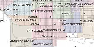
Marconi Plaza is an urban park square located in South Philadelphia, Philadelphia, Pennsylvania, United States. The plaza was named to recognize the 20th-century cultural identity in Philadelphia of the surrounding Italian American enclave neighborhood and became the designation location of the annual Columbus Day Parade.

<span class="mw-page-title-main">Pennsylvania Route 420</span> State highway in Delaware County, Pennsylvania, US

Pennsylvania Route 420 is a north–south state highway in Delaware County, Pennsylvania. The route runs 5.6 miles (9.0 km) from PA 291 in Tinicum Township, a short distance west of the Philadelphia International Airport, northwest to PA 320 in Springfield Township. PA 420 runs through suburban areas, passing through Prospect Park, Folsom, and Morton. The route interchanges with Interstate 95 (I-95) in Tinicum Township and intersects U.S. Route 13 in Prospect Park. PA 420 was first designated by 1928 to run from PA 191 at the intersection of 84th Street and Bartram Avenue in Philadelphia to PA 320 in Springfield. By 1950, the southern terminus was moved to its current location at PA 291.

<span class="mw-page-title-main">Tinicum Island Rear Range Light</span> Lighthouse

The Tinicum Island Rear Range Light is a lighthouse located in the Billingsport section of Paulsboro in Gloucester County, New Jersey, the rear of a pair of range lights marking a section of the channel in the Delaware River south of Philadelphia.

Route 37 is a bus and former streetcar route operated by the Southeastern Pennsylvania Transportation Authority (SEPTA) in Philadelphia, Pennsylvania.

Mingo Creek is a tributary of the Schuylkill River between the Eastwick neighborhood and Philadelphia International Airport, in the United States.

References

  1. "Andrew Eastwick: Savior of Bartram's Garden – PhillyHistory Blog". blog.phillyhistory.org. Retrieved 2024-03-02.
  2. 1 2 McKee, Guian (July 2001). "Liberal Ends Through Illiberal Means: Race, Urban Renewal, and Community in the Eastwick Section of Philadelphia, 1949-1990". Journal of Urban History. 27: 563. doi:10.1177/009614420102700501. S2CID   144193239.
  3. McKee, Guian (July 2001). "Liberal Ends through Illiberal Means: Race, Urban Renewal, and Community in the Eastwick Section of Philadelphia". Journal of Urban History. 27: 549. doi:10.1177/009614420102700501. S2CID   144193239.
  4. McKee, Guian (July 2001). "Liberal Ends through Illiberal Means: Race, Urban Renewal, and Community in the Eastwick Section of Philadelphia, 1949-1990". Journal of Urban History. 27: 547. doi:10.1177/009614420102700501. S2CID   144193239.
  5. Menoret, Pascal (2014). Joyriding in Riyadh. Cambridge, UK: Cambridge University Press. p. 69.
  6. Weart, William (21 January 1962). "Big Project Open in Philadelphia". The New York Times.
  7. Wallace, David (1998-02-01). "Commercial Property; Philadelphia's Airport Is a Hub of Development". The New York Times . Retrieved 2014-11-20.
  8. "Eastwick agree on mass picketing in General Electric Eastwick plant". The Philadelphia Inquirer . February 26, 1946. Retrieved March 10, 2022.
  9. "3,000 pickets crash, police lines in Philly GE strike". The Philadelphia Inquirer . February 28, 1946. Retrieved March 10, 2022.
  10. "Deadly protest in GE Eastwick plant sends multiple injuries and arrests". The Pittsburgh Press . February 28, 1946. Retrieved March 10, 2022.
  11. "War with General Electric Eastwick plant concludes". The News-Item . March 18, 1946. Retrieved March 10, 2022.
  12. "U.S. Census website". United States Census Bureau . Retrieved 2008-01-31.
  13. "Eastwick Branch." Free Library of Philadelphia . Retrieved on January 3, 2008.