Northeast Philadelphia

Last updated
Northeast Philadelphia
Northeast Philadelphia Airport, Pennsylvania (7235311028).jpg
Aerial view around the Northeast Philadelphia Airport
NEPhilaDistrict.PNG
Map of Philadelphia County with Northeast highlighted, which contains the lower Northeast neighborhood. Click for larger image.
Country Flag of the United States.svg  United States of America
State Flag of Pennsylvania.svg  Pennsylvania
County Flag of Philadelphia, Pennsylvania.svg Philadelphia
City Flag of Philadelphia, Pennsylvania.svg Philadelphia
Area
  Total50.8 sq mi (132 km2)
Population
 (2010)
  Total528,810
  Density10,455/sq mi (4,037/km2)
ZIP Code
19111, 19114, 19115, 19116, 19124, 19135, 19136, 19149, 19152, 19154

Northeast Philadelphia, nicknamed Northeast Philly, the Northeast and the Great Northeast, is a section of Philadelphia, Pennsylvania. According to the 2000 census, Northeast Philadelphia has a population of between 300,000 and 450,000, depending on how the area is defined. [1] The Northeast is known as being home to a large working class Irish American population, [2] but it is also home to Polish, German, Jewish, Russian, African American, Brazilian, Puerto Rican, Dominican, Guatemalan, Ukrainian, Indian, Chinese, and Vietnamese neighborhoods.

Contents

Geography

Due to the size of the Northeast, the Philadelphia City Planning Commission divides it into two regions called Lower Northeast and Far Northeast, the names being derived from their distance from Center City. The term Near Northeast is not used colloquially; Lower Northeast is more commonly used, but the term Far Northeast is in widespread use. The demarcation line between the two sections is typically given as Pennypack Creek. [3]

Northeast Philadelphia is bounded by the Delaware River on the east, Bucks County on the north, and Montgomery County on the west. The southern limit is given as Frankford/Tacony Creek or Adams Avenue. [4]

Lower Northeast

Far Northeast

History

Northeast Philadelphia in 1900 when the region was still a collection of towns and farms NE-Philadelphia-1898-1902.jpg
Northeast Philadelphia in 1900 when the region was still a collection of towns and farms

Early European settlement

The first European settlement in the Northeast was by Swedish farmers, who emigrated there when the area was a part of the New Sweden colony. [5] They were followed by English Quakers, including Thomas Holme, who came to begin the settlement of William Penn's Pennsylvania colony in the late 1680s. In the years to follow, Northeast Philadelphia developed as a scattering of small towns and farms that were a part of Philadelphia County, but not the City of Philadelphia. Before consolidation with the City, what is now the Northeast consisted of the townships of Byberry, Delaware, Lower Dublin, Moreland, and Oxford, (largely rural areas); and the boroughs of Bridesburg, Frankford, and White Hall, which were more urbanized. [6]

Growth in industry and farming

While most of the land in what is now the Northeast was dedicated to farming, the presence of many creeks, along with proximity to Philadelphia proper, made the towns of the Northeast suitable for industrial development. The Northeast's first factory was the Rowland Shovel Works on the Pennypack Creek. In 1802, it produced the first shovel made in the United States. [7] More mills and factories followed along the Pennypack and Frankford Creeks, and traces of the mill races and dams remain to this day. The most famous of these factories was the Disston Saw Works in Tacony, founded by English industrialist Henry Disston, whose saw blades were world-renowned. [7] [8]

Consolidation and population increase

By 1854, Philadelphia County was incorporated into the city. [6] In spite of the political incorporation, the Northeast retained its old development patterns for a time, and the dense populations and urban style of housing that marked older, more traditional sections of the city had not yet found their way there. [9] In the first three decades of the 20th century, rapid industrialization led to the growth of industrial sections of the northeast and the neighborhoods surrounding them. [10] These demographic changes, along with the building of the Market-Frankford Line train and new arterial highways, such as the Roosevelt Boulevard, brought new middle class populations to the lower half of the Northeast. [11] Vast tracts of row homes were built in that section of the Northeast for new arrivals in the 1920s and 1930s, typically with small, but valued front lawns, which impart a "garden suburb" quality to much of the Northeast, reducing the sense of physical density felt elsewhere in the city. [12] Much of this development occurred east of Roosevelt Boulevard (Mayfair, Torresdale) and in Oxford Circle. [11]

Post-war growth

Frankford Terminal in 1918, before the construction of the Market-Frankford Line Frankford1918.png
Frankford Terminal in 1918, before the construction of the Market–Frankford Line

After World War II, newer arrivals, armed with the mortgage benefits of the GI Bill, brought the baby boom to the Northeast. This newer population was heavily Jewish or ethnic Catholic [13] (including Irish, Italian, Polish, and German Americans) and completed the development of the region, filling in undeveloped areas of Rhawnhurst and Bell's Corner and developing the previously rural Far Northeast. As older sections of the city lost populations of young families, the Northeast's school-age population swelled, requiring rapid expansion of schools, libraries, cinemas, shopping, transportation, restaurants and other needed amenities. [14]

The period from 1945 through the 1970s was marked in many American cities by urban decline in older, more industrial areas. This was especially true in Philadelphia, in which much of the city's North, West and South sections lost population, factories, jobs and commerce. During the postwar period, the Northeast experienced a heavy influx of growing middle-class families, and had become an almost exclusively white community. This aroused controversy in the 1960s and 1970s, as passions for and against school busing were focused on the Northeast, to address racial imbalances, especially in the city's public schools. That racial imbalance was ultimately addressed by the upward mobility enjoyed by many of the graduates of the Northeast's excellent public and parochial school systems, who made their way out of the Northeast and into the suburbs from the 1980s onward, making room for new arrivals from the city's Latino, African American and Asian populations. [15]

A separate identity

Frankford and Cottman Avenues, a central location in the Northeast Mayfair.JPG
Frankford and Cottman Avenues, a central location in the Northeast

In the 1980s, the Northeast developed along a separate path from much of the rest of the city. In addition to the racial differences mentioned above, the political climate in the Northeast was balanced evenly between Republicans and Democrats, while the rest of the city almost uniformly voted for the latter party. [16] As a result, many Northeasters became more and more discontented with the high city taxes and a perceived imbalance in the services they received for them. [17] This discontent grew to give rise to a secessionist movement, led by State Senator Frank "Hank" Salvatore, among others. Salvatore introduced a bill in the State Senate to allow the Northeast to become a separate county called Liberty County, but the bill failed to progress beyond this stage. [17] As the Philadelphia economy grew stronger, and most discontented people fled to the suburbs, and a new, more popular mayor, Ed Rendell, was elected, the call for secession waned, and the section settled back into life as a part of the city.

Today, the Northeast enjoys greater racial balance and relative stability. The region is uniformly developed, but like many American urban communities, it has witnessed the loss of manufacturing, factory conversions to marginal retail "outlets," and growing vacancies along shopping avenues, especially in the southern part of the region. During the housing boom of the first decade of the 21st century, property tax advantages granted to new construction within the city limits led to a growth in residential units and an escalation of existing home prices in the Northeast. [18]

Demographics

According to the 2010 census, 432,073 people live in the Northeast section of Philadelphia. [19] (Map)

Racial demographics

Irish Americans

The spur of the Irish Famine drew many Irish immigrants to the city.

Today, the Irish in Philadelphia make up 14.2% of the city's population, the largest ethnicity in the city. [21] Although there are Irish in almost every area of the city, they still are predominantly located within Northeast Philadelphia, [2] especially in neighborhoods such as Kensington, Fishtown, and Mayfair.

Political representation and government

While Philadelphia as a whole is heavily Democratic, there is consistent competition between Republicans and Democrats in some parts of the Northeast. Republicans currently hold one State House seat, and a portion of another, in the Northeast and one non at-large Philadelphia City Council seat. As of 2019, no Republican represents any part of the Northeast in the United States Congress. [22]

U.S. House of Representatives

All of Northeast Philadelphia is in the 2nd Congressional District of Pennsylvania, and is currently represented by Brendan Boyle.

Pennsylvania legislature

Senate

In the Pennsylvania State Senate, most of the Northeast is in the 5th district, represented by Jimmy Dillon, [23] while smaller parts are represented by Sharif Street (the 3rd district), [24] and Tina Tartaglione [25] (the 2nd district) [26] All are Democrats.

House of Representatives

The Northeast is split among several State House districts, including those of Democrats Ed Neilson, Kevin Boyle, Pat Gallagher, Jared Solomon, Jason Dawkins, Anthony Bellmon, and Joseph Hohenstein, and Republican Martina White. [27]

Philadelphia City Council

In the Philadelphia City Council, the Far Northeast is represented by the 10th district councilman and Council Minority (Republican) Leader, Brian O'Neill. [28] The Lower Northeast is divided among five other council districts, all represented by Democrats, including the 1st, represented by Mark Squilla, the 5th, represented by Council President Darrell Clarke, the 6th, represented by Michael Driscoll, the 7th, represented by Maria Quiñones-Sanchez, [29] and the 9th, represented by Anthony Phillips. [30] [31]

Public safety

The Philadelphia Police Department patrols four districts within its Northeast Division, including the 7th and 8th districts in the Far Northeast, and the 2nd and 15th in the Near Northeast.

Economy and attractions

Friends Hospital, founded in 1813 by Quakers WTP2 Mike Reali 08b.jpg
Friends Hospital, founded in 1813 by Quakers

Northeast Philadelphia is home to Philadelphia Mills, formerly known as Franklin Mills, a shopping mall that was built on what was once Liberty Bell Park Racetrack, and is one of the most visited attractions in the state. [32] The lower sections of the Northeast still boast pleasant shopping avenues lined by stores and restaurants, such as Castor Avenue. Major shopping centers along Cottman Avenue include, the Cottman-Bustleton Center, and the Roosevelt Mall which opened in 1964 at Cottman Avenue and the Roosevelt Boulevard. [33]

Also present in the Northeast are two nationally recognized medical establishments, Friends Hospital [34] and Fox Chase Cancer Center. [35]

Prior to its disestablishment, Ransome Airlines had its headquarters on the grounds of Northeast Philadelphia Airport. [36]

Education

The first school was founded in the Northeast in 1723 by Silas Crispin, Thomas Holme's son-in-law. [37] The Northeast is home to Fox Chase Farm, an educational facility that is the only working farm left in the Philadelphia city limits. [38]

Frankford Avenue Bridge over Pennypack Creek in Holmesburg Frankford-Avenue-Bridge.jpg
Frankford Avenue Bridge over Pennypack Creek in Holmesburg

Colleges and universities

The main campus of Holy Family University is located in Northeast Philadelphia. The university, founded in 1954, has more than two thousand students. [39]

Primary and secondary schools

The School District of Philadelphia operates public schools in the area. Public high schools in the area include Northeast, Abraham Lincoln, Samuel S. Fels High School, Frankford, George Washington, [40] and Swenson. Several publicly funded charter high schools also operate in Northeast Philadelphia, including Philadelphia Academy, MaST, Franklin Towne and Maritime Academy Charter High School. Northeast Philadelphia is also home to a public magnet school, The Arts Academy at Benjamin Rush.

The Roman Catholic Archdiocese of Philadelphia operates Catholic schools. Catholic high schools in Northeast Philadelphia include St. Hubert Catholic High School for Girls, Father Judge, Cardinal Dougherty, Northeast Catholic, and Archbishop Ryan. [41] It was announced in October 2009 that both Cardinal Dougherty and Northeast Catholic would be closed due to decreasing enrollments.[ citation needed ] Nazareth Academy is an independent Catholic high school founded and operated by the Sisters of the Holy Family of Nazareth.

News media

A free weekly newspaper, the Northeast Times , is distributed throughout the Northeast. A second free newspaper, the Northeast News Gleaner , was also printed there until it closed December 11, 2008. Two citywide newspapers, The Philadelphia Inquirer and Philadelphia Daily News , both dailies, also cover the Northeast.

Recreation

Pennypack Park in Fox Chase PennypackFoxChase.jpg
Pennypack Park in Fox Chase

A prominent geographic feature and recreation destination in Northeast Philadelphia is Pennypack Creek, which runs through Pennypack Park. The park's 1,600 acres (6.5 km2) of woodlands span the width of the Northeast, and serve as a natural oasis amid urban development. The park is home to the oldest stone arch bridge still in use in the United States, built in 1697 on what is now Frankford Avenue. [42] [43] The section is also home to many playgrounds and smaller parks, including Burholme Park.

Transportation

Tacony-Palmyra Bridge connects Northeast Philadelphia with New Jersey. Taconypalmyra.jpg
Tacony–Palmyra Bridge connects Northeast Philadelphia with New Jersey.

The Northeast's main highways are Interstate 95 (Delaware Expressway) [13] and Roosevelt Boulevard (US 1). [13] Secondary major arteries include Cottman Avenue (PA 73), Frankford Avenue (US 13), Woodhaven Road (PA 63), Grant Avenue, Oxford Avenue (PA 232), State Road, Bustleton Avenue (PA 532), Bridge Street, Harbison Avenue, and Academy Road.

The Tacony-Palmyra Bridge, the only Delaware River crossing in Philadelphia not operated by the Delaware River Port Authority (thus resulting in a cheaper toll), allows one to drive between the Tacony section of the city and Palmyra, New Jersey. [44]

The Northeast is also served by SEPTA's Market-Frankford Line, often called the "Frankford El" or "the El" because portions of the rail line are elevated above streets below, including Frankford and Kensington avenues. The northernmost and easternmost terminus of the line is at the Frankford Transportation Center, Frankford Avenue and Bridge Street. Three commuter rail lines also serve the Northeast. An extension of the Broad Street Line along Roosevelt Boulevard has been proposed, Roosevelt Boulevard Subway. Many SEPTA bus routes and all three of its trackless trolley routes run through the Northeast, although north-south buses run more frequently than west-east ones. Most north-south routes terminate at the Frankford Transportation Center. [45]

One of two airports that serve Philadelphia, Northeast Philadelphia Airport (PNE), is located in this section of the city. PNE is the sixth busiest airport in Pennsylvania. [46]

Notable persons

See also

Related Research Articles

<span class="mw-page-title-main">Transportation in Philadelphia</span>

Transportation in Philadelphia involves the various modes of transport within the city and its required infrastructure. In addition to facilitating intracity travel, Philadelphia's transportation system connects Philadelphia to towns of its metropolitan area and surrounding areas within the Northeast megalopolis.

<span class="mw-page-title-main">Frankford, Philadelphia</span> Former Borough in Pennsylvania, United States

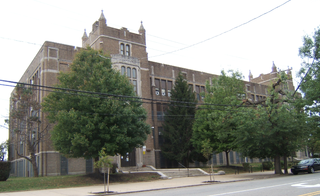
Frankford is a neighborhood in the Northeast section of Philadelphia situated about six miles (10 km) northeast of Center City. Although its borders are vaguely defined, the neighborhood is bounded roughly by the original course of Frankford Creek on the south to Castor Avenue on the northwest and southwest, to Cheltenham Avenue on the north, and to Aramingo Avenue and I-95 on the east. Adjacent neighborhoods are Bridesburg, Juniata, Northwood, Summerdale, and Wissinoming.

Roosevelt Boulevard, officially named the Theodore Roosevelt Memorial Boulevard and often referred to, chiefly by local Philadelphians, simply as "the Boulevard," is a major traffic artery through North and Northeast Philadelphia. The road begins at Interstate 76 in Fairmount Park, running as a freeway also known as the Roosevelt Boulevard Extension or the Roosevelt Expressway through North Philadelphia, then transitioning into a twelve-lane boulevard that forms the spine of Northeast Philadelphia to its end at the city line.

Lawncrest is a neighborhood in the "Near" (lower) Northeast Philadelphia, Pennsylvania. The name is an amalgam of Lawndale and Crescentville, the two primary communities that make up the neighborhood. The Philadelphia Inquirer does not consider Lawncrest to be a neighborhood.

<span class="mw-page-title-main">Holmesburg, Philadelphia</span> Neighborhood of Philadelphia, Pennsylvania, US

Holmesburg began as a Village within Lower Dublin Township, Pennsylvania. It is now a neighborhood in the Northeast section of Philadelphia, Pennsylvania, United States. Holmesburg was named in Honor of Surveyor General of Pennsylvania Thomas Holme, who was a cartographer.

<span class="mw-page-title-main">Mayfair, Philadelphia</span> Neighborhood of Philadelphia in Philadelphia County, Pennsylvania, United States

Mayfair is a working class neighborhood in lower Northeast Philadelphia, Pennsylvania, United States, centered on the intersection of Cottman and Frankford Avenues. It is bordered by Tacony and Wissinoming to the south and east, Holmesburg to the east, Pennypack Park to the north, and Oxford Circle and Rhawnhurst to the west. Mayfair is historically home to a large Irish American population, but more recently has seen accelerated growth of Asian American population

<span class="mw-page-title-main">Rhawnhurst, Philadelphia</span> Neighborhood of Philadelphia, USA

Rhawnhurst is a residential neighborhood in the Northeast section of Philadelphia, Pennsylvania, United States, named for George and William Rhawn by area real estate developers. Roughly bordered by Cottman Avenue to the south, Pennway Street to the west, the Pennypack Creek to the north, and Roosevelt Boulevard to the east, Rhawnhurst encompasses ZIP codes 19152 and part of ZIP code 19111. The geographic center of Rhawnhurst is at the intersection of Castor Avenue and Rhawn Street.

<span class="mw-page-title-main">Bustleton, Philadelphia</span> Neighborhood of Philadelphia in Philadelphia County, Pennsylvania, United States

The Bustleton section of Northeast Philadelphia, United States is located in the Far Northeast, north of Rhawnhurst and Fox Chase and south of Somerton; sitting between Roosevelt Boulevard to the east, the city boundary to the west, Red Lion Road to the north, and Pennypack Park to the south, it is centered at the intersection of Grant Avenue and Bustleton Avenue (PA-532) and is completely included in the 19115 postal ZIP code.

<span class="mw-page-title-main">Pennypack Creek</span>

Pennypack Creek is a 22.6-mile-long (36.4 km) creek in southeastern Pennsylvania in the United States. It runs southeast through lower Bucks County, eastern Montgomery County and the northeast section of Philadelphia, before emptying into the Delaware River.

<span class="mw-page-title-main">Frankford Creek</span> River in Pennsylvania, United States

Frankford Creek is a minor tributary of the Delaware River in southeast Pennsylvania. It derived its name from today's Frankford, Philadelphia neighborhood.

<span class="mw-page-title-main">Tacony, Philadelphia</span> Neighborhood of Philadelphia in Philadelphia County, Pennsylvania, United States

Tacony is a historic neighborhood in Northeast Philadelphia, United States, approximately 8 miles (13 km) from downtown Philadelphia. It is bounded by the east side of Frankford Avenue on the northwest, the south side of Cottman Avenue on the northeast, the north side of Robbins Street on the southwest, and the Delaware River and Interstate 95 on the southeast.

<span class="mw-page-title-main">Connecting Railway</span>

The Connecting Railway was a subsidiary of the Pennsylvania Railroad, incorporated to build a connection between the Philadelphia and Trenton Railroad and the PRR in the city of Philadelphia.

<span class="mw-page-title-main">Oxford Circle, Philadelphia</span> Neighborhood of Philadelphia in Philadelphia County, Pennsylvania, United States

Oxford Circle is a neighborhood in the lower Northeast section of Philadelphia, Pennsylvania, United States. Its namesake is the much used traffic circle at Roosevelt Boulevard and Oxford Avenue. The Oxford Circle neighborhood has traditionally included the areas up to Rhawnhurst and Mayfair but does not really have a fixed boundary, other than in publications about Philadelphia which are of a public relations or informational nature.

<span class="mw-page-title-main">Interstate 95 in Pennsylvania</span> Section of Interstate Highway in United States

Interstate 95 (I-95) is a major north–south Interstate Highway that runs along the East Coast of the United States from Miami, Florida, north to the Canada–United States border at Houlton, Maine. In the state of Pennsylvania, it runs 51.00 miles (82.08 km) from the Delaware state line near Marcus Hook in Delaware County in the southeastern part of the state northeast to the Delaware River–Turnpike Toll Bridge at the New Jersey state line near Bristol in Bucks County, closely paralleling the New Jersey state line for its entire length through Pennsylvania.

<span class="mw-page-title-main">Pennsylvania Route 232</span> State highway in Pennsylvania, US

Pennsylvania Route 232 (PA 232) is a 25.2-mile-long (40.6 km) state highway located in southeastern Pennsylvania. The southern terminus of the route is at U.S. Route 1 (US 1)/US 13 at the Oxford Circle in Philadelphia. The northern terminus is at PA 32 in the borough of New Hope, Bucks County, on the banks of the Delaware River. The route passes through the urban areas of Northeast Philadelphia as Oxford Avenue, serving the Lawncrest, Burholme, and Fox Chase neighborhoods. Upon entering Montgomery County, PA 232 becomes Huntingdon Pike and through suburban areas, serving the communities of Rockledge, Huntingdon Valley, and Bryn Athyn. The route passes through more suburban development in Bucks County as Second Street Pike, running through Southampton and Richboro. In Wrightstown Township, PA 232 enters rural areas and becomes Windy Bush Road as it heads north to New Hope.

<span class="mw-page-title-main">Pennsylvania Route 73</span> State highway in Pennsylvania, US

Pennsylvania Route 73 (PA 73) is a 62.32-mile (100.29 km) long east–west state highway in southeastern Pennsylvania. It runs from PA 61 near Leesport southeast to the New Jersey state line on the Tacony–Palmyra Bridge over the Delaware River in Philadelphia, where the road continues south as New Jersey Route 73. The route passes through rural areas of Berks County, crossing U.S. Route 222 (US 222) in Maiden Creek before heading southeast through Oley and Boyertown. PA 73 continues into Montgomery County and intersects PA 100 in Gilbertsville and PA 29 in Schwenksville before it heads into the northwest suburbs of Philadelphia. The route passes through Skippack and intersects US 202 in Center Square, PA 309 in Springfield Township, and PA 611 near Jenkintown. PA 73 continues through Northeast Philadelphia on Cottman Avenue, crossing US 1 and US 13 before coming to an interchange with Interstate 95 (I-95) near the Tacony–Palmyra Bridge.

<span class="mw-page-title-main">SEPTA City Transit Division surface routes</span>

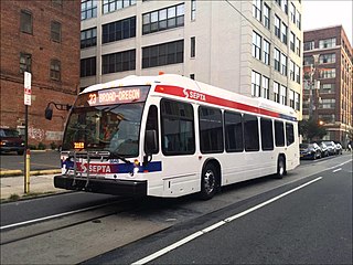
The City Transit Division of the Southeastern Pennsylvania Transportation Authority (SEPTA) operate almost all of Philadelphia's public transit, including all six trolley, three trackless trolley, and 70 bus lines within city limits. Some of the bordering municipalities are served by the City Transit division, despite not being part of the city. For example, Cheltenham Township has 13 city division routes and no Suburban Division ones. The City Transit division also operates the 400 Series routes which are designed to serve students attending schools in the city of Philadelphia.

<span class="mw-page-title-main">Castor Gardens, Philadelphia</span> Neighborhood of Northeast Philadelphia

Castor Gardens is a neighborhood in the lower Northeast section of Philadelphia, Pennsylvania, United States. Castor Gardens' borders are not clearly defined, but it exists in the vicinity of Castor Avenue and Cottman Avenue. It is also near Roosevelt Boulevard. The neighborhood can either be entered from the south, by taking the Oxford Circle exit of Roosevelt Boulevard, or from the north, by taking the Cottman Avenue exit. Adjacent neighborhoods are Mayfair, Lawndale, Burholme, Oxford Circle, and Rhawnhurst.

<span class="mw-page-title-main">U.S. Route 13 in Pennsylvania</span> Highway in Pennsylvania

U.S. Route 13 (US 13) is a United States Numbered Highway running from Fayetteville, North Carolina, north to Morrisville, Pennsylvania. The route runs for 49.359 miles (79.436 km) through the Delaware Valley in the U.S. state of Pennsylvania. The route enters the state from Delaware in Marcus Hook, Delaware County. It continues northeast through Delaware County, passing through the city of Chester before heading through suburban areas along Chester Pike to Darby. US 13 enters the city of Philadelphia on Baltimore Avenue and runs through West Philadelphia to University City, where it turns north along several city streets before heading east across the Schuylkill River along Girard Avenue. The route turns north and heads to North Philadelphia, where it runs northeast along Hunting Park Avenue. US 13 becomes concurrent with US 1 on Roosevelt Boulevard, continuing into Northeast Philadelphia. US 13 splits southeast on a one-way pair of streets before heading northeast out of the city on Frankford Avenue. The route continues into Bucks County as Bristol Pike, heading northeast to Bristol, where it turns into a divided highway. US 13 becomes a freeway in Tullytown and continues north to its terminus at US 1 in Falls Township, near Morrisville. US 13 roughly parallels Interstate 95 (I-95) through its course in Pennsylvania.

<span class="mw-page-title-main">SEPTA Route 56</span>

SEPTA's Trolley Route 56, the Erie and Torresdale Avenues Line, is a former streetcar line that is now served by bus. It is operated by the Southeastern Pennsylvania Transportation Authority (SEPTA) in Philadelphia, Pennsylvania, United States. The line runs between the Tioga and Tacony neighborhoods primarily along Erie Avenue and Torresdale Avenue. Route 56 was one of three "suspended" by the SEPTA board effective June 12, 1992. The two others, Routes 15 and 23, were then also operated by buses as of the same year; however, the Route 15 Trolley has since been restored back to trolley as of September 5, 2005.

References

  1. "Philadelphia County Quick Facts". US Census Bureau. August 16, 2009. Archived from the original on August 1, 2011. Retrieved August 16, 2009.
  2. 1 2 "Global Philadelphia". Global Philadelphia Association. Retrieved February 2, 2015.
  3. "Far NE". City of Philadelphia. Archived from the original on September 30, 2007. Retrieved August 13, 2009.
  4. See "Boundaries have evolved with the times". Archived from the original on December 9, 2004.The Philadelphia Inquirer, Nov. 17, 2004
  5. Martindale, Joseph C. (1867). A History of the Townships of Byberry and Moreland in Philadelphia, Pa.: From Their Earliest Settlement by Whites to the Present Time. Philadelphia, Pa.: T. Ellwood Zell. p. 15. Retrieved September 20, 2009.
  6. 1 2 "Chronology of Philadelphia County Subdivisions, 1683–1854". City of Philadelphia. Retrieved August 13, 2009.
  7. 1 2 "Neighborhood history predates Philadelphia's founding father". Archived from the original on December 9, 2004., The Philadelphia Inquirer, Nov. 17, 2004
  8. A Brief History of Tacony, Louis M. Iatarola
  9. Elizabeth M Geffen (1982). "Industrial Development and Social Crisis 1841–1854". In Weigley, Russell (ed.). Philadelphia, A 300-Year History. New York, NY: W.W. Norton. p.  312. ISBN   978-0-393-01610-9.
  10. Silcox, Harry C. (2009). Remembering Northeast Philadelphia. Charleston, South Carolina: The History Press. pp. 46–54. ISBN   978-1-59629-615-2.
  11. 1 2 Silcox, Harry C. (2009). Remembering Northeast Philadelphia. Charleston, South Carolina: The History Press. pp. 43–45. ISBN   978-1-59629-615-2.
  12. Silcox, Harry C. (2009). Remembering Northeast Philadelphia. Charleston, South Carolina: The History Press. pp. 61–63. ISBN   978-1-59629-615-2.
  13. 1 2 3 Joseph S. Clark Jr.; Dennis J. Clark (1982). "Rally and Relapse 1946–1968". In Weigley, Russell (ed.). Philadelphia, A 300-Year History. New York, NY: W.W. Norton. p.  699. ISBN   978-0-393-01610-9.
  14. Silcox, Harry C. (2009). Remembering Northeast Philadelphia. Charleston, South Carolina: The History Press. pp. 67–68. ISBN   978-1-59629-615-2.
  15. Thomas Ginsburg. "Quietly, quickly, diversity moves in". Archived from the original on December 9, 2004.The Philadelphia Inquirer, Nov. 17, 2004
  16. See, e.g., "1976 Presidential General Election Results by Ward" (PDF). Committee of Seventy. Archived from the original (PDF) on March 29, 2011. Retrieved September 19, 2009.; or "1980 Presidential General Election Results by Ward" (PDF). Committee of Seventy. Archived from the original (PDF) on March 29, 2011. Retrieved September 19, 2009.
  17. 1 2 See, e.g., "Secede? The idea is faint, but not yet dead". Archived from the original on March 13, 2007.The Philadelphia Inquirer, Nov. 17, 2004
  18. Tom Waring (June 12, 2008). "Butkovitz on taxes: Where's the emergency?". Northeast Times. Archived from the original on December 2, 2008. Retrieved September 19, 2009.
  19. "American FactFinder - Community Facts". U.S. Census. Archived from the original on 2020-02-16. Retrieved 2018-02-07.
  20. "Factfinder at census.gov". Archived from the original on 2020-02-12. Retrieved 2011-07-04.
  21. Trulia (15 March 2013). "America's Most Irish Towns". Forbes . Retrieved 7 February 2014.
  22. See United States congressional delegations from Pennsylvania
  23. "Senator Jimmy Dillon". Pennsylvania General Assembly. Retrieved 29 November 2022.
  24. "Shirley M. Kitchen, District 3". Pennsylvania State Senate. Retrieved October 29, 2009.
  25. "Christine M. Tartaglione, District 2". Pennsylvania State Senate. Retrieved October 29, 2009.
  26. This National Atlas Archived 2006-10-02 at the Wayback Machine map shows the district boundaries.
  27. This Pennsylvania Department of State map shows the state House district boundaries.
  28. City of Philadelphia. "PHILADELPHIA 10th CITY COUNCIL DISTRICT". City of Philadelphia, City Council. Retrieved August 15, 2009.
  29. City of Philadelphia. "PHILADELPHIA 7th CITY COUNCIL DISTRICT". City of Philadelphia, City Council. Retrieved August 15, 2009.
  30. City of Philadelphia. "PHILADELPHIA 9th CITY COUNCIL DISTRICT". City of Philadelphia, City Council. Retrieved October 29, 2009.
  31. This map shows the district boundaries.
  32. "Franklin Mills information". Simon Malls. Archived from the original on August 8, 2012. Retrieved August 13, 2009.
  33. "Roosevelt Mall". Centro Properties Group. Retrieved August 13, 2009.
  34. "Directions to Friends Hospital". Friends Hospital. Archived from the original on May 16, 2008. Retrieved October 19, 2009.
  35. "Directions to Fox Chase Cancer Center". Fox Chase Cancer Center. Retrieved October 19, 2009.
  36. "World Airline Directory." Flight International. March 30, 1985. 111." Retrieved on July 23, 2009.
  37. Thomson, John (June 1907). "Descriptive Account of the Lower Dublin Academy and of the Thomas Holme Branch of the Free Library of Philadelphia". Bulletin of the Free Library of Philadelphia. 7: 5. Retrieved September 20, 2009.
  38. Friends of Fox Chase Farm website
  39. "Holy Family University homepage". Archived from the original on October 9, 2007.
  40. "Regional Offices & School Information". School District of Philadelphia. Archived from the original on August 15, 2009. Retrieved August 13, 2009.
  41. "Philadelphia Office of Catholic Education Website". Archdiocese of Philadelphia. Archived from the original on August 14, 2009. Retrieved August 13, 2009.
  42. "Historic Pennypack Park: An oasis for all seasons". Archived from the original on December 5, 2004., The Philadelphia Inquirer, Nov. 17, 2004.
  43. "The Frankford Avenue Bridge: Bridging the Past to the Future for 300 Years". Balford.com. Archived from the original on July 7, 2011. Retrieved January 29, 2011.
  44. Burlington County Bridge Commission "webpage". Archived from the original on January 22, 2008. about the Tacony-Palmyra Bridge.
  45. See this SEPTA map Archived 2006-10-16 at the Wayback Machine of the Frankford Transportation Center
  46. "Philadelphia Northeast Airport". City of Philadelphia. Archived from the original on April 17, 2009. Retrieved September 20, 2009.
  47. "The Irish roots of the world's first supermodel, Gia Carangi, who'd be 57 today". 2017-01-28. Retrieved 14 February 2017.

40°05′14″N74°57′42″W / 40.0873°N 74.9616°W / 40.0873; -74.9616