Etna, Wyoming

Last updated
Etna, Wyoming
WYMap-doton-Etna.PNG
Location of Etna, Wyoming
Usa edcp location map.svg
Red pog.svg
Etna, Wyoming
Location in the United States
Coordinates: 43°1′52″N111°0′58″W / 43.03111°N 111.01611°W / 43.03111; -111.01611
Country United States
State Wyoming
County Lincoln
Area
  Total2.0 sq mi (5.1 km2)
  Land2.0 sq mi (5.1 km2)
  Water0.0 sq mi (0.0 km2)
Elevation
5,827 ft (1,776 m)
Population
 (2010) [1]
  Total164
  Density82/sq mi (32/km2)
Time zone UTC-7 (Mountain (MST))
  Summer (DST) UTC-6 (MDT)
ZIP code
83118
Area code 307
FIPS code 56-25475 [2]
GNIS feature ID1599637 [3]
Etna, Wyoming Etna (Wyoming) 7-09-2014 15-46-01 7-9-2014 15-46-01.JPG
Etna, Wyoming

Etna is a census-designated place (CDP) in Lincoln County, Wyoming, United States. The population was 164 at the 2010 census.

Contents

Geography

Etna is located at 43°2′0″N111°0′58″W / 43.03333°N 111.01611°W / 43.03333; -111.01611 (43.031124, -111.016042). [4] in Star Valley, a grassland valley surrounded by forested mountains.

According to the United States Census Bureau, the CDP has a total area of 2.0 square miles (5.1 km2), all land.

Demographics

As of the census [2] of the year 2000, there were 123 people, 44 households, and 34 families residing in the CDP. The population density was 62.8 people per square mile (24.2/km2). There were 55 housing units at an average density of 28.1/sq mi (10.8/km2). The racial makeup of the CDP was 93.50% White, 1.63% African American, 1.63% from other races, and 3.25% from two or more races. Hispanic or Latino of any race were 4.88% of the population.

There were 44 households, out of which 45.5% had children under the age of 18 living with them, 65.9% were married couples living together, 9.1% had a female householder with no husband present, and 20.5% were non-families. 15.9% of all households were made up of individuals, and 13.6% had someone living alone who was 65 years of age or older. The average household size was 2.80 and the average family size was 3.17.

In the CDP, the population was spread out, with 34.1% under the age of 18, 4.1% from 18 to 24, 29.3% from 25 to 44, 19.5% from 45 to 64, and 13.0% who were 65 years of age or older. The median age was 34 years. For every 100 females, there were 89.2 males. For every 100 females age 18 and over, there were 84.1 males.

The median income for a household in the CDP was $42,917, and the median income for a family was $44,375. Males had a median income of $41,667 versus $0 for females. The per capita income for the CDP was $17,423. There were 19.4% of families and 24.5% of the population living below the poverty line, including 17.1% of under eighteens and 48.1% of those over 64.

Education

Public education in the community of Etna is provided by Lincoln County School District #2.

Transportation

Etna is served by a START Bus commuter service on weekdays with 3 trips a day.


Related Research Articles

<span class="mw-page-title-main">Mountainaire, Arizona</span> CDP in Coconino County, Arizona

Mountainaire is a census-designated place (CDP) in Coconino County, Arizona, United States. The population was 1,119 at the 2010 census.

<span class="mw-page-title-main">Parks, Arizona</span> CDP in Coconino County, Arizona

Parks is a census-designated place (CDP) in Coconino County, Arizona, United States. The population was 1,188 at the 2010 census.

<span class="mw-page-title-main">Sun Lakes, Arizona</span> CDP in Maricopa County, Arizona

Sun Lakes is an unincorporated community and census-designated place (CDP) in Maricopa County, Arizona, United States. The population was 14,868 at the 2020 census. Sun Lakes is an active adult community comprising five country club communities in three homeowner associations. These include the gated communities of Oakwood and IronWood (IronOaks), the gated and non-gated communities of Palo Verde and Cottonwood, and the non-gated community of Sun Lakes 1. Sun Lakes is a master-planned community developed by Robson Communities.

<span class="mw-page-title-main">Picture Rocks, Arizona</span> CDP in Pima County, Arizona

Picture Rocks is a census-designated place (CDP) in Pima County, Arizona, United States, home of the Tucson artifacts. The population was 9,551 at the 2020 United States census.

<span class="mw-page-title-main">Valencia West, Arizona</span> CDP in Pima County, Arizona

Valencia West is a census-designated place (CDP) in Pima County, Arizona, United States. The population was 9,355 at the 2010 census, a 293% increase over the population of 2,380 in 2000.

<span class="mw-page-title-main">Chuichu, Arizona</span> CDP in Pinal County, Arizona

Chuichu is a census-designated place (CDP) in Pinal County, Arizona, United States. The population was 308 at the 2020 census. It is the northernmost traditional village on the Tohono O'odham Nation reservation.

<span class="mw-page-title-main">Queen Valley, Arizona</span> CPD in Pinal County, Arizona

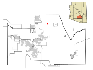
Queen Valley is a census-designated place (CDP) in north central Pinal County, Arizona, United States. The population was 820 at the 2000 census.

<span class="mw-page-title-main">Stanfield, Arizona</span> CDP in Pinal County, Arizona

Stanfield is a census-designated place (CDP) in Pinal County, Arizona, United States. The population was 651 at the 2000 census. Shamrock Farms operates a farm in Stanfield.

<span class="mw-page-title-main">Etna, California</span> City in California, United States

Etna is a city in the Scott Valley area of Siskiyou County, California, United States. Its population is 678 as of the 2020 census, down from 737 from the 2010 census.

<span class="mw-page-title-main">Paradise Heights, Florida</span> Census-designated place in Florida, United States

Paradise Heights is a census-designated place and an unincorporated area in Orange County, Florida, United States. The population was 1,215 at the 2010 census. It is part of the Orlando–Kissimmee Metropolitan Statistical Area.

<span class="mw-page-title-main">North Windham, Maine</span> Census-designated place in Maine, United States

North Windham is a census-designated place (CDP) within the town of Windham in Cumberland County, Maine, United States. The population was 4,904 at the 2010 census. It is part of the Portland–South Portland–Biddeford, Maine Metropolitan Statistical Area.

Damariscotta-Newcastle was a census-designated place (CDP) in Lincoln County, Maine, United States. It designated a concentration of population around where the most developed portions of the towns of Damariscotta and Newcastle meet, generally corresponding to the "Twin Villages" area. As of the 2000 census, the CDP population was 1,751. For the 2010 census, the area was delineated as two separate CDPs, Damariscotta and Newcastle.

<span class="mw-page-title-main">Toston, Montana</span> Census-designated place in Montana, United States

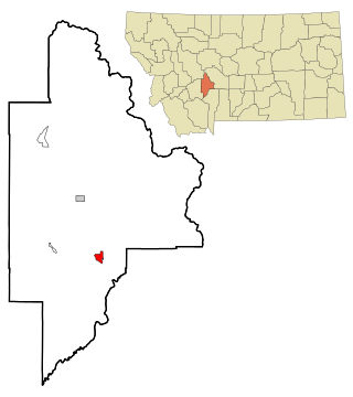
Toston is a census-designated place (CDP) in Broadwater County, Montana, United States. The population was 108 at the 2010 census.

<span class="mw-page-title-main">Four Corners, Montana</span> Census-designated place in Montana, United States

Four Corners is a census-designated place (CDP) in Gallatin County, Montana, United States. The population was 5,901 at the 2020 census, up from 3,146 in 2010. It is part of the Bozeman, MT Micropolitan Statistical Area.

<span class="mw-page-title-main">Beechwood Trails, Ohio</span> Census-designated place in Ohio, United States

Beechwood Trails is a census-designated place (CDP) in Harrison Township, Licking County, Ohio, United States. The population was 3,020 at the 2010 census, up from 2,258 at the 2000 census.

Iron Post is a census-designated place (CDP) in Mayes County, Oklahoma, United States. The population was 117 at the 2000 census, but had declined to 92 in 2010, a loss of more than 21 percent.

<span class="mw-page-title-main">Green Valley, South Dakota</span> CDP in South Dakota, United States

Green Valley is a census-designated place (CDP) and unincorporated community in Pennington County, South Dakota, United States. The population was 1,051 at the 2020 census.

Alpine Northeast is a census-designated place in Lincoln County, Wyoming, United States. The population was 196 at the 2010 census.

Moose Wilson Road is a census-designated place (CDP) in Teton County, Wyoming, United States. The population was 1,821 at the 2010 census. It is part of the Jackson, WY–ID Micropolitan Statistical Area.

<span class="mw-page-title-main">Osage, Wyoming</span> CDP in Wyoming, United States

Osage is a census-designated place (CDP) in Weston County, Wyoming, United States. The population was 151 at the 2020 census.

References

  1. "2010 City Population and Housing Occupancy Status". U.S. Census Bureau. Retrieved July 13, 2012.[ dead link ]
  2. 1 2 "U.S. Census website". United States Census Bureau . Retrieved 2008-01-31.
  3. "US Board on Geographic Names". United States Geological Survey. 2007-10-25. Retrieved 2008-01-31.
  4. "US Gazetteer files: 2010, 2000, and 1990". United States Census Bureau. 2011-02-12. Retrieved 2011-04-23.