Taylor, Wyoming

Last updated
Taylor, Wyoming
USA Wyoming location map.svg
Red pog.svg
Taylor
Usa edcp location map.svg
Red pog.svg
Taylor
Coordinates: 42°3′44″N110°59′35″W / 42.06222°N 110.99306°W / 42.06222; -110.99306 Coordinates: 42°3′44″N110°59′35″W / 42.06222°N 110.99306°W / 42.06222; -110.99306
Country United States
State Wyoming
County Lincoln
Area
  Total2.6 sq mi (6.6 km2)
  Land2.6 sq mi (6.6 km2)
  Water0.0 sq mi (0.0 km2)
Population
 (2010) [1]
  Total90
  Density35/sq mi (14/km2)
Time zone UTC-7 (Mountain (MST))
  Summer (DST) UTC-6 (MDT)
Area code(s) 307
FIPS code 56-75572 [2]

Taylor is a census-designated place (CDP) in Lincoln County, Wyoming, United States. The population was 90 at the 2010 census.

Contents

Geography

Taylor is located at 42°3′44″N110°59′35″W / 42.06222°N 110.99306°W / 42.06222; -110.99306 (42.062216, -110.993112). [3]

According to the United States Census Bureau, the CDP has a total area of 2.6 square miles (6.7 km2), all land. [4]

Demographics

As of the census [2] of 2000, there were 90 people, 27 households, and 23 families residing in the CDP. The population density was 35.1 people per square mile (13.6/km2). There were 28 housing units at an average density of 10.9/sq mi (4.2/km2). The racial makeup of the CDP was 93.33% White, 1.11% Native American, 2.22% Pacific Islander, and 3.33% from two or more races.

There were 27 households, out of which 40.7% had children under the age of 18 living with them, 74.1% were married couples living together, 3.7% had a female householder with no husband present, and 14.8% were non-families. 11.1% of all households were made up of individuals, and none had someone living alone who was 65 years of age or older. The average household size was 3.33 and the average family size was 3.65.

In the CDP, the population was spread out, with 40.0% under the age of 18, 5.6% from 18 to 24, 24.4% from 25 to 44, 23.3% from 45 to 64, and 6.7% who were 65 years of age or older. The median age was 29 years. For every 100 females, there were 80.0 males. For every 100 females age 18 and over, there were 107.7 males.

The median income for a household in the CDP was $38,000, and the median income for a family was $35,625. Males had a median income of $25,313 versus $13,750 for females. The per capita income for the CDP was $12,836. There were 16.7% of families and 20.7% of the population living below the poverty line, including 32.0% of under eighteens and none of those over 64.

Education

Public education in the community of Taylor is provided by Lincoln County School District #2.

Related Research Articles

Albany, Wyoming CDP in Wyoming, United States

Albany is a census-designated place (CDP) in Albany County, Wyoming, United States. The population was 55 at the 2010 census.

Bedford, Wyoming Census-designated place in Wyoming, United States

Bedford is a census-designated place (CDP) in Lincoln County, Wyoming, United States. The population was 201 at the 2010 census.

Fairview, Wyoming Census-designated place in Wyoming, United States

Fairview is a census-designated place (CDP) in Lincoln County, Wyoming, United States. The population was 275 at the 2010 census.

Fontenelle, Wyoming Census-designated place in Wyoming, United States

Fontenelle is a census-designated place (CDP) in Lincoln County, Wyoming, United States. The population was 13 at the 2010 census.

Grover, Wyoming Census-designated place in Wyoming, United States

Grover is a census-designated place (CDP) in Lincoln County, Wyoming, United States. The population was 147 at the 2010 census.

Star Valley Ranch, Wyoming Town in Wyoming, United States

Star Valley Ranch is a town in Lincoln County, Wyoming, United States. The population was 1,503 at the 2010 census. It was incorporated on November 8, 2005; at the 2000 census, it was only a census-designated place (CDP).

Turnerville, Wyoming Census-designated place in Wyoming, United States

Turnerville is a census-designated place (CDP) in Lincoln County, Wyoming, United States. The population was 192 at the 2010 census.

Bessemer Bend, Wyoming CDP in Wyoming, United States

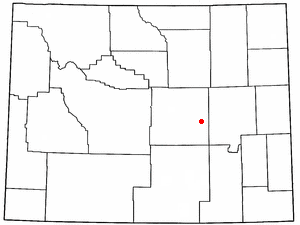
Bessemer Bend is a census-designated place (CDP) in Natrona County, Wyoming, United States. It is part of the Casper, Wyoming Metropolitan Statistical Area. The population was 199 at the 2010 census.

Brookhurst, Wyoming CDP in Wyoming, United States

Brookhurst is a census-designated place (CDP) in Natrona County, Wyoming, United States. It is part of the Casper, Wyoming Metropolitan Statistical Area. The population was 185 at the 2010 census.

Casper Mountain, Wyoming CDP in Wyoming, United States

Casper Mountain is a census-designated place (CDP) on Casper Mountain in Natrona County, Wyoming, United States. It is part of the Casper, Wyoming Metropolitan Statistical Area. The population was 401 at the 2010 census.

Hartrandt, Wyoming CDP in Wyoming, United States

Hartrandt is a census-designated place (CDP) in Natrona County, Wyoming, United States. It is part of the Casper, Wyoming Metropolitan Statistical Area and the population was 693 at the 2010 census.

Homa Hills, Wyoming CDP in Wyoming, United States

Homa Hills is a census-designated place (CDP) in Natrona County, Wyoming, United States. It is part of the Casper, Wyoming Metropolitan Statistical Area. The population was 278 at the 2010 census.

Meadow Acres, Wyoming CDP in Wyoming, United States

Meadow Acres is a census-designated place (CDP) in Natrona County, Wyoming, United States. It is part of the Casper, Wyoming Metropolitan Statistical Area. The population was 198 at the 2010 census.

Mountain View, Natrona County, Wyoming CDP in Wyoming, United States

Mountain View is a census-designated place in Natrona County, Wyoming, United States. It is part of the Casper, Wyoming Metropolitan Statistical Area. The population was 96 at the 2010 census.

Ralston, Wyoming CDP in Wyoming, United States

Ralston is a census-designated place (CDP) in Park County, Wyoming, United States. The population was 280 at the 2010 census.

Calpet, Wyoming Unincorporated community in Wyoming, United States

Calpet is an unincorporated community in Sublette County, Wyoming, United States. The population was 7 at the 2000 census, when it was a census-designated place (CDP).

Eden, Wyoming CDP in Wyoming, United States

Eden is a census-designated place (CDP) in Sweetwater County, Wyoming, United States. The population was 281 at the 2010 census.

Rafter J Ranch, Wyoming CDP in Wyoming, United States

Rafter J Ranch is a census-designated place (CDP) in Teton County, Wyoming, United States. The population was 1,075 at the 2010 census. It is part of the Jackson, WY–ID Micropolitan Statistical Area.

South Park, Wyoming CDP in Wyoming, United States

South Park is a census-designated place (CDP) in Teton County, Wyoming, United States. The population was 1,731 at the 2010 census. It is part of the Jackson, WY–ID Micropolitan Statistical Area. The community does not have any connections with South Park, the animated Comedy Central television series.

Teton Village, Wyoming CDP in Wyoming, United States

Teton Village is a census-designated place (CDP) in Teton County, Wyoming, United States. The population was 330 at the 2010 census. The village surrounds the base of the Jackson Hole Mountain Resort. It is accessed from nearby Jackson and the surrounding area via the Moose-Wilson Road.

References

  1. "2010 City Population and Housing Occupancy Status". U.S. Census Bureau. Retrieved July 13, 2012.CS1 maint: discouraged parameter (link)[ dead link ]
  2. 1 2 "U.S. Census website". United States Census Bureau . Retrieved 2008-01-31.CS1 maint: discouraged parameter (link)
  3. "US Gazetteer files: 2010, 2000, and 1990". United States Census Bureau. 2011-02-12. Retrieved 2011-04-23.CS1 maint: discouraged parameter (link)
  4. "2010 Wyoming Place Names". U.S. Census Bureau. Archived from the original on April 11, 2011. Retrieved July 13, 2012.CS1 maint: discouraged parameter (link)