Star Valley Ranch, Wyoming

Last updated

Star Valley Ranch, Wyoming
Lincoln County Wyoming Incorporated and Unincorporated areas Star Valley Ranch Highlighted 5673180.svg
Location of Star Valley Ranch in Lincoln County, Wyoming
USA Wyoming location map.svg
Red pog.svg
Star Valley Ranch
Location in Wyoming
Usa edcp location map.svg
Red pog.svg
Star Valley Ranch
Location in the United States
Coordinates: 42°58′47″N110°57′50″W / 42.97972°N 110.96389°W / 42.97972; -110.96389
Country United States
State Wyoming
County Lincoln
IncorporatedNovember 8, 2005
Area
[1]
  Total2.72 sq mi (7.04 km2)
  Land2.71 sq mi (7.03 km2)
  Water0.00 sq mi (0.01 km2)
Population
 (2020)
  Total1,866
  Density611.05/sq mi (235.90/km2)
Time zone UTC-7 (Mountain (MST))
  Summer (DST) UTC-6 (MDT)
ZIP code
83127
Area code 307
FIPS code 56-73180 [2]
GNIS feature ID2351263 [3]
Website www.starvalleyranchwy.org

Star Valley Ranch is a town in Lincoln County, Wyoming, United States. The population was 1,866 at the 2020 census. It was incorporated on November 8, 2005; [4] at the 2000 census, it was only a census-designated place (CDP). [2]

Contents

Geography

Star Valley Ranch is located at 42°58′47″N110°57′50″W / 42.97972°N 110.96389°W / 42.97972; -110.96389 (42.979610, –110.963812). [5] It is located in Star Valley, a grassland valley surrounded by forested mountains.

According to the United States Census Bureau, the town has a total area of 2.70 square miles (6.99 km2), all land. [6]

Demographics

Historical population
CensusPop.Note
2000 776
2010 1,50393.7%
2020 1,86624.2%
U.S. Decennial Census [7]

2010 census

As of the census [8] of 2010, there were 1,503 people, 612 households, and 461 families residing in the town. The population density was 556.7 inhabitants per square mile (214.9/km2). There were 954 housing units at an average density of 353.3 per square mile (136.4/km2). The racial makeup of the town was 96.3% White, 0.1% African American, 0.8% Native American, 0.6% Asian, 1.3% from other races, and 0.8% from two or more races. Hispanic or Latino of any race were 3.4% of the population.

There were 612 households, of which 28.3% had children under the age of 18 living with them, 70.1% were married couples living together, 2.9% had a female householder with no husband present, 2.3% had a male householder with no wife present, and 24.7% were non-families. 19.6% of all households were made up of individuals, and 8.7% had someone living alone who was 65 years of age or older. The average household size was 2.46 and the average family size was 2.83.

The median age in the town was 43.2 years. 23.8% of residents were under the age of 18; 2.9% were between the ages of 18 and 24; 25.4% were from 25 to 44; 26.2% were from 45 to 64; and 21.8% were 65 years of age or older. The gender makeup of the town was 51.8% male and 48.2% female.

2000 census

As of the census [2] of 2000, there were 776 people, 357 households, and 292 families residing in the CDP. The population density was 61.1 people per square mile (23.6/km2). There were 856 housing units at an average density of 67.4 per square mile (26.0/km2). The racial makeup of the CDP was 97.68% White, 0.13% African American, 0.77% Native American, 0.26% from other races, and 1.16% from two or more races. Hispanic or Latino of any race were 0.39% of the population.

There were 357 households, out of which 12.0% had children under the age of 18 living with them, 78.7% were married couples living together, 2.8% had a female householder with no husband present, and 18.2% were non-families. 12.9% of all households were made up of individuals, and 7.0% had someone living alone who was 65 years of age or older. The average household size was 2.17 and the average family size was 2.36.

In the CDP, the population was spread out, with 11.5% under the age of 18, 2.4% from 18 to 24, 12.4% from 25 to 44, 36.1% from 45 to 64, and 37.6% who were 65 years of age or older. The median age was 61 years. For every 100 females, there were 101.0 males. For every 100 females age 18 and over, there were 99.7 males.

The median income for a household in the CDP was $47,981, and the median income for a family was $58,036. Males had a median income of $40,313 versus $32,083 for females. The per capita income for the CDP was $28,635. None of the families and 3.9% of the population were living below the poverty line, including no under eighteens and 8.8% of those over 64.

Education

Public education in the town of Star Valley Ranch is provided by Lincoln County School District #2.

Star Valley Ranch has a public library, a branch of the Lincoln County Library System. [9]

Related Research Articles

Deltana is a census-designated place (CDP) in the Southeast Fairbanks Census Area, Alaska, United States. At the 2020 census, the population was 2,359, up from 2,251 in 2010. Native inhabitants are Tanana Athabaskans.

<span class="mw-page-title-main">Mojave Ranch Estates, Arizona</span> CDP in Mohave County, Arizona

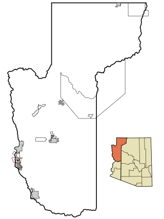
Mojave Ranch Estates is an unincorporated community and census-designated place (CDP) in Mohave County, Arizona, United States. The population was 53 as of the 2020 census.

<span class="mw-page-title-main">Vail, Arizona</span> CDP in Pima County, Arizona

Vail is a census-designated place (CDP) in Pima County, Arizona, United States. It is 24 miles (39 km) southeast of Tucson. The population was 10,208 at the 2010 census, up from 2484 in the 2000 census. The area is known for the nearby Colossal Cave, a large cave system, and the Rincon Mountains District of Saguaro National Park, a top tourism spot within Arizona.

<span class="mw-page-title-main">Queen Valley, Arizona</span> CPD in Pinal County, Arizona

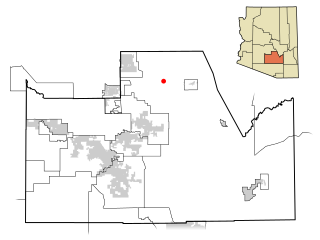
Queen Valley is a census-designated place (CDP) in north central Pinal County, Arizona, United States. The population was 820 at the 2000 census.

<span class="mw-page-title-main">Lucas Valley-Marinwood, California</span> Census-designated place in California, United States

Lucas Valley-Marinwood is a census-designated place (CDP) in Marin County, California, United States. It includes the neighborhoods of Lucas Valley and Marinwood. As of the 2020 census, the population was 6,259.

<span class="mw-page-title-main">Crescent Mills, California</span> Census-designated place in California, United States

Crescent Mills is a census-designated place (CDP) in Plumas County, California, United States. Crescent Mills is located 3.5 miles (5.6 km) southeast of Greenville. The population was 196 at the 2010 census, down from 258 at the 2000 census.

<span class="mw-page-title-main">Valley Ranch, California</span> Census-designated place in California, United States

Valley Ranch is a census-designated place in Plumas County, California, United States. The population was 109 at the 2010 census, up from 92 at the 2000 census.

<span class="mw-page-title-main">Casa de Oro-Mount Helix, California</span> Census designated place in California, United States

Casa de Oro-Mount Helix is a census-designated place (CDP) in the East County region of San Diego County, California.

<span class="mw-page-title-main">Spring Valley, San Diego County, California</span> Census-designated place in California, United States

Spring Valley is a census-designated place (CDP) in the East County region of San Diego County, California. The population was 28,205 at the time of the 2010 census.

<span class="mw-page-title-main">Glen Ellen, California</span> Census designated place in California, United States

Glen Ellen is a census-designated place (CDP) in Sonoma Valley, Sonoma County, California, United States. The population was 784 at the 2010 census, down from 992 at the 2000 census. Glen Ellen is the location of Jack London State Historic Park, Sonoma Valley Regional Park, and a former home of Hunter S. Thompson.

<span class="mw-page-title-main">Bystrom, California</span> Census-designated place in California, United States

Bystrom is a census-designated place (CDP) in Stanislaus County, California, United States. The population was 4,008 at the 2010 census, down from 4,518 at the 2000 census. It is part of the Modesto Metropolitan Statistical Area.

<span class="mw-page-title-main">Kaʻaʻawa, Hawaii</span> Census-designated place in the United States

Kaʻaʻawa is a small community and census-designated place (CDP) located in the windward district of Koʻolauloa, City & County of Honolulu on the island of Oʻahu, Hawaiʻi, United States. As of the 2010 Census, the total population for Kaʻaʻawa was 1,379. In Hawaiian, kaʻaʻawa means "the wrasse (fish)". From the Hawaiian spelling Kaʻaʻawa it is seen that each a is pronounced separately and distinctly, set apart by the two ʻokinas: or.

<span class="mw-page-title-main">Maunaloa, Hawaii</span> Census-designated place in Hawaii, United States

Maunaloa or Mauna Loa is a census-designated place (CDP) in Maui County, Hawaiʻi, United States, in the western part of the island of Molokai. The population was 435 at the 2020 census.

<span class="mw-page-title-main">McGill, Nevada</span> CDP in Nevada, United States

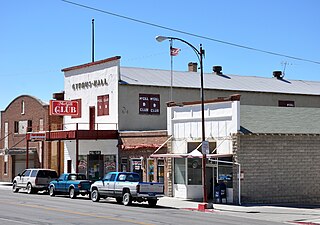
McGill is a census-designated place (CDP) in White Pine County, Nevada, United States. The population was 1,148 at the 2010 census.

<span class="mw-page-title-main">Aspers, Pennsylvania</span> Census-designated place in Pennsylvania, United States

Aspers is a census-designated place in Menallen Township, Adams County, Pennsylvania, United States. As of the 2020 census, it had a population of 486. At the 2000 census it was listed as the Bendersville Station-Aspers CDP.

<span class="mw-page-title-main">Tresckow, Pennsylvania</span> Census-designated place in Pennsylvania, United States

Tresckow, formerly known as Dutchtown, is an unincorporated community and census-designated place (CDP) in Carbon County, Pennsylvania, United States. It is part of Northeastern Pennsylvania and is located west of Junedale and Beaver Meadows, which share the same road network. The community has deep roots in the anthracite coal mining and transportation industries.

<span class="mw-page-title-main">Klingerstown, Pennsylvania</span> CDP in Pennsylvania, United States

Klingerstown is a census-designated place (CDP) in Upper Mahantongo Township, Schuylkill County, Pennsylvania, United States. As of the 2000 census, the CDP population was 102.

<span class="mw-page-title-main">Riverview, South Carolina</span> CDP in South Carolina, United States

Riverview is a census-designated place (CDP) in York County, South Carolina, United States, located southwest of Fort Mill along the Catawba River. The population was 708 at the 2000 census.

<span class="mw-page-title-main">Womelsdorf (Coalton), West Virginia</span> Town in West Virginia, United States

Womelsdorf (Coalton) is a town in Randolph County, West Virginia, United States. The population was 190 at the 2020 census.

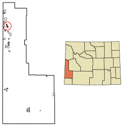
Homa Hills is a census-designated place (CDP) in Natrona County, Wyoming, United States. It is part of the Casper, Wyoming Metropolitan Statistical Area. The population was 278 at the 2010 census.

References

  1. "2019 U.S. Gazetteer Files". United States Census Bureau. Retrieved August 7, 2020.
  2. 1 2 3 "U.S. Census website". United States Census Bureau . Retrieved January 31, 2008.
  3. "US Board on Geographic Names". United States Geological Survey. October 25, 2007. Retrieved January 31, 2008.
  4. Population Estimates Boundary Changes Archived February 6, 2006, at the Wayback Machine , United States Census Bureau, July 1, 2007. Accessed 2008-11-05.
  5. "US Gazetteer files: 2010, 2000, and 1990". United States Census Bureau. February 12, 2011. Retrieved April 23, 2011.
  6. "US Gazetteer files 2010". United States Census Bureau. Archived from the original on January 25, 2012. Retrieved December 14, 2012.
  7. "Census of Population and Housing". Census.gov. Retrieved June 4, 2015.
  8. "U.S. Census website". United States Census Bureau . Retrieved December 14, 2012.
  9. "Wyoming Public Libraries". PublicLibraries.com. Retrieved June 13, 2019.