Gray, Georgia

Last updated

Gray, Georgia
Gray, GA Water Tower.png
Flag of Gray, Georgia.png
Seal of Gray, Georgia.png
Motto: 
Home of the annual Daylily Festival
Jones County Georgia Incorporated and Unincorporated areas Gray Highlighted.svg
Location in Jones County and the state of Georgia
Coordinates: 33°00′31″N83°32′03″W / 33.0086°N 83.5342°W / 33.0086; -83.5342
Country United States
State Georgia
County Jones
Area
[1]
  Total3.95 sq mi (10.22 km2)
  Land3.94 sq mi (10.20 km2)
  Water0.01 sq mi (0.02 km2)
Elevation
603 ft (183 m)
Population
 (2020)
  Total3,436
  Density872.75/sq mi (336.93/km2)
Time zone UTC-5 (Eastern (EST))
  Summer (DST) UTC-4 (EDT)
ZIP code
31032
Area code 478
FIPS code 13-34512 [2]
GNIS feature ID0327996 [3]
Website grayga.us

Gray is a city in Jones County, Georgia, United States. The population was 3,276 at the 2010 census, [4] up from 1,811 at the 2000 census. In 2020, its population was 3,436. The city is the county seat of Jones County. [5] It is part of the Macon metropolitan area.

Contents

History

Gray was founded in the 1850s and named for local resident James M. Gray. [6] In 1905, the seat of Jones County was transferred to Gray. [7]

Geography

Gray is located in central Jones County at 33°00′31″N83°32′03″W / 33.0086°N 83.5342°W / 33.0086; -83.5342 . [8] U.S. Route 129 passes through the center of town, leading northeast 25 miles (40 km) to Eatonton and southwest 14 miles (23 km) to Macon. Monticello is 25 miles (40 km) to the northwest via State Route 11, Milledgeville is 19 miles (31 km) to the east via State Route 22, and Gordon is 15 miles (24 km) to the southeast via State Route 18.

According to the United States Census Bureau, Gray has a total area of 3.9 square miles (10.1 km2), of which 0.01 square miles (0.03 km2), or 0.34%, are water. [4] Gray is drained to the west by tributaries of Walnut Creek, flowing to the Ocmulgee River, and to the east by tributaries of Commissioner Creek, flowing to the Oconee River.

Demographics

Historical population
CensusPop.Note
1920 559
1930 65316.8%
1940 6986.9%
1950 86624.1%
1960 1,32052.4%
1970 2,01452.6%
1980 2,1456.5%
1990 2,1892.1%
2000 1,811−17.3%
2010 3,27680.9%
2020 3,4364.9%
U.S. Decennial Census [9]
Gray racial composition as of 2020 [10]
RaceNum.Perc.
White (non-Hispanic)2,30066.94%
Black or African American (non-Hispanic)92726.98%
Native American 80.23%
Asian 180.52%
Pacific Islander 10.03%
Other/Mixed 1143.32%
Hispanic or Latino 681.98%

As of the 2020 United States census, there were 3,436 people, 1,219 households, and 798 families residing in the city.

Education

Jones County School District

The Jones County School District holds pre-school to grade twelve, and consists of four elementary schools, two middle schools, and one high school. [11] The district has 295 full-time teachers and over 5,014 students. [12]

Related Research Articles

<span class="mw-page-title-main">Cochran, Georgia</span> City in Georgia, United States

Cochran is a city in Bleckley County, Georgia, United States. As of the 2020 census, the city had a population of 5,026. The city is the county seat of Bleckley County.

<span class="mw-page-title-main">Quitman, Georgia</span> City in Georgia, United States

Quitman is a city in and the county seat of Brooks County, Georgia, United States. The population was 4,064 in 2020. The Quitman Historic District is listed on the National Register of Historic Places.

<span class="mw-page-title-main">Eastman, Georgia</span> City in Georgia, United States

Eastman is a city in Dodge County, Georgia, United States. The population was 5,658 at the 2020 census, up from 4,962 at the 2010 census. The city was named after William Pitt Eastman, a native of Massachusetts who purchased a large tract of land along the Macon and Brunswick Railroad, and settled a city on the site.

<span class="mw-page-title-main">Springfield, Georgia</span> City in Georgia, United States

Springfield is a city in Effingham County, Georgia, United States. The population was 2,703 in 2020. The city is the county seat of Effingham County. Springfield is part of the Savannah Metropolitan Statistical Area.

<span class="mw-page-title-main">Blue Ridge, Georgia</span> City in Georgia, United States

Blue Ridge is a city in Fannin County, Georgia, United States. As of the 2020 census, the city had a population of 1,253. The city is the county seat of Fannin County and the largest city in the county as well.

<span class="mw-page-title-main">Greensboro, Georgia</span> City in Georgia, United States

Greensboro is a city in and the county seat of Greene County, Georgia, United States. Its population was 3,648 as of the 2020 census. The city is located approximately halfway between Atlanta and Augusta on Interstate 20.

<span class="mw-page-title-main">Jefferson, Georgia</span> City in Georgia, United States

Jefferson is a city and the county seat of Jackson County, Georgia, United States. The population was 9,432 at the 2010 census, up from 3,825 at the 2000 census. As of 2019 the estimated population was 12,032.

<span class="mw-page-title-main">Monticello, Georgia</span> City in Georgia, United States

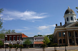
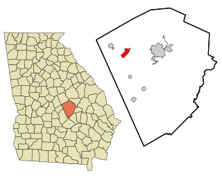
Monticello is the largest city in and the county seat of Jasper County, Georgia, United States. The city includes historic buildings such as the Jasper County Courthouse, Monticello High School and the Monticello Historic District. The population was 2,657 at the 2010 census. It is 56 miles (90 km) southeast of Atlanta.

<span class="mw-page-title-main">Wrightsville, Georgia</span> City in Georgia, United States

Wrightsville is a city in and the county seat of Johnson County, Georgia, United States. The population was 2,195 at the 2010 census, down from 2,223 at the 2000 census. By 2020, its population grew to 3,449. The city limits include Johnson State Prison on the northeast side of town. Wrightsville is part of the Dublin Micropolitan Statistical Area.

<span class="mw-page-title-main">Cadwell, Georgia</span> Town in Georgia, United States

Cadwell is a town in Laurens County, Georgia, United States. The population was 381 in 2020.

<span class="mw-page-title-main">Dudley, Georgia</span> City in Georgia, United States

Dudley is a city in Laurens County, Georgia, United States. The population was 593 in 2020.

<span class="mw-page-title-main">Smithville, Georgia</span> City in Georgia, United States

Smithville is a city in Lee County, Georgia, United States. The population was 593 in 2020. It is part of the Albany, Georgia metropolitan statistical area.

<span class="mw-page-title-main">Oglethorpe, Georgia</span> City in Georgia, United States

Oglethorpe is a city in Macon County, Georgia, United States. The population was 995 at the 2020 census, down from 1,328 in 2010. The city is the county seat of Macon County. It was named for Georgia's founder, James Oglethorpe.

<span class="mw-page-title-main">Forsyth, Georgia</span> City in Georgia, United States

Forsyth is a city in and the county seat of Monroe County, Georgia, United States. The population was 4,384 at the 2020 census, up from 3,788 in 2010. Forsyth is part of the Macon metropolitan statistical area.

<span class="mw-page-title-main">Mount Vernon, Georgia</span> City in Georgia, United States

Mount Vernon is a city in, and the county seat of, Montgomery County, Georgia, United States. The population was 1,900 at the 2020 census, down from 2,451 in 2010. It is home to Brewton–Parker College.

<span class="mw-page-title-main">Chatsworth, Georgia</span> City in Georgia, United States

Chatsworth is a city in and the county seat of Murray County, Georgia, United States. It is part of the Dalton, Georgia, Metropolitan Statistical Area. Its population was 4,874 at the 2020 census, up from 4,299 in 2010. The city is the site of the coldest recorded temperature in Georgia, −17 °F (−27 °C) on January 27, 1940.

<span class="mw-page-title-main">Lexington, Georgia</span> City in Georgia, United States

The city of Lexington is the county seat of Oglethorpe County, Georgia, United States. The population was 239 at the 2000 census.

<span class="mw-page-title-main">Eatonton, Georgia</span> City in Georgia, United States

Eatonton is a city in and county seat of Putnam County, Georgia, United States. As of the 2020 census, the city had a population of 6,307. It was named after William Eaton, an officer and diplomat involved in the First Barbary War. The name consists of his surname with the English suffix "ton", meaning "town".

<span class="mw-page-title-main">Jeffersonville, Georgia</span> City in Georgia, United States

The city of Jeffersonville is the largest city and county seat of Twiggs County, Georgia, United States. The population was 1,035 at the 2010 census, down from 1,209 in 2000.

<span class="mw-page-title-main">Sylvester, Georgia</span> City in Georgia, United States

Sylvester is the county seat of Worth County, Georgia, United States. The population was 5,644 in 2020. The city is the county seat and business center of Worth County and is claimed to be the Peanut Capital of the World due to its peanut production.

References

  1. "2020 U.S. Gazetteer Files". United States Census Bureau. Retrieved December 18, 2021.
  2. "U.S. Census website". United States Census Bureau . Retrieved January 31, 2008.
  3. "US Board on Geographic Names". United States Geological Survey. October 25, 2007. Retrieved January 31, 2008.
  4. 1 2 "Geographic Identifiers: 2010 Census Summary File 1 (G001): Gray city, Georgia". American Factfinder. U.S. Census Bureau. Archived from the original on February 13, 2020. Retrieved May 8, 2018.
  5. "Find a County". National Association of Counties. Archived from the original on May 31, 2011. Retrieved June 7, 2011.
  6. Hellmann, Paul T. (May 13, 2013). Historical Gazetteer of the United States. Routledge. p. 231. ISBN   978-1135948597 . Retrieved November 30, 2013.
  7. Krakow, Kenneth K. (1975). Georgia Place-Names: Their History and Origins (PDF). Macon, GA: Winship Press. p. 97. ISBN   0-915430-00-2.
  8. "US Gazetteer files: 2010, 2000, and 1990". United States Census Bureau. February 12, 2011. Retrieved April 23, 2011.
  9. "Census of Population and Housing". Census.gov. Retrieved June 4, 2015.
  10. "Explore Census Data". data.census.gov. Retrieved December 18, 2021.
  11. Georgia Board of Education [ permanent dead link ], Retrieved June 22, 2010.
  12. School Stats, Retrieved June 22, 2010.