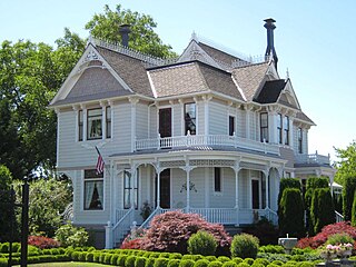
Perrydale is an unincorporated community in Polk County, Oregon, United States, approximately 10 miles from Dallas. It is part of the Salem Metropolitan Statistical Area.

Roy, Oregon is an unincorporated historic community in Washington County, Oregon, United States. It is located south of the Sunset Highway and southeast of the city of Banks.
Camas Valley is an unincorporated community in Douglas County, Oregon, United States, in the valley of the same name. It is on Oregon Route 42, near the Middle Fork Coquille River.
Tenmile is an unincorporated community in Douglas County, Oregon, United States. It is located on Oregon Route 42 southwest of Roseburg.

Blooming is an unincorporated community in Washington County, Oregon, United States near the Tualatin River, about two miles south of Cornelius. Its elevation is 190 feet. There are several plant nurseries in the area.
Salt Creek is an unincorporated historic community in Polk County, Oregon, United States on Oregon Route 22 about six miles northwest of Dallas. As an early European American settlement of the Oregon Country, the cemetery at Salt Creek has graves dating back to 1847. Salt Creek, a tributary of the South Yamhill River, was named by early settlers for the salt licks found on its banks. The Salt Creek post office, named after the creek, was established in 1852 and closed in 1903. James B. Riggs, who arrived in Oregon via the Oregon Trail and the Meek Cutoff in 1845, was the first postmaster. Riggs previously been the first postmaster of Yoncalla, followed by Jesse Applegate.

Milo is an unincorporated community in Douglas County, Oregon, United States, about 17 miles (27 km) east of Canyonville on the South Umpqua River.
Starkey is an unincorporated community in Union County, Oregon, United States, about 26 miles southwest of La Grande. It is about two miles south of Oregon Route 244 in the Blue Mountains.

Olney is an unincorporated community and former company town in Clatsop County, Oregon, United States, on Oregon Route 202 approximately eight miles south of Astoria. Olney is located at 46.100109°N 123.757637°W. Its post office is assigned ZIP code 97325.

Mountaindale is an unincorporated community in Washington County, Oregon, United States, about four miles northwest of North Plains. Settled in the 1850s, the small community was the longtime home of the Mountaindale Store. The area is part of Washington County Fire District 2.
Necanicum is an unincorporated community in Clatsop County, Oregon, United States. It is located approximately 13 miles southeast of Seaside on U.S. Route 26 in the Northern Oregon Coast Range, next to the Necanicum River. Necanicum Junction is about a mile east of the site of the former post office, at the intersection of U.S. 26 and Oregon Route 53. It is served by the Seaside post office.
Nonpareil is an unincorporated historic community in Douglas County, Oregon, United States. It is about 8 miles (13 km) east of Sutherlin, near Calapooya Creek. The population of the area was about 202 in 2000. Nonpareil was the birthplace of novelist H. L. Davis.
Carus is an unincorporated community in Clackamas County, Oregon, United States. It is located about seven miles south of Oregon City, on Oregon Route 213.
Burnt Woods is an unincorporated community in Lincoln County, Oregon, United States. It is located about 16 miles (26 km) west of Philomath on U.S. Route 20 in the Central Oregon Coast Range near the Tumtum River.
Hamlet is an unincorporated community in Clatsop County, Oregon, United States. It is located approximately six miles southeast of Necanicum, in the Northern Oregon Coast Range near the confluence of the North Fork Nehalem River and the Little North Fork Nehalem River. It is surrounded by units of the Clatsop State Forest.
Holland is an unincorporated community in Josephine County, Oregon, United States. It is about eight miles southeast of Cave Junction, in the Illinois Valley south of Oregon Route 46.
Dixie is an unincorporated historic community in Washington County, Oregon, United States. Dixie post office was established five or six miles southwest of Scappoose in 1887, with John Dix as the first postmaster. The office was named for the Dix family and not for the U.S. South. The office closed in 1924, but when real estate was being sold in the area in 1933, a name for the locality was needed for marketing reasons. When a vote was held at a community picnic circa 1936 or 1937, 80 of the attendees chose the name "Dixie" to commemorate the former post office and its postmaster.

Verboort is an unincorporated community in Washington County, Oregon, United States. It is located approximately two miles northeast of Forest Grove, one mile east of Oregon Route 47 in the Tualatin Valley. The community is part of the Forest Grove Rural Fire Protection District.

Thatcher is an unincorporated historic community in Washington County, Oregon, United States. It was located approximately three miles north of Forest Grove at the intersection of Hillside and Thatcher roads. The area is part of the Forest Grove Rural Fire Protection District.
Dryden is an unincorporated community in Josephine County, Oregon, United States. It is located in the Deer Creek Valley about five miles east of Selma. As of 1990 only one house remained; the 1920 structure formerly served as the Dryden Store and post office.


