Raleigh Hills, Oregon

Last updated

Raleigh Hills, Oregon
Raleigh Hills OR10 and OR210.JPG
Washington County Oregon Incorporated and Unincorporated areas Raleigh Hills Highlighted.svg
Location of Raleigh Hills, Oregon
Coordinates: 45°29′30″N122°45′00″W / 45.49167°N 122.75000°W / 45.49167; -122.75000
Country United States
State Oregon
County Washington
Area
[1]
  Total1.52 sq mi (3.94 km2)
  Land1.52 sq mi (3.94 km2)
  Water0.00 sq mi (0.00 km2)
Elevation
[2]
285 ft (87 m)
Population
 (2020) [3]
  Total6,196
  Density4,073.64/sq mi (1,573.07/km2)
Time zone UTC-8 (Pacific (PST))
  Summer (DST) UTC-7 (PDT)
FIPS code 41-60900 [4]
GNIS feature ID2409125 [2]

Raleigh Hills is a census-designated place and neighborhood in Washington County, Oregon within the metropolitan area of Portland, Oregon, United States. It is located in the southwest hills in Washington County, with Beaverton to the west, West Slope to the north, and Progress and Garden Home to the south. As of the 2000 census, the census-designated place had a total population of 5,865.

Contents

Raleigh Hills is located at the intersection of Oregon Routes 10 and 210. Fire protection and EMS services are provided through Tualatin Valley Fire and Rescue. Raleigh Hills is also the location of the first ever New Seasons Market.

History

Raleigh Hills was named after Raleigh Robinson, a resident of the neighborhood. [5] A post office named Raleigh was established in the area in April 1892, and was closed twelve years later. [5] Southern Pacific's Red Electric line had a stop in Raleigh from 1914 until the line ceased operations in 1929. A Raleigh Hills branch of the Portland post office was opened in 1968. [5]

Geography

According to the United States Census Bureau, the neighborhood has a total area of four km2 (1.5 sq mi), all land.

Demographics

Historical population
CensusPop.Note
2020 6,196
U.S. Decennial Census [6] [3]

As of the census [4] of 2000, there were 5865 people in the neighborhood, organized into 2586 households and 1561 families. The population density was 3,829.5 inhabitants per square mile (1,478.6/km2). There were 2,786 housing units at an average density of 1,819.1 per square mile (702.4/km2). The racial makeup of the CDP was 90.08% White, 3.10% Asian, 0.99% African American, 0.31% Native American, 0.19% Pacific Islander, 3.34% from other races, and 1.99% from two or more races. 5.75% of the population were Hispanic or Latino of any race.

There were 2,586 households, out of which 25.6% had children under the age of 18 living with them, 50.8% were married couples living together, 6.3% had a female householder with no husband present, and 39.6% were non-families. 33.4% of all households were made up of individuals, and 12.5% had someone living alone who was 65 years of age or older. The average household size was 2.26 and the average family size was 2.91.

Commercial area along Beaverton-Hillsdale Highway looking west Raleigh Hills Oregon Hwy 10.JPG
Commercial area along Beaverton-Hillsdale Highway looking west

In the neighborhood the population was spread out, with 21.5% under the age of 18, 6.5% from 18 to 24, 25.6% from 25 to 44, 28.2% from 45 to 64, and 18.2% who were 65 years of age or older. The median age was 43 years. For every 100 females, there were 95.3 males. For every 100 females age 18 and over, there were 90.4 males.

The median income for a household in the neighborhood was $60,714, and the median income for a family was $83,300. Males had a median income of $60,186 versus $34,769 for females. The per capita income for the CDP was $37,839. 7.4% of the population and 5.0% of families were below the poverty line. Out of the total population, 11.7% of those under the age of 18 and 2.0% of those 65 and older were living below the poverty line.

Related Research Articles

<span class="mw-page-title-main">Washington County, Oregon</span> County in Oregon, United States

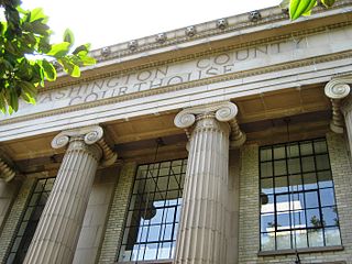
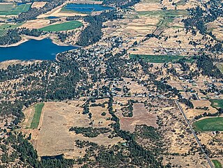
Washington County is one of 36 counties in the U.S. state of Oregon and part of the Portland metropolitan area. The 2020 census recorded the population as 600,372, making it the second most populous county in the state and most populous "Washington County" in the United States. Hillsboro is the county seat and largest city, while other major cities include Beaverton, Tigard, Cornelius, Banks, Gaston, Sherwood, North Plains, and Forest Grove, the county's oldest city. Originally named Twality when created in 1843, the Oregon Territorial Legislature renamed it for the nation's first president in 1849 and included the entire northwest corner of Oregon before new counties were created in 1854. The Tualatin River and its drainage basin lie almost entirely within the county, which shares its boundaries with the Tualatin Valley. It is bordered on the west and north by the Northern Oregon Coast Range, on the south by the Chehalem Mountains, and on the north and east by the Tualatin Mountains, or West Hills.

<span class="mw-page-title-main">Clackamas, Oregon</span> Unincorporated community in the state of Oregon, United States

Clackamas is an unincorporated community and former census-designated place (CDP) in Clackamas County, Oregon, United States, and is a suburb of Portland. The population was approximately 7,000 as of 2010.

<span class="mw-page-title-main">Oatfield, Oregon</span> Unincorporated community in the state of Oregon, United States

Oatfield is an unincorporated community and census-designated place in Clackamas County, Oregon, United States. It is in the Portland metropolitan area. As of the 2010 census, the population of the CDP was 13,415.

<span class="mw-page-title-main">Sunnyside, Clackamas County, Oregon</span> Unincorporated community in the state of Oregon, United States

Sunnyside is a former census-designated place in Clackamas County in the U.S. state of Oregon. Located in the Portland metropolitan area along Interstate 205, the population was 6,791 at the 2000 census. The area was not recorded as a distinct place for the 2010 census.

<span class="mw-page-title-main">Bunker Hill, Oregon</span> CDP in Oregon, United States

Bunker Hill is a census-designated place (CDP) in Coos County, Oregon, United States. As of the 2010 census the population was 1,444.

<span class="mw-page-title-main">Rose Lodge, Oregon</span> Unincorporated community in the state of Oregon, United States

Rose Lodge is a census-designated place (CDP) and unincorporated community in Lincoln County, Oregon, United States, along the 45th parallel. The population was 1,894 at the 2010 census.

<span class="mw-page-title-main">Mehama, Oregon</span> Unincorporated community in the state of Oregon, United States

Mehama is an unincorporated community in Marion County, Oregon, United States, located on Oregon Route 22 and the North Santiam River. For statistical purposes, the United States Census Bureau has defined Mehama as a census-designated place (CDP). The census definition of the area may not precisely correspond to local understanding of the area with the same name. The population was 317 at the 2020 census. It is part of the Salem Metropolitan Statistical Area.

<span class="mw-page-title-main">Eola, Oregon</span> Unincorporated community in the state of Oregon, United States

Eola is an unincorporated community in Polk County, Oregon, United States. It lies four miles west of Salem on Oregon Route 22 at the confluence of Rickreall Creek and the Willamette River.

<span class="mw-page-title-main">Cape Meares, Oregon</span> Unincorporated community in the state of Oregon, United States

Cape Meares is a census-designated place (CDP) and unincorporated community in Tillamook County, Oregon, United States. The population was 110 at the 2000 census.

<span class="mw-page-title-main">Cayuse, Oregon</span> Unincorporated community in the state of Oregon, United States

Cayuse is a census-designated place (CDP) and unincorporated community in Umatilla County, Oregon, United States, located 11 miles (18 km) east of Pendleton on the Umatilla Indian Reservation. The population was 59 at the 2000 census. It is part of the Pendleton–Hermiston Micropolitan Statistical Area.

<span class="mw-page-title-main">Pine Hollow, Oregon</span> Unincorporated community in the state of Oregon, United States

Pine Hollow is a census-designated place (CDP) and unincorporated community in Wasco County, Oregon, United States. It surrounds Pine Hollow Reservoir. The CDP population was 424 at the 2000 census.

<span class="mw-page-title-main">Wamic, Oregon</span> Unincorporated community in the state of Oregon, United States

Wamic is a census-designated place (CDP) and unincorporated community in Wasco County, Oregon, United States. Wamic was named for the Womack family, which settled the area. A post office was established at Wamic in 1884 and it closed in 1958. The population was 36 at the 2000 census.

<span class="mw-page-title-main">Aloha, Oregon</span> Unincorporated community in the state of Oregon, United States

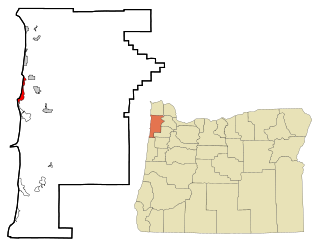
Aloha is a census-designated place and unincorporated community in Washington County, Oregon, United States. By road it is 10.9 miles (17.5 km) west of downtown Portland. As of the 2020 Census, the population was 53,828. Fire protection and EMS services are provided through Tualatin Valley Fire and Rescue and Metro West Ambulance.

<span class="mw-page-title-main">Cedar Hills, Oregon</span> Unincorporated community in the state of Oregon, United States

Cedar Hills is a census-designated place and neighborhood in Washington County, Oregon, United States south of U.S. Route 26 and west of Oregon Route 217 and within the Portland metropolitan area. Construction began in 1946.

<span class="mw-page-title-main">Garden Home–Whitford, Oregon</span> CDP in Oregon, United States

Garden Home-Whitford is a census-designated place (CDP) consisting of the neighborhoods of Garden Home and the smaller Whitford area in Washington County, Oregon, United States. They are located in the southwest hills of Portland, near Beaverton. As of the 2020 census, the CDP population was 7,081.

<span class="mw-page-title-main">Metzger, Oregon</span> Unincorporated community in the state of Oregon, United States

Metzger is a census-designated place and unincorporated community, in Washington County, Oregon, United States. As of the 2010 census, the CDP population was 3,765. It is named for Herman Metzger, who platted the community. It is a suburb located within Portland, Oregon.

<span class="mw-page-title-main">Oak Hills, Oregon</span> Unincorporated community in the state of Oregon, United States

Oak Hills is a census-designated place (CDP) and neighborhood in Washington County, Oregon, United States. The CDP population was 11,903 at the 2020 census. It is on unincorporated land north of Beaverton, west of Cedar Mill, and south/southeast of Bethany. The CDP is roughly bounded by the Sunset Highway on the south, West Union Road on the north, Northwest 174th Avenue on the west, and Northwest 143rd Avenue on the east. The U.S. Postal Service has assigned Beaverton addresses to the area. Fire protection and EMS services are provided through Tualatin Valley Fire and Rescue.

<span class="mw-page-title-main">Rockcreek, Oregon</span> Unincorporated community in the state of Oregon, United States

Rockcreek is a census-designated place in Washington County, Oregon, United States, north of U.S. Route 26. It is named for the Rock Creek neighborhood in the area. As of the 2010 census, the CDP population was 9,316. Named for Rock Creek, a tributary of the Tualatin River, that flows north to south through the neighborhood.

<span class="mw-page-title-main">West Haven-Sylvan, Oregon</span> CDP in Oregon, United States

West Haven-Sylvan is a census-designated place (CDP) in Washington and Multnomah counties, Oregon, United States, north of U.S. Route 26. As of the 2020 census, the CDP population was 9,299.

<span class="mw-page-title-main">West Slope, Oregon</span> Unincorporated community in the state of Oregon, United States

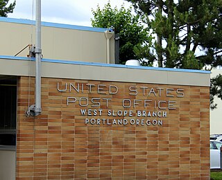
West Slope is an unincorporated suburb of Portland, Oregon, United States and a census-designated place. It is in Washington County, to the west of Portland's West Hills neighborhood, to the northwest of Raleigh Hills and south of U.S. Route 26. Fire protection and EMS services are provided through Tualatin Valley Fire and Rescue.

References

  1. "ArcGIS REST Services Directory". United States Census Bureau. Retrieved October 12, 2022.
  2. 1 2 U.S. Geological Survey Geographic Names Information System: Raleigh Hills, Oregon
  3. 1 2 "Census Population API". United States Census Bureau. Retrieved October 12, 2022.
  4. 1 2 "U.S. Census website". United States Census Bureau . Retrieved January 31, 2008.
  5. 1 2 3 McArthur, Lewis A.; McArthur, Lewis L. (2003) [1928]. Oregon Geographic Names (7th ed.). Portland, Oregon: Oregon Historical Society Press. p. 797-798. ISBN   978-0875952772.
  6. "Census of Population and Housing". Census.gov. Retrieved June 4, 2016.