Harris, Wisconsin

Last updated

Harris, Wisconsin
Harrisville, Wisconsin.jpg
WIMap-doton-Harris.png
Location of Harris, Wisconsin
Coordinates: 43°52′10″N89°25′24″W / 43.86944°N 89.42333°W / 43.86944; -89.42333
Country Flag of the United States.svg  United States
State Flag of Wisconsin.svg  Wisconsin
County Marquette
Area
  Total30.9 sq mi (80.0 km2)
  Land30.6 sq mi (79.2 km2)
  Water0.3 sq mi (0.7 km2)
Elevation
[1]
873 ft (266 m)
Population
 (2000)
  Total729
  Density23.8/sq mi (9.2/km2)
Time zone UTC-6 (Central (CST))
  Summer (DST) UTC-5 (CDT)
FIPS code 55-32775 [2]
GNIS feature ID1583353 [1]

Harris is a town located in Marquette County, Wisconsin. According to the 2000 census, the town had a total population of 729. The unincorporated community of Harrisville is located in the town. Both the community and the town were named for James Harris, who became the first postmaster when the community's post office opened in March 1851. [3] The village of Westfield is adjacent to the town.

Contents

Geography

According to the United States Census Bureau, the town has a total area of 30.9 square miles (80.0 km2) of which 30.6 square miles (79.2 km2) is land and 0.3 square miles (0.8 km2) is water. The total area is 0.94% water.

Demographics

At the 2000 census, [2] there were 729 people, 294 households, and 211 families residing in the town. The population density was 23.8 per square mile (9.2/km2). There were 359 housing units at an average density of 11.7 per square mile (4.5/km2). The racial makeup of the town was 98.08% White, 0.27% African American, 0.14% Native American, 0.14% Asian, 0.41% Pacific Islander, 0.27% from other races, and 0.69% from two or more races. 1.78% of the population were Hispanic or Latino of any race.

There were 294 households, of which 28.2% had children under the age of 18 living with them, 63.9% were married couples living together, 5.4% had a female householder with no husband present, and 28.2% were non-families. 22.1% of all households were made up of individuals, and 10.2% had someone living alone who was 65 years of age or older. The average household size was 2.48 and the average family size was 2.89.

22.6% of the population were under the age of 18, 7.1% from 18 to 24, 22.6% from 25 to 44, 29.2% from 45 to 64, and 18.4% who were 65 years of age or older. The median age was 43 years. For every 100 females, there were 101.4 males. For every 100 females age 18 and over, there were 101.4 males.

The median household income was $37,344, and the median family income was $43,250. Males had a median income of $30,074 versus $25,313 for females. The per capita income for the town was $18,686. 4.4% of the population and 2.9% of families were below the poverty line. Out of the total population, 1.8% of those under the age of 18 and 7.2% of those 65 and older were living below the poverty line.

Notable people

Related Research Articles

<span class="mw-page-title-main">Columbia, Connecticut</span> Town in Connecticut, United States

Columbia is a town in the Capitol Planning Region, Connecticut, United States. The population was 5,272 at the 2020 census. Originally a part of Lebanon, known as the North Society or Lebanon's Crank, Columbia was incorporated in May 1804. The town was named for patriotic reasons after the national symbol "Columbia". Columbia offers pre-kindergarten through 8th grade education in town at Horace W. Porter School, while high school students have a choice of attending four nearby high schools; E. O. Smith High School, Bolton High School (Connecticut), Coventry High School, and Windham Technical High School, part of the Connecticut Technical High School System).

Ripley is a town in Somerset County, Maine, United States. The community was named after Brigadier General Eleazer Wheelock Ripley of the War of 1812. The population was 484 at the 2020 census.

Scio is a town in Allegany County, New York, United States. The population was 1,625 at the 2020 census. The town is in the southern half of the county and north of the village of Wellsville.

<span class="mw-page-title-main">Litchfield, New York</span> Town in New York, United States

Litchfield is a town in Herkimer County, New York, United States. The population was 1,513 at the 2010 census. The town is named after Litchfield, Connecticut, the source of some early settlers of the city.

<span class="mw-page-title-main">Dillonvale, Jefferson County, Ohio</span> Village in Ohio, United States

Dillonvale is a village in southern Jefferson County, Ohio, United States. The population was 589 at the 2020 census. It is part of the Weirton–Steubenville metropolitan area. Charles Eberle was the first mayor of Dillonvale and was the first Postmaster as well.

<span class="mw-page-title-main">North Hills, West Virginia</span> Town in West Virginia, United States

North Hills is a town in Wood County, West Virginia, United States. It is a suburb of Parkersburg. The population was 837 at the 2020 census. North Hills was incorporated on February 15, 1979.

<span class="mw-page-title-main">Sigel, Chippewa County, Wisconsin</span> Town in Wisconsin, United States

Sigel is a town in Chippewa County in the U.S. state of Wisconsin. The population was 1,044 at the 2010 census, up from 825 at the 2000 census.

<span class="mw-page-title-main">Lowville, Wisconsin</span> Town in Wisconsin, United States

Lowville is a town in Columbia County, Wisconsin, United States. The population was 987 at the 2000 census.

<span class="mw-page-title-main">Gardner, Wisconsin</span> Town in Wisconsin, United States

Gardner is a town in Door County, Wisconsin, United States. The population was 1,197 at the 2000 census. The unincorporated community of Little Sturgeon is located in the town.

<span class="mw-page-title-main">Amnicon, Wisconsin</span> Town in Wisconsin, United States

Amnicon is a town in Douglas County, Wisconsin, United States. The population was 1,155 at the 2010 census. The unincorporated communities of Amnicon Falls, Middle River, Rockmont and Wentworth are located in the town.

<span class="mw-page-title-main">Drammen, Wisconsin</span> Town in Wisconsin, United States

Drammen is a town in Eau Claire County, Wisconsin, United States. The population was 800 at the 2000 census. The ghost towns of Nelsonville and Oak Grove were located in the town.

<span class="mw-page-title-main">Bergen, Marathon County, Wisconsin</span> Town in Wisconsin, United States

Bergen is a town in Marathon County, Wisconsin, United States. It is part of the Wausau, Wisconsin Metropolitan Statistical Area. The population was 740 at the 2020 census. The unincorporated community of Moon is located partially in the town.

<span class="mw-page-title-main">Day, Wisconsin</span> Town in Wisconsin, United States

Day is a town in southwest Marathon County, Wisconsin, United States. It is part of the Wausau, Wisconsin Metropolitan Statistical Area. The population was 1,085 at the 2010 census. The unincorporated community of Rozellville is located in the town. The unincorporated community of Rangeline is also located partially in the town.

<span class="mw-page-title-main">Sugar Camp, Wisconsin</span> Town in Wisconsin, United States

Sugar Camp is a town in Oneida County, Wisconsin, United States. The population was 1,694 at the 2010 census. The unincorporated community of Sugar Camp is located in the town

<span class="mw-page-title-main">Mukwonago (town), Wisconsin</span> Town in Wisconsin, United States

Mukwonago is a town in Waukesha County, Wisconsin, United States. The population was 7,781 at the 2020 census. The Village of Mukwonago is located mostly within the town. The unincorporated community of Jericho is also located in the town.

<span class="mw-page-title-main">Adams, Wisconsin</span> City in Wisconsin, United States

Adams is a city in Adams County in the U.S. state of Wisconsin. The population was 1,761 at the 2020 census. The city is located within the Town of Adams.

<span class="mw-page-title-main">Wrightstown, Wisconsin</span> Village in Wisconsin, United States

Wrightstown is a village in Brown and Outagamie counties in the U.S. state of Wisconsin. The population was 2,827 at the 2010 census. Of this, 2,676 were in Brown County, and 151 were in Outagamie County. The village is surrounded mostly by the westernmost part of the Town of Wrightstown in Brown County. On February 28, 2002, the village annexed a portion of land within the adjacent Town of Kaukauna in Outagamie County.

<span class="mw-page-title-main">Colfax, Wisconsin</span> Village in Wisconsin, United States

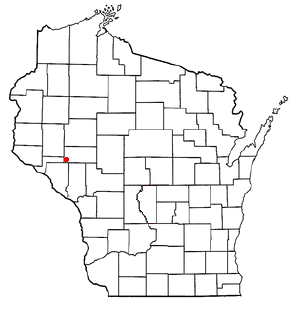
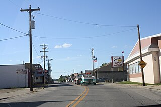
Colfax is a village in Dunn County, Wisconsin, United States. The population was 1,158 at the 2010 census. The village is surrounded by the Town of Colfax.

<span class="mw-page-title-main">Wausaukee, Wisconsin</span> Village in Wisconsin, United States

Wausaukee is a village in Marinette County, Wisconsin, in the United States. The population was 596 at the 2020 census. The village is part of the Marinette, WI–MI Micropolitan Statistical Area.

<span class="mw-page-title-main">Ironton, Wisconsin</span> Village in Wisconsin, United States

Ironton is a village in Sauk County, Wisconsin, United States, along the Little Baraboo River. The population was 253 at the 2010 census. The village is located within the Town of Ironton.

References

  1. 1 2 "US Board on Geographic Names". United States Geological Survey. October 25, 2007. Retrieved January 31, 2008.
  2. 1 2 "U.S. Census website". United States Census Bureau . Retrieved January 31, 2008.
  3. Callary, Edward. Place Names of Wisconsin. Madison, WI: University of Wisconsin Press. p. 115. ISBN   978-0-299-30964-0.
  4. 'Wisconsin Blue Book 1946,' Biographical Sketch of Jerome H. Wheelock, pg. 67