Packwaukee, Wisconsin

Last updated

Packwaukee, Wisconsin
WIMap-doton-Packwaukee.png
Location of Packwaukee, Wisconsin
Coordinates: 43°46′17″N89°25′54″W / 43.77139°N 89.43167°W / 43.77139; -89.43167
Country Flag of the United States.svg  United States
State Flag of Wisconsin.svg  Wisconsin
County Marquette
Area
  Total40.9 sq mi (106.0 km2)
  Land38.1 sq mi (98.7 km2)
  Water2.8 sq mi (7.3 km2)
Elevation
[1]
791 ft (241 m)
Population
 (2000)
  Total2,574
  Density67.5/sq mi (26.1/km2)
Time zone UTC-6 (Central (CST))
  Summer (DST) UTC-5 (CDT)
Area code 608
FIPS code 55-60962 [2]
GNIS feature ID1583888 [1]
Website http://www.townofpackwaukee.org
Welcome sign PackwaukeeWisconsinSign.jpg
Welcome sign

Packwaukee is a town in Marquette County, Wisconsin, United States. The population was 2,574 at the 2000 census. The unincorporated communities of Buffalo Shore Estates and Packwaukee are located in the town.

Contents

Packwaukee was named in honor of Winnebego Chief Packwaukee and was plotted in 1850 and a post office established. [3] The name Packwaukee comes from the Ojibwa meaning "shallow land" or the Potawatomi meaning "it is shallow." Pioneer missionary priest Father Verwyst claimed the name came from the Ojibwa word for "forest opening." [4] In the Menominee language, it is called Paehkuahkiw which means "small round elevation, hillock". [5]

Geography

According to the United States Census Bureau, the town has a total area of 40.9 square miles (106.0 km2), of which, 38.1 square miles (98.7 km2) of it is land and 2.8 square miles (7.3 km2) of it (6.91%) is water.

Demographics

As of the census [2] of 2000, there were 2,574 people, 563 households, and 377 families residing in the town. The population density was 67.5 people per square mile (26.1/km2). There were 932 housing units at an average density of 24.5 per square mile (9.4/km2). The racial makeup of the town was 72.80% White, 19.46% African American, 4.47% Native American, 0.27% Asian, 0.04% Pacific Islander, 0.08% from other races, and 2.87% from two or more races. Hispanic or Latino of any race were 8.55% of the population.

There were 563 households, out of which 20.4% had children under the age of 18 living with them, 56.8% were married couples living together, 5.7% had a female householder with no husband present, and 32.9% were non-families. 27.2% of all households were made up of individuals, and 11.9% had someone living alone who was 65 years of age or older. The average household size was 2.28 and the average family size was 2.76.

In the town, the population was spread out, with 9.8% under the age of 18, 8.6% from 18 to 24, 45.5% from 25 to 44, 23.5% from 45 to 64, and 12.7% who were 65 years of age or older. The median age was 39 years. For every 100 females, there were 304.7 males. For every 100 females age 18 and over, there were 354.6 males.

The median income for a household in the town was $31,823, and the median income for a family was $38,233. Males had a median income of $28,333 versus $22,813 for females. The per capita income for the town was $14,481. About 4.7% of families and 5.1% of the population were below the poverty line, including 6.0% of those under age 18 and 5.5% of those age 65 or over.

History

Packwaukee was settled in 1849 by E. Pettengill, E. T. Older, C. G. Barker, Jesse Older, William Ewen, David Phelps, S. A. Pease, John Chapman, E. King, and Samuel Wayman. [6]

A railroad line was constructed in 1881 to connect the Montello Granite Co. quarry to Packwaukee and the Wisconsin Central Railroad. [6] In 1884, a depot was moved to Packwaukee. It was 20' by 40' and had a waiting room, agent room, and small baggage room. It burned to the ground at 3 am on January 11, 1907. [7]

Related Research Articles

<span class="mw-page-title-main">Ashippun, Wisconsin</span> Town in Wisconsin, United States

Ashippun is a town in Dodge County, Wisconsin, United States. The unincorporated communities of Alderley, Ashippun, and Old Ashippun are located in the town. The population was 2,308 at the 2000 census.

Aurora is a town in Florence County, Wisconsin, United States. The population was 1,186 at the 2000 census. Aurora lies on the Michigan-Wisconsin border, across the Menominee River from Kingsford, Michigan.

<span class="mw-page-title-main">Meeme, Wisconsin</span> Town in Wisconsin, United States

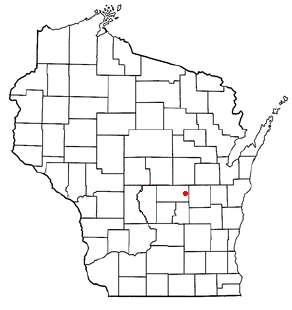
Meeme is a town in Manitowoc County, Wisconsin, United States. The population was 1,538 at the 2000 census. Its Menominee name is Omīnīw which means "pigeon". The Menominee sold this land to the United States in the 1831 Treaty of Washington.

<span class="mw-page-title-main">Marathon, Wisconsin</span> Town in Wisconsin, United States

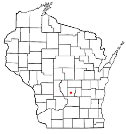
Marathon is a town in Marathon County, Wisconsin, United States. It is part of the Wausau, Wisconsin Metropolitan Statistical Area. The population was 1,048 at the 2010 census. The village of Marathon City was incorporated from a part of the town's original area.

<span class="mw-page-title-main">Porterfield, Wisconsin</span> Town in Wisconsin, United States

Porterfield is a town in Marinette County, Wisconsin, United States. The population was 1,991 at the 2000 census. The unincorporated communities of Bagley Junction, Miles, Porterfield, Rubys Corner, and Walsh are located in the town.

<span class="mw-page-title-main">Keshena, Wisconsin</span> CDP in Wisconsin, United States

Keshena is a census-designated place (CDP) in and the county seat of Menominee County, Wisconsin, United States. Located on the Menominee Indian Reservation, it had a population of 1,257 at the 2020 census. Keshena was named for an Indian chief; the Menominee name is Kesīqnaeh which means "Swift Flying".

<span class="mw-page-title-main">How, Wisconsin</span> Town in Wisconsin, United States

How is a town in Oconto County, Wisconsin, United States. The population was 563 at the 2000 census. The unincorporated community of Hayes is located in the town. The town is named for Calvin F. How, Jr., an insurance and banking executive.

<span class="mw-page-title-main">Pensaukee, Wisconsin</span> Town in Wisconsin, United States

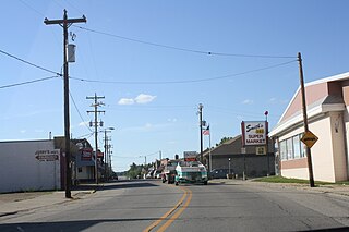
Pensaukee is a town in Oconto County, Wisconsin, United States, on the coast of Green Bay. The population was 1,214 at the 2000 census.

<span class="mw-page-title-main">Stiles, Wisconsin</span> Town in Wisconsin, United States

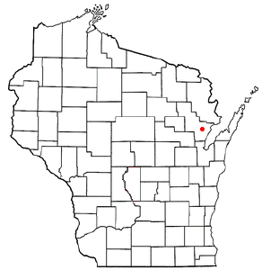
Stiles is a town in Oconto County, Wisconsin, United States. The population was 1,465 at the 2000 census. The unincorporated communities of Stiles and Stiles Junction are located in the town. Situated within ancestral Menominee territory that was ceded to the United States in the 1836 Treaty of the Cedars, its Menominee name is Pæhkuahkiw which means "pointed hillock".

<span class="mw-page-title-main">Underhill, Wisconsin</span> Town in Wisconsin, United States

Underhill is a town in Oconto County, Wisconsin, United States. The population was 846 at the 2000 census.

<span class="mw-page-title-main">Waukechon, Wisconsin</span> Town in Wisconsin, United States

Waukechon is a town in Shawano County, Wisconsin, United States. The population was 928 at the 2000 census. The unincorporated community of Lunds is located in the town. Its Menominee name is Wākecānāpāēw, meaning "crooked beak man", a reference to the Thunderbird Clan of the Ho-Chunk.

<span class="mw-page-title-main">Chain O' Lakes-King, Wisconsin</span> Former CDP in Wisconsin, United States

Chain O' Lakes-King is a former census-designated place (CDP) in Waupaca County, Wisconsin, United States. The population was 2,215 at the 2000 census. It is located within the towns of Farmington and Dayton. For the 2010 census, Chain O' Lakes-King was split into the CDPs of Chain O' Lakes and King.

<span class="mw-page-title-main">Poy Sippi, Wisconsin</span> Town in Wisconsin, United States

Poy Sippi is a town in Waushara County, Wisconsin, United States. The population was 972 at the 2000 census. The census-designated place of Poy Sippi is located in the town. The unincorporated communities of Borth and Fountain Valley are also located in the town.

<span class="mw-page-title-main">Middle Village, Wisconsin</span> CDP in Wisconsin, United States

Middle Village is a census-designated place (CDP), in the towns of Menominee and Red Springs, in Menominee and Shawano counties in the U.S. state of Wisconsin. It does not have any legal status as an incorporated municipality. The population was 290 at the 2020 census.

<span class="mw-page-title-main">Mosinee, Wisconsin</span> City in Wisconsin, United States

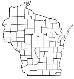
Mosinee is a city in Marathon County, Wisconsin. It is part of the Wausau, Wisconsin Metropolitan Statistical Area. The population was 4,452 at the time of the 2020 census.

<span class="mw-page-title-main">Wausaukee, Wisconsin</span> Village in Wisconsin, United States

Wausaukee is a village in Marinette County, Wisconsin, in the United States. The population was 596 at the 2020 census. The village is part of the Marinette, WI–MI Micropolitan Statistical Area.

<span class="mw-page-title-main">Oconto, Wisconsin</span> City in Wisconsin, United States

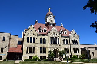
Oconto is a city and county seat of Oconto County, Wisconsin, United States. The population was 4,609 at the 2020 census. It is part of the Green Bay Metropolitan Statistical Area. The city is located partially within the town of Oconto.

Luck is a town in Polk County, Wisconsin, United States. The population was 881 at the 2000 census. The village of Luck is located within the town. The unincorporated community of West Denmark is located in the town. The unincorporated community of Pole Cat Crossing is also located partially in the town.

<span class="mw-page-title-main">Pewaukee (village), Wisconsin</span> Village in Wisconsin, United States

Pewaukee is a village in Waukesha County, Wisconsin, United States. The population was 8,238 at the 2020 census. The village is nearly surrounded by the City of Pewaukee. The village was incorporated from what was formerly the Town of Pewaukee, and the remainder of the town later incorporated as a city.

<span class="mw-page-title-main">Waupaca, Wisconsin</span> City in Wisconsin, United States

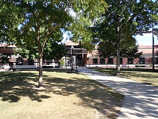
Waupaca is a city in and the county seat of Waupaca County in the U.S. state of Wisconsin. The population was 6,282 at the 2020 census.

References

  1. 1 2 "US Board on Geographic Names". United States Geological Survey. October 25, 2007. Retrieved January 31, 2008.
  2. 1 2 "U.S. Census website". United States Census Bureau . Retrieved January 31, 2008.
  3. Gard, Robert E. (September 9, 2015). The Romance of Wisconsin Place Names. Wisconsin Historical Society. ISBN   9780870207082.
  4. Vogel, Virgil J. (1991). Indian Names on Wisconsin's Map. Univ of Wisconsin Press. ISBN   9780299129842.
  5. Hoffman, Mike. "Menominee Place Names in Wisconsin". The Menominee Clans Story. Retrieved October 6, 2018.
  6. 1 2 History of Northern Wisconsin: Containing an Account of Its Settlement, Growth, Development, and Resources; an Extensive Sketch of Its Counties, Cities, Towns and Villages, Their Improvements, Industries, Manufactories; Biographical Sketches, Portraits of Prominent Men and Early Settlers; Views of County Seats, Etc. ... Western historical Company. 1881.
  7. Reimer, Thomas E. (2004). The Luecks: Posen to Princeton. T.E. Reimer.

43°45′48″N89°27′30″W / 43.76333°N 89.45833°W / 43.76333; -89.45833