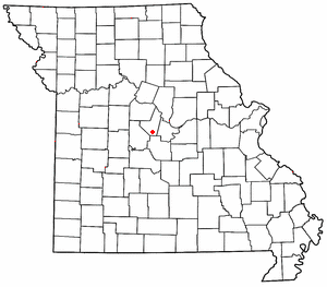
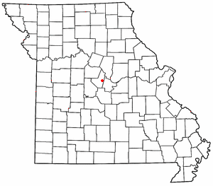
High Point is an unincorporated community in southern Moniteau County, Missouri, United States. [1] It is located ten miles south of California, approximately one mile west of Route 87 on Missouri Route C. [2]
High Point is an unincorporated community in southern Moniteau County, Missouri, United States. [1] It is located ten miles south of California, approximately one mile west of Route 87 on Missouri Route C. [2]
The first settlement at High Point was made in the 1830s. [3] A post office called High Point was established in 1852, and remained in operation until 1973. [4] The community was so named on account of its lofty elevation. [5]
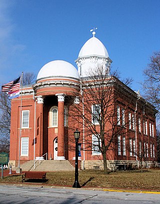
The High Point Historic District was listed on the National Register of Historic Places in 2005. [6]

Morgan County is a county located in the central portion of the U.S. state of Missouri. As of the 2020 census, the population was 21,006. Its county seat is Versailles. The county was organized January 5, 1833 and named for General Daniel Morgan of the American Revolutionary War.
Moniteau County is a county located in the U.S. state of Missouri. As of the 2020 United States census, the population was 15,473. Its county seat is California. The county was organized February 14, 1845 and named for the Moniteau Creek. 'Moniteau' is a French spelling of Manitou, Algonquian for the Great Spirit.

Miller County is a county located in the U.S. state of Missouri. As of the 2020 United States census, the population was 24,722. Its county seat is Tuscumbia. The county was organized February 6, 1837 and named for John Miller, former U.S. Representative and Governor of Missouri.

Cooper County is located in the central portion of the U.S. state of Missouri. As of the 2020 United States census, the population was 17,103. Its county seat is Boonville. The county was organized December 17, 1818 and named for Sarshell Cooper, a frontier settler who was killed by Native Americans near Arrow Rock in 1814. It is a part of the Columbia, Missouri metropolitan area.
Boone County is located in the U.S. state of Missouri. Centrally located in Mid-Missouri, its county seat is Columbia, Missouri's fourth-largest city and location of the University of Missouri. As of the 2020 census, the population was 183,610, making it the state's eighth-most populous county. The county was organized November 16, 1820 and named for the then recently deceased Daniel Boone, whose kin largely populated the Boonslick area, having arrived in the 1810s on the Boone's Lick Road. Boone County comprises the Columbia Metropolitan Area. The towns of Ashland and Centralia are the second and third most populous towns in the county.

California is a city in and the county seat of Moniteau County, Missouri, United States. The 2010 census has the population at 4,278. California is the third largest city in the Jefferson City, Missouri Metropolitan Statistical Area, as well as the largest city in Moniteau County.

Jamestown is a village in northeastern Moniteau County, Missouri, United States. The population was 386 at the 2010 census. It is part of the Jefferson City, Missouri Metropolitan Statistical Area.
McGirk is an unincorporated community in eastern Moniteau County, Missouri, United States. It is located approximately five miles east of California on old U.S. Route 50.

Clark Fork Township is one of fourteen townships in Cooper County, Missouri, USA. As of the 2000 census, its population was 598.

Kelly Township is one of fourteen townships in Cooper County, Missouri, USA. As of the 2000 census, its population was 676.

Saline Township is one of fourteen townships in Cooper County, Missouri, USA. As of the 2000 census, its population was 687.
Marion is an unincorporated community in Cole County, Missouri, United States. Marion is in the northwest corner of the county, in historic Marion Township, and very near the post-1845 county boundary line with Moniteau County. The community is located on Missouri Route 179 and overlooks the Missouri River to the east.
Wilton is an unincorporated community in southwest Boone County, in the U.S. state of Missouri. The community is on the northeast bank of the Missouri River across from the Marion Bottoms Conservation Area. Ashland lies approximately six miles to the northeast on Missouri Route M and Sandy Hook lies across the Missouri three miles to the west in Moniteau County. The lone business in Wilton is the Riverview Store, which serves the local community and users on the Katy Trail.
Moniteau Creek is a stream in Cooper, Moniteau and Cole counties in central Missouri. It is a tributary of the Missouri River. The stream headwaters are in western Moniteau County just west of Tipton. The stream flows north into Cooper County then turns east and flows through the southeastern part of the county and re-enters Moniteau County. The stream continues meandering east passing under Missouri Route 87 south of Jamestown and enters the Missouri River floodplain in the Marion Bottoms Conservation Area between Sandy Hook to the north and Marion to the south. The confluence with the Missouri River floodplain lies in the northern tip of Cole County.
Petite Saline Creek is a stream in Cooper, Moniteau and Morgan counties in the U.S. state of Missouri. It is a tributary of the Missouri River.
Burris Fork is a stream in Moniteau and Morgan counties in the U.S. state of Missouri. It is a tributary of North Moreau Creek.
Kliever is an unincorporated community in eastern Moniteau County, in the U.S. state of Missouri. The primary road which passes through Kliever is Missouri Route 87. The community is about five miles northeast of California and five miles south of Jamestown.
Sandy Hook is an unincorporated community in Moniteau County, in the U.S. state of Missouri. The community is on the southwest bank of the Missouri River floodplain. It lies on Missouri Route 179 between Jamestown to the northwest and Marion to the southeast in Cole County.
Linn Township is an inactive township in Moniteau County, in the U.S. state of Missouri.
High Point Historic District is a national historic district located at High Point, Moniteau County, Missouri. The district encompasses seven contributing buildings in the central business district of High Point. It developed between about 1874 and 1954, and includes representative examples of commercial architecture. Contributing buildings include the J. F. Tising & Sons Store, East Tisinq Store Building / IOOF Meeting Hall, Post Office, McGill Cafe / Residence, and two frame and one brick privy.
Municipalities and communities of Moniteau County, Missouri, United States | ||
|---|---|---|
| Cities |  | |
| Village | ||
| Townships | ||
| CDPs | ||
| Other communities | ||
38°29′04″N92°35′27″W / 38.48444°N 92.59083°W
| | This Moniteau County, Missouri state location article is a stub. You can help Wikipedia by expanding it. |