Hornbeck, Louisiana

Last updated

Hornbeck, Louisiana
Town
Motto: 
"Gateway to Toledo Bend" [1]
Vernon Parish Louisiana Incorporated and Unincorporated areas Hornbeck Highlighted.svg
Location of Hornbeck in Vernon Parish, Louisiana.
Louisiana in United States (US48).svg
Location of Louisiana in the United States
Coordinates: 31°19′33″N93°23′45″W / 31.32583°N 93.39583°W / 31.32583; -93.39583
CountryUnited States
StateLouisiana
Parish Vernon
FoundedOctober 21, 1902
Government
  TypeMayor-Council
Area
[2]
  Total1.16 sq mi (2.99 km2)
  Land1.15 sq mi (2.98 km2)
  Water0.01 sq mi (0.01 km2)
Elevation
325 ft (99 m)
Population
 (2020)
  Total430
  Density373.59/sq mi (144.25/km2)
Time zone UTC-6 (CST)
  Summer (DST) UTC-5 (CDT)
Area code 318
FIPS code 22-36045
Website Town of Hornbeck, Louisiana

Hornbeck is a town in Vernon Parish, Louisiana, United States. The population was 480 at the 2010 census, up from 435 in 2000. It is part of the Fort Johnson South Micropolitan Statistical Area.

Contents

History

As early as the 1830s people settled in the area now known as Hornbeck, but a town didn’t begin to form until 1897, when an agent for the Arkansas Town Site Company named F.A. Hornbeck purchased land along the Kansas City Southern Railroad (KCS) for $8,640. Structures necessary for servicing locomotives were constructed as well as a brick kiln to supply bricks for construction. [3]

In 1897, the first Post Office opened in the area with Walter Carey as the first postmaster and later that same year he was succeeded by D.B. Pate. [3]

The first public school in Hornbeck opened in 1898, with Miss Fannie Monk and W.L. Ford serving as the primary and grammar school teachers. The first secondary school opened in 1907 with G.S. Graybeal serving as its principal, then in 1910 the school became an affiliated high school. [3]

On October 21, 1902, Governor William Wright Heard issued a proclamation declaring that Section 16, Township 4, North Range 10 West was incorporated as Hornbeck; with W.M. Conerly appointed mayor and G.G. Leach, W.L. Maddox and John Carter appointed aldermen; W. Johnson became the town marshal. [3]

Kansas City Southern Railroad established a presence in Hornbeck with the construction of the roundhouse, which allowed for the servicing of engines. The presence of the roundhouse contributed to making Hornbeck a significant junction between Port Arthur, Texas and Shreveport as well as providing an abundance of jobs and influencing the town’s growth. The early twentieth century was a prosperous time for Hornbeck with both the timber and railroad industries having an established presence in the area. Hornbeck became a bustling little town, with a bank, a newspaper, five hotels, five saloons and ten retail stores. [3]

The New Town Hall in Hornbeck, LA in June, 2011. Hornbeck Town Hall.JPG
The New Town Hall in Hornbeck, LA in June, 2011.

In 1912, KCS decided to move the roundhouse to Leesville; this decision was disastrous for Hornbeck’s economy, with the town surviving on the timber, turpentine and farming industries for nearly two more decades. However, when the Great Depression hit in late 1929 it caused the timber and turpentine industries to collapse and brought an abrupt end to Hornbeck’s prosperity. [3]

In the 1940s the Department of War established Camp Polk and conducted what became known as the “Louisiana Maneuvers.” The location of Camp Polk in Vernon Parish helped to stimulate Hornbeck’s economy as well as that of the entire region, especially Vernon Parish. [3]

In the 1960s, with the construction of Toledo Bend Reservoir on the Sabine River, Hornbeck gained an asset and started promoting itself as the “Gateway” to Toledo Bend. [3]

Today, Hornbeck has maintained modest growth, with its elected officials taking a pro-active approach to economic development. On October 21, 2002, Hornbeck celebrated its 100th anniversary. [3]

Geography

Hornbeck is located at 31°19′33″N93°23′45″W / 31.32583°N 93.39583°W / 31.32583; -93.39583 (31.325937, -93.395945). [4]

According to the United States Census Bureau, the town has a total area of 1.2 square miles (3.1 km2), all land.

Notable people

Demographics

Historical population
CensusPop.Note
1910 459
1920 350−23.7%
1930 49140.3%
1940 481−2.0%
1950 5248.9%
1960 374−28.6%
1970 52540.4%
1980 470−10.5%
1990 427−9.1%
2000 4351.9%
2010 48010.3%
2020 430−10.4%
U.S. Decennial Census [8]

As of the census [9] of 2000, there were 435 people, 181 households, and 121 families residing in the town. The population density was 372.9 inhabitants per square mile (144.0/km2). There were 227 housing units at an average density of 194.6 per square mile (75.1/km2). The racial makeup of the town was 94.02% White, 2.30% African American, 2.07% Native American, 0.23% Pacific Islander, 0.23% from other races, and 1.15% from two or more races. Hispanic or Latino of any race were 0.69% of the population. [10]

There were 181 households, out of which 28.7% had children under the age of 18 living with them, 54.7% were married couples living together, 10.5% had a female householder with no husband present, and 32.6% were non-families. 31.5% of all households were made up of individuals, and 15.5% had someone living alone who was 65 years of age or older. The average household size was 2.40 and the average family size was 3.03.

In the town, the population was spread out, with 25.1% under the age of 18, 10.6% from 18 to 24, 27.4% from 25 to 44, 21.6% from 45 to 64, and 15.4% who were 65 years of age or older. The median age was 36 years. For every 100 females, there were 80.5 males. For every 100 females age 18 and over, there were 82.1 males.

The median income for a household in the town was $25,446, and the median income for a family was $33,036. Males had a median income of $27,750 versus $17,000 for females. The per capita income for the town was $11,237. About 13.2% of families and 14.3% of the population were below the poverty line, including 10.7% of those under age 18 and 29.9% of those age 65 or over.

Government

Founded in 1897 and incorporated in 1902, Hornbeck is the northernmost community in Vernon Parish. The first town government was appointed by Governor William Wright Heard in 1902 and consisted of a Mayor, 3 Aldermen and a Town Marshal. Today Hornbeck's government (mayor-council system) consists of a Mayor, four councilmen and one councilwoman and a Chief of Police. [11]

Under the mayor-council government, the mayor serves as the executive officer of the town. As the town's chief administrator and official representative, the mayor is responsible for the general management of the town and for seeing that all laws and ordinances are enforced via the Chief of Police. [11]

Education

Hornbeck is a part of the Vernon Parish School District headquartered in Leesville and has been home to Hornbeck High School, the only public school in the community, since 1898. In 1910, Hornbeck High School became an affiliated high school, although on the school's crest it bears the date 1913. [12]

Related Research Articles

<span class="mw-page-title-main">Vernon Parish, Louisiana</span> Parish in Louisiana, United States

Vernon Parish is a parish located in the U.S. state of Louisiana. As of the 2020 census, the population was 48,750. The parish seat is Leesville. Bordered on the west by the Sabine River, the parish was founded in 1871 during the Reconstruction era.

<span class="mw-page-title-main">London, Arkansas</span> City in Arkansas, United States

London is a city in Pope County, Arkansas, United States. The population was 1,039 at the 2010 census. It is part of the Russellville Micropolitan Statistical Area.

<span class="mw-page-title-main">Mount Lebanon, Louisiana</span> Town in Louisiana, United States

Mount Lebanon is a town in Bienville Parish, Louisiana, United States. The population was 83 at the 2010 census.

<span class="mw-page-title-main">Ringgold, Louisiana</span> Town in Louisiana, United States

Ringgold is a town in the U.S. state of Louisiana, in the western half of Bienville Parish. The town of Ringgold is named for United States Army Major Samuel Ringgold. The population of Ringgold was 1,495 at the 2010 census, and 1,370 at the U.S. Census Bureau's 2019 estimates, down from 1,601 in 2018. The 2020 U.S. census estimates program recorded a population of 1,336, though the census established a population of 1,379. It is the second largest incorporated municipality in Bienville Parish by population.

<span class="mw-page-title-main">Blanchard, Louisiana</span> Town in Louisiana, United States

Blanchard is the suburban town in, and the second-largest municipality by population of Caddo Parish in the U.S. state of Louisiana. With a population of 3,538 at the 2020 U.S. census, it is part of the Shreveport–Bossier City metropolitan statistical area.

<span class="mw-page-title-main">Greenwood, Louisiana</span> Suburban town in Caddo, Louisiana, United States

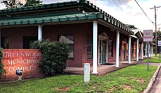
Greenwood is a suburban town in southern Caddo Parish, which is located in the northwest corner of the U.S. state of Louisiana. With a population of 3,166 at the 2020 United States census, it is the third most populous incorporated municipality in Caddo Parish after Shreveport and Blanchard. Part of the Shreveport-Bossier City metropolitan statistical area, it is located 15 miles west of downtown Shreveport.

<span class="mw-page-title-main">Mooringsport, Louisiana</span> Town in Louisiana, United States

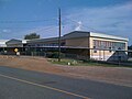
Mooringsport is an incorporated municipality in the U.S. state of Louisiana, located in Caddo Parish. Part of the Shreveport–Bossier City metropolitan area and located approximately 18 miles (29 km) outside of the principal city of Shreveport, the town of Mooringsport had a population of 748 at the 2020 U.S. census.

<span class="mw-page-title-main">Oil City, Louisiana</span> Town in Louisiana, United States

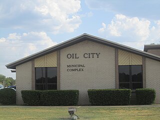
Oil City is a town in Caddo Parish, Louisiana. The population was 1,008 at the time of the 2010 census. Oil City is located on Louisiana Highway 1, north of Caddo Lake. It is part of the Shreveport–Bossier City Metropolitan Statistical Area.

<span class="mw-page-title-main">Campti, Louisiana</span> Town in Louisiana, United States

Campti is a town in the northern part of Natchitoches Parish, Louisiana, United States. The population was 1,056 at the 2010 census. It is part of the Natchitoches Micropolitan Statistical Area. Campti is a flat area of mostly farmland. It is located on the eastern bank of the Red River. Considerable herds of cattle are also raised in the general area.

<span class="mw-page-title-main">Mangham, Louisiana</span> Village in Louisiana, United States

Mangham is a village in Richland Parish in northeastern Louisiana, United States. The population was 672 at the 2010 census. Mangham was established in 1890. It is named for Wiley P. Mangham, the publisher of the Richland Beacon-News, a weekly newspaper in Rayville, the seat of Richland Parish.

<span class="mw-page-title-main">Many, Louisiana</span> Town in Louisiana, United States

Many is a town in, and the parish seat of Sabine Parish in western Louisiana, United States. The population was 2,853 at the 2010 census, a decrease of 36 or 1.246 percent from 2000.

<span class="mw-page-title-main">Zwolle, Louisiana</span> Town in Louisiana, United States

Zwolle is a small town in Sabine Parish, Louisiana, United States. The population was 1,759 at the 2010 census, down from 1,783 in 2000. It was named after Zwolle, a Dutch city in Overijssel.

<span class="mw-page-title-main">Berwick, Louisiana</span> Town in Louisiana, United States

Berwick is a town in St. Mary Parish, Louisiana, United States. The population was 4,946 at the 2010 census. It is part of the Morgan City Micropolitan Statistical Area.

<span class="mw-page-title-main">Leesville, Louisiana</span> City in Louisiana, United States

Leesville is a city in, and the parish seat of, Vernon Parish, Louisiana, United States. The population was 5,649 at the 2020 census. It is part of the Fort Johnson South micropolitan area and is additionally served by the Leesville Airport. The city is home to the Fort Johnson U.S. Army installation.

<span class="mw-page-title-main">New Llano, Louisiana</span> Town in Louisiana, United States

New Llano is a town in Vernon Parish, Louisiana, United States. The population was 2,504 at the 2010 census. It is a part of the Fort Johnson South Micropolitan Statistical Area.

<span class="mw-page-title-main">Rosepine, Louisiana</span> Town in Louisiana, United States

Rosepine is a town in Vernon Parish, Louisiana, United States. The population was 1,692 at the 2010 census. It is part of the Fort Johnson South Micropolitan Statistical Area.

<span class="mw-page-title-main">Shongaloo, Louisiana</span> City in Louisiana, United States

Shongaloo is a village in Webster Parish, Louisiana, United States.

<span class="mw-page-title-main">DeRidder, Louisiana</span> City in Louisiana, United States

DeRidder is a city in, and the parish seat of, Beauregard Parish, Louisiana, United States. A small portion of the city extends into Vernon Parish. As of the 2010 census DeRidder had a population of 10,578. It is the smaller principal city of the DeRidder-Fort Johnson South CSA, a Combined Statistical Area that includes the Fort Johnson South and DeRidder micropolitan areas, which had a combined population of 87,988 at the 2010 census.

<span class="mw-page-title-main">Batesburg-Leesville, South Carolina</span> Town in South Carolina, United States

Batesburg-Leesville is a town located in Lexington and Saluda counties, South Carolina, United States. The town's population was 5,362 as of the 2010 census and an estimated 5,415 in 2019.

<span class="mw-page-title-main">DeRidder-Fort Johnson South, LA CSA</span> Combined Statistical Area in Louisiana, United States

The DeRidder-Fort Johnson South, LA combined statistical area is made up of two parishes in central Louisiana. The statistical area consists of the Fort Johnson South Micropolitan Statistical Area and the DeRidder Micropolitan Statistical Area. As of the 2000 census, the CSA had a population of 85,517.

References

  1. "Town of Hornbeck, Louisiana". Town of Hornbeck, Louisiana. Retrieved August 26, 2012.
  2. "2020 U.S. Gazetteer Files". United States Census Bureau. Retrieved March 20, 2022.
  3. 1 2 3 4 5 6 7 8 9 All information contained in the History Section may be found at the Town of Hornbeck's Archived 2012-03-11 at the Wayback Machine official website.
  4. "US Gazetteer files: 2010, 2000, and 1990". United States Census Bureau. February 12, 2011. Retrieved April 23, 2011.
  5. "Obituary of Bryan A. Poston, Sr". Shreveport Times, October 4, 2009. Retrieved October 4, 2009.
  6. Representative Frank A. Howard's legislative personal page.
  7. William H. West (obituary)
  8. "Census of Population and Housing". Census.gov. Retrieved June 4, 2015.
  9. "U.S. Census website". United States Census Bureau . Retrieved January 31, 2008.
  10. Hornbeck Census Data Archived 2020-02-12 at archive.today .
  11. 1 2 Town of Hornbeck
  12. The Hornbeck High School Official website.