Ireton, Iowa | |
---|---|
Coordinates: 42°58′27″N96°19′4″W / 42.97417°N 96.31778°W Coordinates: 42°58′27″N96°19′4″W / 42.97417°N 96.31778°W | |
Country | United States |
State | Iowa |
County | Sioux |
Area | |
• Total | 1.02 sq mi (2.64 km2) |
• Land | 1.02 sq mi (2.64 km2) |
• Water | 0.00 sq mi (0.00 km2) |
Elevation | 1,424 ft (434 m) |
Population (2020) | |
• Total | 590 |
• Density | 578.43/sq mi (223.34/km2) |
Time zone | UTC-6 (Central (CST)) |
• Summer (DST) | UTC-5 (CDT) |
ZIP code | 51027 |
Area code | 712 |
FIPS code | 19-38820 |
GNIS feature ID | 0457850 |
Website | City of Ireton |
Ireton is a city in Sioux County, Iowa, United States. The population was 590 at the time of the 2020 census. [2]
Ireton was platted in 1882. [3] It was named after Henry Ireton, who served under Oliver Cromwell during the English Civil War. [3] A post office has been in operation in Ireton since 1882. [4]
Ireton is located at 42°58′27″N96°19′4″W / 42.97417°N 96.31778°W (42.974206, -96.317640). [5]
Indian Creek, a tributary of the Big Sioux River flows through the northern part of the city.[ citation needed ]
According to the United States Census Bureau, the city has a total area of 1.01 square miles (2.62 km2), all land. [6] The famous Ireton Christian school is located here
Year | Pop. | ±% |
---|---|---|
1890 | 412 | — |
1900 | 545 | +32.3% |
1910 | 631 | +15.8% |
1920 | 730 | +15.7% |
1930 | 612 | −16.2% |
1940 | 653 | +6.7% |
1950 | 573 | −12.3% |
1960 | 510 | −11.0% |
1970 | 582 | +14.1% |
1980 | 588 | +1.0% |
1990 | 597 | +1.5% |
2000 | 585 | −2.0% |
2010 | 609 | +4.1% |
2020 | 590 | −3.1% |
Source: "U.S. Census website". United States Census Bureau . Retrieved 2020-03-29. and Iowa Data Center Source: |
As of the census [8] of 2010, there were 609 people, 246 households, and 174 families living in the city. The population density was 603.0 inhabitants per square mile (232.8/km2). There were 256 housing units at an average density of 253.5 per square mile (97.9/km2). The racial makeup of the city was 97.9% White, 0.2% African American, 1.8% from other races, and 0.2% from two or more races. Hispanic or Latino of any race were 3.6% of the population.
There were 246 households, of which 32.5% had children under the age of 18 living with them, 61.4% were married couples living together, 5.3% had a female householder with no husband present, 4.1% had a male householder with no wife present, and 29.3% were non-families. 26.0% of all households were made up of individuals, and 14.7% had someone living alone who was 65 years of age or older. The average household size was 2.48 and the average family size was 3.01.
The median age in the city was 38.6 years. 26.3% of residents were under the age of 18; 5.7% were between the ages of 18 and 24; 25.7% were from 25 to 44; 25% were from 45 to 64; and 17.1% were 65 years of age or older. The gender makeup of the city was 48.1% male and 51.9% female.
As of the census [9] of 2000, there were 585 people, 235 households, and 172 families living in the city. The population density was 581.4 inhabitants per square mile (224.5/km2). There were 249 housing units at an average density of 247.5 per square mile (95.6/km2). The racial makeup of the city was 99.15% White, 0.17% Asian, and 0.68% from two or more races. Hispanic or Latino of any race were 0.34% of the population.
There were 235 households, out of which 32.8% had children under the age of 18 living with them, 66.0% were married couples living together, 6.4% had a female householder with no husband present, and 26.4% were non-families. 25.1% of all households were made up of individuals, and 14.5% had someone living alone who was 65 years of age or older. The average household size was 2.49 and the average family size was 2.97.
In the city, the population was spread out, with 25.3% under the age of 18, 8.5% from 18 to 24, 25.0% from 25 to 44, 20.7% from 45 to 64, and 20.5% who were 65 years of age or older. The median age was 39 years. For every 100 females, there were 95.0 males. For every 100 females age 18 and over, there were 94.2 males.
The median income for a household in the city was $36,250, and the median income for a family was $44,063. Males had a median income of $30,673 versus $18,750 for females. The per capita income for the city was $16,879. About 1.7% of families and 1.0% of the population were below the poverty line, including none of those under age 18 and 4.8% of those age 65 or over.
Ireton, Hawarden, Chatsworth, and surrounding rural areas formed the West Sioux Community School District [10] in the fall of 1959. Prior to that time, education in Ireton was provided by the Ireton Public School. The town is home to the Ireton Elementary Center which offers classes for grades kindergarten through first.
The town is also home to Ireton Christian School. The Ireton Christian School offers classes for grades Kindergarten through eight. It is a member of Christian Schools International.
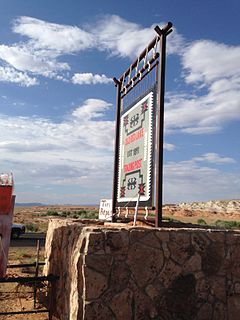
Tonalea is a census-designated place (CDP) in Coconino County, Arizona, United States. The population was 549 at the 2010 census. It has also been known as Red Lake.
Linn Grove is a city in Buena Vista County, Iowa, United States. The population was 163 at the time of the 2020 census. The nearby Chan-Ya-Ta Site contains the remains of a 1000-year-old prehistoric village, and is on the National Register of Historic Places.
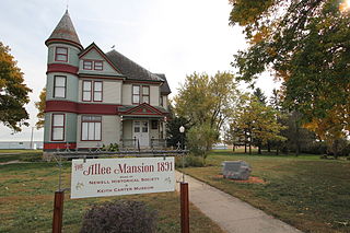
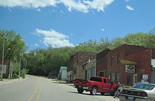
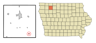
Newell is a city in Buena Vista County, Iowa, United States. The population was 906 according to the 2020 census.
Rembrandt is a city in Buena Vista County, Iowa, United States. The population was 209 at the time of the 2020 census.
Sioux Rapids is a city in Buena Vista County, Iowa, United States. The population was 748 at the time of the 2020 census.
Aurelia is a city in Cherokee County, Iowa, United States. The population was 968 at the 2020 census.
Peterson is a city in Clay County, Iowa, United States. The population was 322 in the 2020 census, a decline from 372 in 2000.
Webb is a city in Clay County, Iowa, United States. The population was 138 in the 2020 census, a decline from 165 in 2000.
Spirit Lake is a city in Dickinson County, Iowa, United States. The population was 5,439 at the 2020 census. It is the county seat of Dickinson County.
Little Sioux is a city in Harrison County, Iowa, United States. The population was 166 at the time of the 2020 census. The city is most known for Little Sioux Scout Ranch of the Boy Scouts of America.
Titonka is a city in Kossuth County, Iowa, United States. The population was 511 at the time of the 2020 census.
Chatsworth is a city in Sioux County, Iowa, United States. The population was 75 at the 2020 census.
Hawarden is a city in Sioux County, Iowa, United States. The population was 2,700 at the time of the 2020 census. It is located on the Big Sioux River.
Matlock is a city in Sioux County, Iowa, United States. The population was 74 at the time of the 2020 census.
Correctionville is a city in Woodbury County, Iowa, United States. It is part of the Sioux City, IA–NE–SD Metropolitan Statistical Area. The population was 766 at the time of the 2020 census. The town name comes from the original survey of the town. Correctionville has been noted for its unusual place name. It is supposedly the longest single-word place name in the state of Iowa.
Hornick is a city in Woodbury County, Iowa, United States. It is part of the Sioux City, IA–NE–SD metropolitan statistical area. The population was 255 at the time of the 2020 census.
Lawton is a city in Woodbury County, Iowa, Iowa, United States. It is part of the Sioux City metropolitan area. The population was 943 at the time of the 2020 census.
Oto is a city in Woodbury County, Iowa, United States. It is part of the Sioux City, IA–NE–SD Metropolitan Statistical Area. The population was 72 at the time of the 2020 census.
Sloan is a city in Woodbury County, Iowa, United States. It is part of the Sioux City, IA–NE–SD Metropolitan Statistical Area. The population was 1,042 at the time of the 2020 census.
Smithland is a city in Woodbury County, Iowa, United States. It is part of the Sioux City, IA–NE–SD Metropolitan Statistical Area. The population was 181 at the time of the 2020 census.