Matlock, Iowa

Last updated
Matlock, Iowa
Sioux County Iowa Incorporated and Unincorporated areas Matlock Highlighted.svg
Location of Matlock, Iowa
Coordinates: 43°14′35″N95°56′4″W / 43.24306°N 95.93444°W / 43.24306; -95.93444 Coordinates: 43°14′35″N95°56′4″W / 43.24306°N 95.93444°W / 43.24306; -95.93444
Country Flag of the United States.svg  United States
State Flag of Iowa.svg  Iowa
County Sioux
Area
[1]
  Total0.38 sq mi (0.98 km2)
  Land0.38 sq mi (0.98 km2)
  Water0.00 sq mi (0.00 km2)
Elevation
1,401 ft (427 m)
Population
 (2020)
  Total74
  Density195.77/sq mi (75.55/km2)
Time zone UTC-6 (Central (CST))
  Summer (DST) UTC-5 (CDT)
ZIP code
51244
Area code 712
FIPS code 19-50385
GNIS feature ID0458854

Matlock is a city in Sioux County, Iowa, United States. The population was 74 at the time of the 2020 census. [2]

Contents

Geography

Matlock is located at 43°14′35″N95°56′4″W / 43.24306°N 95.93444°W / 43.24306; -95.93444 (43.242958, -95.934486). [3]

According to the United States Census Bureau, the city has a total area of 0.37 square miles (0.96 km2), all land. [4]

Demographics

Historical populations
YearPop.±%
1900 94    
1910 118+25.5%
1920 94−20.3%
1930 103+9.6%
1940 112+8.7%
1950 104−7.1%
1960 103−1.0%
1970 89−13.6%
1980 109+22.5%
1990 92−15.6%
2000 83−9.8%
2010 87+4.8%
2020 74−14.9%
Source: "U.S. Census website". United States Census Bureau . Retrieved 2020-03-28. and Iowa Data Center
Source:
U.S. Decennial Census [5] [2]

2010 census

As of the census [6] of 2010, there were 87 people, 34 households, and 24 families living in the city. The population density was 235.1 inhabitants per square mile (90.8/km2). There were 35 housing units at an average density of 94.6 per square mile (36.5/km2). The racial makeup of the city was 100.0% White.

There were 34 households, of which 29.4% had children under the age of 18 living with them, 64.7% were married couples living together, 2.9% had a female householder with no husband present, 2.9% had a male householder with no wife present, and 29.4% were non-families. 17.6% of all households were made up of individuals, and 8.8% had someone living alone who was 65 years of age or older. The average household size was 2.56 and the average family size was 2.96.

The median age in the city was 44.2 years. 25.3% of residents were under the age of 18; 6.8% were between the ages of 18 and 24; 20.7% were from 25 to 44; 29.8% were from 45 to 64; and 17.2% were 65 years of age or older. The gender makeup of the city was 55.2% male and 44.8% female.

2000 census

As of the census [7] of 2000, there were 83 people, 33 households, and 26 families living in the city. The population density was 219.6 inhabitants per square mile (84.8/km2). There were 35 housing units at an average density of 92.6 per square mile (35.8/km2). The racial makeup of the city was 97.59% White and 2.41% Native American.

There were 33 households, out of which 36.4% had children under the age of 18 living with them, 78.8% were married couples living together, and 21.2% were non-families. 18.2% of all households were made up of individuals, and 3.0% had someone living alone who was 65 years of age or older. The average household size was 2.52 and the average family size was 2.88.

In the city, the population was spread out, with 25.3% under the age of 18, 7.2% from 18 to 24, 38.6% from 25 to 44, 18.1% from 45 to 64, and 10.8% who were 65 years of age or older. The median age was 37 years. For every 100 females, there were 107.5 males. For every 100 females age 18 and over, there were 121.4 males.

The median income for a household in the city was $36,750, and the median income for a family was $41,875. Males had a median income of $23,750 versus $16,875 for females. The per capita income for the city was $17,448. There were 4.0% of families and 11.1% of the population living below the poverty line, including 17.4% of under eighteens and none of those over 64.

Education

Matlock is served by the Sheldon Community School District. [8]

Related Research Articles

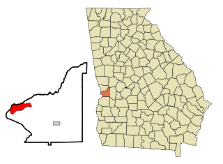
<span class="mw-page-title-main">Fort Benning South, Georgia</span> CDP in Georgia, United States

Fort Benning South is a former census-designated place (CDP) in Chattahoochee County, Georgia, United States. It is part of the Columbus, Georgia-Alabama Metropolitan Statistical Area. The population was 11,737 at the 2000 census. The area is now part of the consolidated city of Cusseta.

<span class="mw-page-title-main">Ionia, Iowa</span> City in Iowa, United States

Ionia is a city in Chickasaw County, Iowa, United States. The population was 226 at the time of the 2020 census.

<span class="mw-page-title-main">Maynard, Iowa</span> City in Iowa, United States

Maynard is a city in Fayette County, Iowa, United States. The population was 476 at the time of the 2020 census.

<span class="mw-page-title-main">Mondamin, Iowa</span> City in Iowa, United States

Mondamin is a city in Harrison County, Iowa, United States. The population was 339 at the time of the 2020 census.

<span class="mw-page-title-main">Prairieburg, Iowa</span> City in Iowa, United States

Prairieburg is a city in Linn County, Iowa, United States. The population was 160 at the time of the 2020 census. It is part of the Cedar Rapids Metropolitan Statistical Area.

<span class="mw-page-title-main">McClelland, Iowa</span> City in Iowa, United States

McClelland is a city in Pottawattamie County, Iowa, United States. The city was founded in 1903 after the Great Western Railroad was extended to include Council Bluffs, IA. The population was 146 at the time of the 2020 census.

<span class="mw-page-title-main">Diagonal, Iowa</span> City in Iowa, United States

Diagonal is a city in northwest Ringgold County, Iowa, United States. The population was 344 at the time of the 2020 census.

<span class="mw-page-title-main">Tingley, Iowa</span> City in Iowa, United States

Tingley is a city in northern Ringgold County, Iowa, United States. The population was 136 at the time of the 2020 census.
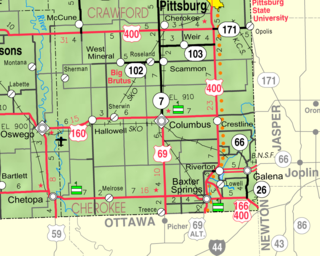
<span class="mw-page-title-main">Roseland, Kansas</span> City in Cherokee County, Kansas

Roseland is a city in Cherokee County, Kansas, United States. As of the 2010 census, the city population was 77.

<span class="mw-page-title-main">Pemberton, Minnesota</span> City in Minnesota, United States

Pemberton is a city in Blue Earth County, Minnesota, United States. The population was 229 at the 2020 census. It is part of the Mankato-North Mankato Metropolitan Statistical Area.

<span class="mw-page-title-main">Felton, Minnesota</span> City in Minnesota, United States

Felton is a city in Clay County, Minnesota, United States. The population was 177 at the 2020 census.

<span class="mw-page-title-main">Effie, Minnesota</span> City in Minnesota, United States

Effie is a city in Itasca County, Minnesota, United States. The population was 123 at the 2010 census.

<span class="mw-page-title-main">Vining, Minnesota</span> City in Minnesota, United States

Vining is a city in Otter Tail County, Minnesota, United States. The population was 62 at the 2020 census.

<span class="mw-page-title-main">Fort Calhoun, Nebraska</span> City in Nebraska, United States

Fort Calhoun is a city in Washington County, Nebraska, United States. The population was 908 at the 2010 census. The city includes Fort Atkinson, the first fort built west of the Missouri River.
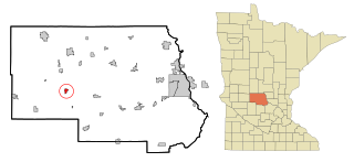
<span class="mw-page-title-main">Spring Hill, Minnesota</span> City in Minnesota, United States

Spring Hill is a city in Stearns County, Minnesota, United States. The population was 85 at the 2010 census. It is part of the St. Cloud Metropolitan Statistical Area.

Meredith is a town in Delaware County, New York, United States. The population was 1,529 at the 2010 census. It is an interior town in the northern part of the county.

<span class="mw-page-title-main">Newburg, North Dakota</span> City in North Dakota, United States

Newburg is a city in Bottineau County, North Dakota, United States. The population was 96 at the 2020 census. Newburg was founded in 1906.

<span class="mw-page-title-main">Merrifield, Virginia</span> Census-designated place in Virginia, United States

Merrifield is a census-designated place (CDP) in Fairfax County, Virginia, United States. The population was 15,212 at the 2010 census.

<span class="mw-page-title-main">Exeland, Wisconsin</span> Village in Wisconsin, United States

Exeland is a village in Sawyer County, Wisconsin, United States. The population was 196 at the 2010 census.

<span class="mw-page-title-main">Spencer (CDP), Massachusetts</span> CDP in Massachusetts, United States

Spencer is a census-designated place (CDP) in the town of Spencer in Worcester County, Massachusetts, United States. The population was 5,700 at the 2010 census.

References

  1. "2020 U.S. Gazetteer Files". United States Census Bureau. Retrieved March 16, 2022.
  2. 1 2 "2020 Census State Redistricting Data". census.gov. United states Census Bureau. Retrieved 12 August 2021.
  3. "US Gazetteer files: 2010, 2000, and 1990". United States Census Bureau. 2011-02-12. Retrieved 2011-04-23.
  4. "US Gazetteer files 2010". United States Census Bureau. Archived from the original on 2012-01-25. Retrieved 2012-05-11.
  5. "Census of Population and Housing". Census.gov. Retrieved June 4, 2015.
  6. "U.S. Census website". United States Census Bureau . Retrieved 2012-05-11.
  7. "U.S. Census website". United States Census Bureau . Retrieved 2008-01-31.
  8. "Sheldon" (PDF). Iowa Department of Education . Retrieved 2020-08-10.