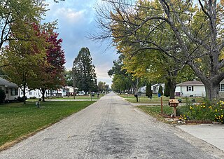
Washburn is an unincorporated town and census-designated place (CDP) in Black Hawk County, Iowa, United States. Washburn lies south of Waterloo on U.S. Route 218. Other towns near Washburn are Gilbertville and La Porte City. The community is part of the Waterloo–Cedar Falls Metropolitan Statistical Area.
Climbing Hill is an unincorporated community in Woodbury County, Iowa, United States. Its elevation is 1,135 feet (346 m). The community is part of the Sioux City, IA–NE–SD Metropolitan Statistical Area. It has a post office with the ZIP code 51015.

Granite is an unincorporated community in Lyon County, Iowa, United States, near the historic Blood Run Site and the Gitchie Manitou State Preserve.
Prole is an unincorporated rural village in northwestern Warren County, Iowa, United States. It lies along Iowa Highway 28 northwest of the city of Indianola, the county seat of Warren County. Its elevation is 978 feet (298 m). Prole has a post office, with the ZIP code of 50229, a cafe, a floral shop and an auto repair shop by way of businesses and services.
Teeds Grove is an unincorporated community in northeastern Clinton County, Iowa, United States. It lies at the intersection of Clinton County Routes E44 and Z50, north of the city of Clinton, the county seat of Clinton County. Its elevation is 692 feet (211 m).
Pilot Grove is an unincorporated community in northern Lee County, Iowa, United States. It lies along local roads northwest of the city of Fort Madison, the county seat of Lee County. Its elevation is 643 feet (196 m).
Beloit is an unincorporated community in Lyon County, Iowa, United States.
Middleburg is an unincorporated community in Iowa, United States. Located in Sioux County, it is near Sioux Center, Boyden and Orange City.
Portland is an unincorporated community and census-designated place (CDP) in Portland Township, Cerro Gordo County, Iowa, United States. As of the 2010 census it had a population of 35. According to the 2020 census, Portland had a population of 28.
Carnes is an unincorporated rural small hamlet in Sioux County, in the U.S. state of Iowa. Presently, the hamlet consists of a grain elevator and a pizza restaurant.
Sulphur Springs is an unincorporated community in Buena Vista County, located in the U.S. state of Iowa.
Cornell is an unincorporated community in Herdland Township, Clay County, Iowa, United States. Cornell is located near U.S. Route 71 and is 3.6 miles (5.8 km) north of Sioux Rapids.
Lorah is an unincorporated community in Pymosa Township, Cass County, Iowa, United States. Lorah is located along U.S. routes 6 and 71, 5.5 miles (8.9 km) north-northeast of Atlantic.
Lyman is an unincorporated community in Noble Township, Cass County, Iowa, United States. Lyman is located along U.S. Route 71 and Iowa Highway 92, 12 miles (19 km) south of Atlantic.
Ladoga is an unincorporated community in Washington Township, Taylor County, Iowa, United States. Ladoga is located along County Route J35, 3 miles (4.8 km) west-southwest of Gravity.
Talmage is an unincorporated community in Jones Township, Union County, Iowa, United States. Talmage is located along U.S. routes 34 and 169, 4.5 miles (7.2 km) east of Afton.
Norwood is an unincorporated community in Otter Creek Township, Lucas County, Iowa, United States. Norwood is located along U.S. Route 65, 6.2 miles (10.0 km) north of Lucas.

Plainview is an unincorporated community in Cleona and Hickory Grove Townships, Scott County, Iowa, United States. Plainview is located along Iowa Highway 130 5.7 miles (9.2 km) north of Walcott.
Ulmer is an unincorporated community in Sac County, in the U.S. state of Iowa.
Adelphi is an unincorporated community in Polk County, in the U.S. state of Iowa.


