Rock Valley, Iowa

Last updated

Rock Valley, Iowa
Motto: 
"Place of opportunities"
Sioux County Iowa Incorporated and Unincorporated areas Rock Valley Highlighted.svg
Location of Rock Valley, Iowa
Coordinates: 43°12′6″N96°17′47″W / 43.20167°N 96.29639°W / 43.20167; -96.29639
Country Flag of the United States (23px).png  United States
State Flag of Iowa.svg  Iowa
County Sioux
Government
  TypeMayor-council
  MayorKevin Van Otterloo
Area
[1]
  Total4.51 sq mi (11.69 km2)
  Land4.46 sq mi (11.55 km2)
  Water0.05 sq mi (0.14 km2)
Elevation
1,250 ft (381 m)
Population
 (2020)
  Total4,059
  Density909.89/sq mi (351.34/km2)
Time zone UTC-6 (Central (CST))
  Summer (DST) UTC-5 (CDT)
ZIP code
51247
Area code 712
FIPS code 19-68205
GNIS feature ID0460747
Website City of Rock Valley

Rock Valley is a city in Sioux County, Iowa, the North Western corner of Iowa, United States, along the Rock River. The population was 4,059 at the time of the 2020 census. [2]

Contents

Geography

Rock Valley is located at 43°12′6″N96°17′47″W / 43.20167°N 96.29639°W / 43.20167; -96.29639 (43.201624, -96.296379). [3]

According to the United States Census Bureau, the city has a total area of 3.27 square miles (8.47 km2), of which 3.22 square miles (8.34 km2) is land and 0.05 square miles (0.13 km2) is water. [4]

Rock Valley is located on U.S. Route 18.

History

The town of Rock Valley was platted in 1879 by a Colonel Ira Warren, a Civil War veteran, and the Chicago Milwaukee & St. Paul Railway on ground owned by Warren. [5]

Economy

In February 2022, a methane digester of Winding Meadows Dairy near Rock Valley owned by Gevo spilled manure which flowed across frozen fields into Lizard Creek (Iowa), a tributary of the Rock River. [6] Eventually it was found 376,414 gallons of liquid manure spilled into waterways and Gevo had no license to operate the digester. [7] The Iowa Department of Natural Resources fined the dairy farmer $10,000 for the spill, but not Gevo. [8]

Education

The Rock Valley Community School District Serves the town and the surrounding area.

Notable people

Demographics

Historical populations
YearPop.±%
1880 100    
1890 542+442.0%
1900 1,054+94.5%
1910 1,198+13.7%
1920 1,347+12.4%
1930 1,204−10.6%
1940 1,507+25.2%
1950 1,581+4.9%
1960 1,693+7.1%
1970 2,205+30.2%
1980 2,706+22.7%
1990 2,540−6.1%
2000 2,702+6.4%
2010 3,354+24.1%
2020 4,059+21.0%
Source: "U.S. Census website". United States Census Bureau . Retrieved March 29, 2020. and Iowa Data Center
Source:
U.S. Decennial Census [10] [2]

2010 census

As of the census [11] of 2010, there were 3,354 people, 1,283 households, and 870 families living in the city. The population density was 1,041.6 inhabitants per square mile (402.2/km2). There were 1,356 housing units at an average density of 421.1 per square mile (162.6/km2). The racial makeup of the city was 92.2% White, 0.3% African American, 0.4% Asian, 5.8% from other races, and 1.2% from two or more races. Hispanic or Latino of any race were 12.2% of the population.

There were 1,283 households, of which 32.9% had children under the age of 18 living with them, 60.9% were married couples living together, 4.2% had a female householder with no husband present, 2.7% had a male householder with no wife present, and 32.2% were non-families. 28.8% of all households were made up of individuals, and 13.5% had someone living alone who was 65 years of age or older. The average household size was 2.54 and the average family size was 3.16.

The median age in the city was 35.8 years. 27.3% of residents were under the age of 18; 8.1% were between the ages of 18 and 24; 25.3% were from 25 to 44; 19.4% were from 45 to 64; and 19.9% were 65 years of age or older. The gender makeup of the city was 49.4% male and 50.6% female.

2000 census

As of the census [12] of 2000, there were 2,702 people, 1,124 households, and 750 families living in the city. The population density was 1,599.9 inhabitants per square mile (617.7/km2). There were 1,202 housing units at an average density of 711.7 per square mile (274.8/km2). The racial makeup of the city was 98.48% White, 0.11% African American, 0.07% Native American, 0.33% Asian, 0.59% from other races, and 0.41% from two or more races. Hispanic or Latino of any race were 1.04% of the population.

There were 1,124 households, out of which 29.4% had children under the age of 18 living with them, 59.8% were married couples living together, 5.2% had a female householder with no husband present, and 33.2% were non-families. 30.9% of all households were made up of individuals, and 16.5% had someone living alone who was 65 years of age or older. The average household size was 2.38 and the average family size was 3.00.

In the city, the population was spread out, with 25.4% under the age of 18, 9.6% from 18 to 24, 24.4% from 25 to 44, 18.3% from 45 to 64, and 22.3% who were 65 years of age or older. The median age was 38 years. For every 100 females, there were 92.6 males. For every 100 females age 18 and over, there were 89.8 males.

The median income for a household in the city was $36,967, and the median income for a family was $45,074. Males had a median income of $31,219 versus $20,833 for females. The per capita income for the city was $19,660. About 1.9% of families and 4.1% of the population were below the poverty line, including 6.7% of those under age 18 and 3.2% of those age 65 or over.

Related Research Articles

<span class="mw-page-title-main">Bridgewater, Iowa</span> City in Iowa, United States

Bridgewater is a city in Jackson Township, Adair County, Iowa, United States. The population was 148 at the time of the 2020 census. Bridgewater was founded in 1885.

<span class="mw-page-title-main">Stuart, Iowa</span> City in Iowa, United States

Stuart is a city in Lincoln Township, Adair County, and in Stuart Township, Guthrie County, in the U.S. state of Iowa. That part of the city within Guthrie County is part of the Des Moines–West Des Moines Metropolitan Statistical Area. The population was 1,782 at the 2020 census.

<span class="mw-page-title-main">Nodaway, Iowa</span> City in Iowa, United States

Nodaway is a city in Nodaway Township, Adams County, Iowa, United States. The population was 74 at the time of the 2020 census. Nodaway was incorporated in 1900.

<span class="mw-page-title-main">Fairbank, Iowa</span> City in Iowa, United States

Fairbank is a city in Buchanan and Fayette counties in the U.S. state of Iowa. The population was 1,111 at the time of the 2020 census.

<span class="mw-page-title-main">Rinard, Iowa</span> City in Iowa, United States

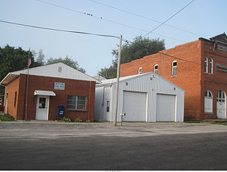
Rinard is a city in Calhoun County, Iowa, United States. The population was 38 at the time of the 2020 census.

<span class="mw-page-title-main">Dow City, Iowa</span> City in Iowa, United States

Dow City is a city in Crawford County, Iowa, United States, along the Boyer River. The population was 485 at the time of the 2020 census.

<span class="mw-page-title-main">Minburn, Iowa</span> City in Iowa, United States

Minburn is a city in Dallas County, Iowa, United States. The population was 325 at the time of the 2020 census. It is part of the Des Moines–West Des Moines Metropolitan Statistical Area.

<span class="mw-page-title-main">Delaware, Iowa</span> City in Iowa, United States

Delaware is a city in Delaware County, Iowa, United States. The population was 142 at the time of the 2020 census.

<span class="mw-page-title-main">Fayette, Iowa</span> City in Iowa, United States

Fayette is a city in Fayette County, Iowa, United States. As of the 2020 census, the city population was 1,256. It was named after the Marquis de la Fayette, French hero of the American Revolutionary War. Fayette is the home of Upper Iowa University, a small private college. The Volga River State Recreation Area is located just north of Fayette, and many other parks and natural areas are nearby.

<span class="mw-page-title-main">St. Lucas, Iowa</span> City in Iowa, United States

St. Lucas is a city in Fayette County, Iowa, United States. The population was 167 at the time of the 2020 census.

<span class="mw-page-title-main">Waucoma, Iowa</span> City in Iowa, United States

Waucoma is a city in Fayette County, Iowa, United States. The population was 229 at the time of the 2020 census.

<span class="mw-page-title-main">Dunlap, Iowa</span> City in Iowa, United States

Dunlap is a city in Harrison and Crawford counties, Iowa, United States, along the Boyer River. The population was 1,038 at the time of the 2020 census.

<span class="mw-page-title-main">South English, Iowa</span> City in Iowa, United States

South English is a city in Keokuk County, Iowa, United States. The population was 202 at the time of the 2020 census. It is named for the English River.

<span class="mw-page-title-main">Lone Rock, Iowa</span> City in Iowa, United States

Lone Rock is a city in Kossuth County, Iowa, United States. The population was 146 at the time of the 2020 census. The city is named after a large boulder.

<span class="mw-page-title-main">Doon, Iowa</span> City in Iowa, United States

Doon is a city in Lyon County, Iowa, United States, along the Rock River. The population was 619 at the time of the 2020 census. The BNSF Railway passes through Doon.

<span class="mw-page-title-main">Neola, Iowa</span> City in Iowa, United States

Neola is a city in Pottawattamie County, Iowa, United States. The population was 918 at the time of the 2020 census.

<span class="mw-page-title-main">Oakland, Iowa</span> City in Iowa, United States

Oakland is a city located along the West Nishnabotna River in Pottawattamie County, Iowa, United States. The population was 1,524 at the time of the 2020 census. Formerly named Big Grove, Oakland is home to Nishna Heritage Museum and a number of historical buildings.

<span class="mw-page-title-main">Milton, Iowa</span> Town in Iowa, United States

Milton is a city in Van Buren County, Iowa, United States. The population was 380 at the time of the 2020 census.

<span class="mw-page-title-main">Moorland, Iowa</span> City in Iowa, United States

Moorland is a small town in Webster County, Iowa, United States. The population was 168 at the time of the 2020 census.

<span class="mw-page-title-main">North English, Iowa</span> City in Iowa, United States

North English is a city located mainly in Iowa county with a small portion in Keokuk county in the U.S. state of Iowa. The population was 1,065 at the time of the 2020 census. It is named for the English River.

References

  1. "2020 U.S. Gazetteer Files". United States Census Bureau. Retrieved March 16, 2022.
  2. 1 2 "2020 Census State Redistricting Data". census.gov. United states Census Bureau. Retrieved August 12, 2021.
  3. "US Gazetteer files: 2010, 2000, and 1990". United States Census Bureau. February 12, 2011. Retrieved April 23, 2011.
  4. "US Gazetteer files 2010". United States Census Bureau. Archived from the original on January 25, 2012. Retrieved May 11, 2012.
  5. City of Rock Valley, Iowa-History
  6. Welte, Dean (February 8, 2022). "Authorities investigating manure spill in Lyon County, IA". KTIV. Retrieved February 17, 2023.
  7. Kavahn Mansouri (March 3, 2022). "Iowa manure recycler operated without state's permission when it leaked waste into creeks" . Retrieved February 17, 2023.
  8. Kavahn Mansouri (July 6, 2022). "Workers in Iowa failed to investigate leak that poured manure wastewater into creeks" . Retrieved February 17, 2023.
  9. Minnesota Legislators Past & Present-Richard Mulder
  10. "Census of Population and Housing". Census.gov. Retrieved June 4, 2015.
  11. "U.S. Census website". United States Census Bureau . Retrieved May 11, 2012.
  12. "U.S. Census website". United States Census Bureau . Retrieved January 31, 2008.